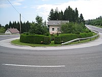
Change street
The change road B 54 is a state road B in Lower Austria and Styria and a former federal highway . It leads over a length of 110 km from Wiener Neustadt over the Wechsel -Pass to Gleisdorf and runs parallel to the south A 2 motorway .
Before the construction of the Süd Autobahn , it was part of the main road connection between Vienna and Graz . Due to their past importance, parts of the route have been developed without intersections. Today, the route over the Wechsel , which is nicknamed Panaromastraße , is a popular excursion route. The Styrian Apple Road begins near Gleisdorf .
history
The princes of Pálffy had the Lower Austrian section from Wiener Neustadt via Schwarzau , Seebenstein , Krumbach and Kirchschlag to Güns (today Kőszeg ), the eastern part of which is now known as Kirchschlager Straße , expanded at their own expense into a road , which was completed in September 1818 . In the years 1827–1828 the connecting line via Aspang to the Styrian border was built. Since 1866, Pálffy'sche Strasse has been one of the 17 Lower Austrian state roads.
The Styrian route section from Gleisdorf via Pischelsdorf , Kaindorf , Hartberg , Greinbach , Rohrbach , Friedberg to the Lower Austrian state border was assigned to the first class district roads by the law of October 3, 1868. On March 9, 1907, the Styrian state parliament decided to relieve the Hartberg old town from through traffic by means of a 700 m long bypass road. Since April 1, 1938, the district roads of the 1st order in Styria have been run as state roads.
After the connection of Austria , the northern section between Wiener Neustadt and Friedberg was converted into a Reichsstraße on April 1, 1940 as part of the standardization of the road system and run as part of Reichsstraße 345 . This Reichsstraße led from Wiener Neustadt via Friedberg to Szombathely .
The Wechselstraße belonged from April 1, 1948 the network of federal roads in Austria . Since it was expanded in the 1960s, it has also briefly covered Burgenland near Neustift an der Lafnitz . In 2002 it was transferred to the provincial administrations of Lower Austria and Styria.
expansion
The first of three parts of the Hartberg bypass was built and approved in 2007/08, the construction dates for the other construction lots have not yet been set.
Web links
Individual evidence
- ↑ Announcement. In: Wiener Zeitung , January 13, 1819, p. 13 (online at ANNO ).
- ↑ Licit. Announcement. In: Wiener Zeitung , September 19, 1827, p. 6 (online at ANNO ).
- ↑ Law on the declaration of a number of streets as state roads, effective for the Archduchy of Austria under the Enns. LGBl. No. 6/1866. § 1 No. 15
- ↑ Law of October 3, 1868, applies to the Duchy of Styria, which defines the 1st class district roads. LGBl. No. 14/1868.
- ^ Announcement by the Imperial and Royal Governor of Styria on September 13, 1907. LGBl. No. 63/1907.
- ^ Law on public roads with the exception of federal roads (State Road Administration Act). LGBl. No. 20/1938, Section 59 Paragraph 2 (b).
- ^ Ordinance and Official Gazette for the Reichsgau Niederdonau , year 1940, p. 109.
- ↑ Federal Roads Act of February 18, 1948, directory A.
- ↑ Written answer to the question “Continuation of the Hartberg bypass”. ( Memento from November 8, 2014 in the Internet Archive ) Landtag Steiermark, XVI. Legislative period 2010; Retrieved November 8, 2014
| B54 | The Wechsel Straße was, like the other former federal highways, in the federal administration. Since April 1, 2002, it has been under state administration and continues to have the B in the number, but not the name Bundesstraße. |


