
Lafnitz (Styria)
|
Lafnitz
|
||
|---|---|---|
| coat of arms | Austria map | |
 |
|
|
| Basic data | ||
| Country: | Austria | |
| State : | Styria | |
| Political District : | Hartberg-Fürstenfeld | |
| License plate : | HF (from 1.7.2013; old: HB) | |
| Surface: | 15.61 km² | |
| Coordinates : | 47 ° 22 ' N , 16 ° 1' E | |
| Height : | 412 m above sea level A. | |
| Residents : | 1,453 (Jan 1, 2020) | |
| Postcodes : | 8233, 8230 | |
| Area code : | 03338 | |
| Community code : | 6 22 26 | |
| NUTS region | AT224 | |
| Address of the municipal administration: |
Lafnitz 31 8233 Lafnitz |
|
| Website: | ||
| politics | ||
| Mayor : | Andreas Hofer ( SPÖ ) | |
|
Municipal Council : (2020) (15 members) |
||
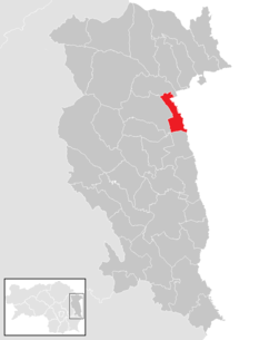
| Location of Lafnitz in the Hartberg-Fürstenfeld district | ||
  |
||
 Lafnitz seen from above |
||
| Source: Municipal data from Statistics Austria | ||

Lafnitz is an Austrian municipality with 1,453 inhabitants (as of January 1, 2020) in Styria on the border with Burgenland . The community is located in the judicial district of Fürstenfeld and in the political district of Hartberg-Fürstenfeld .
geography
Geographical location
Lafnitz is located in the east of Styria in the Lafnitztal . Politically, the community belongs to the Hartberg-Fürstenfeld district , whose district capital Hartberg is about ten kilometers south-west of it. The community is located on the Lafnitz river of the same name , a tributary of the Raab .
The Lafnitz forms the border between Styria and Burgenland south-east of Lafnitz. The municipal area extends along the Haidwald, with settlement only in the north and south. The parish in the south is traversed by the Lungitzbach.
Community structure
|
structure
|
||||||
|
Legend for the breakdown table
|
Lafnitz consists of three cadastral communities and towns of the same name (residents as of January 1, 2020):
- Lafnitz (977 Ew.) With the Rotte Lafnitzer Haide
- Oberlungitz (195 Ew.)
- Wagendorf (281 Ew.) With the Rotte Wagendorfer Haide
Incorporations
On January 1, 1959, the independent municipalities of Oberlungitz and Wagendorf were merged to form the Lungitztal municipality, which was incorporated on January 1, 1969.
Neighboring communities
| Rohrbach an der Lafnitz | Rohrbach an der Lafnitz | Neustift an der Lafnitz |
| Grafendorf near Hartberg |
.svg)
|
Loipersdorf Kitzladen |
| Grafendorf near Hartberg | Sankt Johann in der Haide | Allhau market |
history
The first traces of settlement in the municipality go back to the 4th millennium BC. BC when Eastern Styria was settled by the Lafnitz valley. In Roman times , a Roman road led through what is now the municipality from Baden to the settlement area near Hartberg, which crossed the river here.
Since Lafnitz has the same name as the river on which it lies, the first mentions refer to the river. In 864 this is mentioned for the first time in a deed of donation issued by Ludwig the German . The “Gut an der Lafnitz” mentioned in it could designate today's municipality, as it is further specified in a document from 1272 as being near Rohrbach.
Today's village of Lafnitz is finally mentioned for the first time in 1184 as Lavenz in a document from the Vorau monastery . The place name changed over the years via Laffnicz (1445), Laffnitz (1497) and Lafnicz (1506) to the spelling used today, which appears for the first time in 1527.
Due to the proximity to the border with Hungary , the village has often been the victim of enemy attacks. In the 15th to 18th centuries it was primarily the Hungarians , Turks and Kurucs who hit Lafnitz heavily before the Napoleonic troops marched through the country in 1805 .

Population development

Culture and sights
Sports
The football club SV Lafnitz has played in the 2nd division since the 2018/19 season .
Economy and Infrastructure
traffic
Lafnitz is located directly on the B 54 Wechsel road from Wiener Neustadt to Hartberg, which is well developed in this area . It does not lead through the local area, but around in a long curve. The A 2 south autobahn from Vienna to Graz is also not far away and about nine kilometers (for the Lafnitz part of the municipality) via the Pinkafeld (100) junction and about seven kilometers (for the Wagendorf part of the municipality) via the Hartberg (115) junction and Oberlungitz).
The thermal railway from Vienna to Fehring runs through the municipality, but the Lafnitz stop is no longer served. The next train station is therefore Grafendorf about four kilometers away. There are regional train connections every two hours .
The Graz Airport and the airport Wien-Schwechat are both about 100 km away.
education
All children have been taught in the Lafnitz elementary school since the 2008/09 school year. Before that there was also an elementary school in Wagendorf, but it was only run in one class. Secondary schools are located in Grafendorf and Hartberg.
politics
mayor
At the constituent meeting of the municipal council on July 24, 2020, Andreas Hofer was unanimously elected mayor.
The community board also includes Vice Mayor Andreas Burghard (SPÖ) and the community treasurer Gerald Fuchs, who is provided by the ÖVP.
Head of office is Werner Pichler.
Municipal council
The municipal council consists of 15 members. According to the result of the 2020 municipal council elections , it is composed as follows:
| Political party | 2020 | 2015 | 2010 | 2005 | 2000 | 1995 | ||||||||||||
|---|---|---|---|---|---|---|---|---|---|---|---|---|---|---|---|---|---|---|
| Sti. | % | M. | Sti. | % | M. | Sti. | % | M. | Sti. | % | M. | Sti. | % | M. | Sti. | % | M. | |
| ÖVP | 381 | 40.06 | 6th | 462 | 46.39 | 7th | 439 | 44.48 | 7th | 505 | 50 | 7th | 280 | 28 | 4th | 319 | 32 | 5 |
| SPÖ | 457 | 48.05 | 8th | 446 | 44.78 | 7th | 466 | 47.21 | 7th | 514 | 50 | 8th | 516 | 51 | 8th | 633 | 63 | 10 |
| FPÖ | 35 | 3.68 | 0 | 88 | 8.84 | 1 | 82 | 8.31 | 1 | not running | 207 | 21st | 3 | 59 | 6th | 0 | ||
| GREEN | 78 | 8.20 | 1 | not running | not running | not running | not running | not running | ||||||||||
| Eligible voters | 1198 | 1,150 | 1,120 | 1,124 | 1,098 | |||||||||||||
| voter turnout | 80.3% | 88% | 90% | 92% | 92% | 90% | ||||||||||||
coat of arms
The municipal coat of arms was awarded with effect from December 1, 1998.
Blazon (description of the coat of arms): "Divided by green and red by a silver river, in the upper field an abbot and lily staff of silver crossed at an angle, in the lower field a diagonally reduced silver river."
Individual evidence
- ↑ Local council election 2020 - results Lafnitz. orf.at , accessed on August 22, 2020 .
- ↑ Statistics Austria: Population on January 1st, 2020 by locality (area status on January 1st, 2020) , ( CSV )
- ^ Community Lafnitz, elementary school. Accessed March 31, 2020 .
- ↑ Local council elections Styria 2020 - news.ORF.at. Retrieved June 30, 2020 .
- ^ Notices from the Styrian State Archives 49, 1999, p. 52
Web links
- 62226 - Lafnitz (Styria). Community data, Statistics Austria .
.svg)
Bad Blumau | Bad Loipersdorf | Bad Waltersdorf | Book-St. Magdalena | Burgau | Dechantskirchen | Ebersdorf | Feistritztal | Friedberg | Fürstenfeld | Grafendorf near Hartberg | Greinbach | Großsteinbach | Großwilfersdorf | Hartberg | Hartberg surroundings | Hartl | Ilz | Kaindorf | Lafnitz | Neudau | Ottendorf an der Rittschein | Pinggau | Pöllau | Pöllauberg | Rohr bei Hartberg | Rohrbach an der Lafnitz | Sankt Jakob im Walde | Sankt Johann in der Haide | Sankt Lorenzen am Wechsel | Shepherds | Söchau | Stubenberg | Advance | Waldbach-Mönichwald | Wenigzell