
Ebersdorf (Styria)
|
Ebersdorf
|
||
|---|---|---|
| coat of arms | Austria map | |
 |
|
|
| Basic data | ||
| Country: | Austria | |
| State : | Styria | |
| Political District : | Hartberg-Fürstenfeld | |
| License plate : | HF (from 1.7.2013; old: HB) | |
| Surface: | 17.28 km² | |
| Coordinates : | 47 ° 12 ' N , 15 ° 57' E | |
| Height : | 315 m above sea level A. | |
| Residents : | 1,306 (January 1, 2020) | |
| Postcodes : | 8273, 8272 | |
| Area code : | 03333 | |
| Community code : | 6 22 09 | |
| NUTS region | AT224 | |
| Address of the municipal administration: |
Ebersdorf 222 8273 Ebersdorf near Hartberg |
|
| Website: | ||
| politics | ||
| Mayor : | Gerald Maier ( ÖVP ) | |
|
Municipal Council : (2020) (15 members) |
||
| Location of Ebersdorf in the Hartberg-Fürstenfeld district | ||
  |
||
| Source: Municipal data from Statistics Austria | ||

Ebersdorf is a municipality with 1306 inhabitants (as of January 1, 2020) in the judicial district of Fürstenfeld or Hartberg-Fürstenfeld district in Styria .
geography
Geographical location
Ebersdorf is located on the Pöllauer Safen in the Eastern Styrian hill country . The community is located about ten kilometers south of the district capital Hartberg and about 40 km northeast of the provincial capital Graz . In addition to the Pöllauer Safen, the municipality in the south is traversed by the Nörningbach, a tributary of the Pöllauer Safens, in the valley of the same name. The northern boundary of the municipality is formed by the Dombach, a tributary of the Hartberger Safen .
Community structure
|
structure
|
||||||
|
Legend for the breakdown table
|
The community consists of the following cadastral communities and towns of the same name (residents as of January 1, 2020):
- Ebersdorf (844) with Ebersdorf-Steinfeld, Ebersdorfberg and Ebersdorfhöhe
- Nörning (250) with Auffenberg, Harras and Schmiedbach
- Wagenbach (212) with Dreihöf, Egg, Eichberg, Lichtenegg, Schmalzgrube and Waldviertel
Incorporations
In 1968 the independent community of Wagenbach and part of the community of Neustift bei Sebersdorf were combined with Ebersdorf.
Neighboring communities
| Kaindorf | Book-St. Magdalena | Book-St. Magdalena |
| Kaindorf |
.svg)
|
Bad Waltersdorf |
| Kaindorf | Hartl | Bad Waltersdorf |
history
Eberhardsdorf was mentioned for the first time in 1170 and points to its founder Eberhard von Öblarn . Nörning is first mentioned in 1255 as Nurdinch and Wagenbach in 1423.
The Hungarians invaded in 1418, the Turks in 1529 and 1532. In 1532 the village was completely devastated. In the middle of the 16th century the village consisted of 17 farms and a mill. In 1605 the Haiducken largely destroyed the village. In 1705 the Kuruzzen burned down large parts of the village. In 1770 Ebersdorf became a separate cadastral municipality with Ebersdorfberg, and since 1849 Ebersdorf has been its own local municipality.
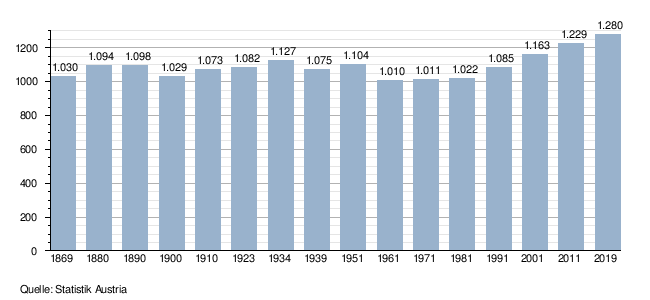
Population development

Culture and sights
- Concerts, readings and theater performances take place in the culture hall. The hall can also be rented for private purposes.
- The community has been part of the Kaindorf ecoregion since 2007 .
Economy and Infrastructure
traffic
Ebersdorf is on the state road from Sebersdorf to Kaindorf . This road offers direct access to the major roads: In Sebersdorf, the A 2 south autobahn to Vienna and Graz is reached in around four kilometers at the Sebersdorf / Bad Waltersdorf junction (126); in Kaindorf, Wechsel Strasse B is around five kilometers away 54 from Hartberg to Gleisdorf .
Ebersdorf is not on any railway line. The nearest train station is around four kilometers away in Sebersdorf and offers access to the Thermenbahn with two-hour regional train connections to Vienna and Fehring .
The Graz Airport is accessible via the South highway and about 65 km away.
Established businesses
In Ebersdorf there are 45 companies with 190 employees. Some farms offer direct sales.
politics
mayor
The mayor is Gerald Maier (ÖVP), the vice mayor is Maria Kröpfl (ÖVP). The community treasurer is Hermine Pichler (FPÖ).
Municipal council
The municipal council consists of 15 members and has been composed of mandates from the following parties since the 2015 municipal council election:
The last municipal council elections brought the following results:
| Political party | 2015 | 2010 | 2005 | 2000 | 1995 | 1990 | ||||||||||||
|---|---|---|---|---|---|---|---|---|---|---|---|---|---|---|---|---|---|---|
| Sti. | % | M. | Sti. | % | M. | Sti. | % | M. | Sti. | % | M. | Sti. | % | M. | Sti. | % | M. | |
| ÖVP | 579 | 66 | 10 | 633 | 77 | 12 | 549 | 74 | 11 | 507 | 69 | 11 | 471 | 66 | 11 | 453 | 63 | 10 |
| SPÖ | 77 | 9 | 1 | not running | not running | 90 | 12 | 2 | 159 | 22nd | 3 | 91 | 13 | 2 | ||||
| FPÖ | 222 | 25th | 4th | 193 | 23 | 3 | 190 | 26th | 4th | 134 | 18th | 2 | 52 | 7th | 1 | 50 | 7th | 1 |
| Free list Ebersdorf | not running | not running | not running | not running | 36 | 5 | 0 | not running | ||||||||||
| ÖVP economic list | not running | not running | not running | not running | not running | 129 | 18th | 2 | ||||||||||
| voter turnout | 84% | 85% | 80% | 86% | 89% | 93% | ||||||||||||
Regional policy
The community belongs to the LEADER region of East Styria and has been part of the Kaindorf ecoregion since 2007 .
On November 20, 2011, the eligible voters of the communities Dienersdorf , Ebersdorf, Großhart , Hartl , Hofkirchen bei Hartberg , Kaindorf and Tiefenbach bei Kaindorf voted on whether these seven communities should be merged into one larger community on the occasion of the structural reform of Styria 2010-2015 . With a total turnout of 65.66%, 3351 valid votes were counted. Of these, only 436 voters (13%) voted for a merger of the municipalities, while 2915 voters (87%) voted against a merger. This clearly rejected the plans of the Styrian state government .
Ebersdorf provides a concept from 2012/13 independently.
coat of arms
The municipal coat of arms has been in use since March 23, 1970.
Coat of arms description : "In a silver and green split shield front three red goldbesamte roses , behind a silver Andrew's cross ."
The roses indicate the agricultural area of the municipality, the cross of St. Andrew symbolizes the patron of the parish church Ebersdorf.
Personalities
Honorary citizen
- 1970: Josef Krainer (1903–1971), Governor of Styria 1948–1971
- 1979 Friedrich Niederl (1920–2012), governor
Sons and daughters of Ebersdorf
- Josef Fink , 1941–1999 (theologian, artist)
Web links
- Community website
- Entry on Ebersdorf in the Austria Forum (in the AEIOU Austria Lexicon )
- 62209 - Ebersdorf (Styria). Community data, Statistics Austria .
Individual evidence
- ↑ Local council election 2020 - Ebersdorf results. orf.at , accessed on August 22, 2020 .
- ↑ Statistics Austria: Population on January 1st, 2020 by locality (area status on January 1st, 2020) , ( CSV )
- ^ Kramer - Mirsch - Rupp: DAHEIM IN ... Documentation of the communities in the Hartberg district. Scripta Verlag, 1996, p. 100-102 .
- ↑ http://www.ebersdorf.eu/arbeit/betriebe.html
- ↑ http://www.ebersdorf.eu/arbeit/abhofverkauf.html
- ^ Team municipal office - Ebersdorf municipality. Retrieved on March 25, 2020 (German).
- ↑ Elections. Retrieved March 25, 2020 .
- ↑ Wiener Zeitung : A total of 87 percent of the Eastern Styrian communities surveyed were against merger , November 20, 2011. ( Memento of November 24, 2011 in the Internet Archive )
- ↑ The new municipal structure of Styria ( Memento of the original from July 29, 2013 in the Internet Archive ) Info: The archive link was inserted automatically and has not yet been checked. Please check the original and archive link according to the instructions and then remove this notice. . List of final version A01, 2012 (pdf, gemeindeststrukturreform.steiermark.at; 97 kB).
- ^ Map in the presentation of the results of the municipal structural reform . kleinezeitung.at of January 21, 2013. Map status: January 13, 2013.
- ↑ Kramer - Mirsch - Rupp: DAHEIM IN ... Documentation of the communities in the Hartberg district. Scripta Verlag, 1996, p. 103 .
- ↑ Südost-Tagespost, October 6, 1970, p. 6.
.svg)
Bad Blumau | Bad Loipersdorf | Bad Waltersdorf | Book-St. Magdalena | Burgau | Dechantskirchen | Ebersdorf | Feistritztal | Friedberg | Fürstenfeld | Grafendorf near Hartberg | Greinbach | Großsteinbach | Großwilfersdorf | Hartberg | Hartberg surroundings | Hartl | Ilz | Kaindorf | Lafnitz | Neudau | Ottendorf an der Rittschein | Pinggau | Pöllau | Pöllauberg | Rohr bei Hartberg | Rohrbach an der Lafnitz | Sankt Jakob im Walde | Sankt Johann in der Haide | Sankt Lorenzen am Wechsel | Shepherds | Söchau | Stubenberg | Advance | Waldbach-Mönichwald | Wenigzell