Silnice I / 52
| Silnice I / 52 in the Czech Republic | |

|
|
| |
|
| map | |
| Basic data | |
| Operator: | Ředitelství silnic a dálnic ČR |
| Overall length: | 24 km |
| of which in operation: | 24 km |
|
Kraj ( region ): |
Jihomoravský kraj |
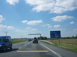
| The street near Pasohlávky (Weißstätten) | |
The Silnice I / 52 ( Czech for: "1st class road 52") is a Czech state road (1st class road). It is part of the European route 461 .
course
The road begins south of Pohořelice (Pohrlitz), where the route from Brno , which has been upgraded to the Dálnice 52 motorway since January 1, 2016, merges into it, and runs southwards via Mikulov (Nikolsburg), where the Silnice I / 40 branches off to the east. From there, after around 2 kilometers, it reaches the border with Austria , where it merges into Brünner Straße B 7, which begins before Drasenhofen .
The total length of the road is around 24 kilometers.
history
From 1940 to 1945 the street formed a section of Reichsstraße 116 .
Individual evidence
- ↑ Freytag & Berndt Autoatlas Česko, 2010 edition, ISBN 978-80-7316-056-2
