Silnice I / 34
| Silnice I / 34 in the Czech Republic | |

|
|
| |
|
| map | |
| Basic data | |
| Operator: | Ředitelství silnic a dálnic ČR |
| Overall length: | 202.590 km |
| of which in operation: | 202.590 km |
|
Kraj ( region ): |
Jihočeský kraj |
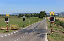
| The road at Vendolí (Pole village) | |
The Silnice I / 34 ( Czech for: "1st class road 34") is a Czech state road (1st class road).
course
The road branches off on the northeastern outskirts of Budweis (České Budějovice) from Silnice I / 3 ( European route 55 ) to the east, leads, at the same time as European route 551 , via Lišov (Lischau) to Třeboň (Wittingau), where it unites over one length of around 2 kilometers with the Silnice I / 24 ( European route 49 ), leaves this in a north-easterly direction and leads via Stráž nad Nežárkou (Platz an der Naser) to Jindřichův Hradec (Neuhaus), where the Silnice I / 23 meets it from there with this on to Jarošov nad Nežárkou (Jareschau), where the Silnice I / 23 separates from it again, and on via Kamenice nad Lipou (Kamnitz an der Linde) to Pelhřimov (Pilgrams), on the northern outskirts of which the western section of the Silnice I / 19 ends at it. The Silnice I / 34 continues in a north-easterly direction to Humpolec (Humpoletz, after 1939 temporarily Gumpolds) and crosses Dálnice 1 ( European route 50 ) at its junction (exit) 90, where European route 551 ends. In its further course, the street reaches Havlíčkův Brod (Deutsch Brod), runs a short distance here together with the Silnice I / 38 , branches off from this to the east and separates after 6 kilometers at Rouštany from the eastern section of the Silnice I / 19. The Silnice I / 37 is crossed in Ždírec nad Doubravou (Zdiretz) . The continuation of Silnice I / 34 then reaches Hlinsko v Čechách , turns here to the east and reaches the town of Svitavy via Polička , where it crosses Silnice I / 43 ( European route 461 ). After another 4 kilometers, it ends at Silnice I / 35 ( European route 442 ).
The length of the road is almost 203 kilometers.
history
From 1940 to 1945 the road to Jindřichův Hradec (Neuhaus) formed part of Reichsstraße 371 and from Humpolec part of Reichsstraße 349 .
Individual evidence
- ↑ Freytag & Berndt Autoatlas Česko, 2010 edition, ISBN 978-80-7316-056-2

