Silnice I / 11
| Silnice I / 11 in the Czech Republic | |

|
|
| |
|
| map | |
| Basic data | |
| Operator: | Ředitelství silnic a dálnic ČR |
| Overall length: | 353.747 km |
| of which in operation: | 353.747 km |
|
Kraj ( region ): |
Středočeský kraj |
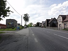
| The street in Rýmařov | |
The Silnice I / 11 ( Czech for "1st class road 11") is a Czech state road (1st class road).
course

The road currently begins in Choťánky (Chotianek) near Poděbrady (Poděbrady), where it branches off from Silnice I / 32 to the east, runs at some distance parallel to the Dálnice 11 motorway ( European route 67 ), passes through Chlumec nad Cidlinou (Chlumetz an der Cidlina) ) and Nové Město nad Cidlinou (Neustadtl), where the Silnice I / 36 branches off, leads through Hradec Králové (Königgrätz), where Silnice I / 31 crossed the Elbe and the Silnice I / 35 ( European route ) in the train of the city ring (městský okruh) 442 ) and takes up the Silnice I / 36 again at Čestice u Častolovic (Tschestitz). It continues via Kostelec nad Orlicí (Adlerkosteletz) and Vamberk (Wamberg), where it crosses the Silnice I / 14 , to Žamberk (Senftenberg in Bohemia). From there the road continues via Jablonné nad Orlicí (fork on the Adler), meets Silnice I / 43 in Červená Voda (Mährisch Rothwasser) , runs for a distance of eight kilometers together with Silnice I / 43, separates in Bukovice (Bukowitz) from this again, meets in Bludov (Blauda) on the Silnice I / 14, with which it shares the following ten kilometers through the town of Šumperk (Mährisch Schönberg). In Rapotín (riding village) the streets divide again; the Silnice I / 11 leads through the Rabenseifener Bergland (Hraběšická vrchovina) and Rýmařov (Roman town) to Bruntál (Freudenthal). There she crosses the Silnice I / 45 . In its further course in an easterly direction it touches Horní Benešov (Benisch) and meets the Silnice I / 57 before Opava (Troppau) , with which it runs a short distance together. In its further course to Ostrava (Ostrau) and past this city, it is partially expanded to four lanes. At Ostrava it crosses the Dálnice 1 motorway at its junction (exit) 354 and the Dálnice 56 motorway . The Silnice I / 11 continues in four lanes to Havířov and from there to Český Těšín (Czech part of the twin towns of Teschen). It now forms part of the European route 75 . It bypasses the city of Třinec (Trzinietz) and essentially follows the course of the Olsa (Olše) to Jablunkov (Jablunkau). From there it leads south over the Jablunka Pass and the border with Slovakia . On the Slovak side, it continues as Cesta I triedy 11 via Čadca to Žilina (Sillein).
The length of the road is around 354 kilometers; this makes it the longest of its class in the Czech Republic.
history
From 1940 to 1945 the road in the west to Hradec Králové formed part of the Reichsstraße 325 , from Hradec Králové to Rapotín the Reichstraße 147 , from Rapotín to Opava the Reichstraße 351 and from Opava to the Slovakian border the Reichstraße 145 .
Individual evidence
- ↑ https://www.rsd.cz/wps/wcm/connect/c627e870-3aa0-4636-924c-323ddd3a6f4a/2016_7_cr_500vrst.jpg?MOD=AJPERES , accessed on November 16, 2016
- ↑ Freytag & Berndt Autoatlas Česko, 2010 edition, ISBN 978-80-7316-056-2


