Silnice I / 65
| Silnice I / 65 in the Czech Republic | |

|
|
| map | |
| Basic data | |
| Operator: | Ředitelství silnic a dálnic ČR |
| Start of the street: | Rádlo ( 50 ° 41 ′ N , 15 ° 7 ′ E ) |
| End of street: | Jablonec nad Nisou ( 50 ° 43 ′ N , 15 ° 10 ′ E ) |
| Overall length: | 8.322 km |
| of which in operation: | 8.322 km |
|
Kraj ( region ): |
Liberecký kraj |
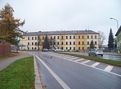
| The street in Jablonec nad Nisou (Gablonz) | |
The Silnice I / 65 ( Czech for: "1st class street 65") is a Czech state road (1st class street).
course
The road begins at junction 33 of Dálnice 35 (previously the R 35 expressway), which has been upgraded since January 1, 2016, near Rádelský Mlýn, runs from there in an easterly direction to Rychnov u Jablonce nad Nisou (Reichenau) and further north to Jablonec nad Nisou ( Gablonz), where it ends at Silnice I / 14 .
The total length of the road is a good 8 kilometers.
Individual evidence
- ↑ Freytag & Berndt Autoatlas Česko, 2010 edition, ISBN 978-80-7316-056-2
