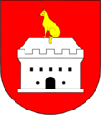
Choťánky
| Choťánky | ||||
|---|---|---|---|---|
|
||||
| Basic data | ||||
| State : |
|
|||
| Region : | Středočeský kraj | |||
| District : | Nymburk | |||
| Area : | 402 ha | |||
| Geographic location : | 50 ° 9 ' N , 15 ° 10' E | |||
| Height: | 189 m nm | |||
| Residents : | 439 (Jan 1, 2019) | |||
| Postal code : | 290 01 | |||
| License plate : | S. | |||
| traffic | ||||
| Street: | Poděbrady - Libice nad Cidlinou | |||
| structure | ||||
| Status: | local community | |||
| Districts: | 1 | |||
| administration | ||||
| Mayor : | Pavel Pistor (as of 2015) | |||
| Address: | Choťánky 24 290 01 Poděbrady |
|||
| Municipality number: | 537217 | |||
| Website : | www.chotanky.cz | |||
Choťánky (German Chotianek ) is a municipality in the Czech Republic. It is located three kilometers east of Poděbrady and belongs to the Okres Nymburk .
geography
Choťánky is to the right of the Elbe in the Elbe meadows on the Bohemian Table. To the south lies the mouth of the Cidlina , in the northeast runs the Sánský kanál .
The Kolín – Děčín railway runs through the village without stopping . In the south is the D 11 / E 67 motorway with exit 47 Poděbrady-východ, from which the state road 32 leads to Jičín to the east past Choťánky .
Neighboring towns are Vystrkov, Vrčení and Pátek in the north, Odřepsy in the northeast, Libice nad Cidlinou in the southeast, Velký Osek and Oseček in the south, Sokoleč in the southwest, Kluk and V Zátiší in the west and Poděbrady and Sanspareil in the northwest.
history
Archaeological finds during the construction of the road from Vrčení show settlement during the Neolithic and Hallstatt periods . In the 10th century there was a fortified Slavnikid castle near Choťánky and, after their extinction in 995, the Vršovci .
The first written record of Chotětice comes from 1345. At that time the village belonged to the Poděbrady domain. The fortress located in the village was a feud of Poděbrady Castle . In the 15th century, probably during the Hussite siege of Podebrady in 1426, the fortress fell into desolation and was later given the name Kočičí hrádek ( Katzenburg ). Until the abolition of patrimonial Chotětice remained almost always under the Poděbrady rule. The lands belonging to Katzenburg were divided up, farms laid out and the festivals removed. In the 18th century, the current name Choťánky became common. From 1850 Choťánky formed a municipality in the Poděbrady district . In 1900 the place consisted of 77 houses and had 419 inhabitants. On January 1, 1961, the community came to Okres Nymburk.
There is a golf course west of Cho Chánky.
Community structure
No districts are shown for the municipality of Choťánky. The settlements Vrčení and Vystrkov ( Wystrkow ) belong to Choťánky .
Partner municipality
- Vrčeň , Czech Republic
Attractions
- Bell tower, built in 1882
- Alluvial forest Klucký luh, south of the village
- Remains of the Slavnikid fort, southeast of the village


