Sokoleč
| Sokoleč | ||||
|---|---|---|---|---|
|
||||
| Basic data | ||||
| State : |
|
|||
| Region : | Středočeský kraj | |||
| District : | Nymburk | |||
| Area : | 627 ha | |||
| Geographic location : | 50 ° 6 ' N , 15 ° 6' E | |||
| Height: | 192 m nm | |||
| Residents : | 1,018 (Jan 1, 2019) | |||
| Postal code : | 290 01 | |||
| License plate : | S. | |||
| traffic | ||||
| Street: | Poděbrady - Cerhenice | |||
| structure | ||||
| Status: | local community | |||
| Districts: | 1 | |||
| administration | ||||
| Mayor : | Marián Sipajda (as of 2015) | |||
| Address: | Poděbradská 51 290 01 Sokoleč |
|||
| Municipality number: | 537811 | |||
| Website : | www.sokolec.cz | |||
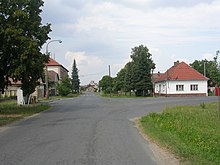
Sokoleč (German Sokoletsch , also Sokolecz ) is a municipality in the Czech Republic. It is located five kilometers south of Poděbrady and belongs to the Okres Nymburk .
geography
Sokoleč is located to the left of the Elbe at the Sokolečská strouha moat on the Bohemian Table. The village lies within the large Velim railway test ring , on the western edge of the village is the small ring. The D11 / E 67 motorway runs to the north, at exit 39 Poděbrady-jih. State road 38 between Nymburk and Kolín lies to the east . To the south-east are the corridors of the village Popovice, which was extinguished in the Thirty Years War.
Neighboring towns are Přední Lhota and Kluk in the north, Libice nad Cidlinou in the northeast, Oseček and Předhradí in the east, Pňov and Klipec in the southeast, Dolní Nouzov, Horní Nouzov and Velim in the south, Cerhenice in the southwest, Ratenice in the west and Vrbová Lhota in the north-west.
history
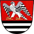
The first written mention of Sokolčí took place in 1332. According to old traditions, the place is said to have been a fief of the royal falconer as early as the beginning of the 13th century , from which the place name originated. The residents worked as lumberjacks in the stately forests; later agriculture and handicrafts became the main occupation. In 1799 a village school was inaugurated.
After the abolition of patrimonial Sokoleč formed a municipality in the Poděbrady district from 1850 . In the 19th century the cultivation of sugar beet and chicory began, around 1880 a chicory artery was created . The new school was built between 1900 and 1904. In 1906 a farmer found a golden ax in a field near Sokoleč, which is now in the museum in Poděbrady. Since 1961 the community belongs to Okres Nymburk. In 1963 the Velim Railway Test Ring was established . Since 2005, the Mýtina Festival for Country, Folk and Tramp Music has been held annually in June on the Mýtina forest meadow located one kilometer outside the village.
Community structure
No districts are shown for the municipality of Sokoleč.
Attractions
- Monument to František Novák
- Chapel on the village square, built in 1799
Sons and daughters of the church
- František Novák , (1902-1940), Czech pilot and flight acrobat as king of the air referred
Web links
Individual evidence
- ↑ Český statistický úřad - The population of the Czech municipalities as of January 1, 2019 (PDF; 7.4 MiB)


