
Moravskoslezský kraj
|
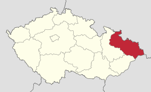
Moravskoslezský kraj Moravian-Silesian Region |
|
|---|---|
 |
 |
| map | |
  |
|
| Basic data | |
| Historic country : | Silesia , Moravia |
| Administrative headquarters : | Ostrava |
| Biggest town: | Ostrava |
| ISO 3166-2 : |
CZ-80
|
| Residents : | 1,203,299 (January 1, 2019) |
| Population density : | 224 inhabitants / km² |
| Vehicle registration number : |
T
|
| geography | |
| Area : | 5,427 km² |
| Expansion: | North-South: up to 54 km West-East: 133 km |
| The highest point: | 1.491 nm |
| Deepest point: | 195 m nm |
| Administrative division | |
| Districts : | 6th |
| Municipalities : | 300 |
Moravskoslezský kraj , German Moravian-Silesian Region , until May 2001 Ostravský kraj ( Ostrava Region ), is one of the 14 regions of the Czech Republic . There are 299 municipalities in the region, including 39 cities (2007). Council is based in Ostrava ( Ostrava ).
The region borders on Poland to the north and east and Slovakia to the south-east . Intrastate there are limits to the regions Olomouc ( Olomouc ) and Zlín .
Statistical key figures
| Statistical key figures 2002 | ||||
|---|---|---|---|---|
| Area in km² | Residents 1) | Average age 1) | Municipalities 2) | |
| Okres Bruntál | 1,658 | 93,080 | 42.5 | 67 |
| Okres Frýdek-Místek | 1,273 | 213,628 | 41.9 | 72 |
| Okres Karviná | 347 | 251,370 | 42.8 | 17th |
| Okres Nový Jičín | 918 | 151.737 | 41.6 | 54 |
| Okres Opava | 1,144 | 176,600 | 40.4 | 77 |
| Okres Ostrava-město | 214 | 323.464 | 40.6 | 13 |
1) on January 1, 2017 2) in 2016
Share of gross domestic product (2001): 10.4%
Unemployment rate (2017): 6.97%
landscape
The Moravian-Silesian region has a very diverse landscape. In the north are the Hrubý Jeseník massifs with the highest mountain in Moravia Praděd ( 1.491 m nm ), which slowly merge into the Nízký Jeseník ( Nízký Jeseník ), the high valley and finally into the Oderské vrchy . The center of the region is formed by the densely populated areas of the plain around Troppau ( Opava ), the Ostrauer Pan (Ostravská pánev) and the Moravian Gate (Moravská brána). In the southeast the landscape becomes mountainous again through the Beskids . The area occupies 5,535 km², 7% of the total area of the Czech Republic. More than half can be used for agriculture, 35% take up forest areas. In addition to natural wealth, the district also has many raw materials such as coal, natural gas, limestone, granite, marble, slate, gypsum stone, gravel sand, sand and brick clay. The main river is the springing in the Oder Mountains Or . Where the Oder and Olsa ( Olše ) flow together, there is also the lowest point in the region with 195 m nm.The Beskydy, Jeseníky and Poodří are among the 131 other small areas protected by the state Nature parks.
Demographics
With 1.2 million inhabitants, it is the third most populous district in the Czech Republic (2017) after Středočeský kraj (1.33 million) and Hlavní město Praha (1.28 million). The population density is almost twice as high as in other districts. 23% of the population lives in cities with more than 5,000 and 60% in cities with more than 20,000 inhabitants, unique in the Czech Republic. In the region, the birth rate is falling and the population is aging. The migration balance (2006) is also negative . The average age of the population is 42.2 years (2017). A large group of Roma lives in the district .
environment
The district is one of the most damaging to the environment in the Czech Republic. There are major problems with the recultivation of the landscape and the purification of the groundwater.
economy
The area was already heavily industrialized during the time of Austria-Hungary in the 19th century and was one of the most important industrial areas in Central Europe. However, the focus on heavy industry today brings with it many social problems since this branch of the economy stopped developing. At 10.4%, however, it is still the second largest district after Prague, which contributes to the gross domestic product . Today all pig iron, 92% of steel and 98% of coke in the Czech Republic are produced here. The extraction of hard coal also only takes place here. Another important branch of the economy is the energy industry, gas production, the commercial vehicle industry and the tobacco and food industries. In the region there are 23 industrial zones on a total of 1080 ha. In 2006, 5536 foreign companies worked there, most of them from Slovakia (24.8%), Poland (18.5%) and Germany (14.5%).
For the purpose of development of tourism and economic cooperation, the four Euro-regions Beskid (were Beskydy ), Jeseníky ( Praděd ), Silesia ( Silesia ) and the Cieszyn Silesia ( Těšín Silesia ) founded.
labour market
Despite the decline in production in heavy industry and coal reserves, 536,000 people work in industry, a further 13% in trade. The gross wage is about a thousand crowns lower than the national average. The structure of the economy also brings significant problems in dealing with unemployment . Almost 6.97% (2017) are unemployed, the proportion of long-term unemployed is almost half.
Transport infrastructure
The A1 motorway runs through the district from Brno to Bohumin on the Polish border. A connection to the Polish A4 is under construction. The traffic continues on the international roads Opava – Ostrava – Český Těšín - Mosty u Jablunkova and Nový Jičín – Frýdek-Místek – Český Těšín. The rail network has been modernized and the Esko S-Bahn system has been in place in the region since December 14, 2008 . In Mošnov the regional is Ostrava Airport .
Education and Healthcare
131,000 students are educated in 458 primary schools. There are also 36 high schools, 85 technical high schools, 56 vocational schools, 10 institutions of post-secondary education and 3 public universities in Ostrava and Opava / Karviná.
There are 284 residents for one doctor. In addition, there are 7,900 beds in 20 hospitals and 3,100 beds in specialist institutes for the treatment of protracted illnesses. There are also 10,000 old people's places.
Culture
The traditional cultural center is Ostrava. There are 19 theaters, 63 museums, 99 galleries and 63 cinemas, 429 libraries, 113 stadiums, 26 winter stadiums and hundreds of sports fields, sports halls and pools in the district. The Janáček Symphony Orchestra is also located in Ostrava . In the north of the district there are spa stays, a wide network of cycle paths and all kinds of winter sports. There are also many historical monuments in the district, such as the centers of the towns of Příbor , Nový Jičín and Štramberk . But there are also architectural monuments to be found here, such as the castles in Hradec nad Moravicí , Raduň , Kravaříce or Fulnek . Significant castles include Sovinec , Starý Jičín and Hukvaldy . The exhibitions are in the Technical automobile museum Tatra in Kopřivnice , Wagon Museum in Studénka at the Mining Museum in Ostrava-Petřkovice visit.
politics
Hejtman ( governor ) of the region has been Ivo Vondrák ( ANO ) since November 11, 2016 . He is the fourth Hejtman after Miroslav Novák ( ČSSD , 2012–2016), Jaroslav Palas (ČSSD, 2008–2012) and Evžen Tošenovský ( ODS , 2000–2008).
6 members of the ANO, 3 members of the KDU-ČSL and 2 members of the ODS are represented in the 11-member regional council.
In the regional parliament, which consists of 65 members, ANO was the strongest party and won 22 seats with 25.7% of the votes. The second strongest party was the ČSSD with 16.66% of the votes and thus 14 seats. KSČM , which is traditionally strong in this district , achieved 9 mandates with 11.38%. The Christian Democratic KDU-ČSL won 8 seats with 10.17% of the vote. The party of civil rights , which ran together with the right-wing populist party Freedom and Direct Democracy , got 7.02% and so 6 seats. The bourgeois ODS also had 6 mandates with 6.93%.
Among other things, the independents (NEZÁVISLÍ) and TOP 09 failed because of the threshold clause applicable to entry into parliament .
Districts / Okresy

- Okres Bruntál ( Freudenthal District )
- Okres Frýdek-Místek ( Friedeck-Friedberg District )
- Okres Karviná ( Karviná District )
- Okres Nový Jičín ( Neu-Titschein District )
- Okres Opava ( Opava District )
- Okres Ostrava-město ( Ostrava-City District )
District Cities
- Frýdek-Místek ( Friedeck-Friedberg )
- Karviná ( Karwin )
- Opava ( Troppau )
- Ostrava ( Ostrau )
- Bruntál ( Freudenthal )
- Nový Jičín ( new certificate )
Biggest cities
| Surname | Name (german) | Name (polish) | Residents (January 1, 2017) |
|---|---|---|---|
| Ostrava | Ostrau | Ostrawa | 291,634 |
| Havířov | Hawierzów | 73.274 | |
| Opava | Troppau | Opawa | 57,387 |
| Frýdek-Místek | Friedeck-Friedberg | Frydek-Mistek | 56,719 |
| Karviná | Karviná | Karwina | 54,413 |
| Třinec | Trzynietz | Trzyniec | 35,596 |
| Orlová | Orlau | Orłowa | 29,231 |
| Český Těšín | Teschen | Czeski Cieszyn | 24,650 |
| Krnov | Hunter village | Krnów, Karniów | 23,762 |
| Nový Jičín | Neu-Titschein | Nowy Jiczyn | 23,550 |
| Kopřivnice | Nesselsdorf | Koprzywnica | 22,237 |
| Bohumín | Oderberg | Bogumin | 20,980 |
| Bruntál | Freudenthal | Bruntal | 16,583 |
| Hlučín | Hultschin | Hluczyn | 13,970 |
| Frenštát pod Radhoštěm | Frankstadt under the Radhoscht | 10,887 | |
| Frýdlant nad Ostravicí | Friedland on the Ostrawitza | Frydlant nad Ostrawicą | 9,895 |
| Studénka | Stauding | 9,691 | |
| Příbor | Freiberg | 8,447 | |
| Rýmařov | Roman city | Rymarzów | 8,345 |
| Bílovec | Wagstadt | Biłowiec | 7,415 |
| Odry | Odrau | 7,291 |
See also
Web links
- Homepage of the region (cz / en)
- Statistical information on the region (cz)
Individual evidence
- ↑ a b c o-kraji.kr-moravskoslezsky.cz ( Memento from June 8, 2008 in the Internet Archive )
- ↑ POČET OBYVATEL V OBCÍCH. Retrieved September 23, 2017 (Czech).
- ↑ Hejtman kraje. Retrieved September 23, 2017 (Czech).
- ↑ Rada kraje. Retrieved September 23, 2017 (Czech).
- ↑ rozdělení křesel. Retrieved September 23, 2017 (Czech).
Bruntál | Frýdek-Místek | Karviná | Nový Jičín | Opava | Ostrava-město
Coordinates: 49 ° 49 ' N , 17 ° 58' E