
Moravian Gate
.jpg)

The Moravian Gate ( Moravská brána in Czech , Brama morawska in Polish ) is a valley watershed between the catchment areas of the Oder and the March ( Danube ) in Moravia ( Czech Republic ) and is therefore part of the great European watershed .
It lies between the Niederes Gesenke ( Oder Mountains and Kuhländchen ) mountain ranges in the north-west, the Hostein Mountains in the south, and the Moravian-Silesian Beskids ( Moravian Wallachia ) in the south-east, north of the town of Hranice na Moravě ( Moravian White Churches ) at an altitude of about 310 m nm Its apex is on the Kuče hill between the villages of Olšovec ( Ollspitz ) and Bělotín ( Bölten ). The Ludina, which flows past in the west, belongs to the catchment area of the March, while the Doubrava in the east feeds its water via the Luha to the Oder.
This is where the main traffic connections between ( Prague , Vienna , Brno ) Přerov and Ostrava ( Warsaw ) run: the railway line of the Czech main corridor II and the European route 462 on the D1 motorway . The apex position of the planned Danube-Oder Canal should also run here.
history
The Moravian Gate has been an eye of a needle since at least the Bronze Age , through which various important ancient trade routes that branched north and south ran from here, such as the so-called Amber Road .
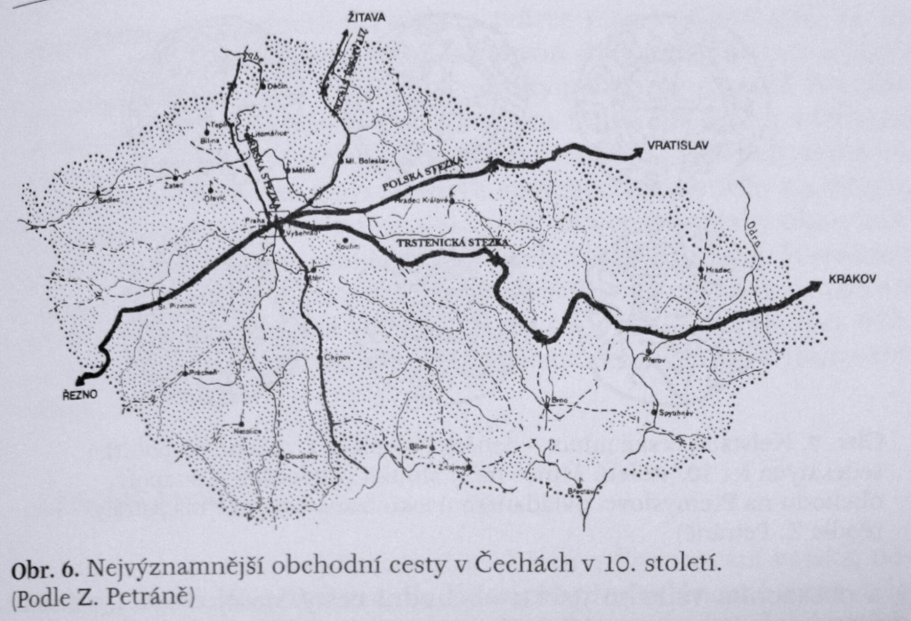
In the 10th century the trade route from Prague to Krakow, which the Chronica Boemorum mentions and which Czech history calls Trstenická stezka , went to the Trstenice river in the East Bohemian border region (German name: "Strenitzer Steig").
The city name Hranice means border (s) in the Czech Republic and is reminiscent of the Slavic tribal era when it separated the Moravians from the Golensizen . At that time the area of the gate was quite swampy and difficult to pass through in the wet seasons. An alternative was the Jablunka Pass . As a result, the Moravian Empire under Svatopluk I attacked the Upper Silesian tribes and Wislanes and possibly also expanded. During the period of colonization under German law, the Kuhländchen landscape was created , which until the 20th century made up the south-easternmost Sudeten German peninsula and separated the Lachish language from the rest of Moravia with the Sudetes and West Beskids .
Web links
- Picture on Panoramio
- Moravian Gate in the Alpen-Adria-Universität Klagenfurt
Individual evidence
- ↑ Arnold Spekke: The Ancient Amber Routes and the Geographical Discovery of the Eastern Baltic. Stockholm 1957; Reprint: Chicago 1976.
- ^ Trade routes in the Czech Republic in the 10th century
- ↑ Piotr Bogoń: Na przedpolu Bramy Morawskiej - obecność wpływów południowych na Górnym Śląsku i zachodnich krańcach Małopolski we wczesnym średniowieczu , Katowice, 2012, p. 41
Coordinates: 49 ° 35 ′ 9.4 ″ N , 17 ° 45 ′ 19 ″ E