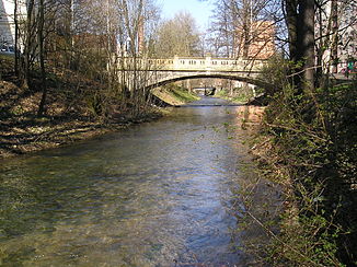
Loučná (river)
| Loučná | ||
|
Loučná in Litomyšl |
||
| Data | ||
| location | Czech Republic | |
| River system | Elbe | |
| Drain over | Elbe → North Sea | |
| source | northwest of Ostrý Kámen in the Svitavská pahorkatina | |
| Source height | 541 m nm | |
| muzzle | below Počaply in the Elbe Coordinates: 50 ° 3 ′ 35 ″ N , 15 ° 49 ′ 23 ″ E 50 ° 3 ′ 35 ″ N , 15 ° 49 ′ 23 ″ E |
|
| Mouth height | 217 m nm | |
| Height difference | 324 m | |
| Bottom slope | 4 ‰ | |
| length | 81 km | |
| Catchment area | 732.4 km² | |
| Left tributaries | Jalový potok, Desná | |
| Right tributaries | Lodrantka, Zadní Lodrantka | |
| Small towns | Litomyšl , Vysoké Mýto , Dašice , Sezemice nad Loučnou | |
The Loučná (German Lautschna ) is a left tributary of the Elbe in the Czech Republic .
It rises at 541 m above sea level. M. northwest of Ostrý Kámen in Svitavská pahorkatina and flows through the places Karle , Chmelík , Trstěnice and Čistá in a north-westerly direction .
From Čistá the river seeps away and comes back to the surface about two kilometers north in Benátky through the Loučná spring. Further places on the Loučná are downstream Litomyšl , Tržek , Nová Sídla , Řídký , Cerekvice nad Loučnou , Hrušová , Vysoké Mýto , Zámrsk and Týnišťko . There the river changes its direction initially to the west and flows on Radhošť , Uhersko and Moravany nad Loučnou to Dašice , where the Lodrantka flows into it.
Lány , Velké Koloděje and Sezemice are on the further course . Below Počaply, the Loučná flows 81 kilometers at an altitude of 217 m above sea level. M. the Elbe. The catchment area has an area of 732.4 km².
In the Middle Ages, the Strenitzer Steig, an important trade link between Bohemia and Moravia , ran along the river, which used to be called Trstenice , Mejtka and Mauthner Fluss .
Significant tributaries
- Jalový potok (l), underground at Čistá
- Desná (l), between Nová Sídla and Řídký
- Lodrantka (r), below Dašice
- Zadní Lodrantka (r), near Sezemice

