
Ústecký kraj
| Ústecký kraj Aussiger region |
|
|---|---|
 |
 |
| map | |
  |
|
| Basic data | |
| Historic country : | Bohemia |
| Administrative headquarters : | Ústí nad Labem |
| Biggest town: | Ústí nad Labem |
| ISO 3166-2 : | CZ-42 |
| Residents : | 820,789 (January 1, 2019) |
| Population density : | 154.0 inhabitants / km² (January 1, 2017) |
| Vehicle registration number : | U |
| geography | |
| Area : | 5,335 km² |
| Administrative division | |
| Districts : | 7th |
| Municipalities : | 354 |
The Ústecký kraj ( German Aussiger Region ) is one of the 14 regions of the Czech Republic . The region is located in northern Bohemia and comprises the western half of the northern Bohemian industrial area, which is important for the Czech Republic. The administrative seat is in Ústí nad Labem ( Aussig ). The north-western border also forms the state border with Germany ; in a clockwise direction, the regions Liberec (Reichenberg) , Central Bohemia , Pilsen and Karlsbad follow . The total area is 5,335 km² (6.8% of the area of the Czech Republic).
The region comprises 354 municipalities, including 46 cities. The Ústecký kraj covers the area of seven former Okresy (political districts).
geography
location
The border with Germany is formed by the Krušné hory ( Ore Mountains ), Elbe Sandstone Mountains and Lužické hory ( Lusatian Mountains ). In the southeast there are plains, the Česká křídová tabule ( Bohemian chalk board ) with the legendary mountain Říp ( Georgsberg ) and České středohoří ( Bohemian Central Uplands ). The central landscape is the North Bohemian Basin . The largest river in the district is the Elbe with its left tributaries Ohře ( Eger ) and Bílina ( Biela ) and the right tributaries Ploučnice ( Polzen ) and Kamenice ( Kamnitz ). There are also mineral and medicinal water springs in the district. The largest water area is the Nechranická nádrž reservoir on the Eger River in the western part of the district.
The highest point is Mount Klínovec ( Keilberg ), whose highest point, however, in the district of Carlsbad is located. The deepest natural point is the surface of the Elbe near Hřensko ( Herrnskretschen ) ( 115 m nm ), which is also the deepest point in the whole of the Czech Republic.
50% of the land is used for agriculture, forests make up 30%, and water areas 2%.
Cities
| city | Residents (January 1, 2017) |
|---|---|
| Ústí nad Labem | 92,984 |
| Must | 66,768 |
| Teplice | 49,697 |
| Děčín | 49,521 |
| Chomutov | 48,739 |
| Litvínov | 24,308 |
| Litoměřice | 24,168 |
| Jirkov | 19,595 |
| Žatec | 19.193 |
| Louny | 18,501 |
| Kadaň | 17,924 |
| Bílina | 17.205 |
| Varnsdorf | 15,477 |
| Klášterec nad Ohří | 14,573 |
| Roudnice nad Labem | 12,949 |
| Krupka | 12,788 |
| Rumburk | 11,095 |
| Štětí | 8,807 |
| Lovosice | 8,735 |
| Duchcov | 8,359 |
| Dubí | 7,927 |
| Podbořany | 6,389 |
| Šluknov | 5,611 |
| Česká Kamenice | 5,293 |
| Jílové | 5,167 |
| Postoloprty | 4,735 |
environment
Industrialization, especially after the Second World War, caused high environmental pollution. The lignite - opencast accelerated erosion in the area designated as a brazier North Bohemian basin. The emissions led to the death of forests in the early 1970s. Despite many efforts in recultivation and emission reduction, the pollution of the environment is still high and the Ústecký kraj is one of the districts with the greatest environmental damage in the Czech Republic.
natural reserve
In the region of Ústecký kraj there are a number of protected landscapes: the National Park České Švýcarsko ( Czech Switzerland ), the protected landscape areas (PLA) Labské Sandstones ( Elbe Sandstone Mountains ), České Středohoří ( Czech Central Mountains ), Lužické ( Lusatian Mountains ), Kokořínsko ( Daubaer Switzerland ) and 136 areas protected as nature reserves and natural monuments.
population
As of January 1, 2017, there were around 821,377 residents in the district, making the district fifth in the Czech Republic. The population density is 154.0 inhabitants / km² and is thus well above the country's average of 130 inhabitants / km². The highest population density is found in the brown coal pan, the Ore Mountains and the agricultural area around Louny and Litoměřice are sparsely populated. The largest place is the district town of Ústí nad Labem with 93,000 inhabitants. The district occupies the foremost place in the birth rate (10.6 per 1000 inhabitants), but also has a relatively high death rate of 10.9 per 1000 inhabitants. Similar to Karlovarský kraj, the divorce rate is very high: 3.8 per 1000 inhabitants.
Administrative structure
.svg)
The region (kraj) is made up of seven former political districts (okresy).
| Statistical key figures 2002 | ||||
|---|---|---|---|---|
| Okres | Area in km² | Residents 1) | Average age 1) | Communities |
| Okres Děčín (DC) | 909 | 130,787 | 41.9 | 52 |
| Okres Chomutov (CV) | 935 | 124,249 | 41.2 | 44 |
| Okres Litoměřice (LT) | 1,032 | 119,342 | 41.9 | 105 |
| Okres Louny (LN) | 1,118 | 86,346 | 41.5 | 70 |
| Okres Most (MO) | 467 | 112,881 | 41.7 | 26th |
| Okres Teplice (TP) | 469 | 128,476 | 41.7 | 34 |
| Okres Ústí nad Labem (UL) | 405 | 119.296 | 41.5 | 23 |
| total | 5335 | 821.377 | - | 354 |
1) on January 1, 2017
Economy and Infrastructure
The high proportion of natural resources, especially lignite, is economically important for the region . The brown coal pan extends in the North Bohemian Basin at the foot of the Ore Mountains from the district town of Ústí nad Labem to Kadaň . In addition, there are high-quality glass and foundry sands as well as natural stones. Four areas, especially also at the foot of the Ore Mountains, are characterized by high industrial settlement: Okres Chomutov, Most, Teplice and partly Ústí nad Labem. The sectors of energy supply, mining, mechanical engineering, chemical industry and glass production are strongly represented.
In the Litoměřice and Louny districts, on the other hand, agriculture has a predominant role. Above all, vegetables and hops are grown , with fruit in the Elbe Valley and along the Eger. These areas are also called Zahrada Čech (Bohemian Garden). The wines from the Litoměřice area and, in recent years, the wine-growing areas around Most also have a good reputation . Hardly any economic activity can be found on the ridges of the Ore Mountains and in the Schluckenauer tip north of Děčín (Šluknovsko).
At the end of 2002, 156,000 companies were registered, 113,000 of them small businesses. Most companies do trade. The most important companies in the region include Spolchemie , Mostecká uhelná společnost ( Brix coal company ), Severočeské doly ( North Bohemian mines ), Unipetrol Litvínov and the hospitals in Ústí nad Labem and Most .
As of December 31, 2005, its share in the gross domestic product was 6.5%.
labour market
Around 357,900 people are employed in the Aussig region. The average wage on December 31, 2005 was CZK 17,094 , below the national average of CZK 19,024. The decline in mining, the dismantling of large farms and the decline in agricultural production are the reasons for the long-term highest unemployment in the Czech Republic of around 7.38% (Czech Republic 4.79%) as of March 31, 2017.
Transport infrastructure
The major backbone of the road infrastructure is the D8 / E 55 motorway (partial completion 2006: State border – Trmice; Lovosice – Prague). With the German A 17 to the north , it connects Ústí with Dresden and Prague. The route is part of the pan-European transport corridor No. 4 from Berlin to Istanbul. The European route 442 forms the east-west connection along the Egergraben via Chomutov and Louny to Prague . The R7 expressway forms another main route between Prague, Chomutov and on to Chemnitz (Saxony).
The region has a dense rail network. The important international rail route Berlin - Prague - Vienna / Budapest runs along the Elbe . Since 2008 there has been a line system in local rail passenger transport that is marketed as " Regiotakt Ústecký kraj ".
Railway routes in the region
- Railway line Dresden – Děčín (left Elbe), railway line Praha – Děčín (left Elbe) , railway line Kolín – Děčín (right Elbe)
- Railway line Ústí nad Labem-Chomutov , railway Chomutov-Cheb , railway Trmice-Bílina
- Railway line Prague – Most , railway line Most – Moldava
- Railway line Praha – Chomutov , railway line Chomutov – Vejprty / Reitzenhain
- Railway line Bakov nad Jizerou-Ebersbach , railway line Rumburk-Sebnitz
- Railway Děčín – Jedlová , railway line Benešov nad Ploučnicí – Česká Lípa
- Railway line Teplice – Lovosice – Litoměřice-Česká Lípa-Liberec (North Bohemian Transversal Railway)
- Děčín – Chomutov railway line
The Elbe is navigable and allows access to the North Sea .
Culture and social affairs
education
In 2005/06 there were 319 kindergartens, 244 elementary schools, 24 grammar schools, 73 specialist grammar schools and 11 institutions of post-secondary education in the region. Public higher education is represented by the Jan Evangelista Purkyně University in Ústí nad Labem. There are also branches of the Prague ČVUT in Děčín, the Bergakademie TU Ostrava in Most and the chemistry school VŠCHT in Most.
Healthcare
There are 5,893 beds available in 20 hospitals, the most important ones in Ústí nad Labem and Most. There are also ten rehabilitation clinics with 1,436 beds in the district.
Cultural assets
During the lifting of okresy as authorities in the Ústecký kraj took over in late 2001 from louny district the Nový Hrad Castle , which is being restored under the leadership of the Regional Museum of Louny for tourist use since the 1994th At the beginning of 2012, the castle was transferred to a subsidy operation of the Ústecký kraj, which is continuing the work on its own.
Attractions
In view of the dense settlement in the early Middle Ages, the region has a large number of historical sites. The most famous are the Romanesque rotunda on the legendary mountain Říp , the Gothic church in Most , the baroque castle Duchcov , the monasteries Osek and Doksany , the castles Ploskovice , Libochovice as well as the old towns of Úštěk , Roudnice nad Labemmeritz and the episcopal city of Leith . In the fortress town of Terezín there is a memorial for the victims of the Theresienstadt concentration camp . Some of the villages in the Litoměřice region are protected monuments.
Despite its high industrialization, the region offers a beautiful landscape. These include Bohemian Switzerland and the Bohemian Central Uplands with Porta Bohemica , the rock town of Tiské stěny and many others. Sports enthusiasts can visit the Hippodrom, Autodrom and golf courses in Most. The region is also well developed with cycle paths (cyklotrasa). There are also excellent winter sports opportunities in the Ore Mountains and Lusatian Mountains.

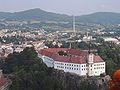
View of Litoměřice from the bridge over the Elbe

Gate of the Small Fortress Theresienstadt
View from the Shepherd's Wall (Pastýřská stěna) over Děčín

in the Kamenice Valley - Jetřichovice exit


politics
Hejtman ( governor ) of Ústecký kraj has been Oldřich Bubeníček ( KSČM ) since November 20, 2012 . He is the third Hejtman in the district after Jana Vaňhová ( ČSSD ), who held office from 2008 to 2012, and Jiří Šulc ( ODS ), who held office from 2000 to 2008. Bubeníček is the first KSČM politician in the Czech Republic to take over the post of Hejtman in a Kráj after 1990. He governs in a coalition of his KSČM and the Social Democrats (ČSSD), which occupy the positions in the council of the district (rada kraje).
The district council is elected by the regional parliament (Zastupitelstvo kraje) . In the last elections to the regional parliament ( Zastupitelstvo kraje ) in 2016, the turnout was 28.94 percent. The regional parliament has 55 seats, of which ANO received 20 as the strongest political force with 23.24%. The traditionally strong KSČM in this district, which after the 2012 elections became the strongest force in a regional election in the Czech Republic for the first time, achieved only the second strongest result with 15.82% and thus 13 seats. The ČSSD had 10 seats with 11.9%, the ODS had 7 seats with 8.54%. The remaining 5 seats went to SPO + SPD (6.07%). The remaining votes were cast for parties that failed because of the 5 percent threshold for entry into parliament.
International cooperation
International cooperation is confirmed by two Euroregions . The Elbe / Labe Euroregion covers an area of 5400 km² and is home to 1.4 million people. 214 Czech and 63 Saxon communities belong to it. These include areas of Northern Bohemia, Saxon Switzerland, part of the Saxon Upper Elbe and the Eastern Ore Mountains. The euro region Erzgebirge / Krušnohoří form on the Czech side 72 municipalities in the districts of Chomutov, Most, Louny and Teplice.
Web links
- Homepage of the region (cz / de / en)
- Czech Statistical Office: Statistical information on the region ( Memento of October 27, 2007 in the Internet Archive ) (cz / en)
Individual evidence
- ↑ a b Czech Statistical Office: Page no longer available , search in web archives: 1-1. Position of the region in the Czech Republic: selected indicators, 2005
- ↑ Czech Statistical Office: Statistical information on education, culture, sport and health care in the region ( Memento of October 11, 2007 in the Internet Archive )
- ↑ http://www.zameknovyhrad.cz/vismo/dokumenty2.asp?id_org=450043&id=1005&p1=52
- ↑ rozdělení křesel. Retrieved September 24, 2017 (Czech).
Coordinates: 50 ° 32 ' N , 13 ° 50' E