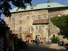
Daubai Switzerland
The Daubaer Switzerland (Czech Dubské Švýcarsko , even Dubské Skály or Polomené Mountains today as the local conservation area Kokořínsko dt (. Area around Kokorschin )) to the place Dauba (Dubé) named, is located in North Bohemia ( Czech Republic to the southeast) of the Czech Central Mountains ( České středohoří ) and belongs geomorphologically to the Rollberger hill country ( Ralská pahorkatina ). The area is bounded by the Elbe lowlands , the Jizera ( Iser ) lowlands , the Doksy ( Hirschberg am See ) pond area and merges into the Bohemian Central Mountains in the northeast. Most of the Daubian Switzerland is under landscape protection as CHKO Kokořínsko after Kokořín . The area was largely populated by Germans until 1945/46.
Emergence
As in Bohemian Switzerland and the other sandstone regions of Bohemia, the Chalk Sea also deposited sand here, which solidified into sandstone over the course of millions of years . In the Tertiary, volcanic magmas broke through the sandstone and formed the highest mountains. Due to the proximity of the Elbe ( Labe ) as a base for erosion , a large number of valleys were created, which structure the landscape today. The most important is the Kokořínsky důl ( Kokorschiner valley ), which drains into the Elbe ( Labe ) near Mělník ( Melnik ) .
landscape
Typical of Dauba's Switzerland are cool, shady valleys framed by sandstone cliffs, but also dry rocky reefs lined with pine trees. Some mountains built from volcanic rocks tower over this forest rock wilderness. The villages are characterized by well-kept half-timbered houses , which are here on the southern border of their distribution area.
natural reserve
Since 1976, the landscape of Daubai Switzerland has been under landscape protection as Chráněná krajinná oblast Kokořínsko on 271.57 km². The management of the protected area is located in Mělník . Particularly valuable landscape components are under special state protection as a nature reserve or natural monument .
Nature reserves
(PR = přírodní rezervace )
- PR Kokořínský důl (2096.97 ha) - one of the largest nature reserves in the Czech Republic
- PR Kostelecké bory (55.13 ha)
- PR Mokřady dolní Liběchovky (36.26 ha)
- PR Mokřady horní Liběchovky (75.12 ha)
- PR Vlhošť (81.99 ha)
Natural monuments
(PP = přírodní památka )
- PP Černý důl (1.71 ha)
- PP Deštenské pastviny (2.34 ha)
- PP Husa ( goose ) (3.95 ha) - rock formation in the shape of a goose as a result of iron incrustations
- PP Kamenný vrch u Křenova (0.39 ha)
- PP Krápník
- PP Martinské stěny ( Martinswand ) (3.18 ha)
- PP Mrzínov (0.87 ha)
- PP Na Oboře (3.46 ha)
- PP Osinalické bučiny (7.51 ha)
- PP Pod Hvězdou (1.88 ha)
- PP Prameny Pšovky (8.77 ha)
- PP Ronov (8.73 ha)
- PP Stráně Hlubokého dolu (4.64 ha)
- PP Stráně Truskavenského dolu (0.53 ha)
- PP Střezivojický špičák (0.5 ha)
- PP Stříbrný vrch (2.81 ha)
- PP Želízky (1.05 ha)
Attractions
- Mělník ( Melnik ): Castle and historic old town
- Úštěk ( Auscha ): historic old town with synagogue and the so-called bird houses (Ptači domky)
- Kokořín Castle ( Kokorschin )
- Helfenburk Castle ( Helfenburg )
- Houska Castle ( Hauska )
- Liběchov Castle ( Liboch )
Significant surveys
- Vlhošť ( Wilschtberg ), 614 m
- Vrátenská hora ( Wratner Mountain ), 508 m
- Berkovský vrch ( Vrchhabener Mountain ), 480 m
- Nedvezi, ( Nedoweska ), 458 m
- Husa ( goose ), 449 m
- Čap ( Tschap ), 387 m
places
Rock climbing
There is also limited climbing in Daubai Switzerland. The first rock was conquered before the First World War . Quargelstein was conquered as one of the most important rocks in 1909. Most of the rocks in Daubaer Schweiz are very small and widely scattered across the area. Significant rocks are almost completely missing. The rock is very poor in binding agents and usually very soft.
See also
- Switzerland (landscape name) (regions named "Switzerland")
Individual evidence
- ^ Marie Vojtíšková / Břetislav Vojtíšek / Markéta Myšková: Dubá a okolí. Praha (Terra) 1993, p. 25
Web links
- CHKO Kokořínsko (Czech / English)
- Photo gallery Kokořínsko and surroundings / Charles University (Czech)
- Geonames
Coordinates: 50 ° 32 ' N , 14 ° 32' E


