
Hochleithen
|
Hochleithen
|
||
|---|---|---|
| coat of arms | Austria map | |
 |
|
|
| Basic data | ||
| Country: | Austria | |
| State : | Lower Austria | |
| Political District : | Mistelbach | |
| License plate : | MI | |
| Main town : | Wolfpassing on the Hochleithen | |
| Surface: | 19.91 km² | |
| Coordinates : | 48 ° 27 ' N , 16 ° 31' E | |
| Height : | 226 m above sea level A. | |
| Residents : | 1,144 (January 1, 2020) | |
| Population density : | 57 inhabitants per km² | |
| Postcodes : | 2123, 2125 | |
| Area code : | 02245 | |
| Community code : | 3 16 22 | |
| NUTS region | AT126 | |
| Address of the municipal administration: |
Community center 1 2123 Traunfeld |
|
| Website: | ||
| politics | ||
| Mayor : | Adolf Mechtler ( ÖVP ) | |
|
Municipal Council : ( 2020 ) (19 members) |
||
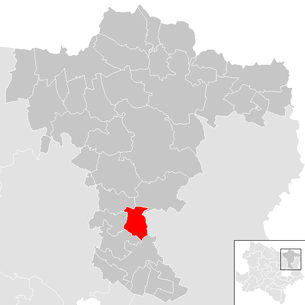
| Location of Hochleithen in the Mistelbach district | ||
  |
||
| Source: Municipal data from Statistics Austria | ||

Hochleithen is a municipality with 1144 inhabitants (as of January 1, 2020) in the Mistelbach district in Lower Austria .
geography
Hochleithen is located around 10 km north of Wolkersdorf in the Weinviertel in Lower Austria. The area of the municipality covers 19.83 square kilometers. 6.82 percent of the area is forested.
Community structure
The municipality includes the following three localities (population in brackets as of January 1, 2020):
- Bogenneusiedl (169)
- Traunfeld (360)
- Wolfpassing on the Hochleithen (615)
The community consists of the cadastral communities Bogenneusiedl, Traunfeld and Wolfpassing an der Hochleithen.
Neighboring communities
history
- Second World War
In the last days of the Second World War , Hochleithen and its cadastral communities became the scene of violent and eventful battles between troops of the Wehrmacht and the Red Army . On April 15, 1945, the Soviets carried out a low-flying attack on a German artillery position in Bogenneusiedl, killing civilians and destroying several buildings. In Traunfeld there were tough defensive battles by the Germans using tanks and light artillery against strong Soviet troops equipped with Stalin organs. Only after heavy mortar fire did the Soviets manage to take the site on April 16, and 21 buildings were completely destroyed. In Wolfpassing, three civilians were killed in the course of alternating fighting, and 51 buildings were destroyed by flames.
Population development
According to the results of the 2001 census , there were 1084 inhabitants. In 1991 the municipality had 1026 inhabitants, in 1981 1014 and in 1971 1014 inhabitants.
politics
The municipal council has 19 members.
- With the municipal council elections in Lower Austria in 1990, the municipal council had the following distribution: 10 ÖVP, 7 SPÖ and 2 FPÖ.
- With the municipal council elections in Lower Austria in 1995, the municipal council had the following distribution: 11 ÖVP, 6 SPÖ, 4 FH − Für Hochleithen and 2 FPÖ.
- With the municipal council elections in Lower Austria in 2000, the municipal council had the following distribution: 8 ÖVP, 5 SPÖ, 1 FPÖ and 1 FH − Für Hochleithen.
- With the municipal council elections in Lower Austria in 2005 , the municipal council had the following distribution: 13 ÖVP, 5 SPÖ and 1 FPÖ.
- With the municipal council elections in Lower Austria 2010 , the municipal council had the following distribution: 12 ÖVP, 6 SPÖ and 1 FPÖ.
- With the municipal council elections in Lower Austria in 2015 , the municipal council had the following distribution: 14 ÖVP and 5 SPÖ.
- With the municipal council elections in Lower Austria 2020 , the municipal council has the following distribution: 14 ÖVP and 5 MRV team Robert Vielnascher (SPÖ).
- mayor
- until 2005 Josef Regner (ÖVP)
- since 2005 Adolf Mechtler (ÖVP)
Culture and sights
.JPG)


- Catholic parish church Wolfpassing an der Hochleithen hl. Nicholas
- Catholic parish church Traunfeld hl. Johannes Nepomuk
- Catholic branch church Bogenneusiedl hl. Johannes Nepomuk
economy
In 2001 there were 31 non-agricultural workplaces, agricultural and forestry operations 63 according to the 1999 survey. According to the 2001 census, the number of people in employment at home was 493. In 2001, the activity rate was 47.14 percent.
Web links
- 31622 - Hochleithen. Community data, Statistics Austria .
Individual evidence
- ↑ Statistics Austria: Population on January 1st, 2020 by locality (area status on January 1st, 2020) , ( CSV )
- ^ Army History Museum / Military History Institute (HGM / MHI), Military History Research Department (MilFoA), study collection, inventory 1945, box 5, fasc. 45/9, municipality reports Lower Austria, District Mistelbach
- ^ Result of the local council election 1995 in Hochleithen. Office of the Lower Austrian State Government, March 30, 2000, accessed on March 15, 2020 .
- ^ Election result of the municipal council election 2000 in Hochleithen. Office of the Lower Austrian State Government, February 4, 2005, accessed on March 15, 2020 .
- ^ Election result of the 2005 municipal council election in Hochleithen. Office of the Lower Austrian State Government, March 4, 2005, accessed on March 15, 2020 .
- ^ Election result of the 2010 municipal council election in Hochleithen. Office of the Lower Austrian State Government, October 8, 2010, accessed on March 15, 2020 .
- ^ Election result of the 2015 municipal council election in Hochleithen. Office of the Lower Austrian State Government, December 1, 2015, accessed on March 15, 2020 .
- ↑ Results of the municipal council election 2020 in Hochleithen. Office of the Lower Austrian State Government, January 26, 2020, accessed on March 15, 2020 .

Altlichtenwarth | Asparn on the Zaya | Bernhardsthal | Bockfließ | Drasenhofen | Falkenstein | Fallbach | Gaubitsch | Gaweinstal | Gnadendorf | Großebersdorf | Grossengersdorf | Greater harras | Great Krut | Hausbrunn | Herrnbaumgarten | Hochleithen | Kreuttal | Kreuzstetten | Laa an der Thaya | Shop Village | Mistelbach | Neudorf im Weinviertel | Niederleis | Ottenthal | Pillichsdorf | Poysdorf | Rabensburg | Schrattenberg | Staatz | Stronsdorf | Ulrichskirchen-Schleinbach | Unterstinkenbrunn | Wildendürnbach | Wilfersdorf | Wolkersdorf
Cadastral communities: Bogenneusiedl | Traunfeld | Wolfpassing on the Hochleithen
Locations: Bogenneusiedl | Traunfeld | Wolfpassing on the Hochleithen
Villages: Bogenneusiedl | Traunfeld | Wolfpassing on the Hochleithen
Counting district: Wolfpassing adHochl. | Traunfeld | Bogenneusiedl