
Shop village
|
market community Shop village
|
||
|---|---|---|
| coat of arms | Austria map | |
 |
|
|
| Basic data | ||
| Country: | Austria | |
| State : | Lower Austria | |
| Political District : | Mistelbach | |
| License plate : | MI | |
| Surface: | 50.12 km² | |
| Coordinates : | 48 ° 32 ′ N , 16 ° 29 ′ E | |
| Height : | 228 m above sea level A. | |
| Residents : | 2,304 (January 1, 2020) | |
| Population density : | 46 inhabitants per km² | |
| Postal code : | 2126 | |
| Area code : | 02575 | |
| Community code : | 3 16 30 | |
| NUTS region | AT125 | |
| UN / LOCODE | AT LDO | |
| Address of the municipal administration: |
Cardinal Franz König Str. 1 2126 Ladendorf |
|
| Website: | ||
| politics | ||
| Mayor : | Thomas Ludwig ( ÖVP ) | |
|
Municipal Council : ( 2020 ) (21 members) |
||
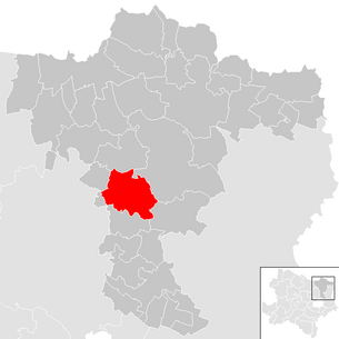
| Location of Ladendorf in the Mistelbach district | ||
  |
||
 Castle and Parish Church (2007) |
||
| Source: Municipal data from Statistics Austria | ||

Ladendorf is an Austrian market town with 2304 inhabitants (as of January 1, 2020) in the Mistelbach district in Lower Austria .
geography
Ladendorf is located in the Weinviertel in Lower Austria. The area of the market town covers 50.07 km². 16.92 percent of the area is forested.
Community structure
The municipality includes the following seven localities (population in brackets as of January 1, 2020):
- Eggersdorf (98)
- Garmanns (92)
- Count Sulz (148)
- Herrnleis (153)
- Ladendorf (1318)
- New Construction (414)
- Pürstendorf (81)
The community consists of the cadastral communities Eggersdorf, Garmanns, Grafensulz, Herrnleis, Ladendorf, Neubau and Pürstendorf.
Neighboring communities
history
In the municipality there are findings for a settlement in the early Bronze Age and in the time of the urnfield culture . The first documentary mention comes from the year 1161. In the 16th century, Ladendorf is mentioned as a market. In 1877 the market rights were renewed.
In the last days of the Second World War , between April 10 and 21, 1945, four civilians were killed, 19 buildings destroyed and ten bridges blown up in fighting between Wehrmacht and Red Army troops in Ladendorf . Civilians were also killed in fighting in Garmanns and five buildings were destroyed. Fierce fighting took place in Pürstendorf on April 18 and 19, in which three civilians were killed and eight buildings were destroyed.
coat of arms
Blazon : split from black and white, covered with a torn linden tree split from white and green with five branches, on each of which there are three stalked leaves.
religion
The Ladendorf parish belonged to the Ernstbrunn deanery until it was dissolved in 2016 and the parish was assigned to the Wolkersdorf-Pillichsdorf deanery .
Population development
According to the results of the 2001 census, there were 2110 inhabitants. In 1991 the market town had 1936 inhabitants, in 1981 1876 and in 1971 2118 inhabitants.
politics
The municipal council has 21 members.
- With the municipal council elections in Lower Austria in 1990, the municipal council had the following distribution: 12 ÖVP , 4 SPÖ and 3 FPÖ . (19 members)
- With the municipal council elections in Lower Austria in 1995, the municipal council had the following distribution: 10 ÖVP, 4 SPÖ, 3 FPÖ, 1 Ladendorf Aktiv and 1 Greens .
- With the municipal council elections in Lower Austria in 2000, the municipal council had the following distribution: 11 ÖVP, 4 SPÖ, 3 FPÖ and 1 Greens. (19 members)
- With the municipal council elections in Lower Austria in 2005 , the municipal council had the following distribution: 14 ÖVP, 5 SPÖ, 1 FPÖ and 1 Greens.
- With the municipal elections in Lower Austria in 2010 , the municipal council had the following distribution: 15 ÖVP, 3 SPÖ, 2 FPÖ and 1 Greens.
- With the municipal council elections in Lower Austria in 2015 , the municipal council had the following distribution: 12 ÖVP, 4 MUT-Mit Another-Independent-Banner, 2 SPÖ, 2 FPÖ and 1 Greens.
- With the municipal council elections in Lower Austria in 2020 , the municipal council has the following distribution: 15 ÖVP, 2 MUT-Mit einer-Mitbaren-Independent-Transparent, 2 SPÖ and 2 Greens.
- mayor
- until 2015 Othmar Matzinger (ÖVP)
- 2015–2016 Manfred Hager (ÖVP)
- since 2016 Thomas Ludwig (ÖVP)
Culture and sights

.JPG)


- Ladendorf Palace : The palace was rebuilt around 1722 by Field Marshal Wirich Philipp Graf Daun - from the father of Maria Theresa's Field Marshal Leopold Joseph Graf Daun - and was damaged in the Second World War.
- Lindenallee in Ladendorf
- Catholic parish church Ladendorf hl. Andreas: The church, built in 1776, is located in front of the main entrance to the castle.
- Catholic parish church Grafensulz hl. Aegidius: The late Romanesque church has a chapel extension from a former charnel house .
- Catholic parish church Herrnleis hl. Nikolaus: The parish church in a cemetery is raised next to a bulk box .
economy
In 2001 there were 54 non-agricultural workplaces, 100 agricultural and forestry holdings (1999 survey). The number of people in employment at the place of residence was 930 (2001 census). The employment rate in 2001 was 45.21 percent.
Ladendorf is located directly on the Laaer Ostbahn (timetable picture 902, routes S2 and S7) and is therefore conveniently connected to the regional transport network north of Vienna.
education
There is a kindergarten and a primary school in Ladendorf .
Personalities
- Sons and daughters of the church
- Johann Carl Khevenhüller (1839–1905), nobleman
- Mathias Dersch (1865–1943), politician of the Christian Social Party
- Karl Schwab (1936-2020), politician of the FPÖ , member of the Lower Austrian state parliament
- People related to the community
- Heinz Cibulka (* 1943), photographer, action artist, object artist and writer; lives and works in Ladendorf
- Magdalena Frey , photographer and video artist; lives and works in Vienna and Ladendorf
Web links
- 31630 - Ladendorf. Community data, Statistics Austria .
- Market town of Ladendorf
Individual evidence
- ↑ Statistics Austria: Population on January 1st, 2020 by locality (area status on January 1st, 2020) , ( CSV )
- ^ DEHIO Lower Austria north of the Danube . Berger, 2010, ISBN 978-3-85028-395-3 , pp. 627 .
- ^ Army History Museum / Military History Institute (HGM / MHI) , Military History Research Department (MilFoA), study collection, inventory 1945, box 5, fasc. 45/9, municipality reports Lower Austria, District Mistelbach
- ^ Result of the local council election 1995 in Ladendorf. Office of the Lower Austrian State Government, March 30, 2000, accessed on March 18, 2020 .
- ^ Election result of the municipal council election 2000 in Ladendorf. Office of the Lower Austrian State Government, February 4, 2005, accessed on March 18, 2020 .
- ^ Election result of the local council election 2005 in Ladendorf. Office of the Lower Austrian State Government, March 4, 2005, accessed on March 18, 2020 .
- ^ Election result of the municipal council election 2010 in Ladendorf. Office of the Lower Austrian State Government, October 8, 2010, accessed on March 18, 2020 .
- ^ Election result of the 2015 municipal council election in Ladendorf. Office of the Lower Austrian State Government, December 1, 2015, accessed on March 18, 2020 .
- ↑ Results of the municipal council election 2020 in Ladendorf. Office of the Lower Austrian State Government, January 26, 2020, accessed on March 18, 2020 .

Altlichtenwarth | Asparn on the Zaya | Bernhardsthal | Bockfließ | Drasenhofen | Falkenstein | Fallbach | Gaubitsch | Gaweinstal | Gnadendorf | Großebersdorf | Grossengersdorf | Greater harras | Great Krut | Hausbrunn | Herrnbaumgarten | Hochleithen | Kreuttal | Kreuzstetten | Laa an der Thaya | Shop Village | Mistelbach | Neudorf im Weinviertel | Niederleis | Ottenthal | Pillichsdorf | Poysdorf | Rabensburg | Schrattenberg | Staatz | Stronsdorf | Ulrichskirchen-Schleinbach | Unterstinkenbrunn | Wildendürnbach | Wilfersdorf | Wolkersdorf
Cadastral communities: Eggersdorf | Garmanns | Grafensulz | Herrnleis | Shop Village | New building | Pürstendorf
Locations: Eggersdorf | Garmanns | Grafensulz | Herrnleis | Shop Village | New building | Pürstendorf
Market place: Ladendorf Villages: Eggersdorf | Garmanns | Grafensulz | Herrnleis | New building | Pürstendorf Other locations: Khevenhüller Castle
Counting district: Ladendorf | Garmanns | New building | Herrnleis | Pürstendorf | Eggersdorf | Count Sulz