Brigittenau Bridge
Coordinates: 48 ° 14 ′ 16 ″ N , 16 ° 23 ′ 40 ″ E
|
|
||
|---|---|---|
| Brigitte Auer bridge and Brigittenau from the Danube Tower seen from | ||
| use | Road bridge | |
| Convicted | Klosterneuburger Strasse | |
| Crossing of | Danube | |
| place | Vienna | |
| overall length | 630 meters (river and flood bridge) |
|
| width | 32.25 meters | |
| start of building | March 24, 1980 | |
| completion | December 1981 | |
| opening | October 25, 1982 | |
| location | ||
|
|
||
| State road B14a in Austria | |

|
|
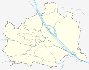
| map | |
| Basic data | |
| Overall length: | 1.5 km |
|
State : |
|
The Brigittenauer Brücke is a six-lane road bridge over the Danube in Vienna . It also has walking and cycling paths. The red color and the spiral ramps to the footpath and bike path are characteristic.
It connects the two Viennese districts of Brigittenau and Floridsdorf . The comparatively young bridge was only opened in 1982. Since it was built before the Danube Island was built, it was partly built in the dryness of the old floodplain . The river bed of the New Danube was only dug after this section had been built, which led to significant cost savings.
history
Already in the 1920s there were plans for a bridge over the Danube at the level of Innstrasse . For a long time it was mistakenly called the Traisen Bridge , as it was an extension of the Traisengasse . After the collapse of the Reichsbrücke in 1976 and its reconstruction, the Brigittenau Bridge was built as another bridge over the Danube, as a preventive measure to counteract new traffic problems. It was also planned as part of an inner-city motorway ring (A20), whereby an underground road through Brigittenau should have led to the belt that had been expanded into the motorway . The ring would then have been closed over parts of the A23 and A22 . In addition, the north motorway was planned to follow the bridge . The project was canceled due to resistance from the population, today the Brigittenau Bridge is one of the least frequented Danube bridges and looks a bit oversized.
On March 24, 1980, the then city councilor Heinz Nittel broke ground . The last structural part was installed on November 10, 1981 and the shell was completed on December 11.
use
The Brigittenauer Brücke was originally part of the Danube bank A22 motorway . In 1997, in the course of the introduction of the motorway vignette in Austria , it was downgraded to a motor road so that the bridge could still be used without a vignette. Since then it has had the street name B14a.
description
The river bridge , as the part over the original Danube is called, has a length of 355 meters and a width of 32.25 meters. The total steel weight is 5,000 t. The flood bridge , as the second part is called, is 275 meters long and the same width. At the motorway junction with the Danube bank motorway on the Floridsdorf side, it is trumpet-shaped 54 meters wide.
The bridge is designed as a steel bridge, with the ramps made of prestressed concrete .
literature
- Rudolf Gerlich: Wiener Brücken , GEWISTA-Werbegesellschaft mbh, City Council of Vienna and Publishing House for Youth and People, Vienna 1982
Web links
- Danube bridges in Vienna; History, construction, special features ( Memento from September 7, 2005 in the Internet Archive )
Individual evidence
- ↑ Traisenbrücke: four lanes . In: Arbeiter-Zeitung . Vienna August 3, 1976, p. 2 ( berufer-zeitung.at - the open online archive - digitized).
- ↑ Brigittenau bridging the gap . In: Arbeiter-Zeitung . Vienna November 11, 1981, p. 06 ( berufer-zeitung.at - the open online archive - digitized).
- ↑ The shell of the new bridge is ready . In: Arbeiter-Zeitung . Vienna December 12, 1981, p. 09 ( berufer-zeitung.at - the open online archive - digitized).


