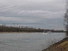
Barbara pipe bridge
The Barbarabrücke is a pipe bridge for natural gas and has been crossing the Danube between the Lobau (in the 22nd district of Vienna ) and the Mannswörther Au, which belongs to Schwechat , since 1957 . The gas pipeline runs from Schwechat to Baumgarten an der March and has a throughput capacity of 150,000 m³ per hour.
architecture
In order to supply Styria in particular with natural gas, OMV needed to cross the Danube for a pipe with a diameter of 42 centimeters. Since a truss bridge common for pipes would have been too heavy due to the large span , Franz Masanz from Waagner Bíró AG designed a new type of suspension bridge system, which was also patented .
In addition to the large span of 320 meters, the wind-prone location also caused problems . The bridge therefore had to be as rigid as possible. This problem was solved by the spatial routing of the suspension cables between the tips of the pylons . The 36.90 meter high pylons are Y-shaped; the suspension cables and the tensioning cables just above the pipe are brought together in an anchor body. These 506 meter long tension cables prevent the bridge from twisting and the suspension ropes from becoming slack. The tensioning and suspension cables are connected in the middle with a clamp to ensure sufficient rigidity. The pipe itself is movably mounted on rollers in the longitudinal direction and has no static function.
Aerodynamic tests were carried out at the Graz University of Technology in order to examine the vibration conditions. This resulted in the use of a steel grating as a web over the pipe. The Barbara Bridge is designed for wind speeds of up to 180 km / h.
Web links
literature
- Hermann Beer, Franz Masanz: The Barbarabrücke over the Danube , In: Österreichischen Ingenieurzeitschrift, 1959, ISSN 0029-9219
Coordinates: 48 ° 8 ′ 26.8 ″ N , 16 ° 33 ′ 9.7 ″ E


