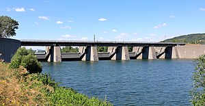
Inlet structure Langenzersdorf
Coordinates: 48 ° 17 ′ 54 ″ N , 16 ° 20 ′ 52 ″ E
| Inlet structure Langenzersdorf | ||
|---|---|---|
| Inlet structure in front of the confluence with the Danube | ||
| use | Pedestrians , cyclists | |
| Crossing of | New Danube | |
| place | Klosterneuburg / Langenzersdorf | |
| construction | Beam bridge made of prestressed concrete | |
| completion | 1975 | |
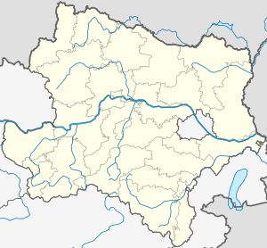
| location | ||
|
|
||
The Langenzersdorf inlet structure is the first of the three weir systems in the New Danube and is located north of Vienna at river kilometer 1938.06 (cf. Danube # kilometrage ). Here the New Danube branches off from the Danube . For pedestrians and cyclists, it also provides a connection between Langenzersdorf and the Danube Island .
The inlet structure was built in 1975 as part of the Viennese Danube regulation together with the New Danube and the Danube Island.
When the Danube floods, the weirs of the inlet structure are opened and the water is directed into the New Danube to prevent flooding. This usually results in a bathing ban on the New Danube for up to a few weeks until the water is of bathing quality again.
The total capacity of the Danube and the New Danube is 14,000 m³ / second. 8,000 m³ / second correspond to a water level of 7 meters, during the “flood of the century” in 2002 it was 10,000 m³ / second.
See also
Web links
- Weir systems of the Danube flood protection. Description of the intake structure on wien.gv.at. Retrieved July 11, 2019.


