Waluliso Bridge
Coordinates: 48 ° 10 ′ 33 ″ N , 16 ° 29 ′ 28 ″ E
| Waluliso Bridge | ||
|---|---|---|
| Waluliso Bridge looking towards Danube Island (2016) | ||
| use | Pedestrians , cyclists | |
| Crossing of | New Danube | |
| place | Vienna | |
| construction | Pontoon bridge | |
| overall length | 160 m | |
| width | 3 m | |
| building-costs | 1.7 million euros | |
| start of building | 1997 | |
| completion | 1998 | |
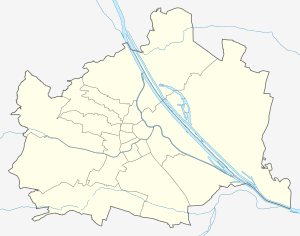
| location | ||
|
|
||
The Walulisobrücke is a pontoon bridge over the New Danube in Vienna's 22nd district, Donaustadt . It crosses the orographic left of the Danube at the level of Lobgrundstrasse and the New Danube to the left of the Danube Island and was opened in 1998 after a nine-month construction period. Together with the Freudenau power plant , it allows pedestrians and cyclists to cross the Danube and New Danube completely. Before high water is diverted over the New Danube and out of season (around the end of October to the beginning of April), the floating bodies are turned out in the direction of the New Danube, making the bridge impassable during this time. The same applies to the Ponte Cagrana (or Copa footbridge).
The 160 meters long and 3 meters wide bridge was named after the 1996 deceased Viennese original Waluliso named, of a long time for the construction of a bridge on the Danube Island on the New Danube to the nudist -Gelände in the field of so-called Deer Island in the Lobau had used .
The Waluliso Bridge opens at the beginning of April and can be used until September or October, depending on the weather. The bridge is closed in the event of high water. Municipal Department 45 - Vienna Waters is responsible for opening / closing the bridge.
Individual evidence
- ↑ http://wien.orf.at/news/stories/2649772/ Flood: Weirs remained closed, ORF.at from May 29, 2014
- ↑ Municipal Department 45 - Vienna Waters
Web links
- wien.at - Opening of the Waluliso Bridge (City Hall correspondence of June 7, 1998)
- https://www.wien.gv.at/kontakte/ma45/ (Viennese waters on wien.at)


