Vienna municipal districts
Politically, Vienna is divided into 23 municipal districts ( city districts ). The Viennese refer to the districts either with their names (such as "Hernals") or with their numbers ("17th District" or "The Seventeenth", in writing also "Vienna 17" or "Vienna XVII"). These numbers are located on every street sign in front of the street name (for example “17., Pezzlgasse”) and also form the second and third digits of the postcode (1010 for the 1st district to 1230 for the 23rd district; 1300 denotes the one not in the city area located Flughafen Wien , 1400, the post office of the Vienna International Center). In the dialect, instead of the term “district”, “Hieb” is sometimes used, or for districts with ..zehnte also ..teen “The Seventeen”.
Municipal district and district part (definitions)
The Viennese municipal district cannot be compared with the concept of the political district of the rest of the Austrian administrative structure , which represents an administrative area of a district administration with several municipalities : As a statutory city, the municipality of Vienna (also) has the rank of a political district, the municipal districts are seen as comparable to a locality : Just as in some areas mayor may serve as local mayor, parish councils are run by district heads.
The districts are further subdivided into district parts; some of them have historical significance. In the inner districts (2–9) and in the 20th, it is the suburbs from which these districts were formed in 1850. In the outer districts, district parts are usually the places from which the districts emerged and are congruent with the cadastral communities in the land register. For newly created parts of the district, names were occasionally first used privately and later officially (see e.g. Nordbahnviertel , Quartier Belvedere , Sonnwendviertel , Seestadt Aspern ).
history
The city and its suburbs
The original city of Vienna consisted only of the area surrounded by the city walls , today the majority of the 1st district, the inner city. To this day, when Viennese speak of “going into the city” in Vienna, they mean the 1st district. From the 15th century, there was more intensive settlement in front of the city wall. At the beginning of the Turkish siege in 1529, the medieval suburbs were burned down so as not to provide cover for the enemy. The modern suburbs that emerged later were legally subordinate to the respective manor . In 1683 the suburbs were again badly affected by the second Turkish siege. In 1704 the line wall was built to protect it in the area of today's belt . (The term line comes from military fastening technology; in this specific case, it also referred to a sales tax limit.)
1850: Suburbs incorporated, suburbs independent
In 1848/49 the manorial rights were replaced and the localities became municipalities. Section 2 of the Provisional Municipal Act of 1849 stipulated: Suburbs have to form a single local municipality with the actual city. In 1850 the city and 34 suburbs were therefore merged; the city wall was not demolished until 1858. The former suburbs have been divided into districts 2 to 8. Subdivisions later created ten districts: In 1861, the 5th district was separated from the 4th district, thus districts 5-8 became districts 6-9. In 1874 the parts of the 4th and 5th district outside of the newly designed belt were combined to form the 10th district (which was expanded in 1892 and 1954).
Outside the line wall were the so-called suburbs, some of which - such as B. Währing - had already grown into smaller towns. Since the line wall was a tax frontier where imports into the city and suburbs were subject to consumption tax, life in the suburbs was significantly cheaper. For this reason, and because some of the suburbs had long since become self-confident communities that certainly valued their autonomy, the negotiations on incorporation dragged on for around 20 years.
1890–1892, 1904–1906: suburbs incorporated

It was not until Emperor Franz Joseph, at the opening of the Türkenschanzpark in the municipality of Währing (today 18th district) in 1888, delivered a sensational speech, probably inspired by his kk Prime Minister and childhood friend Eduard Taaffe , about the hoped-for "elimination of the physical boundaries of the suburbs", the project was made ready for a decision: On December 19, 1890, the Lower Austrian provincial law on the incorporation of 34 suburbs and the division of the city into 19 districts was passed, on January 1, 1892, the municipal district offices of the new districts had 11 to 19 and the others adapted administrative structures to take effect. In 1900 the 20th district was separated from the 2nd. A state law passed at the end of 1904 , the large municipality of Floridsdorf , located on the eastern side of the Danube (on the left bank of the Danube), with five other municipalities and some parts of the municipality, became part of Vienna in 1905/1906 as the 21st district. The new district office for the 21st district started operations on January 1, 1906. Until then, Vienna had only extended to the left bank of the Danube in the 2nd district, which until 1938 extended to the former main arm of the river, the Old Danube .
1938: 97 municipalities incorporated

After the "Anschluss" in 1938, 97 Lower Austrian localities were incorporated by resolution of the Reich Government on October 1, 1938 with effect from October 15, 1938 . With an area of 1215 km² Vienna became the “largest German city”. The extent of the incorporation was valid until the territorial changes decided in 1946 came into force in 1954 and led to the designation Greater Vienna . This was divided into 26 districts. New districts were:
- 14th district: Penzing . The former 14th district, Rudolfsheim , was united with Fünfhaus (15th), the former 13th divided into two parts and expanded.
- 22nd district: Groß-Enzersdorf
- 23rd district: Schwechat
- 24th district: Mödling
- 25th district: Liesing
- 26th district: Klosterneuburg
The places Breitenfurt , Laab im Walde , Perchtoldsdorf , Vösendorf and Hennersdorf did not remain in the Mödling district, but were added to the 25th district, Liesing. The new outer districts were referred to as rural districts with the outlying parishes .
After the end of the Second World War , it was constitutionally decided in June 1946 in Vienna, Lower Austria and in the National Council to reverse a large part of the incorporation, but the entry into force of the relevant laws failed due to the resistance of the Soviet representatives in the Control Council . This resulted in the following compromise: The citizens of these districts were allowed to elect mandataries for the Lower Austrian state parliament, but they had no voting rights there . On the other hand, the peripheral communities remained in Vienna and under Vienna administration, but had no representation in the Vienna City Council.
1954: 80 parishes left
In 1954, the Soviet representatives of the occupying powers also agreed to the reorganization of many peripheral communities; the laws passed in 1946 were promulgated and came into force on September 1, 1954. At that time, however, the citizens had often already got used to belonging to Vienna. Vienna itself also campaigned to remain in the city association. There were even unofficial referendums, as in Mödling and Klosterneuburg . The political decision already made in 1945/46 remained upright: only parts of the 22nd (today Donaustadt ) and 25th district (as the 23rd district) and a number of places on the outskirts (a total of 17 localities) remained with Vienna. 80 localities, now again autonomous communities, came back to Lower Austria ( Vienna-area district ). As a result, Vienna lost two thirds of its area, which was now 415 km².
Relics from Greater Vienna are still visible today when it comes to electricity, gas and telephone. The power supply of the peripheral communities is largely still provided by Wien-Energie and not by EVN . Kledering , Mauerbach , Perchtoldsdorf , Schwechat , Vösendorf and other peripheral communities still form part of the Vienna telephone network with the area code 01 (or +43-1 from abroad).
Districts and district parts
Since today's urban area resulted from numerous incorporations of former suburbs and suburbs , you can still find their names and the names of former places on the city map. To this day, in some parts of the city there are structurally and mentally delimitable neighborhoods or residential areas, quarters or quarters, locally called Grätzl . This is particularly clear in the outskirts, where the traditional town centers (e.g. Kaiserebersdorf , Mauer , Hütteldorf , Grinzing ) have often been preserved.
The districts 1 to 9 and 20 are considered internal districts (also within the belt area called, although this is not true for the 2nd, 20th and part of the 3rd district). All others, especially the districts 10 to 19, are referred to as outer districts . 21st, 22nd and 23rd districts are also referred to as peripheral districts .
Over the decades, district boundaries weren't just changed in 1938. So came z. B. the part of Alservorstadt south of Alser Straße , in 1850 part of today's 9th district, in 1862 the 8th district. In 1905, in the districts on the western belt , the district boundaries that ran in parallel streets from the time of the line wall were moved to the belt. (For example, the Vienna Volksoper moved from the 18th to the 9th district.) The Schmelz parade ground , the remaining undeveloped part of which is now in the 15th district, was once one of three neighboring districts. The town of Albern an der Donau had to change its district in 1954 and 1956 for reasons of occupation law. The border between the 21st and 22nd districts was largely moved northward in 1954. In the last thirty years there have been minor border shifts in order to be able to assign infrastructure facilities such as the Naschmarkt (2009 for the 6th) to one instead of two districts.
Although it has the fewest inhabitants, the 1st district has the most employees with 100,745 employees. The reason for this high job density is, on the one hand, tourism , which animates the shopping streets and alleys, and, on the other hand, good accessibility in the city center, an important location and prestige factor for many companies, especially in the service sector.
The Danube city , the 22nd district, is the largest in area and second largest in terms of population. It covers 10,231 hectares and 165,265 inhabitants. Due to the large area, the Danube city is also one of the most sparsely populated districts. Only the 13th district in the west of the city, Hietzing , has an even lower population density with 1,348 people per km², because the almost uninhabited Lainzer Tiergarten (25 km²) belongs to the district.
The smallest area is in the 8th district, Josefstadt. However, since 23,930 people live on just 1.09 km², this results in the city's second-highest population density. There is an even higher population density in the 5th district, Margareten . 53,071 people live there on two square kilometers, which at 26,390 people per km² exceeds all other districts of the city.
List of districts of Vienna 2018 in descending order of area: 22nd (largest area), 21st, 13th, 14th, 23rd, 10th, 19th, 11th, 2nd, 17th, 16th, 12th, 3rd , 18th, 20th, 15th, 9th, 1st, 5th, 4th, 7th, 6th and 8th district (smallest area).
When quoting district names in texts, it should be noted that the names of the 1st, 2nd, 3rd, 4th, 8th, 20th and 22nd district are female and are mentioned with an article (e.g. "in der Leopoldstadt" , "Auf der Wieden", "die Josefstadt"), while the names of the 7th and 9th districts are male ("am Neubau", "der Alsergrund") and also have an article. All other district names are quoted without an article (e.g. "in Döbling").
| No. | Parish | coat of arms | District parts | Incorporation | Area in ha | Inhabitants (January 1, 2017) |
Inhabitants per km² |
Employees (2013) |
|---|---|---|---|---|---|---|---|---|
| 1 | Inner city |
|
- | 1850: District area outside the city wall | 287 | 16,465 | 5,737 | 110.104 |
| 2 | Leopoldstadt |
|
|
1850 including Brigittenau, 20th district since 1900, and Kaisermühlen, 21st district in 1938, 22nd district in 1954; 1954/1955 with Albern (see 11th district) | 1.924 | 105.003 | 5,458 | 69,739 |
| 3 | Country road |
|
|
1850; since 1938 with Arsenal and Schweizergarten (previously 10th district) | 740 | 90.183 | 12,187 | 95,793 |
| 4th | Wieden |
|
|
1850 (until 1861 including Margareten, until 1874 including part of Favoriten) | 178 | 33,035 | 18,559 | 28,237 |
| 5 | Margareten |
|
|
1850 as part of Wiedens, 1861 district (until 1874 including part of Favoriten) | 201 | 55,356 | 27,540 | 19,656 |
| 6th | Mariahilf |
|
|
1850 (managed as the 5th district until 1861) | 145 | 31,865 | 21,825 | 28,451 |
| 7th | New building |
|
Small parts of the former suburbs of Mariahilf, Laimgrube and Altlerchenfeld are also part of the new building |
1850 (managed as the 6th district until 1861) | 161 | 32,197 | 19,998 | 35,183 |
| 8th | Josefstadt |
|
|
1850 (listed as the 7th district until 1861); since 1862 with part of Alservorstadt (until then in the 9th district) | 109 | 25,528 | 23,420 | 16.096 |
| 9 | Alsergrund |
|
|
1850 (listed as the 8th district until 1861); until 1862 Alservorstadt also south of Alser Straße , then to the 8th district | 297 | 42,709 | 14,380 | 50,457 |
| 10 | Favorites |
|
|
1850 northern part in the 4th, from 1861 also 5th district; 1874 10th district, 1892 to the Donauländebahn ; 1938: Arsenal to the 3rd district; Rothneusiedl, Oberlaa, Unterlaa incorporated (23rd district, Schwechat ), since 1954 in the 10th district | 3,182 | 198.083 | 6.225 | 63.907 |
| 11 | Simmering |
|
|
1892, 1938 (Albern 1938–1954 in the 23rd district, Schwechat , 1954–1955 in the 2nd district) | 2,326 | 100.137 | 4,305 | 34,667 |
| 12 | Meidling |
|
|
1892 | 810 | 95,955 | 11,846 | 35,755 |
| 13 | Hietzing |
|
|
1892; until 1938 with Baumgarten, Breitensee, Hütteldorf, Penzing; since 1938 with Friedensstadt , settlement Auhofer Trennstück and neighboring settlements ; Lainzer Tiergarten incorporated in 1938 (then 25th district, 1954 23rd district; since 1956 in the 13th district) | 3,772 | 54,171 | 1,436 | 25,791 |
| 14th | Penzing |
|
|
1892 Baumgarten, Breitensee, Hütteldorf, Penzing parts of the 13th district, 1938 14th district with Hadersdorf-Weidlingau | 3,376 | 92,337 | 2,735 | 28,651 |
| 15th | Rudolfsheim-Fünfhaus |
|
|
1892 (until 1938: 14., Rudolfsheim; 15., Fünfhaus, then until 1957 district name Fünfhaus) | 392 | 78,999 | 20,153 | 28,808 |
| 16 | Ottakring |
|
|
1892 | 867 | 104,323 | 12,033 | 29,492 |
| 17th | Hernals |
|
|
1892 | 1,139 | 57,180 | 5,020 | 14,323 |
| 18th | Currency ring |
|
|
1892 (until 1938 with Neustift am Walde and Salmannsdorf ) | 635 | 51,128 | 8,052 | 14,407 |
| 19th | Dobling |
|
|
1892, Kuchelauer Hafen 1938; since 1938 with Neustift am Walde and Salmannsdorf (until then 18th district) | 2,494 | 72.107 | 2,891 | 30,341 |
| 20th | Brigittenau |
|
|
1850 as part of the 2nd district, separated from this in 1900 | 571 | 86,868 | 15,213 | 28,389 |
| 21st | Floridsdorf |
|
|
1905, 1911 (Strebersdorf), 1905–1938 with Aspern, Hirschstetten, Lobau, Stadlau, from 1938 with Stammersdorf, 1905–1954 with Kagran, 1938–1954 with Kaisermühlen | 4,444 | 158.712 | 3,571 | 53,911 |
| 22nd | Danube city |
|
|
1905–1938 Aspern, Hirschstetten, Lobau, Stadlau in the 21st district; 1938 22nd district, Groß-Enzersdorf , with Breitenlee, Essling, Süßenbrunn; 1954 Kagran, Kaisermühlen from the 21st district, Groß-Enzersdorf u. a. to Lower Austria | 10,231 | 184.188 | 1,800 | 59,616 |
| 23 | Liesing |
|
|
1938 25th district (with larger extent), 1954 23rd district, 1956 Lainzer Tiergarten to the 13th district | 3,207 | 101.053 | 3.151 | 54.065 |
| City vienna |
|
- | - | 41,487 | 1,867,582 | 4,502 | 955.839 |
politics
The “district parliament ” of each district is the district council whose elections (with a separate ballot) take place at the same time as the municipal council elections; its individual member is referred to as the district council. Since 1995, citizens of other EU member states who live in Vienna have been entitled to vote in the district council elections.
The elected district chairman is the representative of a district . He is always the most votes in the district council elections party found one of his two deputies as well. The second deputy belongs to the second largest party in the district. Currently the FPÖ provides the district head in the 11th district, the Greens the district head in the 2nd, 7th and 18th district, the ÖVP in the bourgeois inner districts 1 and 8 as well as in the districts 13 and 19, which are largely comprised of villa quarters in other 15 districts the district head is provided by the SPÖ (all information based on the results of the municipal elections in Vienna ).
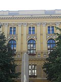
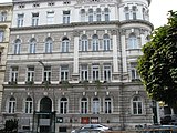
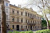
District representatives and district heads each have their seat in an official building in the district.
The magistrate district offices ( MBAs ) are also located in the district for which they are responsible; Exceptions are the 4th, 6th, 8th, 9th, 14th and 19th districts, which have a common district office with another district: the 4th with the 5th, the 6th with the 7th, the 8th with the 1st, the 9th with the 17th, the 14th with the 13th, and the 19th with the 18th district. The MBAs are not subordinate to the district politicians, but to the municipal director, as they function as a "branch" of the municipal authorities of the City of Vienna or the office of the Vienna provincial government.
In 2002 the Vienna State Parliament extended the right to vote in the district elections to non-EU citizens who have been resident in Vienna for at least five years. However, this regulation was repealed by the Constitutional Court in 2004 due to a complaint by the FPÖ and the ÖVP before it could have been applied.
The municipal council (the same person as the Vienna Landtag) has allocated funds to the districts in the sense of decentralization for autonomous use, for example to maintain compulsory schools, traffic areas (if these do not belong to the higher-ranking road network) and parks. Furthermore, the districts are involved in important urban planning, traffic organization and construction processes. The district council or the committee commissioned by it has to make decisions on this. The municipal council or the responsible city council acts as a second instance.
District Boards:
| Parish | image | address | annotation |
|---|---|---|---|
| 1., Inner City |

|
Wipplingerstraße 6–8 | ( Old Town Hall ) Building under monument protection |
| 2., Leopoldstadt |

|
Karmelitergasse 9 | Listed building |
| 3rd, country road |

|
Karl-Borromäus-Platz 3 | Listed building |
| 4th, Wieden |

|
Favoritenstrasse 18 | |
| 5th, Margareten |

|
Schönbrunner Strasse 54 | |
| 6., Mariahilf |

|
Amerlingstrasse 11 | Listed building |
| 7th, new building |

|
Hermanngasse 24-26 | Listed building |
| 8th, Josefstadt |

|
Schlesingerplatz 4 | Listed building |
| 9., Alsergrund |

|
Währinger Strasse 43 | Listed building |
| 10. Favorites |

|
Keplerplatz 5 | Listed building |
| 11th, Simmering |

|
Enkplatz 2 | Listed building |
| 12. Meidling |

|
Schönbrunner Strasse 259 | |
| 13th, Hietzing |

|
Hietzinger quay 1–3 | Listed building |
| 14., Penzing |

|
Hütteldorfer Strasse 188 | (Former Baumgarten geriatric center ) Building under monument protection |
| 15th, Rudolfsheim-Fünfhaus |

|
Gasgasse 8-10 | Listed building |
| 16., Ottakring |

|
Richard-Wagner-Platz 19 | Listed building |
| 17th, Hernals |

|
Elterleinplatz 14 | Listed building |
| 18th, Währing |

|
Martinstrasse 100 | Listed building |
| 19., Dobling |

|
Grinzinger Allee 6 | |
| 20th, Brigittenau |

|
Brigittaplatz 10 | Listed building |
| 21., Floridsdorf |

|
At the Spitz 1 | Listed building |
| 22., Donaustadt |

|
Schrödingerplatz 1 | |
| 23rd, Liesing |

|
Perchtoldsdorfer Strasse 2 | Listed building |
literature
- Felix Czeike (Ed.): Historisches Lexikon Wien. 5 volumes, Kremayr & Scheriau, Vienna 1992–1997.
- Peter Diem , Michael Göbl, Eva Saibel: The Viennese districts. Their history, their personality, their coat of arms . Pearl series , Vienna 2002.
- The provisional municipal law of March 6, 1850 with its supplementary provisions [until November 6, 1866] in: Report of the commission appointed by the Vienna City Council to revise the municipal statute. First volume. = Templates for the revision of the provisional Vienna Municipal Code of March 6, 1850 , self-published by Vienna Municipal Council, Vienna 1868, p. 137 ( online version at Google Books)
Web links
- www.wien.gv.at/bezirke/ Official websites of the Viennese districts
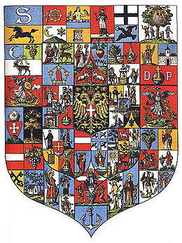
- www.wien.gv.at/bezirke/bezirkswappen/ Bezirkswappen
- Vienna district coat of arms large
- MAP Vienna and the Danube around 1850 before the bastions were demolished and before the first Danube regulation
Individual evidence
- ^ Hieb, the district (in Vienna). ostarrichi.org, accessed August 2, 2012 .
- ↑ RGBl. No. 17 of March 17, 1849 (= p. 203 f.)
- ↑ LGBl. F. Lower Austria. No. 45/1890 (= p. 55)
- ^ Announcement by the Imperial and Royal Governor of December 9, 1891, LGBl. F. Lower Austria. No. 60/1891 (= p. 235)
- ↑ LGBl. F. Lower Austria. No. 1/1905 (= p. 1)
- ^ Announcement of the kk governor of December 28, 1905, LGBl. F. Lower Austria. No. 169/1905 (= p. 222)
- ^ Law on Territorial Changes in the Land of Austria of October 1, 1938 , Law Gazette for the Land of Austria No. 443 of October 6, 1938, p. 2227 ff.
- ↑ Gerhard Botz: National Socialism in Vienna - takeover of power, securing rule, radicalization, war preparation 1938/39 . In: Historical magazine . Mandelbaum, August 5, 2019, ISSN 2196-680X , p. 392 , doi : 10.1515 / hzhz-2019-1335 .
- ↑ Territorial Change Act, Federal Law Gazette 110/1954
- ^ Announcement by the Imperial and Royal Governor in the Archduchy of Austria under the Enns from June 7, 1905 , LGBl. For Lower Austria. No. 101/1905 (= p. 87)
- ↑ Urban area according to usage classes and municipal districts, 2012 . Retrieved February 8, 2014.
- ↑ Population on 1.1.2017 by nationality or country of birth and municipalities . Statistics Austria. Retrieved May 25, 2017.
- ↑ Employees at the place of work by district in 2013 . Retrieved April 26, 2016.

