Leopoldstadt (district of Vienna)
| Leopoldstadt | |
|---|---|
| coat of arms | map |
 |

|
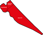
The Leopoldstadt was until 1848/1849 one of the historic city of Vienna explained submissive place and was in the course of the incorporation of various suburbs in 1850 to a part of the new urban area of Vienna. Together with other parts of the area, it now formed the 2nd district of Vienna , which was also named Leopoldstadt .
history
The area of Leopoldstadt was originally called Werd (island) opposite the Red Tower , then Niederer Werd and finally Unterer Werd and was located between the main arms of the unregulated Danube and the arm of the Danube closest to the city center, then often called the Vienna Arm, today the Danube Canal .
The name "Unterer Werd" was first mentioned in 1337. In the 15th century, the city of Vienna acquired property and farms here. The settlement was built in the floodplain, which previously served mainly as pastureland: for the livestock of the residents of Vienna as well as for cattle imported from Hungary or in transit (around 1500 50,000 were driven to Austria per year, some of which were driven on to southern Germany) and horses; the city received grazing money for it. The harvested hay was fed to draft animals, and timber and firewood for the city was obtained from the Lower Werd.
In 1670 that was the Jewish population of the town on the orders of Emperor Leopold I expropriated and expelled . The synagogue was burned down by the Viennese, and the Leopold's Church, which was dedicated to Saint Leopold , namesake of the emperor, was built on the site . This is where the name Leopoldstadt came from.
Jews later returned and settled here in such large numbers that the area was nicknamed " Mazze Island" in the 19th century .
In 1850 the town was incorporated into Vienna as part of the new 2nd district of the same name, which occupied the entire island between the Danube Canal and the main river of the Danube, which emerged from the Danube regulation until 1870. Until the Second World War , the district remained the largest Jewish quarter in Vienna, but as several churches and the hospital of the Barmherzigen Brüder show it was by no means exclusively inhabited by Jewish Viennese.
The history of the district is recorded in more detail under History of Vienna .
coat of arms
The coat of arms of Leopoldstadt shows Saint Leopold in front of a silver background on a green meadow. He wears a blue skirt with a gold sword, a red, hermelin-trimmed cloak and the Austrian ducal hat . In his right hand the saint holds a model of a church, in the left the banner of the Archduchy of Austria under the Enns, like the Lower Austrian coat of arms consisting of five golden eagles on a blue background.
Personalities
- Eduard Strauss (1835–1916), Austrian composer and conductor
- Johann Strauss (father) (1804–1849), Austrian composer and conductor
- Katharina Waldmüller (1792–1850), Austrian singer
- Johann Baptist Weber , pastor of St. Leopold , founder of the first Austrian savings bank in 1819
See also
Individual evidence
- ↑ Christoph Sonnlechner: The “ecological footprint” of Vienna in the late Middle Ages - an approximation. In: Ferdinand Opll, Christoph Sonnlechner: European cities in the Middle Ages. (Susanne Claudine Pils: Research and contributions to the history of Vienna. Volume 52), Studienverlag, Innsbruck 2010, ISBN 978-3-7065-4856-4 , p. 360 f.
- ^ Brigitte Hamann: Hitler's Vienna - Apprenticeship Years of a Dictator , Piper-Verlag, Munich 1996, 2nd edition 2010, ISBN 978-3-492-22653-0 , p. 467.
literature
- Felix Czeike : Historical Lexicon Vienna. Volume 1: A – Da. Kremayr & Scheriau, Vienna 1992, ISBN 3-218-00543-4 .
Coordinates: 48 ° 13 ' N , 16 ° 24' E
