Sankt Ulrich (Vienna)
| Ortisei | |
|---|---|
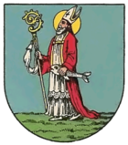
| coat of arms | map |
 |

|
Ortisei was an independent suburban community until 1850 and is now a district of Vienna in the 7th district of Neubau .
history
The place Zeismannsbrunn , from which the first settlement of today's 7th district began, was mentioned in a document as early as 1202 . The mint master and city judge Dietrich owned an estate here and in 1211 donated a chapel that was dedicated to St. Ulrich . Over time, the name of the Ulrichskirche was transferred to the surrounding village. Dietrich's heirs sold the farm to the knight Greif . In 1302, the Schottenstift exchanged the patronage of Maria am Gestade with that of Ortisei. Other properties belonged to an Adlold . However, these were withdrawn from him in 1309 as punishment for participating in an uprising. A total of three property complexes were created:
- Neudeggerlehen, originally owned by the Diocese of Passau , there was a castle, the tower of which has been preserved from 1852.
- Oberhof, property of the sovereign.
- Surroundings of the Ulrich chapel, owned by the Schottenstift.
However, since the city of Vienna was in possession of the land registers of older monasteries and relied on the emperor's orders, there were constant conflicts between Vienna and the Schottenkloster. For the time being, however, the Scots were able to gain the upper hand and the Neudeggerlehen passed into the possession of the Schottenstift in 1694 and the Oberhof in 1629. In addition to St. Ulrich, the three basic complexes also resulted in a new building and Schottenfeld .
As early as 1314, the area around the Ulrichskapelle was densely built up, with further building work being continued mainly in the lower Neustiftgasse. The reason for this was the favorable location on the Ottakringer Bach , which was used for irrigation and waste disposal. In this way a ditch village was created . Most of the houses were destroyed both in 1529 during the first and in 1683 during the second Turkish siege of Vienna . The Ulrichskirche was used by Kara Mustafa as a viewing platform.
Ortisei was a center of the Reformation . The Protestant schoolmaster Cosmas Trinkl was able to teach from 1586 and the owner of the upper court, Johann Baptista Pacheleb , had Lutheran masses held until 1614. In the course of the Counter Reformation , however, Pacheleb had to give up the Oberhof and Trinkl was expelled from the country. In 1589 Ortisei was raised to its own parish.
In the middle of the 17th century an aqueduct was laid from St. Ulrich to Vienna. The court building clerk Peter Concorz confirmed on December 22, 1651 that he collected water from the Sankt Ulrich vicarage in a three- inch- wide tube, “introduced it into the city in the large kettle behind the new castle at the bastion and from there forever Times ” - for the first time at the imperial expense - led an inch-wide tube into the Schottenkloster.
On August 11, 1835, almost the entire village was destroyed by fire . Today there is little left of the old town. The area around St.-Ulrichs-Platz is characterized by baroque houses , in house no. 4 there are still remnants of medieval walls.
Today Ortisei is a census district of the official statistics consisting of seven census districts, the borderline of which does not, however, coincide with that of the formerly independent municipality.
Personalities
- Christoph Willibald Gluck (1714–1787), composer
- Joseph Lanner (1801–1843), composer and conductor
- Johann Strauss (son) (1825–1899), composer and conductor
- Johann Joseph Resler (1702–1772), Baroque sculptor
literature
- Hans Rotter: New building. A home book of the 7th district of Vienna , Verlag für Jugend und Volk, Vienna 1925
- Elfriede Faber: Neubau , Pichler, Vienna 1995, ISBN 3-85058-065-2
- Ferdinand Opll: Der Wiener Burgfried , Franz Deuticke, Vienna 1985, ISBN 3-7005-4546-0
Web links
Individual evidence
- ↑ Richard Perger, court architect Conchort and the water from Ortisei , in: communications, reports, notes from the district museum building 17 (commemorative "10 Years of District Museum in Amerlinghaus "), Vienna 1988, 9-26
- ^ Schottenkirche archive, contracts
Coordinates: 48 ° 12 ' N , 16 ° 21' E

