
Landstrasse (Vienna)
|
Landstrasse III. Viennese district |
|
|---|---|
| coat of arms | map |
 |
 .svg) |
| Geographic location : | 48 ° 12 ' N , 16 ° 24' E |
| Surface: | 7.39 km² |
| Residents: | 91,680 (January 1, 2020) |
| Population density : | 12,406 inhabitants / km² |
| Postal code : | 1030 |
| Address of the district office: |
Karl-Borromäus-Platz 3 1030 Vienna |
| Website: | www.wien.gv.at |
| politics | |
| District Head : | Erich Hohenberger ( SPÖ ) |
|
District council election 2015 |
A total of 56 seats |
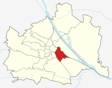
The highway is the third Viennese district and was built in 1850 by former incorporation suburbs. It is located southeast of the inner city (1st district) and is one of the inner districts, the extended city center. As the only one of the districts 3 to 9, after which the belt was built on its edge as a thoroughfare, the 3rd district has its outer border not on this street, but further away from the center. In the district you will find the Belvedere Palace , the Hundertwasser-Krawinahaus , the Arsenal as well as cultural institutions and embassies.
geography
_(cropped).jpg)
location
The Landstrasse district is located in the south-eastern center of Vienna and covers an area of 7.42 km² or 1.8% of Vienna's urban area. This puts the Landstrasse in the middle of the Viennese municipal districts. Compared to the other “inner districts”, the district has a high proportion of commercial building areas and green spaces. The district lies along several terraces of the Danube , with the Danube Canal forming the eastern and Vienna the north-western border. In the south of the district, the Laaer Berg borders on Landstrasse.
geology
The district area of the Landstrasse was mainly formed by the Danube, which over the years formed several terraces . During the Ice Age in particular, large masses of debris formed due to frost, which the Danube carried into the Vienna Basin . In the warm-time phases, the Danube cut into the gravel body and formed terraces, the terraces getting older with increasing distance from the Danube or the Danube Canal. There are three Danube terraces in the district, the height of which rises from the Danube Canal to the west. The “zone of recent meanders ” is located close to the Danube Canal , the city terrace ( crack ice age ) follows at the level of Landstraßer Hauptstraße ( 172 m above sea level ) and the arsenal terrace ( minimum ice age ) on the site of the arsenal . The highest point is 202 m above sea level. in Arsenalstrasse, on the border with Vienna's 10th district, opposite the 21er Haus (Arsenalstrasse 1).
The structure of the terraces is always the same with the exception of the youngest terrace ("zone of recent meanders"). The subsoil consists mainly of Tegel and partly sandy deposits from the Pannonian , above it layers of gravel that were piled up during the Ice Ages. The top layer is made of loess that was blown from the foothills of the Alps. On the youngest terrace, on the other hand, there are sediments such as fine sand and silite above the gravel layer. The rocks of the gravel layer were mainly formed from erosion from the Alps and the Bohemian Massif . This gravel layer reaches a height of twelve meters on Landstraßer Hauptstrasse. The flat stones are usually sandstone from the nearby Vienna Woods . The round pebbles consist largely of crystalline rocks such as granite , gneiss and quartz . The granites, like the black amphibolites, come from the Bohemian Massif . The gray to greenish gneiss was removed from the Central Alps and the Bohemian Massif. Other round to oval gravels consist of lime and come from the Northern Limestone Alps .
Land use
The construction area of the Landstrasse comprises 57.96% (Vienna-wide 33.32%) of the district area, whereby this is the seventh-highest value of a Viennese municipality district. The share of residential building space in total building land is a very low 46.54% for Vienna. A further 25.85% is accounted for by commercial building areas and 22.33% for areas dedicated to cultural, religious, sporting or public areas. Green spaces make up a total of 13.18% in Landstrasse, with Landstrasse being in the lower middle field of the Vienna districts. 73.82% of the green space is allocated to parks, 11.67% to sports and leisure areas, the rest to allotment gardens, meadows and a small remainder of agricultural land. Since the district has hardly any area shares on its border rivers Wienfluss and Donaukanal, only 0.12% of the district area is accounted for by bodies of water. The proportion of traffic areas in the district area is the seventh-highest value in Vienna at 28.74%.
| Construction area | Green space | Waters | Traffic areas | |||||||
|---|---|---|---|---|---|---|---|---|---|---|
| 431.88 | 98.21 | 0.93 | 214.14 | |||||||
| Housing | Service area | public facilities | Agriculture | Parks | Woods | grasslands | Allotments | Leisure areas | ||
| 200.99 | 111.64 | 96.45 | 2.62 | 72.50 | 0 | 6.09 | 5.54 | 11.64 | ||
Neighboring districts
The highway is one of the so-called "inner districts". In the northeast and east, the right bank of the Danube Canal forms the border with Leopoldstadt . The southern border runs in a zigzag through the industrial development area of the districts Landstrasse and Simmering . In the south-west, the Landstrasse borders the Favoriten district along Arsenalstrasse (the border is the middle of the main lane), in the west, Prinz-Eugen-Strasse forms the border with Wieden . In the north, the Wien River separates the Landstrasse from the inner city .
District parts


The district area was formed from the three previously independent localities Weißgerber , Erdberg and Landstrasse ; all three were ultimately under the rule of the Viennese magistrate . In addition to these three official district parts, there are neighborhoods that can be demarcated in popular terms, so-called Grätzln , such as the Fasanviertel around Fasangasse or Sankt Marx . In terms of the land register , the 3rd district consists of the Landstrasse cadastral community and small parts of the Simmering cadastral community in the south of the district.
The district part of Weißgerber is located in the north of the district area and essentially comprises the area between the Danube Canal, Wienfluss and Marxergasse. The area is largely built up with residential buildings (including the Hundertwasser-Krawina-Haus). In addition, institutions such as Statistics Austria , the Financial Directorate, the Justice Center Wien-Mitte and the Kunst Haus Wien have settled.
Southeast of the Weißgerber district is the eponymous district Landstrasse . It includes numerous embassy buildings and residential complexes with a higher proportion of green space. In addition to several parks (parts of the city parks , Arenbergpark , Botanical Garden of the University of Vienna ) are also several castles ( Palais Schwarzenberg , Lower and Upper Belvedere ) in this part of the district. The University of Music and Performing Arts Vienna , the Vienna Konzerthaus and the Austrian Mint are also located here.
South of Marxergasse and east of Landstraßer Hauptstraße lies the Erdberg district . In addition to residential buildings, the south of Erdberg in particular is dominated by industrial areas. A large sports center, the postal center, the headquarters of Wiener Linien and the state archive are also located here.

Erdberger Mais is an area south of the Danube Canal at the eastern end of the district in the east of Erdberg. This area emerged from a loop of the river ( meander ) of the (then) Danube, today's Danube Canal, it has no defined boundaries and lies roughly between Schlachthausgasse and the route of the southeast bypass . When the districts of today's district emerged, it was still (until the 18th century) a river basin. The name has nothing to do with maize as a grain , but is an old word for young forest or logging, the grammatical gender is unclear, all three articles are used in the literature. In the 21st century, its scope is essentially only recognizable through embankments and uneven terrain. A final clear remnant is protected in Baumgasse, at the corner of Maiselgasse, as natural monument no. 752 “Danube Prallhang”. The Danube still flowed by here in the 18th century, today the (regulated) course of this river is about 2.8 km north. The relatively soft soil of the higher Danube terrace was washed away. In this way, a terrain edge more than 10 m high was created. The Prallhang is the last near-natural and river morphological structure.
When NS- Greater Vienna was created on October 15, 1938, the arsenal and the area adjacent to the southeast were transferred from the 10th to the 3rd district.
A statistical breakdown of the district area exists in the census districts in which the census districts of the municipality are summarized. The eleven counting districts in Landstrasse are Weißgerber, Landstrasse, Belvedere-Diplomatic Quarter, Fasangasse, Rudolfspital-Rennwegkaserne, Erdberg, Erdberger Mais - St. Marx, Arsenal, Ungargasse, Altes Gaswerk and Wildganshof.
history
prehistory
The first traces of settlement in what is now the third district date from the Bronze Age . In the 9th century BC Chr. , The area was used by the Celts settled, the Latène culture spread. The Celtic settlement in the area between today's Rennweg and the upper Belvedere Palace is likely to have existed until Roman times. With the incorporation of the area there was a civil town belonging to the Roman military camp Vindobona . Munizipalstrasse and Limesstrasse ran through the district . The center of the civil town was in what is now the Aspang train station . It was destroyed around 395 by an incursion by the Marcomanni .
In the area of today's Rochusmarkt there was the Nikolaikloster before 1529, after which today's district part Landstrasse Nikolai-Vorstadt was named. In both sieges by the Ottomans, the suburb suffered heavy damage.
In 1715 the St. Elisabeth Hospital was founded on Landstraßer Hauptstrasse.
State Chancellor Metternich , who held office until 1848, is assigned the phrase The Balkans begin on Rennweg . The name Ungargasse also indicates that the long-distance roads from Vienna to Hungary and the Balkans started here.
Since the incorporation in Vienna in 1850
Today's Landstrasse district was created through the incorporation of several localities that were created in the Middle Ages and early modern times. With a proclamation on March 20, 1850, the boundaries of the new 3rd district, Landstrasse, were drawn. It was formed from the suburbs of Landstrasse , Weißgerber and Erdberg . There were also areas between the Liniengraben and the Vienna – Bruck an der Leitha railway (the Ostbahn ), Sankt Marx and the river bed of the Vienna from the then Mondscheinsteg to the mouth of the Danube Canal (today the right bank of the river is the district boundary).

After the incorporation, the district developed in many ways. Numerous embassies settled around today's Reisnerstrasse. In the middle of the 19th century, the Fasanviertel was created between Rennweg and Landstraßer Gürtel . In Erdberg the settled Vienna Central cattle market with its stables and the existing slaughterhouse was expanded (see. Fleischversorgung of Vienna ). From 1894 the line wall , since 1704 fortifications and finally until 1891 still tax borders, was removed. At the beginning of the 20th century, the Landstraßer Gürtel was completed as the last part of this 14-district road.
After 1900, upper-class apartment complexes with a late historical character influenced by Secessionism were built around Dannebergplatz (parceling out the garden of the Palais Arenberg ), Esteplatz and on the Weißgerberlände . By subdividing the gardens of the Palais Modena , the ensemble around the Modenapark was created in the interwar period .
Until the 20th century, the district was primarily home to the middle classes of the population, but with the rise of trade and industry it developed more and more into a working-class district. That is why there was a strong expansion of municipal housing in the interwar period . An important example of this is the Rabenhof between Hainburger Strasse and Baumgasse.
The last Federal Chancellor of the First Republic, Kurt Schuschnigg , lived in Belvedere Palace until 1938 . During the Second World War, thousands of Jewish citizens were deported to the extermination camps from the Aspang train station, which no longer exists today . The place of the victims of the deportation reminds of this . Two flak towers were built in the Arenbergpark to defend against enemy aircraft and as an air raid shelter; one of the two is used by the MAK as a Contemporary Art Tower .
After the Second World War , there were five minor changes to the district boundaries. The border to Simmering was moved in 1995 (in the area Schlechtastraße and Hüttenbrennergasse between Gudrunstraße and St. Marxer Friedhof), 2000 (in the area Urschenböckgasse and Litfaßstraße) and 2003 (in the area Döblerhofstraße, Guglgasse, Paragonstraße and Erdbergstraße). In addition to traffic areas, industrial and commercial areas in particular were affected. In 1999 there was a slight change in the border to Wieden (in the Schwarzenbergplatz and Prinz-Eugen-Straße area) and in 2000 and 2009 to Favoriten (in the Arsenalstraße area).
Since the beginning of the 1990s, the district has been connected to the Vienna underground network by the newly built underground line U3.
Future developments

The plans focus primarily on two areas: Erdberg and Wien Mitte train station .

There had been plans for the station since the mid-1990s, some of which had progressed very far, but failed due to the incompatibility with the UNESCO World Heritage Site status of the old town. From 2007 to 2013, a revised plan was finally implemented. In the vicinity of the train station, a number of new buildings were built to upgrade the area, such as the Justice Center Wien-Mitte .
Another focus of urban planning is the industrial area in Erdberg, especially at the former Sankt Marx slaughterhouse , where apartments and industrial companies (11,000 inhabitants and 45,000 jobs) are being built on a large area. The biological research center Campus Vienna Biocenter and the T-Mobile main building are also located on the edge of this area .
population
Population development
Source: Statistics.at

Population development
The Landstrasse district had 88,678 inhabitants in 1869. By opening up new residential areas, the number of inhabitants had almost doubled to 166,981 by 1910. After the collapse of Austria-Hungary, the population fell by around 12%, but remained constant until the 1930s. In the run-up to World War II, the population began to decline again, with the expulsion and murder of the district's Jewish population also having an impact. After the Second World War, the population continued to decline, with the largest slumps occurring in the 1960s and 1970s. After a low in 2001, the population has started to rise again in recent years and amounted to 87,953 people at the beginning of 2015.
Population structure
In 2001, the age structure of the Landstrasse population hardly deviated from the Viennese average. Only the number of children under the age of 15 was 13.3%, slightly more below the Vienna average of 14.7%. The proportion of the population between 15 and 59 years was 64.4% (Vienna: 63.6%). The proportion of the population aged 60 or more was 22.3%, slightly above the Vienna figure of 21.7%. With a proportion of 46.9% men and 53.1% women, the gender distribution in the district was in line with the Viennese average, while the Landstraßer population was married slightly less often than the average Viennese with 38.4% compared to 41.2%.
Origin and language
The proportion of foreign residents in the district was 21.4% in 2005 (Vienna: 18.7%), and compared to 2001 (18.5%), as in the entire federal state, shows an upward trend. The highest proportion of foreigners in 2005 was made up of around 4.9% of the district population, citizens of Serbia and Montenegro . Another 2.2% were Turkish , 1.9% German , 1.5% Polish and 1.0% each of Croatian or Bosnian citizens. In 2001, a total of 26.9% of the Landstraßer population were not born in Austria. 7.1% spoke Serbian as the colloquial language , 4.5% Turkish and 2.4% Croatian .
religion
The religious beliefs of the population in the Landstrasse district hardly differed from the average in Vienna in the 2001 census. In 2001, 48.6% of residents stated that they belonged to the Roman Catholic Church (Vienna: 49.2%). There are five Roman Catholic parishes in the municipality that belong to City Deanery 3 . 7.5% of the residents were of Islamic faith, 7.0% belonged to the Orthodox Church and 5.0% were Protestants , who usually belong to the Evangelical Parish AB Landstrasse . 24.8% of the district population did not belong to any religious community, 7.2% had given no or a different religious denomination.
politics
| District chairman since 1945 | |
|---|---|
| Ludwig Fischer ( ÖVP ) | 4 / 1945-1946 |
| Josef Pfeifer ( SPÖ ) | 1946-1959 |
| Franz Seitler ( SPÖ ) | 1959-1973 |
| Jakob Berger ( SPÖ ) | 1973-1982 |
| Günther Reciczky ( SPÖ ) | 1982-1983 |
| Rudolf Bergen ( SPÖ ) | 1983-1989 |
| Erich Hohenberger ( SPÖ ) | 1989– |
After the district was incorporated, the councils of the three former suburbs remained in office until 1862. In that year, Matthäus Mayer was the first to take over the office of district head of the new district. The settlement of trade and industry resulted in a strong influx of workers, followed by the rise of the Social Democrats . In the first elections after the First World War, the Social Democrats won an absolute majority in the district. In the course of the Justice Palace fire in 1927, fighting broke out between the Republican Schutzbund and the armed forces in the 3rd district . The Social Democrats, however, remained the dominant party. In the district council elections in 1932, they won 16 out of 30 seats, with 7 seats each for the Christian Socialists and the National Socialists. After the February fights in 1934, the Social Democrats were banned nationwide, and District Chairman Adolf Lahner was replaced by Viktor Kainzmayer. In the first state parliament elections in 1945, the SPÖ again achieved an absolute majority with 57%, followed by the ÖVP with around 35% and the KPÖ with 8% of the votes. The district representation was filled in the same way. At the end of the 80s the rise of the FPÖ began , which was able to increase its share of the vote up to 25% by 1996 and gained the right to the district chairman's deputy, while the SPÖ fell back to almost 36%. In 2001 this trend reversed, the SPÖ received 41.4% of the votes, the FPÖ only 18.4% and the ÖVP 18.7%, with which the ÖVP achieved the office of deputy district head. The Greens were able to significantly increase their number of mandates , who with 17.1% were able to catch up with the ÖVP. The LIF reached 3.4%. In the 2005 district council elections , the SPÖ achieved 42.7%, the ÖVP 21.7%, the Greens 20.5%, the FPÖ 11.6% and the KPÖ 1.9%, with which the KPÖ succeeded in re-entering the district council. In the 2010 district council elections, the SPÖ was able to maintain its claim to leadership despite slight losses with 40.6%. The Greens took second place for the first time with 19.7% and won the district chairman's deputy. The FPÖ was able to increase strongly to 18.0%, the ÖVP slipped with 17.0% to its worst result so far. The KPÖ was able to keep its mandate with 2.0%. The BZÖ reached 1.1%, which was not enough for a mandate.
coat of arms
The coat of arms of the Landstrasse district combines the coats of arms of those places from which the 3rd district was formed in 1850. The upper left part of the coat of arms stands for the Landstrasse district . It shows Saint Nicholas in episcopal regalia . Nicholas was the patron saint of the St. Niklas convent. In his right hand Nicholas is holding three spheres lying on a book. Nikolaus is said to have given these balls to the daughter of an impoverished nobleman in the 4th century . The upper right part of the coat of arms symbolizes the Erdberg district . The two strawberry blossoms and the hanging, red strawberry symbolize an incorrect derivation of the name of Erdberg. This does not come from the strawberries, but from an Ertpurch ( fortification ). The lower part of the coat of arms stands for the district part of Weißgerber . The two silver goats in a fighting position come from different guild coats of arms of the tanners . Due to the unpleasant smell, these had to settle outside of Vienna.
Culture and sights
Attractions
Churches

The Rochuskirche was built in 1687 after the previous structure, which was only a few decades old , had been destroyed in the course of the second Turkish siege of Vienna in 1683. The St. Nikolai cemetery in front of the church was closed in 1784, the remains of those who were buried here were transferred to the Sankt Marxer cemetery, today the Rochusmarkt is located here.
1717–1728 the Church and monastery of the Salesian Sisters were built, the monastery was used by Empress Wilhelmine Amalie as a widow's seat.
From 1754–1763, the Guard Church was built on Rennweg. Originally it was part of the Imperial Hospital, which was later converted into the Leibgardekaserne . It is sometimes called the "Polish Church" because it is used by the Polish Catholic community, and services are mainly held in Polish.
In 1768 the so-called orphanage church (“Church of Mary's Birth”) was built on Rennweg, and in 1783 it was elevated to parish church. The church " St. Othmar unter den Weißgerbern ", consecrated in 1873, with its 80 meter high tower is the highest church in the district and the fifth highest in Vienna. It was built in the neo-Gothic style based on designs by Friedrich von Schmidt . In 1906 the Herz-Jesu-Kirche planned by Gustav von Neumann was completed. The Januarius Chapel in Ungargasse was once part of the Harrach Palace .
The Russian Orthodox Cathedral on Jaurèsgasse was built in 1899 and is the seat of the Russian Orthodox community in Vienna. The Serbian Orthodox Church of Saint Sava is located on the ground floor of a residential and parish hall built in 1890. The Pauluskirche of the Evangelical Church of the Augsburg Confession on Sebastianplatz, consecrated in 1970, is also located on the ground floor of a residential building. In the courtyard of a house in Kolonitzgasse there is also the Armenian Apostolic Church of St. Hripsime , which was consecrated in 1968 and cannot be seen from the street as a church building .
Parks and cemeteries


Due to the large number of palaces, parks have a long tradition in the Landstrasse district. Prince Eugene of Savoy had his Belvedere Palace built between 1700 and 1721 by the architect Johann Lucas von Hildebrandt , for which the horticultural artist Dominique Girard designed a baroque garden. The Botanical Garden of the University of Vienna , which goes back to a “ Hortus Medicus ” (medicinal plant garden ) created by Archduchess Maria Theresa in 1754, is also located near the Belvedere Gardens . Also in the immediate vicinity is the approximately 75,000 m² Schwarzenberg private park, which, like the Belvedere Gardens, was laid out at the beginning of the 18th century. In contrast to the Belvedere Gardens, it is not open to the public and is only available to hotel guests in the Palais Schwarzenberg . From the 18th century and the approximately 31,500 square meters, later after the owner of Princess Franziska Arenberg comes named Arenbergpark that around 1785 for the now-defunct palace of Prince Nikolaus Esterhazy had been created. Opposite the Arenbergpark there are two small parks on Ziehrerplatz and Sebastianplatz. The Modenapark, with around 8,000 m² much smaller than other stately gardens, is only the remnant of what was once an extensive park. The garden, which was laid out as an ornamental park in 1700, originally extended far to the east and belonged to Duke Franz von in the 19th century Modena .

More recent, but much better known, is the 65,000 m² Vienna City Park , which opened in 1862 on an area of the former water glacis on the Vienna River . The city park was the first public park in Vienna. On the edge of the city park is the city garden department, which moved here in 1907 into a villa designed by Josef Bittner (1879–1945) in the style of the home style. The district's largest park, the Schweizergarten , at around 165,000 m² , was also created after a fortification structure, the linear wall , was demolished . The Schweizergarten is home to large ponds, an alpine plant garden , a rosarium and numerous exotic trees. In addition to the large parks, there are other gardens and parks in the Landstrasse district. The Kardinal-Nagl-Park (around 7,500 m²) with play and sports areas for children and young people is located directly at the station of the same name on the U3 underground line. The park was extensively renovated as part of the extension of the U3. Rochuspark (3,500 m²) and Grete-Jost-Park (1,500 m²), which were created in this area during the construction of the underground, are also located in the area of an underground station . The 1995 named "Park of the Victims of Deportation" on the grounds of the Aspangbahnhof reminds of the people who were transported from here to the extermination camps by the National Socialists.

Today there is only one preserved cemetery in the Landstrasse district. The Sankt Marxer Friedhof was laid out on the instructions of Emperor Joseph II along with four other cemeteries outside the line wall. These cemeteries served as the main burial grounds until the opening of the Vienna Central Cemetery . Older cemeteries, such as the one around the Erdberg parish church , were closed. The cemetery, which also houses the tomb of Wolfgang Amadeus Mozart , was closed after the opening of the central cemetery and is now a park.
More Attractions


Belvedere Palace in the west of the district consists of the Upper and Lower Belvedere and large gardens. After the State Treaty was signed on May 15, 1955, Foreign Minister Leopold Figl presented the document on the balcony of the Belvederes. The act was edited together with the sound recording of the words “ Austria is free! “To a media icon . Between the Belvedere and Schwarzenbergplatz is the Schwarzenberg Palace, which Adam Franz Karl Fürst von Schwarzenberg used as the summer palace.
The Rasumofsky Palace , whose gardens once extended as far as the Danube Canal, is located on Rasumofskygasse and was built by Louis Montoyer in 1806 as a garden palace for the Russian Prince Andrei Kirillowitsch Rasumowski . Nearby, at the Marxergasse, the 2001 burnt were Sofiensäle . These once served as a swimming pool, but also as a dance and concert hall, in the 1990s they functioned as an event and clubbing location. After the fire, the ruin remained for years, it was then rebuilt and has been used as a hotel and residential building since 2013.
Portois & Fix , the seat of the furniture company of the same name, dates from around 1900 . The listed Karl-Borromäus-Brunnen on Karl-Borromäus-Platz is one of the few examples of free sculptures from the Art Nouveau period.
In the interwar period, numerous municipal buildings were built all over Vienna , including in the 3rd district. The largest of these communal residential complexes include the Hanuschhof , the Wildganshof (which, according to the original plans, should have been cut by a high-speed railway line) and the Rabenhof , in which the Rabenhof Theater is located.
The Wittgenstein House , built in the 1920s, was designed by the philosopher Ludwig Wittgenstein in collaboration with the architect Paul Engelmann . It originally served as a residential palace for Margarethe Stonborough-Wittgenstein . The two flak towers in Arenbergpark were built in 1943 during the Second World War.
A more recent municipal building is the Hundertwasserhaus , built in the 1980s , which is one of the district's most popular tourist attractions due to its unusual design by Friedensreich Hundertwasser .
The 87-meter-high City Tower Vienna , which houses the Justice Center Wien-Mitte, was completed in 2003. A year later, the T-Center in Sankt Marx was another example of modern architecture in the district. The office building designed by Günther Domenig is used by Magenta Telekom and some sister companies. Since the end of the 2000s, a new district with residential and office buildings has been built on the nearby area of the former Sankt Marx slaughterhouse ; the former use is still reminiscent of the listed administration building, which is now used by the Media Quarter Marx , as well as the gate system with its stone cattle sculptures .
Culture

The Wiener Konzerthaus and the adjoining Akademietheater are located on Lothringerstraße and thus border directly on the 1st district. Today the Akademietheater is one of several venues in the Burgtheater . In the Rabenhof Theater, which was originally used as a cinema, mainly "young theater" and cabaret are performed. The 3-room anatomy theater in the former anatomy building of the veterinary medical institute in Beatrixgasse was founded in 2006 by Hubert "Hubsi" Kramar . The Puppet Theater Lilarum is a puppet theater founded in 1980 as a touring stage , which has been using a venue in Erdberg since 1997 and is now Austria's largest puppet theater that is continuously used.
The city theater on Schwarzenbergplatz was one of the oldest in 1916 cinemas opened in Vienna. 1993-2013 it was one of the four festival cinemas of the Viennale . The arena in the industrial area in the east of the district is a venue for concerts and other music events; in summer the open-air area is used for open-air cinema.
An area in the west of the municipality is part of the World Heritage Site Historic Center of Vienna . Its outer zone is bordered by Hinteren Zollamtsstraße, Invalidenstraße , Ungargasse and Jacquingasse. The core zone includes the Belvedere Palace, Schwarzenbergplatz, the city park, the concert hall and the academy theater.
Museums

The Austrian Gallery Belvedere in Belvedere Palace houses an important collection of Austrian art and the world's largest Gustav Klimt collection. In the Lower Belvedere, the former living and state rooms of Prince Eugene can also be viewed . The rooms and the orangery are used for special exhibitions. One of the most popular museums in Vienna is the Kunst Haus Wien , which has a permanent exhibition with works by the artist Friedensreich Hundertwasser. The nearby Hundertwasser-Krawinahaus can also be visited, opposite is the Village-Galerie with a permanent exhibition of Hundertwasserwerke. Another museum located near the Hunderwasserhaus is the Forgery Museum Vienna . Another well-known museum is the Army History Museum in the Arsenal , which shows the military history of the Habsburg Monarchy from the end of the 16th century to 1918 and Austria until 1945. In addition, visitors to the museum are brought closer to 200 years of Austrian naval history. Also in the Landstrasse district is the Remise Transport Museum , the largest tram museum in the world, which exclusively presents the history of a city's public transport. The Arnold Schönberg Center and the Bohemian Forest Museum are also located in the district .
The Landstrasse district museum focuses on the representation of the Roman civil city as well as the district, cultural and art history. A memorial room of the museum is dedicated to the approximately 13,000 Jewish residents of the district who were robbed, forced to flee or - mostly in the concentration camps - murdered during the Nazi dictatorship . The people are recorded in a database that can be viewed in the museum.
Sports
Economy and Infrastructure
economy

Economic history
The livelihood of the early settlements in the district was agriculture. The main source of income for the first inhabitants of Erdberg was viticulture . Together with vegetable growing, viticulture remained the livelihood of the Erdberg population until the 19th century. Alttunaw , the predecessor settlement of the suburb "Unter den Weißgerbern", was inhabited by butchers , intestinal washers and gardeners even before the first Turkish siege of Vienna . The red and white tanners , Flecksieder and Lederer Vienna also moved to Weißgerber in 1561 after their quarter had been destroyed during the Turkish siege and the administration wanted to relocate the professional groups from the city center due to the unpleasant smell. White tanners long retained the character of a settlement of gardeners, tanners and butchers. The butchers held their markets on the site of today's Wien Mitte train station until the end of the 18th century , and in 1797 the cattle market was moved to St. Marx.
With the beginning of industrialization, from the second half of the 18th century, more and more factories and businesses settled in the suburbs . There were chemical factories, cloth factories, mirror factories, and book printing factories. The settlement of new factories at the same time forced the influx of workers from all parts of the monarchy, so that the character of the area was permanently changed. Several traditional companies still exist in the district today. Siemens has had a branch here since 1882 . The Henkel company has also had a branch in the district since 1893 and employs around 700 people in today's Austrian headquarters. Another well-known company in the district is the confectionery manufacturer Niemetz . In 2004 the Austrian T-Mobile subsidiary T-Mobile Austria also relocated its company headquarters to the newly built T-Center . Since 2011, the headquarters of Österreichische Post AG has also been located on the former Siemens site in Haidingergasse.
Workplaces and employees
The 2001 census of workplaces in the Landstrasse district showed 5,924 workplaces with 67,812 employees, 94 percent of whom were employed. Compared to 1991, the number of workplaces had risen by 20.8 percent and the number of employees had increased by 9.9 percent in the same period. The branch of industry with the highest number of employees was real estate and corporate service providers with 1,706 workplaces (28.8 percent) and 12,838 employees (18.9 percent). In terms of employment figures, they are followed by public administration and social security (13.7 percent), the transport and communications sector (12.7 percent), retail (12.6 percent) and manufacturing (9.0%). A total of 49 companies employed more than 200 people in 2001, the sizes of which were significantly high, especially in public administration and in transport and communication. In 2001, the commuter rate in the Landstrasse district was very high. Of the 37,804 gainfully employed people who lived in the district, only 10,994 (29.1 percent) worked in their place of residence. On the other hand, 26,810 residents of the district had to commute to work, with 85.8 percent of those commuting in another district (especially Innere Stadt, Alsergrund, Favoriten, Leopoldstadt and Liesing), 13.5 percent in Lower Austria and the rest in other federal states or in Found work abroad. While a large number of the Landstrasse population commuted from the district to work, there were a large number of commuters into the district. 84.4 percent of those employed in the Landstrasse district did not come from here. The 59,464 commuters came mainly from other districts of Vienna (65.5 percent), in particular from Donaustadt, Favoriten, Simmering, Floridsdorf and Leopoldstadt, from Lower Austria (26.5 percent) and Burgenland (4.1 percent).
safety
Three police stations of the Federal Police are established in Landstrasse ; these are located at Juchgasse 19, at Fiakerplatz 4 and at Invalidenstrasse 2. The Landstrasse city police station responsible for this district is located in the Juchgasse office .
traffic
The district's traffic junction is the Wien Mitte / Landstrasse train station (former name: Hauptzollamt), which is located on the site of the former Vienna port of the Wiener Neustädter Canal .
In the Landstrasse district there are a number of higher-ranking public transport stations. The U3 line crosses the third district between the Landstrasse (Wien Mitte) and Erdberg stations in a north-west-south-east direction; the U4 line runs between Landstrasse and Stadtpark along the north-western border of the district. The main route of the Vienna S-Bahn connects with three stations the area from Wien Mitte via Rennweg and the Fasanviertel to the upper Belvedere; At the Rennweg station, the airport route branches off from the main route.
Four tram lines - O, 1, 18 and 71 - as well as several bus lines ensure the close development of the district and connect it with the neighboring districts.
In terms of road technology, the third district is supplied by the A23 and A4 motorways as well as the main roads B1 , B221 and B227 .
Health and social

In addition to numerous doctors from various specialties resident in the district, there are also the Rudolfstiftung Hospital of the City of Vienna run by the Vienna Hospital Association and two spiritual hospitals, namely the St. Elisabeth Hospital and the Sacred Heart Hospital. Another base for medical care is the “ Health Center Wien-Mitte ” of the Vienna Regional Health Insurance Fund .
These are other important positions in health issues
- District Health Office in the Municipal District Office (various vaccinations , advice on medical issues, but also official functions), the
- Parent counseling center (formerly mother counseling center, advice on the care and support of the child, but also examinations according to the mother-child passport and vaccinations according to the Austrian vaccination plan), one of five
- Preventive medical check-ups run by the city's health department (Hainburger Strasse 57-63), the
- Vaccination service and travel medical advice to the City of Vienna at Thomas-Klestil-Platz, as well as the
- Psychotherapeutic outpatient clinic at the Sigmund Freud University in Vienna on Schnirchgasse, where 130 therapists treat just over a thousand patients.
Historic hospitals in the district are the Citizens Hospital in Sankt Marx , which was run by Emperor Karl VI. Heiliggeistspital founded with the Imperial Hospital, which was later moved here . They were all closed by Emperor Joseph II and put to another use. Also closed by Emperor Joseph II was Cardinal Sigismund von Kollonitz with the help of Emperor Karl VI. and other benefactors founded the poor and supply house, which in 1784 converted it into a disability house for soldiers. The demolition took place in 1909 after the residents had been relocated to the house for the disabled in Hietzing. Between 1884 and the end of 1925, Wilhelm Svetlin's (1849-1914) private mental hospital existed at Leonhardgasse 3–5 . Prominent patients here included Hugo Wolf and Carl Schuch . Garrison Hospital II was also part of the Rennweg barracks .
By Adolf Ignaz Mautner von Markhof (1801–1889) and his wife, Julie Marcelline b. Kadisch (1812–1887), the Kronprinz-Rudolf Children's Hospital at Baumgasse 26 was donated in 1872 (later additions in 1901 and 1904 to ON 30 and ON 28). In 1921 it was renamed Mautner Markhof'sches Kinderspital and in 1924 - after the foundation was abolished - taken over by the municipality of Vienna and continued until it was closed on December 16, 1998. The structure was later demolished.
In the 1990s and 2000s, a number of homeless houses were built in the third district - in addition to the already existing temporary residential building of the municipality of Vienna in Gänsbachergasse, the senior citizens' home of the ARGE Non-Sedentary Aid was built in Schlachthausgasse, the Lighthouse Vienna in Dampfschiffstraße and the nineerHAUS in Hagenmüllergasse.
Personalities
- Anton Diabelli (1781–1858), composer and music publisher, died here
- Ludwig Boltzmann (1844–1906), physicist and philosopher
- Erwin Schrödinger (1887–1961), physicist and science theorist
- Friedrich Mohs (1773–1839), mineralogist
- Robert Musil (1880–1942), writer and theater critic
- Adalbert Stifter (1805–1868), writer, painter and educator
- Hugo von Hofmannsthal (1874–1929), writer, playwright, poet and librettist
- Wolfgang Amadeus Mozart (1756–1791), musician and composer, lived here in 1787
- Carl Wilhelm Christian Ritter von Doderer (1825–1900), architect
- Heimito von Doderer (1896–1966), writer
- Wilhelm Carl Gustav Ritter von Doderer (1854–1932), architect, engineer and building contractor
- Friedrich Gulda (1930–2000), pianist and composer
- Gustav Mahler (1860–1911), composer
- Joe Zawinul (1932-2007), musician
- Thomas Klestil (1932–2004), diplomat and politician
- Ludwig van Beethoven (1770–1827), composer and pianist, lived here from 1817 to 1819 (Landstraßer Hauptstrasse No. 31)
- Maria Jacobi (1910–1976), community and city councilor
- Fred Zinnemann (1907–1997), film director
- Ingeborg Bachmann (1926–1973), writer, lived here from 1946 to 1953
- Joseph Marx (1882–1964), composer, pianist, music educator and critic, lived here from 1915 to 1961
- Rudolf von Eichthal , lived here from 1919 to 1974 (Landstraßer Hauptstrasse No. 4A)
- Jura Soyfer (1912–1939), writer, lived here in his childhood
- Anton Schönfeld (1827–1898), military and general troop inspector
- Anton Dawidowicz (1910–1993), music teacher , conductor and composer
See also
literature
- Felix Czeike: Viennese district culture guide: III. Country road . Jugend und Volk, Vienna 1984, ISBN 3-224-10611-5 .
- Helmut Kretschmer: Landstraße: History of the 3rd Viennese district and its old places . Jugend und Volk, Vienna 1982, ISBN 3-7141-6216-X .
- Carola Leitner (Ed.): Landstrasse: Vienna's 3rd district in old photographs . Ueberreuter, Vienna 2006, ISBN 3-8000-7247-5 .
- Birgit Trinkler, Michael Strand: Vienna district handbooks. 3rd district Landstrasse . Pichler Verlag, Vienna 2002, ISBN 3-85431-246-6 .
- Christoph Römer: Vienna - Landstrasse - A picture sheet . Sutton Verlag, Vienna 2001, ISBN 3-89702-315-6 .
- Franz Schäfer: The Landstrasse - a district with tradition and a future: History of Landstrasse social democracy . Verl. D. SPÖ Vienna, Vienna 1989.
- Alexander Stollhof, Doris Weißmüller-Zametzer (eds.): The Landstrasse 1933–1955: a district writes its book . Böhlau, Vienna 2006, ISBN 3-205-77536-8 .
- Karl Ziak : The new Landstraßer Heimatbuch: history of a Viennese district . Europaverlag, Vienna 1975, ISBN 3-203-50537-1 .
Web links
- Private website on the 3rd district of Vienna
- District side of the City of Vienna
- Strategic plan Erdbergermais ( Memento of November 12, 2005 in the Internet Archive ) on the website of the City of Vienna
- District Museum Landstrasse
Individual evidence
- ↑ Statistics Austria - Population at the beginning of 2002–2020 by municipalities (area status 01/01/2020)
- ↑ District council elections 2015
- ↑ Geodata Viewer of the City Surveying Vienna. Retrieved January 26, 2017 .
-
^ Thomas Hofmann: Landstraßer Geologie. In: Vienna district handbooks. 3rd district Landstrasse. Vienna 2002, pp. 23-26;
ders.:Thomas Hofmann: Donaustadt geology - a well-rounded affair. In: Vienna district handbooks. 22nd district of Donaustadt. Vienna 2002, pp. 15-18. - ↑ a b Municipal Department 5 (MA5): Types of use by district ( PDF ( Memento from September 29, 2007 in the Internet Archive ))
- ^ Information on the website of the City of Vienna
- ↑ Description of the natural monument in Vienna's geographical information system ViennaGIS. (accessed August 22, 2016).
- ↑ Friedrich Hauer, Severin Hohensinner: water, garden, city fragment. Origin and metamorphoses of the Erdberger maize. In: Viennese history sheets . Edited by the Association for the History of the City of Vienna . 71st year. Issue 2/2016. ISSN 0043-5317 ZDB -ID 2245-7 . Pp. 77-93.
- ^ Ordinance of the Mayor of the City of Vienna on the division of the area of the City of Vienna into districts of October 15, 1938
- ^ Law on a change in the border between the 3rd and 11th district. (PDF; 535 kB) Provincial Law Gazette for Vienna, accessed on December 15, 2008 .
- ^ Law on changes to the border between the 3rd and 11th district. Provincial Law Gazette for Vienna, accessed on December 15, 2008 .
- ^ Law on changes to the boundaries between the 3rd and 11th district. Provincial Law Gazette for Vienna, accessed on December 15, 2008 .
- ^ Law on changes in the boundaries between the 3rd, 4th and 5th district. Provincial Law Gazette for Vienna, accessed on December 15, 2008 .
- ↑ Law on a change in the border between the 3rd and 10th district of Vienna (6/2000). Provincial Law Gazette for Vienna, accessed on December 15, 2008 .
- ↑ Shifting the border to the middle of the main carriageway
- ↑ Census of May 15, 2001. Final resident population and number of citizens (with population development since 1869). District of Vienna: Vienna 3., Landstrasse , on Statistics.at (PDF, 12 kB).
- ↑ a b c d Statistics Austria, 2001 population census
- ↑ MA 5 Resident Population by Nationality and District 2001-2005 ( Memento from June 17, 2009 in the Internet Archive )
- ↑ Josef Bittner. In: Architects Lexicon Vienna 1770–1945. Published by the Architekturzentrum Wien . Vienna 2007.
- ^ Wiener Stadtgartenamt - parks and gardens on Landstrasse
- ^ List of monuments in the 3rd district (PDF; 23 kB) of the Federal Monuments Office
- ↑ Entry on Art Nouveau in the Austria Forum (in the AEIOU Austria Lexicon )
- ^ Wiener Zeitung : - Not just names , January 10, 2008 (accessed November 7, 2013)
- ^ Vienna district handbooks: 3rd district Landstrasse. Vienna 2002, pp. 32–38.
- ^ Abandonment of the Svetlin Sanatorium. Rental of the building for residential use. In: Wiener Sonn- und Mondags -Zeitung , No. 51/1925 (LXIII. Year), December 21, 1925, p. 7, column 1 f. (Online at ANNO ). .
- ↑ Article in: Wiener Bilder , January 16, 1898, p. 7 (online at ANNO ). (Apartment at Reisnerstrasse 21)
1., Inner City | 2., Leopoldstadt | 3rd, highway | 4., Wieden | 5th, Margareten | 6., Mariahilf | 7., new building | 8., Josefstadt | 9., Alsergrund | 10., Favorites | 11., Simmering | 12., Meidling | 13., Hietzing | 14., Penzing | 15., Rudolfsheim-Fünfhaus | 16., Ottakring | 17th, Hernals | 18., Währing | 19., Döbling | 20th, Brigittenau | 21., Floridsdorf | 22., Donaustadt | 23rd, Liesing