Laaer Berg
| Laaer Berg | ||
|---|---|---|
|
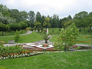
Kurpark Oberlaa on the southern slope of the Laaer Berg |
||
| height | 251 m above sea level A. | |
| location | Vienna , Austria | |
| Mountains | Vienna Woods | |
| Dominance | 8.2 km → Rose Hill | |
| Notch height | 40 m ↓ at Hetzendorf station | |
| Coordinates | 48 ° 9 '37 " N , 16 ° 23' 38" E | |
|
|
||
| rock | Sand , clay , gravel . | |
| Age of the rock | Pannonian , Pleistocene | |
| particularities | today urban area | |
The Laaer Berg (pronounced: Laa-a Berg , colloquially also for short: La-Berg ) is located on the southern edge of Vienna , in the 10th district of Vienna, Favoriten . At its highest point, it measures 251 meters.
geography
The Laaer Berg forms with the Wienerberg ( 244 m above sea level ) to the west and the Boschberg in between, the furthest projection of the Vienna Woods into the Vienna Basin and belongs to the terraced landscape on the edge of the basin. The range of hills lies between the valley of the Vienna (to the Danube Canal ) and the Danube in the north and the lowlands of the Liesing (to the Schwechat ) in the south. It forms the easternmost branch of the Northern Alps in the Vienna area and the spur between the Danube valley and the valley funnel of the southern Vienna basin and the Steinfeld .
- North slope
Austria's busiest motorway, the Südosttangente city motorway, runs on the northern slope, which forms the transition to the densely built-up urban area and the Ankerbrot site . Above and next to it, office and residential complexes were built up to 2008 as part of the urban development project “ Monte Laa ”. The northern part of the hill is also characterized by the Laaer Wald nature reserve; on its edge there is a small historical amusement park called the Bohemian Prater . To the south of it lies the old boundary stone Magere Henne on Laaer-Berg-Straße .
- west
To the west are the Generali-Arena and the Laaerbergbad . To the west of Favoritenstraße , where the U1 with the Altes Landgut and Alaudagasse stations has facilitated access to Laaer Berg since 2017, the mountain merges into the Wiener Berg, which is a little lower at 244 meters .
- South slope
On the southern slope, the Per-Albin-Hansson-Siedlung Ost and the large Kurpark Oberlaa with the Therme Wien , which emerged from the grounds of the Vienna International Garden Show (WIG) in 1974 , take up most of the space. There are also two other stations of the U1, Neulaa and Oberlaa . At the southern foot of the Liesingbach there are the two places Oberlaa and Unterlaa , after which the Laaer Berg is named; their wine taverns are not only visited by local residents.
- East slope
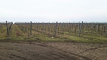
The eastern slope of the Laaer Berg is used for viticulture . This is also where the Goldberg is located, on which one of the last colonies of ground squirrels exists in Vienna.
The Laaer Berg is the namesake of the official statistics census district of the same name, which consists of two census districts.
geology
The Laaer Berg consists of sands and clays (colloquially also known as loam ) of the Pannonian and is covered in the uppermost area by ice-age gravel from the highest of the six river terraces , which were deposited like stairs by the Danube . The structure of the terraces in the Vienna area has not yet been fully clarified, as the Vienna Basin ( burglary basin ) is still a tectonically active area and adjustments are therefore possible.
nature
The largest part of the Laaer Berg was originally intensively grazed and free from forests and only on its top did a light downy oak forest , which Clusius had already mentioned in 1583 as "Silvula [...] ad Lachen". The open steppe areas housed a Pannonian flora with many rare species that was unique for Vienna . Due to the juxtaposition of dry grass and wet locations in the vicinity of the brick ponds, there was an extraordinary wealth of species. As early as 1905, when the Vienna green belt was being planned, the intention was to reforest 234 hectares of forest on Laaer Berg. However, this project was only started in 1953 with a delay of around 50 years to an extent of 40 hectares. Due to the geological nature and dryness of the gravel soils, however, there were severe failures and after three years only a tenth of the trees that had been planted were still alive. As a result, the city administration, which did not want to be dissuaded from the project, had large trenches dug with excavators, filled with soil and artificially watered the trees planted there. It was not until 1982 that the now well-grown forest was made accessible to the public. From today's nature conservation point of view, the well-intentioned afforestation and destruction of the unique dry vegetation are consistently viewed negatively, but at least saved the mountain from being blocked.
history
Brickworks
In the 19th century, the Laaer Berg, like the Wienerberg, was characterized by brick pits and brickworks due to the occurrence of clay . The workers employed there came mainly from the crown lands of Bohemia and Moravia . They were Austrian citizens and often had Czech as their mother tongue. The expression Ziegelböhm comes from this time .
There were exploitative working conditions, as the poor doctor and later chairman of the Social Democracy , Viktor Adler , who was able to infiltrate one of the factories of Wienerberger AG without being recognized, discovered. At this time the Bohemian Prater was built on the edge of the Laaer Berg , which offered the workers of the brick factories leisure time fun. The pits created by the excessive clay mining later filled with groundwater and were surrounded by parks.
Former radio telegraph station
In 1913, a radio telegraph station for shortwave was built on the eastern slope of the Laaer Berg and was in operation as a receiving system until the end of 1985. The shortwave system was operated by the former state company Radio Austria AG and, together with the shortwave transmitter in Bad Deutsch-Altenburg, served to handle international telegraphy connections.
Radiotelegraphy Station was originally built for communication by the military, especially with the Navy, using wireless telegraphy . In the founding year 1913, the station was put into operation with an arc transmitter with 20 kW transmission power, after the start of the war the transmission power was increased to 40 kW. However, the transmission operation was not satisfactory and so after the end of the war a significantly larger transmission system for radio telegraphy was put into operation in Bad Deutsch-Altenburg, about 40 km away. From then on, the radio telegraphy station on Laaerberg only served as a reception system.
Film production
In the 1920s, Laaer Berg was a center for international silent film production. Around the Filmteich (see Filmteichstraße ), which today belongs to the Kurpark Oberlaa , were created 1920–1922 for the production of “Sodom and Gomorrha” by Sascha-Filmindustrie AG, with large monumental wooden and cardboard backdrops that - depending on the source - 3,000 to 14,000 extras were surrounded. They were conducted by director Michael Curtiz (Mihály Kertész), who made the cult film "Casablanca" in the USA twenty years later .
The Schmerber Cross is located in the area known as the “Film City” .
Vineyards and settlements
There used to be vineyards of Klosterneuburg Abbey on the slopes of the Laaer Berg . Due to the remote location, however, the income was not very interesting for the monastery, which is why the area was given to the Austro-Hungarian military command Arsenal as a military training area ; After the collapse of the monarchy in 1918, Klosterneuburg Monastery did not take back the area. The military command decided to distribute the entire area to those returning from Russia during the First World War. In April 1920 there was still a barrack camp (Ukrainian collection point) on Laaerstrasse .
On January 1, 1919, the first lease contracts were signed with interested parties in the monastery barracks . The lease amounted to one crown per year, whereby at the beginning there was an obligation to grow vegetables and to keep small animals. Over the decades, the purpose gardens of the homecoming settlement have turned into pretty gardens with beautiful residential buildings, and the fallow grounds of the abandoned brickworks have turned into a recreational area.
Further allotment gardens, settlements and community housing complexes gradually condensed the settlement. Large areas still remained free. The soccer field, which was later converted into the Franz-Horr-Stadion , today's Generali-Arena, was built near Favoritenstrasse in 1925 .
From the Laaerbergbad to Monte Laa
After the Second World War, further housing estates were built, the Per-Albin-Hansson-Siedlung Ost being the largest from 1966–1977 . The construction of the Laaerberg baths 1957–1959 (based on plans by Erich Franz Leischner ), the utilization of the thermal spring on the northern edge of Oberlaa from 1969 (now called Therme Wien ) and the holding of the Vienna International Garden Show 1974 (wig74) on the Laaer Berg brought further developmental impulses . For the time being, the last major project was the Monte Laa settlement and residential area built up to 2008 .
Transport links
Due to the comparatively sparse settlement, the central area of the Laaer Berg has not been included in the city's underground or tram network to this day . This area is served by city bus routes that run from underground stations. There are also regional bus routes, especially on Laaer-Berg-Straße.
The tram line 67 ran from 1914 to 2017 on the western edge of the mountain on Favoritenstraße in north-south direction to Rothneusiedl . On the occasion of the international garden show in 1974, it was extended on the southern edge parallel to the Donauländebahn to today's Therme Wien (formerly Thermalbad Oberlaa). In 2014, the 67er was withdrawn to the Alaudagasse stop so that the route to Therme Wien can be upgraded to the underground line, and shortened to Reumannplatz in the course of the opening of the U1 route to Oberlaa.
Along the Favoritenstrasse and the Donauländebahn , the U1 underground line has been in operation since September 2, 2017 from Reumannplatz in the center of the district to the new U1 terminus at Therme Wien . As a result, the Altes Landgut , Alaudagasse , Neulaa and Oberlaa underground stations were built on the western and southern edges of the Laaer Berg by around 2017 . The extension largely replaced the east branch of tram line 67.
Individual evidence
- ↑ On the trail of the last Viennese ground squirrels ( page no longer available , search in web archives ) Info: The link was automatically marked as defective. Please check the link according to the instructions and then remove this notice. (ORF Vienna, November 8, 2008)
- ↑ Alexander Mrkvicka, Susanne Leputsch: Green in the City, Urban Green Space Policy in the 20th Century , in: Karl Brunner, Petra Schneider (Ed.): Environment City, History of Nature and Habitat Vienna , Vienna 2005, p. 482, ISBN 3-205-77400-0
- ↑ Wolfgang Adler, Alexander Ch. Mrkvicka (Ed.): The flora of Vienna - yesterday and today. The wild fern and flowering plants in the city of Vienna from the middle of the 19th century to the turn of the millennium , Vienna 2003, p. 63, ISBN 978-3900275969
- ↑ Radio stations in today's territory of Austria - Vienna-Laaerberg ( Memento of the original from January 31, 2007 in the Internet Archive ) Info: The archive link was inserted automatically and has not yet been checked. Please check the original and archive link according to the instructions and then remove this notice.
- ↑ The relics of the kuk radio: Military infrastructure for civil purposes orf.at, June 15, 2017, accessed June 15, 2017.
- ^ History of the broadcasting center in Laaerberg. Retrieved May 27, 2020 .
- ^ Line 67 (Vienna) in the Stadtverkehr-Austria-Wiki
Web links
- Entry on Laaer Berg in the Austria Forum (in the AEIOU Austria Lexicon )


