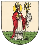
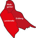
Landstrasse (part of Vienna's district)
| Country road | |
|---|---|
| coat of arms | map |
 |

|
Highway is a district of Vienna in the 3rd district of Vienna highway .
history

Even under the Romans , the civil town ( Canabae ) of the legionary camp Vindobona was located in this area .
The suburb of Landstrasse developed around a branch that had formed in the area of today's Rochusmarkt around a Nikolaikapelle . Around 1200, the suburb was called Niklasvorstadt , later the area was also called Landstrazz , Bey St. Nicolau , Vor dem Stubentore or An der Landstraß . The name "Landstraße" referred to the country and army road leading from the city of Vienna outwards towards Hungary , which goes back to a Roman Limes road. A Cistercian monastery was located in the immediate vicinity until 1529. This was consecrated to St. Mary, but because of its proximity to the Nikolaikapelle “St. Nikolai in front of the Stubentor ”.
As a result of the Crusades and increased contact with the Orient , plague and leprosy broke out more and more frequently in Vienna . Several infirmaries were created in this way . One of them was founded in the area of the highway by the Order of Lazarus , the infirmary of St. Lazar. The chapel belonging to the hospital was consecrated to St. Mark in 1370 , after which the name St. Marx became established for the surrounding area. Until 1784 the hospital remained as the “Citizens Hospital of St. Marx”. Later on, poor, frail people were placed here. In the 19th century, the site was acquired by Adolf Mautner and converted into a brewery.
Like many other suburbs, Landstrasse suffered from the ravages of the Turkish sieges . In September 1529, some buildings that were close to the city of Vienna were also demolished by the defenders. Although the siege of Vienna during the second Turkish siege took place mainly from the west, the suburb of Landstraße and the surrounding towns went up in flames. After that, however, a rapid reconstruction began. In addition, the nobility and bourgeoisie poured into the suburbs and built numerous palaces such as the Belvedere , Palais Schwarzenberg and Palais Harrach . In 1775 there were still 336 houses, in 1849 there were already 741. In addition, trade and industry in Landstraße developed much more strongly than in the surrounding towns. There was a sugar refinery as well as cloth, mirror and piano factories.
Personalities
- Franz Josef Hadatsch (1798–1849), civil servant and writer
- Johann Nepomuk Hofzinser (1806–1875), magician
literature
- Vienna district handbooks. 3rd district Landstrasse . Vienna 2002
Web links
- District history Landstrasse. District Museum Landstrasse, archived from the original on October 14, 2013 ; accessed on January 3, 2018 .
Coordinates: 48 ° 12 ' N , 16 ° 23' E
