Donaufeld
| Donaufeld | |
|---|---|
| coat of arms | map |
 |

|
Donaufeld is a district of Vienna in the 21st district of Floridsdorf . The place was an independent municipality between 1881 and 1894 and is today one of the 89 Viennese cadastral communities .
geography
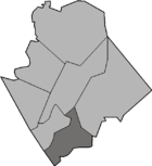
Today's cadastral municipality extends over an area of about 440 hectares . The cadastral community used to have two bodies of water that are outside the Floridsdorf district. Due to administrative simplifications, these areas were transferred to the cadastral community of Kagran in 2008 and to the cadastral community of Brigittenau in 2014 . As the southernmost district of Floridsdorf, Donaufeld borders on Brigittenau in the south-west across the Danube and on the Danube city in the south-east. Within Floridsdorf, Donaufeld borders the districts of Floridsdorf , Großjedlersdorf and Leopoldau. The Danube and its tributaries divide the Donaufeld into three parts. The uninhabited Danube Island lies between the Danube and the New Danube , the Danube fields stretching from the district border to the northern railway bridge. The Bruckhaufen settlement is located between the New Danube and the Old Danube, and the historic center of Donaufeld is on the other side of the Old Danube.
history
The later Donaufeld originally belonged to the municipality of Leopoldau. Numerous factories and houses were built here around the middle of the 19th century. This resulted in two new localities: Neu-Leopoldau and Mühlschüttel . In 1881 these two places were separated from the municipality of Leopoldau and formed a separate municipality of Neu-Leopoldau with Mühlschüttel , which was renamed Donaufeld in 1886 due to the risk of confusion with the municipality of Leopoldau .
In 1894, due to a resolution of the Lower Austrian state parliament, Donaufeld was merged with the communities of Jedlesee , Floridsdorf and Neu-Jedlersdorf to form the large community of Floridsdorf . On December 28, 1904, together with other localities, the incorporation in Vienna into the 21st Viennese district of Floridsdorf took place.
Culture and sights

The Donaufelder parish church is a neo-Gothic brick building and with its 96 meter high tower it is the third highest church in Vienna. With the Islamic Center Vienna there is another remarkable sacred building in the district.
Like other Viennese cadastral communities on the Danube, Donaufeld is the venue for the annual Danube Island Festival , the largest open-air festival in Europe.
With the Danube Island and the Old Danube, the district has a large leisure and swimming area. The beach baths Angelibad and Eisenbahnerbad are located on the Old Danube . The Freiligrathpark is a park not far from the Donaufelder parish church.
Economy and Infrastructure
There is an industrial area in the north of Donaufeld. The Floridsdorf refinery, which operated until 1970, was also located here . The eastern area of the district is used by commercial gardeners. This approximately 70 hectare agricultural area, which also includes the southern tip of Leopoldau, is designated as the Donaufeld target area in the Vienna urban development plan. The plan is to create “a lively district with a high quality of life.” In the course of this, the construction of a new tram line as an additional connection between Floridsdorf and the Danube Center is being considered.
In terms of traffic, Donaufeld is mainly developed through the Danube bank motorway . There is a motorway junction at the Brigittenauer Bridge . Another important street is Donaufelder Straße, where tram lines 25 and 26 also run.
The elementary school Mengergasse 33 and the Donaufeld Nord campus with an all-day elementary school and a kindergarten are located in Donaufeld.
Personalities
- Antonie Baumberg (1859–1902), writer, founder of the Donaufelder women's charity
- Hans Morawitz (1893–1966), politician
literature
- Raimund Hinkel: Vienna XXI. Floridsdorf. The home book . Brandstätter, Vienna 1994, ISBN 3-85447-528-4 .
Web links
- Entry on Donaufeld in the Austria Forum (in the AEIOU Austria Lexicon )
- leopoldau.at - Chronicle of Leopoldau
- Donaufeld - target area for urban development on the website of wien.at
Individual evidence
- ↑ Official Journal for Surveying 2008/3 - 3464th Ordinance of the Federal Office for Metrology and Surveying of March 17, 2008 regarding the changes to the cadastral communities Donaufeld, Kaisermühlen, Kagran and Leopoldau. (pdf, 367KB) , accessed on July 4, 2017.
- ↑ Official Journal for Surveying 2014/1 - 4295th Ordinance of the Federal Office for Metrology and Surveying of December 16, 2013 regarding the change of the cadastral communities Donaufeld and Brigittenau. (pdf, 496KB) , accessed on July 4, 2017.
- ↑ Urban development plan 2005 - Donaufeld target area ( Memento from April 22, 2009 in the Internet Archive )
- ^ Campus Donaufeld Nord - new building , accessed on June 5, 2013.
Coordinates: 48 ° 15 ′ 10 ″ N , 16 ° 24 ′ 32 ″ E

