
Zaya
| Zaya | ||
_in_Hauskirchen.JPG) Zaya in house churches |
||
| Data | ||
| location | Weinviertel , Lower Austria ( Austria ) | |
| River system | Danube | |
| Drain over | March → Danube → Black Sea | |
| source | south of the village of Klement in the Leiser mountains 48 ° 33 ′ 51 ″ N , 16 ° 22 ′ 6 ″ E |
|
| Source height | 380 m above sea level A. | |
| muzzle | near Drösing in the March coordinates: 48 ° 32 '55 " N , 16 ° 56' 46" E 48 ° 32 '55 " N , 16 ° 56' 46" E |
|
| Mouth height | 150 m above sea level A. | |
| Height difference | 230 m | |
| Bottom slope | 4 ‰ | |
| length | 58 km | |
| Catchment area | 613.9 km² | |
| Discharge at the Niederabsdorf A Eo gauge: 515.6 km² Location: 6.8 km above the mouth |
NNQ (22.01.2006) MNQ 1981–2012 MQ 1981–2012 Mq 1981–2012 MHQ 1981–2012 HHQ (30.06.1994) |
70 l / s 330 l / s 750 l / s 1.5 l / (s km²) 6.98 m³ / s 18.6 m³ / s |
| Small towns | Mistelbach | |
The Zaya is a tributary of the March in the Lower Austrian region of Weinviertel .
The name is of Germanic origin and is made up of * sauj- ("moist") and * ahwo ("waters") and probably means "the kingdom of water". The water was first mentioned in 1045 as "Zaiove".
It rises south of the village of Klement in the Leiser Mountains and flows through the communities of Ernstbrunn , Gnadendorf , Asparn an der Zaya , Mistelbach an der Zaya , Wilfersdorf , Hauskirchen , Neusiedl an der Zaya , Dobermannsdorf , Ringelsdorf and flows into the March at Drösing . The Zaya flows mainly in a west-east direction, is 58 km long and covers an altitude difference of 230 meters. Between Asparn and Dobermannsdorf, the route of the Korneuburg – Hohenau local railway , which has now been closed for passenger traffic, runs parallel to the river.
The Zaya used to meander in the lowlands of the lower Zaya Valley and was surrounded by extensive wetlands and alluvial forests . Until the early modern era , water power was used extensively by mills. There were once almost 50 of them on the Zaya, one every 1.2 kilometers on average. From the end of the 18th century, the water began to be straightened and lowered. The river has been degraded to a drainage ditch, the task of which is to drain the water as quickly as possible. On the one hand, this should protect the settlements against floods and, above all, enable more intensive agricultural use of the river area. Since wetlands and backwaters serve as receiving waters during floods and dampen the flood peaks in the places downstream, the measures have on the contrary increased the risk of flooding in many places. In addition, valuable habitats for animal and plant species that have now become rare have been destroyed and biodiversity has been reduced. The Zaya meadows in Mistelbach are the most important remnants of the former wetlands of the Zaya.
See also: Waters in the Weinviertel
photos

Zaya Quelle at Klement
Flow limiter at Mistelbach

Zaya between Hohenau an der March and Waltersdorf

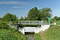
Zaya Bridge in Hauskirchen


Individual evidence
- ↑ BMLFUW (Hrsg.): Area directory of the river areas: Danube area from the Enns to the Leitha. In: Contributions to Austria's Hydrography Issue 62, Vienna 2014, p. 146. PDF download , accessed on July 8, 2018.
- ^ Ministry for an Austria worth living in (ed.): Hydrographisches Jahrbuch von Österreich 2012. 120th volume. Vienna 2014, p. OG 270, PDF (13.6 MB) on bmlrt.gv.at (yearbook 2012)
- ↑ E. Schuster: The Etymology of Lower Austrian Place Names , Part 3, Association for Regional Studies of Lower Austria, 1994 Vienna, p. 525ff
- ↑ Heinz Wiesbauer and Manuel Denner: Wetlands - Natural and Cultural History of the Weinviertel Waters , Vienna 2013 (published by the Federal Ministry for Agriculture, Forestry, Environment and Water Management and the Office of the Lower Austrian Provincial Government, Department of Water Management)