
Guntramsdorf
|
market community Guntramsdorf
|
||
|---|---|---|
| coat of arms | Austria map | |
 |
|
|
| Basic data | ||
| Country: | Austria | |
| State : | Lower Austria | |
| Political District : | Mödling | |
| License plate : | MD | |
| Surface: | 14.86 km² | |
| Coordinates : | 48 ° 3 ' N , 16 ° 19' E | |
| Height : | 193 m above sea level A. | |
| Residents : | 9,227 (January 1, 2020) | |
| Population density : | 621 inhabitants per km² | |
| Postal code : | 2353 | |
| Area code : | 02236 | |
| Community code : | 3 17 10 | |
| NUTS region | AT127 | |
| UN / LOCODE | AT GUN | |
| Address of the municipal administration: |
Town hall quarter 1/1 2353 Guntramsdorf |
|
| Website: | ||
| politics | ||
| Mayor : | Robert Weber ( SPÖ ) | |
|
Municipal Council : ( 2020 ) (33 members) |
||
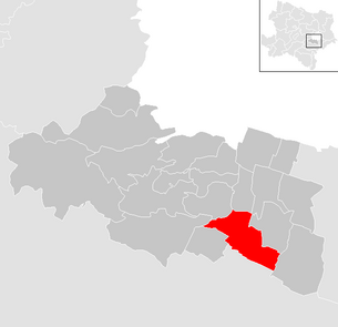
| Location of Guntramsdorf in the Mödling district | ||
  |
||
 The town hall quarter at the local train station |
||
| Source: Municipal data from Statistics Austria | ||

Guntramsdorf is a market town with 9227 inhabitants (as of January 1, 2020) in the industrial district in Lower Austria .
geography
location
The place is on the western edge of the Vienna basin on the thermal line . Most of the settlement area is on the plain. Only the centuries-old vineyards are located on the slopes of the Eichkogel (367 m above sea level) and the Anninger (675 m) on the edge of the Vienna Woods . The townscape is characterized by several ponds, among other things. Some of them are made accessible to the public as bathing ponds and recreational areas, including the so-called ocean in the Neu-Guntramsdorf district and the so-called wind turbine pond near the old town. Both ponds are directly on the B17 ( Wiener Neustädter Straße ).
Most of the ponds in the municipality were created around 1900 after groundwater ingress in clay pits that were used for brick extraction ( brick ponds ). On the southern edge of the village, directly on the municipality border with Traiskirchen (border with the cadastral municipality Möllersdorf), there is a privately owned pond called Ocean II .
structure
The municipality is congruent with the cadastral municipality of the same name . The main localities besides the market itself are the villages of Neu-Guntramsdorf (under 2,000 inhabitants) and Blumensiedlung (under 300 inhabitants). Most of the settlement can be found in the old town , and the Neu-Guntramsdorf settlement has also existed since 1938 (based on a concept by Georg Laub ), about two kilometers north of the old town, on the bank of the ocean pond.
A continuous settlement axis developed between the Altort and Neu-Guntramsdorf since around 1980. This created an almost closed settlement area since around 2000.
Neighboring communities
| Mödling | Wiener Neudorf | Biedermannsdorf |
| Gaaden |
.svg)
|
Laxenburg |
| Gumpoldskirchen | Möllersdorf ( district of Baden ) | Münchendorf |
The border to Biedermannsdorf lies in the industrial center of Lower Austria South and is only approx. 150 m long.
history
From the 1st to the 4th century the area was part of the Roman province of Pannonia .
A grave field from the Latène period was uncovered on the Schwechat terrace south of the Vienna city limits . There were a total of 18 graves, some with stone enclosures, 14 of which were body and two cremations. A fragment of a sword scabbard and simple ceramic objects were found among grave goods. Medically significant were three skulls with traces of trepanation , both single and double and triple bores. After the healing traces on the skullcap, the single drilling was successful for at least some time, the double and triple drilling must have ended fatally, as shown by traces of inflammation on the bone. The objects are exhibited in the local history museum Guntramsdorf and in the Prehistory Museum in Asparn / Zaya .

The historical time of Guntramsdorf begins with the first Ostmark of the empire of Charlemagne (around 800). The name of Guntramsdorf refers to the founder, who may have been called "Guntram". According to a document from the year 859, Count Kozel , Prince of Pannonia (Hungary), gave goods to the Regensburg Monastery . The following witnesses are given: Count Ratpot and Count Guntram. This Count Guntram is likely to be the founder of Guntramsdorf, as there is no Guntram mentioned in documents before him.
At the time of Leopold III. (1095–1136) Guntramsdorf was owned by the knight Heinrich II von Kuenring . This was called Heinric de Gundrammisdorf. It got its name from Guntramsdorf Castle, located between Mödling and Baden . This fortified knight's seat probably stood on the site of the later castle. Only the baroque pavilion remains from this castle today. Around 1200 Guntramsdorf was owned by the Dukes of Mödling . From 1246 to 1365 Guntramsdorf was owned by the Guntramsdorfer family. According to Wisgrill III. Goods and relationships throughout the country. In 1570 the rule was from Zwettl to the Heiligenkreuz sold.
The local history of Guntramsdorf reports that in the Middle Ages there was an artificial fish pond in the area of today's cemetery. As a special feature it is reported that the fishing yield of this pond represented a double-digit share of the budget of the then sovereign.

After the annexation of Austria in 1938, the place was incorporated into the city of Vienna to the 24th district. The first major residential construction activity of the 20th century in Guntramsdorf also fell during this period. With confiscated former Austrian union funds the so-called were east ocean -Teiches created numerous apartment blocks in today's district of Neu-Guntramsdorf: On August 13, 1938 set Gauleiter Odilo Globocnik the groundbreaking ceremony for the construction of the Franz Holzweber (1904-1934), as a martyr hanged after Juliputsch , dedicated settlement. After the end of the war, the settlement became the property of the non-profit housing and settlement company Neue Heimat, with a sharp increase in population . In 1951, the locality component Eichkogelsiedlung is mentioned for the first time in Austria's local directory ; from 1961 the settlement appears as Neu-Guntramsdorf in the local registers based on the ten-year population censuses .
From 1941 onwards, the huge Ostmark aircraft engine works were built in the north of Neu-Guntramsdorf, bordering the local area of Wiener Neudorf . Forced laborers and prisoners from the Mauthausen concentration camp were brought in to establish and operate the plant . To accommodate up to 3,170 prisoners, a large sub-camp of the Mauthausen concentration camp was set up in 1943 in the Guntramsdorf municipality . Since 1995, guided tours for schools by a local concentration camp memorial association and annual commemoration ceremonies have been taking place in the former camp area at a memorial.
In the first days of April 1945 there was heavy fighting in the Guntramsdorf area between parts of the German 6th SS Panzer Army under Sepp Dietrich and the Soviet 3rd Ukrainian Front under Marshal Tolbuchin . After Tolbuchin's surprising break-in into the southern Vienna Basin on April 1, the 2nd SS Panzer Division was relocated from the Neusiedler See area to the south of Vienna on the night of April 2 and a line of resistance was set up from Gumpoldskirchen via Guntramsdorf and Laxenburg to Moosbrunn. Since Tolbuchin rearranged his troops to encircle Vienna to the west and to the general attack from the south from April 2nd to 4th, Guntramsdorf remained at the front for these three days and suffered severe damage, mainly from Soviet fire.
In 1954 the place became independent again together with the other municipalities that were incorporated in 1938 and fell back to Lower Austria. The energy supply is still with the Viennese and not the Lower Austrian state energy supplier.
Population development
| census | Residents |
|---|---|
| 2011 | 8,955 |
| 2001 | 8,421 |
| 1991 | 6,977 |
| 1981 | 6,090 |
| 1971 | 6,017 |
Source: population development of Guntramsdorf. (PDF) Statistics Austria
politics

Community representation
- Mayor : Robert Weber, SPÖ (2nd term of office)
- Vice Mayor : Nikolaus Brenner, SPÖ
- Municipal Council (33 mandates):
| list | be right | Mandates |
|---|---|---|
| SPÖ | 2,424 | 17th |
| ÖVP | 995 | 6th |
| FPÖ | 791 | 5 |
| NEOS | 435 | 3 |
| GREEN | 402 | 2 |
Economy and Infrastructure
The original agricultural place has changed into an important industrial location in the second half of the 20th century. Parts of the Lower Lower Austria-South industrial center , which is managed by Ecoplus , belong to the northern part of the municipality. But other large industrial companies such as the lacquer factory Axalta, the former DuPont (Stolllack) by Herbert Turnauer , the Assmannmühle and numerous other small and medium-sized companies are located here.
In July and August 2013, the market town of Guntramsdorf put five of its own solar power plants on the roofs of various public buildings into operation on the initiative of the then environmental council and vice mayor, Robert Weber (mayor from 2015). It can cover more than the entire electricity requirement (130%) for public street lighting in the town.
Other companies in Guntramsdorf:
- Danfoss Austria (cooling, heating and control technology)
- Raiffeisen warehouse
Only viticulture has survived over time. Guntramsdorf belongs to the Thermenregion wine-growing region . There are up to 28 wine taverns in the village .
traffic
Road network: Guntramsdorf is located on Wiener Neustädter Straße B 17 (the former Triester Bundesstraße) and on the A2 Süd Autobahn . There is currently no direct connection from the A2 to the low-level road network in Guntramsdorf, but this is discussed again and again.

There is a special feature with regard to the connection to the rail network . The Guntramsdorf municipality is touched by two lines of the Austrian Federal Railways ( Südbahn and Aspangbahn ) as well as the private railway Badner Bahn and has exactly one train station on each of these routes, whereby the train station of the Südbahn is actually on Gumpoldskirchner municipality area. The unique feature for Austria is that these three routes have no crossing point or connecting line in the municipality. Topologically, all three lines are parallel.
In addition, there are extensive tracks in the industrial center of Lower Austria South , only part of which is located in Guntramsdorf's municipality. The connection to the rail network is via a connecting line that branches off the Aspangbahn north of Guntramsdorf Kaiserau station on an open line.
The main mode of transport in local and near regional rail traffic is the Badner Bahn (local railway Vienna-Baden) due to the central location of the Guntramsdorf Lokalbahn station and the high train frequency . The commuter traffic to and from the federal capital Vienna takes place mainly on this tram-like private railway, not least because the B17 and the A2 are at risk of congestion during rush hour. Before the Badner Bahn was established, Guntramsdorf had been connected to Wiener Neudorf via a steam tramway route since 1886 and was connected to the network of the former Baden tramway from 1899 .
The Badner Bahn is used to a very large extent for local passenger transport and the Southern Railway to a much lesser extent. The Aspang Railway plays practically no role in local public transport.
Waterways: Guntramsdorf is located on the oldest artificial waterway in Eastern Austria, the Wiener Neustädter Canal . The three-stage lock system, planned and built by Sebastian von Maillard from 1797 to 1799, is remarkable . After Maillard left in 1799, the canal was extended under the supervision of Joseph Schemerl von Leytenbach in 1803 to Wiener Neustadt and in 1811 to the Pöttschinger Sattel. A planned connection to Raab and the Adriatic Sea was never completed. Since the start of construction of the Aspang Railway in 1879, this waterway was only used as a traffic route in the southern sections and made completely impossible from 1936 onwards by the construction of small power stations at canal locks. The canal's importance ultimately lies in the water and energy supply of local commercial enterprises. In the municipality of Guntramsdorf, the Wiener Neustädter Canal is accompanied by a cycle path.
Culture and sights
buildings
- In addition to the renovated local history museum, which was built by the former elementary school director Ernst Wurth, there is the industrial museum Museum Walzengravieranstalt Guntramsdorf in the house of the former Karl Endler roller engraving facility, which produced rollers for textile printing from 1914 to 1986 .
- Parish church hl. James on the church square
- Parish church hl. Josef the worker in Neu-Guntramsdorf
Events
The Jakobitage has been taking place in Guntramsdorf for 45 years from mid-July to the end of July - a wine festival at which local winegrowers serve on Kirchenplatz. Around 3,000 guests from near and far each day, a total of around 30,000 to 35,000, visit the stands for 13 days.
At the beginning of August, a so-called beach party takes place annually on the grounds of the ocean bathing pond . The festival, at which reggae is mainly played by live bands, is known far beyond the boundaries of the district and has been attracting thousands of visitors from the nearby capital of Vienna for years. Since 2018 there has also been the Bike Night, one day before the actual beach party.
The Guntramsdorf Spring Run, which was held between 2006 and 2008 as part of the Thermen Trophy in Guntramsdorf, was very well known. The route led around the wind turbine pond and through the Guntramsdorf vineyards. One lap was about 5275 m (equivalent to an eighth marathon ). In 2009 the Guntramsdorf Spring Run was no longer included in the Thermentrophy program and was canceled without replacement.
Sports
There are also several sports options in Guntramsdorf: whether football, volleyball, (table) tennis, judo, horse riding, shooting or golf. The judo club ATUS-Guntramsdorf, the oldest judo club in Lower Austria, is particularly successful. His team has already produced numerous Lower Austrian regional champions in several weight classes. The Guntramsdorf table tennis club is also particularly successful. It was founded in 1985 and has been one of the young strongholds of Lower Austria from the start.
Personalities
- Ernst Aigner (* 1966), professional football player with u. a. FK Austria Wien and as a national player participant in the 1990 World Cup in Italy
- Leopoldine Blahetka (1809–1885), pianist and composer
- Gerald Groß (* 1964), journalist and PR entrepreneur
- Gabriele Heinisch-Hosek (* 1961), politician, former Federal Minister. D. for education and culture, most recently member of the National Council
- Oskar Herz (1866 - declared dead after deportation in 1947), entrepreneur and local politician
- Christian Höbart (* 1975), former liberal member of the National Council , General Secretary Team HC Strache
- Max Hussarek von Heinlein (1865–1935), Imperial and Royal Austrian Prime Minister, owner of a castle in Guntramsdorf
- Josef von Kühn (1833–1913), founder of the Volksküche, owner of the "Kühnhof" castle and apartment building in Guntramsdorf
- Heinrich Fuss (1845–1913), sculptor
- Franz Josef Mayer-Gunthof (1894–1977), industrialist, President of the Federation of Industrialists 1960–1972
- Hans-Henning Scharsach (* 1943), journalist
- Josef Schoiswohl (1901–1991), Catholic diocesan bishop of Graz-Seckau
- Josef Staudinger (1949–2015), President of the Lower Austria Chamber of Labor , former Mayor of Guntramsdorf (SPÖ), trade union official (Bau-Holz)
- Mongo Stojka (1929–2014), singer, guitarist and author
literature
- Joseph I. Müller: Chronicle of the Guntramsdorf market . Pasternak, Mödling 1897.
- Josef Knoll: Chronicle of the market town and parish Guntramsdorf . (Illustrated). Self-published by Knoll, Guntramsdorf 1957.
- -: Second improved and enlarged edition. Self-published by Knoll, Guntramsdorf 1967.
- Hans Sternhart, Hans Pötschner: 100 years of Badner Bahn . Slezak, Vienna 1973, ISBN 3-900134-19-7 .
- Josef Knoll: Heimatbuch Guntramsdorf . Self-published by Knoll, Guntramsdorf 1977. (Actually: improved and expanded edition of the 1967 chronicle).
- Ernst Wurth: Brick works in Guntramsdorf. 1618-1918 . Philipp, Baden near Vienna (1980).
- Paul Slezak, Friedrich Slezak, Josef Otto Slezak : From the ship canal to the railroad. Wiener Neustädter Canal and Aspangbahn . 2nd Edition. International Archive for Locomotive History , Volume 30, ZDB -ID 256348-4 . Slezak, Vienna 1989, ISBN 978-3-85416-151-6 .
- Fritz Lange: From Vienna to the Adriatic Sea - The Wiener Neustädter Canal . Sutton Verlag, Erfurt 2003, ISBN 3-89702-621-X .
- Ernst Wurth: Guntramsdorf in old views . European Library, Zaltbommel 1992, ISBN 90-288-5522-X .
- Alexandra Treidl: The Guntramsdorf Palace. About dealing with a historical palace complex in the 20th century . Thesis. University of Natural Resources and Life Sciences, Vienna 2005.
Web links
- Community website
- Entry on Guntramsdorf in the Austria Forum (in the AEIOU Austria Lexicon )
- 31710 - Guntramsdorf. Community data, Statistics Austria .
Individual evidence
- ↑ 166. Guntramsdorf . In: Austrian official calendar online . (Course of publication: proven from 2002). Jusline Österreich GmbH / Verlag Österreich, Vienna 2013, ZDB -ID 259-8 .
- ↑ Ingeburg Weinberger: Settling does not mean building, but rather! Ideology transfer in settlement construction under National Socialism in Greater Vienna. Dissertation 2010, 514 pp. - Online p. 215 , accessed on March 1, 2014
-
^ Susanne Sievers , Otto Helmut Urban , Peter C. Ramsl: Lexicon for Celtic Archeology . Volumes A-K and L-Z . Verlag der Österreichische Akademie der Wissenschaften , Vienna 2012, ISBN 978-3-7001-6765-5 , p. 709.
A picture of the skull with the successful single trephination and the later fatal triple treadmill can be seen in Helmut Birkhan : Kelten. Images of their culture. Publishing house of the Austrian Academy of Sciences, Vienna 1999, ISBN 3-7001-2814-2 , p. 340, image 614. - ↑ Josef Widemann (ed.): The traditions of the Regensburg bishopric and the St. Emmeram monastery . Second reprint of the Munich 1943 edition. Sources and discussions on Bavarian history, Nue series Volume 8, ZDB -ID 503539-9 . Scientia-Verlag, Aalen 1988, ISBN 3-511-03769-7 .
- ↑ Bernhard Link, Annales Austrio-Clara-Vallenses (Vienna 1723) Vol. 2, p. 471.
-
↑ Homesteads between fields and gardens. Groundbreaking ceremony for the wood weaver settlement by Gauleiter Globocnik. In: Volks-Zeitung , No. 223/1938 (LXXXIV. Volume), August 14, 1938, p. 1 (picture) and 9 (online at ANNO ). ;
(Caption :) Under the fluttering flags of German socialism, with oak leaves on the work tool - this is how it goes with massive steps to new work for our national community. In: Das Kleine Blatt , No. 223/1938 (XII. Volume), August 14, 1938, p. 1. (Online at ANNO ). ;
–A–: A new city is growing out of the heathland. Groundbreaking ceremony for the "wood weaver settlement". In: Das Kleine Blatt , No. 223/1938 (XII. Year), August 14, 1938, p. 8 f. (Online at ANNO ). ;
(Caption :) Right: Gauleiter Globocnik broke ground (…). In: Wiener Bilder , No. 34/1938 (XLIII. Volume), August 21, 1938, p. 7, bottom right. (Online at ANNO ). . - ^ Wilhelm Rausch (ed.), Hermann Rafetseder (edit.): Area and name changes of the municipalities of Austria since the middle of the 19th century . Research on the history of cities and markets in Austria, Volume 2. Landesverlag, Linz (an der Donau) 1989, ISBN 3-900387-22-2 , p. 336.
- ^ Hans Egger, Franz Jordan: Fires on the Danube. The finale of the Second World War in Vienna, Lower Austria and Northern Burgenland. Stocker, Graz 2004, ISBN 3-7020-1053-X , pp. 101–112. (Partly at the same time: Dissertation, University of Vienna, Vienna 2002: Hans Egger: The war 1939–1945 in eastern Austria and its prehistory ). (The work brings details of the battles around Gumpoldskirchen and Guntramsdorf).
- ↑ Gutramsdorf community: SPÖ, NEOS and GRÜNE agree on cooperation in the future local council (accessed on March 28, 2015)
- ^ Election results for the 2015 municipal council elections in Guntramsdorf. Office of the Lower Austrian State Government, December 1, 2015, accessed on March 8, 2019 .
- ↑ Marktgemeinde Guntramsdorf: Marktgemeinde Guntramsdorf - 2020-01-26: Municipal council election. Accessed February 16, 2020 .
- ↑ Valerie Else Riebe: The Wr. Neustädter Schiffahrts Canal. Self-published, Vienna 1936. P. 18 ff.
- ↑ Valerie Else Riebe: The Wr. Neustädter Schiffahrts Canal. Self-published, Vienna 1936. P. 76 ff.
- ↑ Valerie Else Riebe: The Wr. Neustädter Schiffahrts Canal. Self-published, Vienna 1936. p. 111.
- ↑ SPONSOR PARTNER - Jakobitage Guntramsdorf. Retrieved July 1, 2019 .
- ↑ http://www.thermentrophy.at/
Remarks
- ↑ According to the 1951 census , the Eichkogel settlement mentioned for the first time that year had 1,661 residents. - From: Knoll: Chronicle of the market community , Guntramsdorf 1957.

Achau | Biedermannsdorf | Breitenfurt near Vienna | Brunn am Gebirge | Gaaden | Giesshübl | Gumpoldskirchen | Guntramsdorf | Hennersdorf | Hinterbrühl | Cold people | Laab in the forest | Laxenburg | Maria Enzersdorf | Mödling | Münchendorf | Perchtoldsdorf | Vösendorf | Wiener Neudorf | Vienna Woods
Cadastral municipality and locality: Guntramsdorf
Market place: Guntramsdorf | Settlements: Flower settlement • Neu-Guntramsdorf | Other location: industrial center Lower Austria-South
Counting district: Guntramsdorf center | Guntramsdorf-West | Guntramsdorf-Süd and Ost | Neu-Guntramsdorf | Guntramsdorf-North