Bad Traunstein
|
market community Bad Traunstein
|
||
|---|---|---|
| coat of arms | Austria map | |
|
|
||
| Basic data | ||
| Country: | Austria | |
| State : | Lower Austria | |
| Political District : | Zwettl | |
| License plate : | ZT | |
| Surface: | 47.45 km² | |
| Coordinates : | 48 ° 25 ′ N , 15 ° 5 ′ E | |
| Height : | 923 m above sea level A. | |
| Residents : | 1.005 (January 1, 2020) | |
| Postal code : | 3632 | |
| Area code : | 02878 | |
| Community code : | 3 25 28 | |
| NUTS region | AT124 | |
| Address of the municipal administration: |
Wiegensteinstrasse 2 3632 Bad Traunstein |
|
| Website: | ||
| politics | ||
| mayor | Roland Zimmer ( ÖVP ) | |
|
Municipal Council : ( 2020 ) (19 members) |
||
| Location of Bad Traunstein in the Zwettl district | ||
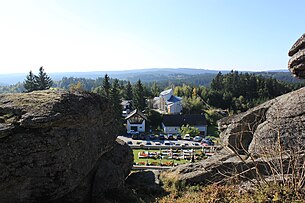
 View from the Wachtstein |
||
| Source: Municipal data from Statistics Austria | ||
Bad Traunstein (formerly Traunstein [ in the Waldviertel ]) is a market town with 1005 inhabitants (as of January 1, 2020) in the Zwettl district in Lower Austria .
geography
Bad Traunstein is located in the Waldviertel in Lower Austria approx. 25 km south of the district capital Zwettl . The area of the market town covers 47.45 km², 58.8% of the area is forested. Bad Traunstein is between 850 and 948 m above sea level. The Wachtstein is the highest point and offers a view over the entire Waldviertel.
Community structure
The municipal area comprises the following 14 localities (population in brackets as of January 1, 2020):
- Bad Traunstein (300)
- Beaver loft (30)
- Dietmanns (80)
- Belt Mountain (10)
- Haselberg (40)
- Hummelberg (75)
- Kaltenbach (82)
- Pfaffings (27)
- Prettles (17)
- Schoenau (61)
- Spielberg (84)
- Stone (83)
- Walterschlag (23)
- Weidenegg (93)
Neighboring communities
| Schönbach | Grafenschlag | Sallingberg |

|
Ottenschlag | |
| Bear head | Gutenbrunn | Martinsberg |
history
Traunstein was first mentioned in a document in 1361. In 1371 the place is not yet mentioned as a market, but as a parish and seat of a regional court. Documents from 1580 mention market justice and a parish school.
After a competition for health tourism in the Waldviertel broke out with the neighboring municipality of Ottenschlag in 2006 , Traunstein was able to secure a lead. On October 12, 2008, after an 18-month construction period, a spa center built for 18 million euros and supported by the public sector was opened by Governor Erwin Pröll . A total of 100 different forms of therapy can be offered, with the emphasis on mud and mud applications. This paved the way for the municipality to change its name to “Bad Traunstein”, which was sought by the municipal council on September 9, 2009. On the basis of a resolution by the Lower Austrian state government, the municipality has officially been allowed to use the addition of bath since May 20, 2010 . With this promotional addition, the comprehensive health offer should come into its own even more clearly.
Population development
According to the results of the 2001 census, there were 1089 inhabitants. In 1991 the market town had 1121 inhabitants, in 1981 1244 and in 1971 1274 inhabitants.
politics
The municipal council has 19 members. (For documents from 1990 to 2005, see Traunstein.)
- With the municipal council elections in Lower Austria in 1990, the municipal council had the following distribution: 17 ÖVP and 2 SPÖ.
- With the municipal council elections in Lower Austria in 1995, the municipal council had the following distribution: 16 ÖVP and 3 SPÖ.
- With the municipal council elections in Lower Austria in 2000, the municipal council had the following distribution: 16 ÖVP, 2 SPÖ and 1 FPÖ.
- With the municipal council elections in Lower Austria in 2005 , the municipal council had the following distribution: 16 ÖVP and 3 SPÖ.
- With the municipal council elections in Lower Austria in 2010 , the municipal council had the following distribution: 18 ÖVP and 1 SPÖ.
- With the municipal council elections in Lower Austria in 2015 , the municipal council has the following distribution: 18 ÖVP and 1 SPÖ.
- With the municipal council elections in Lower Austria 2020 , the municipal council has the following distribution: 17 ÖVP and 2 SPÖ.
- mayor
- until 2005 Anton Trondl (ÖVP)
- 2005-2018 Angela Fichtinger (ÖVP)
- since 2018 Roland Zimmer (ÖVP)
Culture and sights
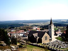
- Catholic parish church Bad Traunstein hl. George
economy
In 2001 there were 37 non-agricultural workplaces, and according to the 1999 survey there were 149 in agriculture and forestry. The number of people in work at home was 496 according to the 2001 census. In 2001 the employment rate was 46.92%.
- tourism
Bad Traunstein is on the north-south long-distance hiking trail .
Personalities
- Josef Elter (1926–1997), pastor and sculptor
- Hans Neumüller (1908–1953), painter and poet
Web links
- 32528 - Bad Traunstein. Community data, Statistics Austria .
Individual evidence
- ↑ Statistics Austria: Population on January 1st, 2020 by locality (area status on January 1st, 2020) , ( CSV )
- ↑ ORF of February 5, 2006: Dispute over spa centers in the Waldviertel (accessed on May 19, 2010)
- ^ Province of Lower Austria: New Bad Traunstein Spa Center opened ( Memento from July 14, 2016 in the Internet Archive ) (accessed on May 19, 2010)
- ↑ Marktgemeinde Bad Traunstein, on May 17, 2010: Bad Traunstein (accessed on May 19, 2010)
- ^ Result of the 1995 municipal council election in Bad Traunstein. Office of the Lower Austrian State Government, March 30, 2000, accessed on January 11, 2020 .
- ^ Election result of the municipal council election 2000 in Bad Traunstein. Office of the Lower Austrian State Government, February 4, 2005, accessed on January 11, 2020 .
- ^ Result of the 2005 municipal council election in Bad Traunstein. Office of the Lower Austrian State Government, March 4, 2005, accessed on December 11, 2020 .
- ^ Election result of the municipal council election 2010 in Bad Traunstein. Office of the Lower Austrian State Government, October 8, 2010, accessed on January 11, 2020 .
- ^ Election result of the 2015 municipal council election in Bad Traunstein. Office of the Lower Austrian State Government, December 1, 2015, accessed on January 11, 2020 .
- ↑ Results of the 2020 municipal council elections in Bad Traunstein. Office of the Lower Austrian State Government, January 26, 2020, accessed on January 31, 2020 .
- ↑ Market town of Bad Traunstein New mayor elected in Bad Traunstein (accessed on March 9, 2018)


