
Kottes-Purk
|
market community Kottes-Purk
|
||
|---|---|---|
| coat of arms | Austria map | |
 |
|
|
| Basic data | ||
| Country: | Austria | |
| State : | Lower Austria | |
| Political District : | Zwettl | |
| License plate : | ZT | |
| Main town : | Kottes | |
| Surface: | 58.48 km² | |
| Coordinates : | 48 ° 25 ′ N , 15 ° 18 ′ E | |
| Height : | 706 m above sea level A. | |
| Residents : | 1,465 (January 1, 2020) | |
| Population density : | 25 inhabitants per km² | |
| Postcodes : | 3622, 3623 | |
| Area code : | 02873 | |
| Community code : | 3 25 15 | |
| NUTS region | AT124 | |
| Address of the municipal administration: |
Kottes 18 3623 Kottes-Purk |
|
| Website: | ||
| politics | ||
| Mayor : | Josef Zottl ( ÖVP ) | |
|
Municipal Council : ( 2020 ) (19 members) |
||
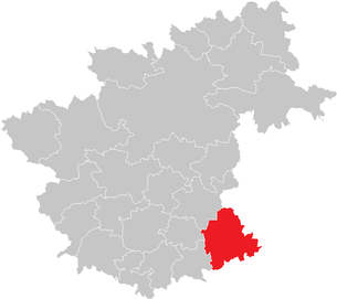
| Location of Kottes-Purk in the Zwettl district | ||
  |
||
 Kottes, capital of the municipality of Kottes-Purk |
||
| Source: Municipal data from Statistics Austria | ||

Kottes-Purk is a market town with 1465 inhabitants (as of January 1, 2020) in the Zwettl district in Lower Austria . Kottes lies between 650 m and 890 m above sea level, surrounded by forest-covered hills.
geography


Kottes-Purk is located in the valley of the Kleine Krems in the Waldviertel in Lower Austria. The area of the market town covers 58.6 square kilometers. 38.68 percent of the area is forested.
Community structure
The municipality includes the following 32 localities (population in brackets as of January 1, 2020):
- Bernhards (16)
- Thanks Wood (54)
- Double (4)
- Elsenreith (134)
- Ensberg (4)
- Serious (2)
- Fur (14)
- Fohra (12)
- Gotthardschlag (27)
- Gschwendt (34)
- Gunsles (10)
- Heitzles (55)
- Hörans (12)
- Limestone Pit (48)
- Koppenhof (12)
- Kottes (396)
- Leopolds (26)
- Münichreith (32)
- Pfaffenschlag (23)
- Pötzles (16)
- Pure (12)
- Reichpolds (32)
- Court of Justice (19)
- Round (29)
- Schoberhof (9)
- Singenreith (22)
- Teichmanns (29)
- Trittings (33)
- Voirans (35)
- Voitsau (97)
- Weikartschlag (54)
- Wernhies (12)
The community consists of the cadastral communities Bernhards, Dankholz, Doppl, Elsenreith, Ensberg, Ernst, Felles, Fohra, Gotthardschlag, Gschwendt, Günzles, Heitzles, Hörans, Kalkgrub, Kottes, Leopolds, Münichreith, Pfaffenschlag, Pötzles, Purk, Reichpolds, Richterhof, Runds, Schoberhof, Singenreith, Teichmanns, Trittings, Voirans, Voitsau, Weikartsschlag and Wernhies.
Neighboring communities
| Sallingberg | Lichtenau in the Waldviertel | |
| Ottenschlag |
.svg)
|
Albrechtsberg on the Great Krems |
| Kirchschlag , Raxendorf | Mühldorf | Weinzierl am Walde |
history
Before 1108 Voitsau was still called Vogitisawa = Au des Vogit (the bailiff).
This region of the southern Waldviertel was under the influence of the noble-free Waldo von Grie towards the end of the 11th century and was shaped by farms belonging to aristocratic entourage. This was also the case with Kottes, whose court in the last third of the 11th century represented a kind of opening center for clearing and in the 12th century developed into an administrative center due to the development of the parish.
The cleared area around Purk was in the border area of Waldos, where he had set up a permanent house (= "Wallburg"?). The territory came under contract to the Margrave of Babenberg , who handed it over to his sister Gerberga, wife of the Bohemian Duke Bořivoj II. , Around 1100 as a marriage property . By 1120 at the latest, she had a church built in the area of the castle in swampy ground, which was consecrated in 1124. The later Anger shape of the place is deceptive. In the early 12th century Göttweiger owned, the settlement consisted of a line of seven farmers west of the Purker Paches with farm fields of approx. 11 yoke. A half-sized hoof indicates the service function at the castle / church. Adjacent there, the Göttweiger official seat was created from another hoof. It was not until the 14th century that the monastery gradually settled peasants east of the church, which resulted in the anger shape of the town center. (Univ. Doz. Dr. Hans Krawarik)
Population development
According to the results of the 2001 census , there were 1628 inhabitants. In 1991 the market town had 1672 inhabitants, in 1981 1788 and in 1972 1890 inhabitants.
politics
The municipal council has 19 members.
- With the municipal council elections in Lower Austria in 1990, the municipal council had the following distribution: 16 ÖVP, 2 SPÖ and 1 FPÖ.
- With the municipal council elections in Lower Austria in 1995, the municipal council had the following distribution: 16 ÖVP, 2 SPÖ and 1 FPÖ.
- With the municipal council elections in Lower Austria in 2000, the municipal council had the following distribution: 16 ÖVP, 2 SPÖ and 1 FPÖ.
- With the municipal council elections in Lower Austria in 2005 , the municipal council had the following distribution: 16 ÖVP and 3 SPÖ.
- With the municipal elections in Lower Austria in 2010 , the municipal council had the following distribution: 15 ÖVP, 3 SPÖ and 1 FPÖ.
- With the municipal council elections in Lower Austria in 2015 , the municipal council had the following distribution: 15 ÖVP and 4 SPÖ.
- With the municipal council elections in Lower Austria 2020 , the municipal council has the following distribution: 16 ÖVP and 3 SPÖ.
- mayor
- 1971–1990 Josef Vogl
- 1990–1992 Friedrich Lagler
- 1992–2005 Franz Hörhan (ÖVP)
- 2005–2017 Wolfgang Vogl (ÖVP)
- since 2017 Josef Zottl (ÖVP)
Culture and sights


- Catholic parish church Kottes Mariä Himmelfahrt
- Catholic parish church Purk hl. Martin
- Elsenreith local chapel
- Local chapel Voitsau
economy
In 2001 there were 60 non-agricultural workplaces, agricultural and forestry holdings according to the 1999 survey 238. According to the 2001 census, the number of people in employment in the place of residence was 726. In 2001 the activity rate was 46.13 percent.
Wachau marble was quarried in the numerous quarries .
literature
- Heimat Kottes-Purk, published by the market town of Kottes-Purk.
Web links
- 32515 - Kottes-Purk. Community data, Statistics Austria .
- Website of the municipality of Kottes-Purk
Individual evidence
- ↑ Statistics Austria: Population on January 1st, 2020 by locality (area status on January 1st, 2020) , ( CSV )
- ^ Result of the local council election 1995 in Kottes-Purk. Office of the Lower Austrian State Government, March 30, 2000, accessed on December 6, 2019 .
- ^ Election result of the municipal council election 2000 in Kottes-Purk. Office of the Lower Austrian State Government, February 4, 2005, accessed December 6, 2019 .
- ^ Election result of the local council election 2005 in Kottes-Purk. Office of the Lower Austrian State Government, March 4, 2005, accessed December 6, 2019 .
- ^ Election result of the municipal council election 2010 in Kottes-Purk. Office of the Lower Austrian State Government, October 8, 2010, accessed December 6, 2019 .
- ^ Election results for the 2015 municipal council elections in Kottes-Purk. Office of the Lower Austrian state government, December 1, 2015, accessed on December 6, 2019 .
- ↑ Results of the municipal council election 2020 in Kottes-Purk. Office of the Lower Austrian State Government, January 26, 2020, accessed on January 31, 2020 .

Allentsteig | Altmelon | Arbesbach | Bad Traunstein | Bear head | Echsenbach | Göpfritz an der Wild | Grafenschlag | Big Gerungs | Großgöttfritz | Gutenbrunn | Kirchschlag | Kottes-Purk | Long strike | Martinsberg | Ottenschlag | Pölla | Rappottenstein | Sallingberg | Schönbach | Schwarzenau | Schweiggers | Waldhausen | Zwettl-Lower Austria