
Ostalbkreis
| coat of arms | Germany map |
|---|---|

|

Coordinates: 48 ° 50 ' N , 10 ° 6' E |
| Basic data | |
| State : | Baden-Württemberg |
| Administrative region : | Stuttgart |
| Region : | East Württemberg |
| Administrative headquarters : | Bask |
| Area : | 1,511.54 km 2 |
| Residents: | 314,002 (Dec. 31, 2018) |
| Population density : | 208 inhabitants per km 2 |
| License plate : | AA, GD |
| Circle key : | 08 1 36 |
| NUTS : | DE11D |
| Circle structure: | 42 municipalities |
| Address of the district administration: |
Stuttgarter Strasse 41 73430 Aalen |
| Website : | |
| District Administrator : | Klaus Pavel ( CDU ) |
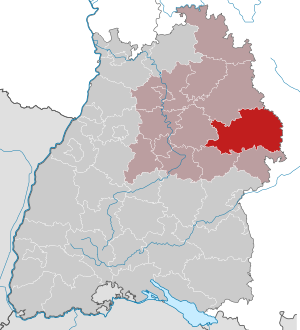
| Location of the Ostalbkreis in Baden-Württemberg | |
  |
|
In terms of its area, the Ostalbkreis is the third largest district in Baden-Württemberg after the Ortenaukreis and the Ravensburg district . Together with the Heidenheim district, it forms the East Württemberg region in the Stuttgart administrative region . The county seat and largest city is Aalen ; the second largest city is Schwäbisch Gmünd .
geography
location
The Ostalbkreis is mainly part of the eastern Swabian Alb (hence its name Ostalbkreis) and the eastern Welzheimer Forest , which is part of the Swabian-Franconian Forest , as well as the Ellwang Mountains in the north of the district. In the south of the district the Rems flows in a westerly direction, it flows into the Neckar at Remseck am Neckar . In the eastern district area, two further right tributaries of the Neckar, the Jagst and the Kocher , flow first to the north, later also to the west. In the far east, the district extends into the Nördlinger Ries . The three centers of the district, Aalen, Schwäbisch Gmünd and Ellwangen (Jagst) are located on the three rivers.
The highest point of the district is at 781 m at the Franz-Keller-Haus hiking home on the Kalten Feld , the lowest at 277 m when the Rems emerges from the district at Lorch-Waldhausen.
places
The list of places in the Ostalbkreis contains around 920 places ( towns , villages , hamlets , farms , living spaces ) in the Ostalbkreis in a geographical sense.
Neighboring areas
The Ostalbkreis borders clockwise in the north, starting with the districts of Schwäbisch Hall (in Baden-Württemberg), Ansbach and Donau-Ries (both in Bavaria ) as well as Heidenheim , Göppingen and in the west on the Rems-Murr-Kreis (all in turn in Baden- Württemberg).
Division of space

According to data from the State Statistical Office , as of 2015.
history
The Ostalbkreis was formed by the district reform on January 1, 1973 . At that time, the Aalen district was combined with most of the Schwäbisch Gmünd district to form the new Ostalb district. Then there were the communities of Rechenberg and Stimpfach in the Crailsheim district and the Gschwend community in the Backnang district . Aalen became the district town. The two old districts of Aalen and Schwäbisch Gmünd go back to the old Württemberg regional offices of the same name , which were established after the transition of the area to Württemberg in 1803 and were transferred to the districts of Aalen and Schwäbisch Gmünd in 1938. At that time, the Aalen district took on the Aalen , Ellwangen and Neresheim district offices , the Schwäbisch Gmünd district took on the Gmünd district authorities and parts of the Gaildorf and Welzheim district offices .
On January 1, 1975, the municipality of Stimpfach, enlarged by Rechenberg, became part of the Schwäbisch Hall district . On January 1, 1977, there was a small exchange of territory with the Rems-Murr district .
After the municipal reform has been completed, the Ostalbkreis will still comprise 42 municipalities, including 9 cities and of these, in turn, 3 " large district cities " ( Aalen , Ellwangen (Jagst) and Schwäbisch Gmünd ). The largest city is Aalen, the smallest municipality is Obergröningen .
Population development
The population figures are census results (¹) or official updates from the Baden-Württemberg State Statistical Office ( main residences only ).
|
|
politics
The district is administered by the district council and the district administrator.
District council
The district council is elected for five years by those entitled to vote in the district. The local elections on May 26, 2019 led to the following preliminary results.
| Parties and constituencies |
% 2019 |
Seats 2019 |
% 2014 |
Seats 2014 |
% 2009 |
Seats 2009 |
% 2004 |
Seats 2004 |
% 1999 |
Seats 1999 |
% 1994 |
Seats 1994 |
% 1989 |
Seats 1989 |
|
| CDU | Christian Democratic Union of Germany | 36.0 | 26th | 43.0 | 31 | 41.6 | 35 | 45.0 | 35 | 48.9 | 39 | 43.5 | 38 | 46.4 | 38 |
| GREEN | Alliance 90 / The Greens | 17.7 | 13 | 11.0 | 8th | 9.3 | 7th | 8.1 | 5 | 6.9 | 5 | 9.7 | 7th | 6.8 | 4th |
| FW | Free voters Ostalbkreis | 16.2 | 12 | 15.7 | 13 | 15.4 | 13 | - | - | - | - | - | - | - | - |
| Flat share | Electoral associations | - | - | - | - | - | - | 19.9 | 15th | 15.7 | 12 | 9.9 | 11 | 5.5 | 7th |
| SPD | Social Democratic Party of Germany | 15.6 | 12 | 21.2 | 14th | 22.1 | 15th | 23.8 | 16 | 26.0 | 18th | 28.8 | 21st | 30.0 | 21st |
| AfD | Alternative for Germany | 6.5 | 5 | 2.2 | 1 | - | - | - | - | - | - | - | - | - | - |
| THE LEFT. | THE LEFT. | 3.7 | 3 | 2.6 | 2 | 2.9 | 2 | - | - | - | - | - | - | - | - |
| FDP | Free Democratic Party | 3.2 | 2 | 2.4 | 2 | 4.5 | 3 | - | - | - | - | - | - | - | - |
| REP | The Republicans | - | - | - | - | 1.7 | 1 | 3.1 | 2 | 2.1 | 1 | 2.3 | 1 | 2.6 | 1 |
| Others | Other ; u. a. pro Aalen , active citizens , NO! | 1.2 | - | 1.7 | - | 2.5 | - | - | - | 0.4 | - | 5.8 | 2 | 8.8 | 5 |
| total | 100.0 | 73 | 100.0 | 71 | 100.0 | 76 | 100.0 | 73 | 100.0 | 75 | 100.0 | 80 | 100.0 | 76 | |
| voter turnout | 58.7% | 48.3% | 50.9% | 51.7% | 54.9% | 66.7% | 62.8% | ||||||||
- WG: Voter associations, as the results from 1989 to 2004 cannot be broken down into individual groups of voters.
District administrators
The district councilor is elected by the district council for a term of office of 8 years. This is the legal representative and representative of the district as well as chairman of the district council and its committees. He heads the district office and is an official of the district. His area of responsibility includes the preparation of the district council meetings and its committees. He calls meetings, chairs them and implements the resolutions passed there. He has no voting rights in the committees . His deputy is the first state official.
The district administrators of the Aalen district 1945–1972:
- 1945–1946: Max Freiherr von Lütgendorf-Leinburg
- 1946–1970: Anton Huber (CDU)
- 1970–1972: Gustav Wabro (CDU)
The district administrators of the Schwäbisch Gmünd district 1945–1972:
- 1945–1961: Konrad Burkhardt
- 1961–1972: Friedrich Karl Röther
The district administrators of the Ostalbkreis since 1973:
- 1973–1980: Gustav Wabro (CDU)
- 1980–1996: Diethelm Winter
- Since 1996: Klaus Pavel (CDU)
- from probably September 12, 2020: Joachim Bläse (CDU)
coat of arms
Description: A red pole in gold, topped with a golden abbot; in front a black lion, behind a half black eagle at the crack
(Award of coat of arms: November 5, 1975)
Meaning: The Staufer lion stands for the household property of the Hohenstaufers , which was part of the district. Later some free imperial cities (Aalen, Schwäbisch Gmünd, Bopfingen) emerged, which is why the imperial eagle is depicted in the coat of arms. The abbot's staff is intended to symbolize the formerly spiritual territories ( Prince Provost Ellwangen , Neresheim Monastery and others).
District partnerships
The Ostalbkreis has had a partnership with the Province of Ravenna in Italy since 1992 .
Economy and Infrastructure
In the Future Atlas 2016 , the Ostalbkreis was ranked 69th out of 402 districts, municipal associations and independent cities in Germany, making it one of the regions with “high future prospects”. In the 2019 edition, it was ranked 59th out of 401.
traffic
The district-wide transport association OstalbMobil , in which all bus companies and local rail passenger transport are integrated, has existed in local public transport since December 9, 2007 .
Railways
The two largest cities in the district, Aalen and Schwäbisch Gmünd, are located on the Stuttgart-Bad Cannstatt - Aalen railway line , also called Remsbahn, which was built in 1861 by the Württemberg State Railways and which was continued in 1863 to Nördlingen in Bavaria. The latter section is known today as the Riesbahn .
The north-south route of the Brenzbahn Aalen - Heidenheim was added in 1864 (extended from Heidenheim to Ulm in 1876) and was put into operation in 1866 - branching off in Goldshöfe - as the Obere Jagstbahn to Crailsheim.
The Alb plateau of the Härtsfeld was opened up in 1901 by the Badische Lokal-Eisenbahn-Gesellschaft with the Härtsfeldbahn , a narrow-gauge railway from Aalen to Neresheim and further into the Danube valley to Dillingen .
The mentioned railways meet or met at Aalen station .
The Hohenstaufenring train bound from 1912 Gmünd Göppingen. The city Heubach got its connection to the main track in Unterböbingen 1920 by Heubach train .
In the Kocher valley, Untergröningen had been the end point of the Upper Kocher Valley Railway from Gaildorf since 1903 , which the Württembergische Eisenbahn-Gesellschaft built and operated until it was closed.
The main lines (105 km) of the maximum 151 km long rail network have been preserved. The branch lines (46 km) were closed:
- 1972: Unterböbingen - Heubach (four kilometers)
- 1972: Aalen - Neresheim (- Dillingen) (meter gauge) (30 km)
- 1984: Schwäbisch Gmünd - Reitprechts (- Göppingen) (eleven kilometers)
- 2000: (Gaildorf West–) Untergröningen (one kilometer)
As of 2014, the companies Scholz in Essingen on the Remsbahn and the paper mill Palm and Munksjö Paper , both in Unterkochen on the Brenzbahn, had their own siding in the Ostalbkreis .
Streets
The federal motorway 7 Ulm - Würzburg , whose section Feuchtwangen - Heidenheim was opened in 1987, runs through the eastern district area in a south-north direction . In addition, several federal, state and district roads open up the district, including the B 29 Stuttgart- Aalen, which was expanded to four lanes until 1985 to Schwäbisch Gmünd and from 2015 to 2019 during the Mögglingen bypass, and the B 19 Ulm- Schwäbisch Hall .
Facilities in the district
The Ostalbkreis is responsible for the following vocational schools :
- Technical School Aalen with (branches: information technology , technology and design and media technology (GMT))
- Aalen Commercial School
- Justus-von-Liebig-Schule Aalen (home economics and agricultural school; includes a biotechnological high school and a nutritional high school)
- District Vocational School Center Ellwangen (industrial, commercial and home economics school)
- Commercial school Schwäbisch Gmünd
- Commercial school in Schwäbisch Gmünd
- Agnes von Hohenstaufen School Schwäbisch Gmünd (Home Economics School)
In addition, they are also responsible for the following special education and advice centers :
- Klosterbergschule Schwäbisch Gmünd (special focus on mental development and physical-motor development)
- Jagsttalschule Westhausen with school kindergarten (support focus on intellectual development)
- Schloss-Schule Wasseralfingen with school kindergartens (focus on language)
- Aalen special education and advice center for students in long-term hospital treatment
- Heideschule Mutlangen (special focus on language)
In addition, the Ostalbkreis belongs to the school association of the state high school for gifted Schwäbisch Gmünd , which supports the state high school for gifted Schwäbisch Gmünd with the associated competence center for the promotion of gifted children.
The Ostalbkreis is the recipient of Ostalb- Hospital Aalen, which in the form of self-operation is organized and which also includes the clinic on lpf belongs Bopfingen. In addition, the Schwäbisch Gmünd Staufer Clinic in Mutlangen and the St. Anna Virngrund Clinic in Ellwangen are owned by the Ostalb district.
The Catholic Church is the sponsor of the Haus Lindenhof Foundation , which operates facilities for people with disabilities, people in need of care and the unemployed in the area of the district. The seat is in the homonymous courtyard near Schwäbisch Gmünd.
cities and communes
(Residents on December 31, 2018)
Agreed administrative communities and municipal administration associations
|
|
  |
Nature reserves
The Ostalbkreis has the following nature reserves with a total area of 2,049.35 hectares, which is 1.36 percent of the area:
- Pond : 22.8 ha; Markings Wört and Ellenberg
- Bargauer Horn : 25.2 ha; District hamlet in the mountains
- Beiberg-Buchberg : 20.8 ha; Bopfingen district
- Tannenwald mountain slide : 10.9 ha; Waldstetten district
- Birch pond with upper and lower wood pond : 22.5 ha; district Wört
- Blasienberg : 41.8 ha; District Kirchheim am Ries
- Breitweiher with Hilsenweiher : 14.3 ha; Stödtlen district
- Dent column : 24.1 ha; Gemarkungen Waldhausen and Elchingen
- Dossinger Valley : 22.6 ha; Landmark Dorfmerkingen
- Ellwang Castle Pond and the surrounding area : 63.0 ha; District Ellwangen
- Goldberg: 32.45 hectares; Districts Trochtelfingen , Pflaumloch , Goldburghausen and Kirchheim am Ries
- Goldshöfer Sande : 46.5 ha; District Hofen
- Gromberger Heide : 18 ha; Lauchheim district
- Ipf : 71 ha; Gemarkungen Bopfingen and Oberndorf
- Cold field with Hornberg, Galgenberg and Eierberg : 634.4 ha; Gemarkungen Degenfeld , Waldstetten , Wißgoldingen , Nenningen and Weissenstein
- Kapf near Trochtelfingen : 61.1 ha; District Trochtelfingen
- Leintal between Leinecksee and Leinhäusle : 202.5 ha; Districts Spraitbach , Durlangen and Alfdorf
- Lindenfeld : 75.0 ha; District Bettringen
- Lorcher quarry ponds : 18.5 ha; Markings Lorch and Waldhausen
- Muckental : 33.3 ha; Ellenberg district
- Orbachtal with litter meadows : 5.9 ha; Rosenberg district
- Rough meadow : 4 ha; Bartholomä district
- Riegelberg : 21.3 ha; Utzmemmingen district
- Rosenstein : 22.0 ha; Districts Lautern and Heubach
- Rot- and Seebachtal : 15.6 ha; Gschwend district
- Schechinger Weiher : 12.7 ha; District Schechingen
- Scheuelberg: 119 ha; Gemarkungen Bargau and Heubach
- Schloßberg with Flochberg ruins : 9.4 ha; Bopfingen district
- Great Wimbach Gorge : 3.1 ha; Markings Frickenhofen and Laufen am Kocher
- Stockmühle reservoir : 44.1 ha; Lippach district
- Quarry terraces in the Egautal : 10.7 ha; Gemarkungen Neresheim and Dischingen
- Litter meadow near Rötenbach : 5.6 ha; Bartholomä district
- Valley of the Blind Red : 60.7 ha; Gemarkungen Neuler , Abtsgmuend and Pommertsweiler
- Tierstein with hillside forest and Eger spring : 2.9 ha; Aufhausen ( Bopfingen ) district
- Tonsberg, Käsbühl, Karkstein : 173.4 ha; Landmarks Aufhausen ( Bopfingen ), Oberdorf am Ipf and Röttingen ( Lauchheim )
- Volkmarsberg : 68.1 ha; District Oberkochen
- Buch pre-basin : 11.2 ha; Districts Schwabsberg , Dalkingen and Westhausen
- Chain of ponds at the Spitalhof : 23.2 ha; district Wört
- Pond meadows : 27.8 ha; Essingen district
- Wental with side valleys and field island Klösterle : 288.9 ha; Gemarkungen Essingen and Steinheim
- Meadow valleys near the Menzlesmühle : 62.8 ha; Gemarkungen Altersberg , front Steinberg and Kaiserbach
- Zwing : 102.0 ha; Districts Neresheim , Auernheim and Dischingen
License Plate
On January 1, 1973, the district was assigned the distinctive sign AA , which had been valid for the Aalen district since July 1, 1956 . It is still issued today.
Vehicles from the old district of Schwäbisch Gmünd initially received license plates with the letter A and the numbers from 1000 to 9999. Subsequently, until the 1990s, the letter pairs PA to ZZ with the numbers from 100 to 999 were assigned.
Since February 25, 2013, the distinctive sign GD (Schwäbisch Gmünd) has also been available.
literature
- The state of Baden-Wuerttemberg - official description according to districts and municipalities (in eight volumes); Edited by the Baden-Württemberg State Archives Department; Volume IV: Stuttgart District - Regional Associations Franconia and East Wuerttemberg, Stuttgart 1980, ISBN 3-17-005708-1 .
- Diethelm Winter (ed.): The Ostalbkreis . Theiss, Stuttgart 1992, ISBN 3-8062-0891-3 .
- The nature reserves in the Stuttgart administrative region . Edited by Reinhard Wolf . Jan Thorbecke Verlag, Stuttgart 2002. ISBN 3-7995-5173-5 .
- The Ostalbkreis . Aalen 2016. ISBN 978-3-9818293-0-3 ( online ).
Web links
- Official website of the district
- Literature from and about Ostalbkreis in the catalog of the German National Library
- OSTALBum. Joint blog of the municipal archives in and around the Ostalbkreis on hypotheses.org
Individual evidence
- ↑ a b Statistisches Landesamt Baden-Württemberg - Population by nationality and gender on December 31, 2018 (CSV file) ( help on this ).
- ↑ Survey of land according to type of actual use in 2015
- ^ Federal Statistical Office (ed.): Historical municipality directory for the Federal Republic of Germany. Name, border and key number changes in municipalities, counties and administrative districts from May 27, 1970 to December 31, 1982 . W. Kohlhammer, Stuttgart / Mainz 1983, ISBN 3-17-003263-1 , p. 470 ff .
- ↑ [1] Result of the district council election 2019.
- ↑ statistik.baden-wuerttemberg.de Result of the district election 2014.
- ↑ ostalbkreis.de result of the district council election in 2009.
- ↑ statistik.baden-wuerttemberg.de ( page no longer available , search in web archives ) Info: The link was automatically marked as defective. Please check the link according to the instructions and then remove this notice. Distribution of votes in the district elections 1989-2009.
- ↑ statistik.baden-wuerttemberg.de ( page no longer available , search in web archives ) Info: The link was automatically marked as defective. Please check the link according to the instructions and then remove this notice. Distribution of seats in the district elections 1989-2009.
- ↑ District Office Ostalbkreis: “Dr. Joachim Bläse will be the new district administrator of the Ostalb district ” , press release no. 288 of June 30, 2020
- ↑ Future Atlas 2016. Archived from the original on October 2, 2017 ; accessed on March 24, 2018 . Info: The archive link was inserted automatically and has not yet been checked. Please check the original and archive link according to the instructions and then remove this notice.
- ↑ PROGNOS future atlas. Handelsblatt, accessed on December 10, 2019 .
- ↑ Train drivers leave Mugele containers behind , Gmünder Tagespost, article from November 7, 2014.
- ↑ www.schule-bw.de .
- ↑ LUBW protected area statistics (download) ( page no longer available , search in web archives ) Info: The link was automatically marked as defective. Please check the link according to the instructions and then remove this notice.
Alb-Danube District | Baden-Baden | Biberach | Lake Constance district | Boeblingen | Breisgau-Upper Black Forest | Calw | Emmendingen | Enzkreis | Esslingen | Freiburg im Breisgau | Freudenstadt | Göppingen | Heidelberg | Heidenheim | Heilbronn (Land) | Heilbronn (city) | Hohenlohekreis | Karlsruhe (State) | Karlsruhe (city) | Constance | Loerrach | Ludwigsburg | Main-Tauber district | Mannheim | Neckar-Odenwald district | Ortenaukreis | Ostalbkreis | Pforzheim | Rastatt | Ravensburg | Rems-Murr-Kreis | Reutlingen | Rhein-Neckar District | Rottweil | Schwäbisch Hall | Schwarzwald-Baar district | Sigmaringen | Stuttgart | Tübingen | Tuttlingen | Ulm | Waldshut | Zollernalb district