
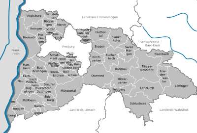
District of Breisgau-Hochschwarzwald
| coat of arms | Germany map |
|---|---|

|

Coordinates: 48 ° 0 ' N , 7 ° 51' E |
| Basic data | |
| State : | Baden-Württemberg |
| Administrative region : | Freiburg |
| Region : | Southern Upper Rhine |
| Administrative headquarters : | Freiburg in Breisgau |
| Area : | 1,378.34 km 2 |
| Residents: | 262,795 (Dec. 31, 2018) |
| Population density : | 191 inhabitants per km 2 |
| License plate : | FR |
| Circle key : | 08 3 15 |
| NUTS : | DE132 |
| Circle structure: | 50 parishes |
| Address of the district administration: |
Stadtstrasse 2 79104 Freiburg im Breisgau |
| Website : | |
| District Administrator : | Dorothea Störr-Ritter ( CDU ) |
| Location of the district of Breisgau-Hochschwarzwald in Baden-Württemberg | |
 .svg) |
|
The district of Breisgau-Hochschwarzwald is located in the southwest of Baden-Württemberg ( Germany ). The district includes 50 cities and municipalities with 133 districts. The district itself belongs to the southern Upper Rhine region within the administrative district of Freiburg .
The district office is located in Freiburg im Breisgau : the city is almost completely enclosed by the district, but does not belong to it. In addition, the district office maintains three branch offices in Müllheim , Titisee-Neustadt and Breisach am Rhein .
With an area of 1378.3 km², the Breisgau-Hochschwarzwald district is the sixth largest in Baden-Württemberg. 131.0 km² of this are settlement and traffic areas (as of 1997). The district has an extension of 65 km in east-west direction and 42 km in north-south direction.
geography
location
The district comprises differently landscaped areas: in the Upper Rhine Plain are the Markgräflerland with the foothills zone , which is joined further north by the Breisgau with the Kaiserstuhl , the Tuniberg and the Nimberg .
The Black Forest includes the side valleys open to the Rhine plain ( Glottertal , Dreisamtal , Höllental and Münstertal ), the Upper Black Forest with its highest elevation, the Feldberg, and extends to the Baar plateau .
In the middle of the district is the area of the urban district of Freiburg, which is almost completely enclosed by the district of Breisgau-Hochschwarzwald. Only on its north side does the urban district of Freiburg share a three-kilometer-long border with the municipality of Vörstetten and thus with the district of Emmendingen.
Neighboring areas
The district of Breisgau-Hochschwarzwald borders clockwise in the north, beginning with the districts of Emmendingen , Schwarzwald-Baar-Kreis , Waldshut and Lörrach . In the west, the Rhine forms the state border with France . This is where the Haut-Rhin department is located .
Division of space

According to data from the State Statistical Office , as of 2015.
climate
The climate in the district is very different. With Ihringen as the place with the highest annual average temperature in Germany and the Feldberg summit, both the warmest and coldest places in Baden-Württemberg are in the Breisgau-Hochschwarzwald district. In terms of climate, the district is one of the warmest regions in Germany: the mean annual temperature in the Rhine Valley is 11 ° C, the average amount of precipitation is around 900 mm, and the duration of sunshine is around 1800 hours. In the Parish March that time was on 13 August 2003 with 40.2 ° C the highest ever measured in Germany temperature registered. March shared this value with Gärmersdorf near Amberg , Freiburg and Karlsruhe .
history
Since the 8th century , the Grafschaft Breisgau and Grafschaft Baar , which belonged to the Duchy of Alemannia , developed in the area of today's district . The eastern part (upper reaches of the Danube and Neckar) were under the Carolingian rule of the Alaholfinger . After the collapse of the Franconian Empire in 843, the area belonged to Eastern Franconia and partly from 920 to the Duchy of Swabia . From 1368, the Breisgau became the property of the House of Habsburg (see Upper Austria ). The princes of Fürstenberg ruled in the Baar , while the area south of Freiburg ( Markgräflerland ) came into the possession of the Margraves of Baden . After the end of the Napoleonic Wars, in 1805/06 the entire area of today's district became part of the Grand Duchy of Baden .
The district of Breisgau-Hochschwarzwald was formed by the district reform on January 1, 1973 mainly from the earlier districts of Freiburg , Müllheim and Hochschwarzwald (seat in Neustadt in the Black Forest). Furthermore, the municipality of Unadingen came from the district of Donaueschingen to the district area. Further communities were incorporated into the independent city of Freiburg. The southern part came from the district of Müllheim to the district of Lörrach and some communities from the former district of Hochschwarzwald also went to the district of Waldshut .
On July 1, 1973 ( Munzingen ), on September 1, 1973 ( Hochdorf ) and on July 1, 1974 ( Ebnet ) and ( Kappel ), further communities were incorporated into the urban district of Freiburg. On September 1, 1973, the community of Schönenbach, which belonged to the district of Waldshut, was added. On January 1, 1974, Kiechlinsbergen was assigned to the district of Emmendingen . Leiselheim followed on April 1, 1974. On March 18, 1975, Grünwald from the Waldshut district was added (reclassification from Bonndorf in the Black Forest to Lenzkirch ).
The three old districts were formed in 1939 from the districts of the same name, which were established in greater numbers at the beginning of the 19th century when the area came to Baden. In the course of history, the districts were changed several times until in 1936 there were only the offices of Freiburg, Müllheim, Neustadt in the Black Forest and Staufen. Staufen was divided between the offices of Freiburg and Müllheim. The district of Neustadt, formed in 1939, was renamed the Hochschwarzwald district in 1956.
After the community reform has been completed, the Breisgau-Hochschwarzwald district will comprise 50 communities, including ten towns. There are no large district towns (yet). The largest and at the same time the youngest town is Bad Krozingen (since September 1, 2005), the smallest municipality is Heuweiler .
Population development
The population figures are census results (1987) or official updates from the Baden-Württemberg State Statistical Office ( main residences only ).
|
|
According to studies by the Federal Statistical Office and the State Statistical Office of Baden-Württemberg , nowhere in Germany do people have a higher life expectancy than in the Breisgau-Hochschwarzwald district, men live on average 80.9 and women 84.9 years old. This prompted the Hochschwarzwald Tourismus GmbH to win the photographer Manfred Baumann for a project: He photographed 15 Black Forest people who have already exceeded this average age, including the Olympic champion Georg Thoma and the grandfather of Fabian Rießle . This resulted in the exhibition “ Live up to the woods” with texts and audio documents about the life of the photographed.
politics
District council
The district council is elected for five years by those entitled to vote in the district. The local elections on May 26, 2019 led to the following result:
Results of the district elections since 1989
| Parties and constituencies |
%
2019 |
Seats
2019 |
% 2014 |
Seats 2014 |
% 2009 |
Seats 2009 |
% 2004 |
Seats 2004 |
% 1999 |
Seats 1999 |
% 1994 |
Seats 1994 |
% 1989 |
Seats 1989 |
|
| CDU | Christian Democratic Union of Germany | 29.59 | 20th | 39.95 | 28 | 39.45 | 31 | 45.2 | 34 | 49.7 | 37 | 42.8 | 32 | 44.8 | 34 |
| FW | Free voting community BH | 22.99 | 15th | 18.75 | 12 | 20.75 | 13 | - | - | - | - | - | - | - | - |
| Flat share * | Electoral associations | - | - | - | - | - | - | 18.8 | 12 | 16.2 | 9 | 13.9 | 9 | 12.9 | 8th |
| SPD | Social Democratic Party of Germany | 12.78 | 9 | 16.48 | 11 | 16.23 | 10 | 15.3 | 10 | 17.9 | 11 | 21.7 | 16 | 21.4 | 14th |
| GREEN | Alliance 90 / The Greens | 22.28 | 14th | 15.99 | 12 | 14.11 | 9 | 13.7 | 9 | 9.1 | 6th | 13.1 | 9 | 10.7 | 7th |
| FDP | Free Democratic Party | 6.11 | 4th | 4.79 | 3 | 8.93 | 6th | 7.1 | 4th | 7.1 | 4th | 6.6 | 4th | 8.4 | 5 |
| AfD | Alternative for Germany | 4.93 | 3 | 4.05 | 3 | - | - | - | - | - | - | - | - | - | - |
| LEFT | Die Linke / Linke list Breisgau-Hochschwarzwald | 1.32 | 1 | - | - | 0.53 | - | - | - | - | - | - | - | - | - |
| REP | The Republicans | - | - | - | - | - | - | - | - | - | - | 1.9 | 1 | 1.7 | 1 |
| total | 100.0 | 66 | 100.0 | 69 | 100.0 | 69 | 100.0 | 69 | 100.0 | 67 | 100.0 | 71 | 100.0 | 69 | |
| voter turnout | 63.34% | 54.65% | 56.34% | 57.8% | 57.2% | 70.1% | 66.2% | ||||||||
* Voter associations from 1989 to 2004 not broken down into individual groups of voters
District Administrator
This is the legal representative and representative of the district as well as chairman of the district council and its committees. He heads the district office and is an official of the district. His area of responsibility includes the preparation of the district council meetings and its committees. He calls meetings, chairs them and implements the resolutions passed there. He has no voting rights in the committees . His deputy is the first state official.
The district councils of the district Freiburg 1945-1972:
- 1945–1947: Manfred Pfister (acting)
- 1947–1953: Franz Schühly
- 1953–1968: Alfons Oswald
- 1968–1972: Emil Schill
The district councils of the district Hochschwarzwald 1945-1972 (until 1956 Neustadt district):
- 1945: Rudolf Kohlhepp (acting)
- 1946: Gerhard Schwoerer
- 1947–1949: Ernst Ballweg (acting)
- 1949–1972: Alfred Mallebrein
The district councils of the district Müllheim 1945-1972:
- 1945–1947: Adolf Bachmann
- 1947: Fritz Höfer (acting)
- 1947–1972: Berthold Allgaier
The district administrators of the Breisgau-Hochschwarzwald district since 1973:
- 1972–1993: Emil Schill
- 1993–2008: Jochen Glaeser
- since 2008: Dorothea Störr-Ritter (CDU)
coat of arms

Description : Split: in front a silver bar in red, behind in gold a red diagonal bar; in the golden heart shield a black eagle
Meaning : The front part of the coat of arms reminds of the historical affiliation of the Breisgau to front Austria (red-white-red), the rear part of the long-term affiliation of large parts of the district area to the margraviate of Baden (yellow-red-yellow). The eagle in the middle comes from the coat of arms of the dukes of Zähringen or the counts of Freiburg and princes of Fürstenberg , who also ruled over parts of the area. The eagle is also part of the coat of arms of the city of Breisach am Rhein . The coat of arms was awarded to the new district of Breisgau-Hochschwarzwald on August 2, 1974.

Coat of arms of the Zähringer

Fürstenberg coat of arms

Coat of arms of the city of Breisach


flag
The flag is hoisted as a hanging banner version, i.e. upright. The colors are taken from the coat of arms and reflect the Baden and the Upper Austrian origins. This flag has been used in this version since March 15, 1989. It is only used by the authorities and institutions of the district. There is a civil version of this flag without the coat of arms. This may be used by the population. The colors “red” and “yellow” have been used as backgrounds in many of the district flags of the districts of the former state of Baden. The old Baden flag from 1871 to 1891 had a red and a yellow horizontal stripe.
theatre
The festival in Breisach am Rhein is the largest theater in the Breisgau-Hochschwarzwald district. It offers open-air productions from June to September each year.
Economy and Infrastructure
In the Future Atlas 2016 , the district of Breisgau-Hochschwarzwald was ranked 149th out of 402 districts, municipal associations and independent cities in Germany, making it one of the regions with a “balanced risk-opportunity mix”.
Important branches of the economy are tourism , particularly through the thermal springs in Bad Krozingen and Badenweiler , and viticulture in the Rhine valley. In addition, the Black Forest is a popular holiday destination for winter sports enthusiasts and hikers .
Larger employers in the industrial sector are in Eisenbach (Upper Black Forest) (watchmaking) and Lenzkirch (environmental measuring instruments).
Many employees commute to Freiburg im Breisgau , which is almost completely enclosed by the district.
traffic
Street
Two major highways run through the district from north to south, on the one hand the federal highway 5 Karlsruhe - Basel and the federal highway 3 Karlsruhe - Basel. From Breisach in the west, the federal road 31 leads east into the Black Forest. The streets cross in Freiburg im Breisgau.
rail
The city of Freiburg has become an important rail hub in the Upper Rhine Plain. The Badische Staatsbahn started with the Rhine Valley Railway Karlsruhe – Basel as the main axis, which was continued from Offenburg to here in 1845 and two years later to Müllheim and in 1855 to Basel.
Two cross-connections were built from this route across the Rhine into Alsace , Germany at the time :
- in the direction of Colmar, the line from Freiburg to Breisach opened in 1871 and
- in the direction of Mulhouse a distance from Müllheim via Neuchâtel .
In 1887 the Höllentalbahn from Freiburg reached Neustadt in the Black Forest and in 1901 Donaueschingen via Löffingen . In 1907 the branch line Kappel-Gutachbrücke-Lenzkirch-Bonndorf branched off from near Neustadt . The Titisee – Seebrugg three-track railway , which was commissioned by the Deutsche Reichsbahn in 1926, has the highest station in the Deutsche Bahn network in Feldberg-Bärental at 967 m above sea level .
The current network of Südwestdeutsche Verkehrs AG (SWEG) includes the lines of the Kaiserstuhlbahn Gottenheim – Endingen am Kaiserstuhl and Breisach – Endingen, which were opened by the Badischer Eisenbahn-Konsortium in 1894/1895, and the Bad Krozingen – Staufen – Sulzburg and Bad Krozingen – Staufen – Sulzburg line , which was also built by Vering & Waechter in 1894 the Münstertalbahn branching off in Staufen - created in 1916 under the direction of the Deutsche Eisenbahn-Betriebsgesellschaft .
A special feature was the narrow-gauge railway opened by the Müllheim-Badenweiler Railway in 1896 , which was converted into a tram-like electric railway in 1914.
The railway network now comprised 208 km of routes. Of these, 26 km have now been shut down:
- 1945: Breisach – Neu Breisach / Alsace (proportionately one kilometer in today's district)
- 1955: Müllheim Bhf – Badenweiler (eight kilometers, meter gauge, electrical operation)
- 1976 (passenger train traffic 1966): Kappel-Gutachbrücke – Bonndorf (eleven kilometers proportionately)
- 1973/1996 (passenger train service 1969): Staufen – Grunern – Sulzburg (six kilometers)
The cross-border route Müllheim – Neuchâtel – Mulhouse / Alsace (four kilometers in part, electrical operation) was not used by scheduled passenger trains for several decades, even on the German section.
The district of Breisgau-Hochschwarzwald joined forces with the neighboring district of Emmendingen to the north and the city of Freiburg at the end of the 1980s to form the Regio-Verkehrsverbund Freiburg (RVF) ( public transport ). With the so-called Regio-Karte, a uniform monthly pass for the entire area was introduced for the first time. Passenger train services on the Freiburg – Breisach route have been provided by the Breisgau S-Bahn since 1997 . The new tendering for almost all local public transport services on the railway lines in the district has already been carried out, so that the new transport contracts can come into force once they have been fully electrified.
Ship and air traffic
The only port in the district is in Breisach am Rhein.
The district of Breisgau-Hochschwarzwald lies in the catchment area of the Euro-Airport Basel-Mulhouse-Freiburg .
District facilities
The district of Breisgau-Hochschwarzwald is responsible for the following schools:
- Albert-Schweitzer- Gymnasium Gundelfingen
- Faust high school in Staufen im Breisgau
- Bad Krozingen district high school
- High Black Forest District High School in Titisee-Neustadt
- Neuchâtel district high school
- Marie-Curie-Gymnasium Kirchzarten
- Markgräfler Gymnasium Müllheim
- Martin-Schongauer-Gymnasium Breisach
It is also responsible for the following vocational schools :
- Georg-Kerschensteiner-Schule (commercial and domestic and social care school with technical high school) Müllheim
- Trade school Breisach am Rhein with boarding school
- Hans-Thoma-Schule (industrial, domestic and commercial school) Titisee-Neustadt
- Commercial School Müllheim (u. A. With commercial high school )
- Technical school for agriculture in Freiburg with boarding school, also the special school Malteserschlossschule for the mentally handicapped in Heitersheim.
Together with the city of Freiburg im Breisgau, the district of Breisgau-Hochschwarzwald is also the sponsor of the Edith Stein School (housekeeping, social care and agricultural school) Freiburg im Breisgau, the special educational and advisory centers Günterstal in Freiburg im Breisgau (focus on intellectual development), the Richard Mittermaier School in Freiburg im Breisgau (specialization in intellectual development) and the Sprachheilschule in Freiburg im Breisgau (specialization in language).
Until 1998, the district of Breisgau-Hochschwarzwald was responsible for the three district hospitals in Breisach am Rhein, Müllheim (Baden) and Titisee-Neustadt. Then these clinics were handed over to Helios Kliniken GmbH. The district is represented on the supervisory board of this company.
cities and communes
(Residents on December 31, 2018)

Agreed administrative communities and municipal administration associations
|
|
License Plate
On January 1, 1973, the district was assigned the distinctive sign FR , which had been valid for the Freiburg district since July 1, 1956 . It is still issued today.
Until the 1990s, vehicles from the old districts received special identification numbers:
| area | Letters | numbers |
|---|---|---|
| Old district of Freiburg im Breisgau | A to Z | 1 to 999 |
| AA to TZ | 1 to 99 | |
| H to M | 1000 to 9999 | |
| S to U | ||
| Altkreis Müllheim | UA to WZ | 1 to 99 |
| A, C, N, P, V | 1000 to 9999 | |
| Altkreis Hochschwarzwald | XA to ZZ | 1 to 99 |
| OF THE | 1000 to 9999 |
literature
- Landesarchivdirektion Baden-Württemberg (Ed.): The state of Baden-Württemberg. Official description by district and municipality . VI: Freiburg administrative district. Kohlhammer, Stuttgart 1982, ISBN 3-17-007174-2 .
- District Breisgau-Hochschwarzwald (Hrsg.): Breisgau-Hochschwarzwald. Land from the Rhine over the Black Forest to the Baar , Karl Schillinger, Freiburg im Breisgau 1980, ISBN 3-921340-44-6 .
Web links
Individual evidence
- ↑ State Statistical Office Baden-Württemberg - Population by nationality and gender on December 31, 2018 (CSV file) ( help on this ).
- ↑ Survey of land according to type of actual use in 2015
- ↑ Manfred Frietsch: March: March - Hitzepol und Sonnseite , Badische Zeitung, February 19, 2013, accessed on November 29, 2013
- ^ Deutscher Wetterdienst: Wetterrekorde - Luft Temperatur, dwd.de, accessed on November 29, 2013
- ^ Federal Statistical Office (ed.): Historical municipality directory for the Federal Republic of Germany. Name, border and key number changes in municipalities, counties and administrative districts from May 27, 1970 to December 31, 1982 . W. Kohlhammer, Stuttgart / Mainz 1983, ISBN 3-17-003263-1 , p. 506 ff .
- ↑ Otto Schnekenburger: The forest is your church. Badische Zeitung, May 12, 2019, accessed on May 22, 2019 .
- ↑ Cheers to our elders. Retrieved May 22, 2019 .
- ↑ Results of the 2019 district assembly. Accessed June 25, 2019 .
- ↑ [1] ( Page no longer available , search in web archives ) Info: The link was automatically marked as defective. Please check the link according to the instructions and then remove this notice. Distribution of votes in the district elections 1989–2009
- ↑ [2] ( Page no longer available , search in web archives ) Info: The link was automatically marked as defective. Please check the link according to the instructions and then remove this notice. Distribution of seats in district elections 1989–2009
- ↑ Future Atlas 2016. Archived from the original on October 2, 2017 ; accessed on March 23, 2018 .
- ↑ State Statistical Office Baden-Württemberg - Population by nationality and gender on December 31, 2018 (CSV file) ( help on this ).
Alb-Danube District | Baden-Baden | Biberach | Lake Constance district | Boeblingen | Breisgau-Upper Black Forest | Calw | Emmendingen | Enzkreis | Esslingen | Freiburg im Breisgau | Freudenstadt | Göppingen | Heidelberg | Heidenheim | Heilbronn (Land) | Heilbronn (city) | Hohenlohekreis | Karlsruhe (State) | Karlsruhe (city) | Constance | Loerrach | Ludwigsburg | Main-Tauber district | Mannheim | Neckar-Odenwald district | Ortenaukreis | Ostalbkreis | Pforzheim | Rastatt | Ravensburg | Rems-Murr-Kreis | Reutlingen | Rhein-Neckar District | Rottweil | Schwäbisch Hall | Schwarzwald-Baar district | Sigmaringen | Stuttgart | Tübingen | Tuttlingen | Ulm | Waldshut | Zollernalb district