
Main-Tauber district
| coat of arms | Germany map |
|---|---|

|

Coordinates: 49 ° 37 ' N , 9 ° 40' E |
| Basic data | |
| State : | Baden-Württemberg |
| Administrative region : | Stuttgart |
| Region : | Heilbronn-Franconia |
| Administrative headquarters : | Tauberbischofsheim |
| Area : | 1,304.4 km 2 |
| Residents: | 132,321 (Dec. 31, 2018) |
| Population density : | 101 inhabitants per km 2 |
| License plate : | TBB, MGH |
| Circle key : | 08 1 28 |
| NUTS : | DE11B |
| Circle structure: | 18 parishes |
| Address of the district administration: |
Gartenstrasse 1 97941 Tauberbischofsheim |
| Website : | |
| District Administrator : | Reinhard Frank ( CDU ) |
| Location of the Main-Tauber district in Baden-Württemberg | |
  |
|

The Main-Tauber district is the northernmost district in the Franconian north-east of Baden-Württemberg . It belongs to the Heilbronn-Franken region in the Stuttgart administrative region and is practically congruent with the Tauberfranken region , which runs through the length of the Tauber to its confluence with the Main . The two rivers also give their name to the district, which is part of the Liebliches Taubertal holiday landscape .
The district office is located in the district town of Tauberbischofsheim .
The Main-Tauber district is part of the Stuttgart metropolitan region and is unique in that it borders on three other metropolitan regions ( Nuremberg , Rhine-Main and Rhine-Neckar ).
geography

Geographical location
The Main-Tauber district is predominantly in the Tauberland region , but also has a share of building land and, in the north, of the foothills of the Spessart . Coming from the southeast, the Tauber , a left tributary of the Main , runs through the district and flows into it in Wertheim . Both rivers gave the district its name. Due to its location in the rain shadow of the Odenwald and Spessart, the Main-Tauber district is characterized by a dry and warm climate . The duration of sunshine in summer is similar to that on the Upper Rhine .
The landscape of the district located at the northern end of the administrative district of Stuttgart is built according to its north-west location in the south-west German layered landscape from rocks of the red sandstone , the shell limestone and the Lower Keuper . The shell limestone predominates over a large area.
The lowest point of the Main-Tauber district is near Freudenberg at 125 m above sea level. NN , the highest point at Niederstetten - Sichertshausen , at 482 m above sea level. NN . With its north-south extension of over 100 kilometers, the Main-Tauber district is one of the largest of the 35 districts in Baden-Württemberg, but it also has the lowest population density of all.
places
The list of places in the Main-Tauber-Kreis contains the almost 400 existing places ( towns , villages , hamlets , farms and living spaces ) of the Main-Tauber-Kreis in the geographical sense. The abandoned settlements are listed in the list of deserted areas in the Main-Tauber district .
Neighboring areas
The district borders in a clockwise direction in the northwest on the districts of Miltenberg , Main-Spessart , Würzburg , Neustadt an der Aisch-Bad Windsheim and Ansbach (all Bavarian ) and Schwäbisch Hall , Hohenlohekreis and Neckar-Odenwald-Kreis (all in Baden-Württemberg) .
nature
landscape
The landscape of the Main-Tauber district is characterized by the wooded Tauber Franconian hill country. A stone bar landscape is typical on the sides of the Taubertal and its side valleys . There are extensive fruit and wine-growing areas in the valley lowlands.
Division of space

According to data from the State Statistical Office , as of 2015.
Protected areas and natural monuments
FFH areas
In the Main-Tauber district there are the following eleven FFH areas that have been designated according to Directive 92/43 / EEC (Fauna-Flora-Habitat Directive) : Jagsttal Dörzbach-Krautheim , Jagsttal Langenburg-Mulfingen , northeastern Tauberland , northwestern Tauberland and Brehmbach , Odenwald and building land Hardheim , sandstone Spessart , Seckachtal and Schefflenzer Wald , Taubergrund near Creglingen , Taubergrund Weikersheim-Niederstetten , Unteres Taubertal and western Taubergrund . The FFH areas are part of the European Natura 2000 network of protected areas .
Geotopes
In the Main-Tauber-Kreis 62 geotopes officially by the State Office for Geology, Raw Materials and Mining (LGRB) as protected or privileged geotopes reported.
Landscape protection areas
There are 14 landscape protection areas in the Main-Tauber district .
- Assamstadt : 84.0 ha; Assamstadt district; since 1981.
- Bad Mergentheim : 4,044.0 ha; Bad Mergentheim district; since 2005.
- Creglingen : 2027.9 ha; Districts Creglingen, Niederstetten and Weikersheim; since 1997.
- Freudenberg : 1,704.5 hectares; Freudenberg and Wertheim districts; since 1984.
- Won scythes and valley northeast of Eichswiesen : 4.8 ha; Niederstetten district; since 1992.
- Igersheim : 497.4 ha; Bad Mergentheim and Igersheim districts; since 1979.
- Kembachtal : 744.0 ha; Wertheim district, since 1985.
- Königheim : 773.0 ha; Königheim district; since 2006.
- Lauda-Koenigshofen : 3,181.0 ha; Lauda-Königshofen district; since 2005.
- Main-Tauber Valley : 2988.0 ha; Tauberbischofsheim and Werbach districts; since 1953.
- Niederstetten : 1786.0 ha; Niederstetten district; since 1992.
- Weikersheim : 2,718.0 ha; Bad Mergentheim, Creglingen, Niederstetten and Weikersheim districts; Since 1993.
- Werbach : 2125.0 ha; Districts Werbach, Werbachhausen, Wenkheim and Gamburg; since 1985.
- Wertheim : 3932.0 ha; Freudenberg, Külsheim, Werbach and Wertheim districts; since 1979.
Nature reserves
There are 36 nature reserves in the Main-Tauber district . According to the protected area statistics of the State Institute for the Environment, Measurements and Nature Conservation Baden-Württemberg (LUBW), 1029.49 hectares of the district are under nature protection, that is 0.79 percent.
- Adell : 18.2 hectares; Königheim municipality, Königheim district
- Altenberg : 87.0 ha; Igersheim community, Igersheim district
- Apple Mountain : 22.5 ha; Municipality Werbach , district Gamburg
- Outer reed : 22.5 ha; City of Boxberg , Wölchingen district
- Besselberg vineyards : 37.3 ha; City of Grünsfeld , district of Grünsfeld
- Birkenberg : 26.0 ha; City of Bad Mergentheim , Mergentheim and Edelfingen districts
- Fallow land near Tauberbischofsheim : 64.4 ha; City of Tauberbischofsheim, Tauberbischofsheim district
- Dörre Wieslein : 2.5 ha; Königheim community, Pülfringen and Brehmen districts
- Edelberg : 4.2 ha; City of Lauda-Königshofen , Sachsenflur district
- Ellenberg-Kapf : 17.5 ha; City of Wertheim, Dertingen district
- Alder forest near the Lichteler Landturm : 0.84 ha; City of Niederstetten, Rinderfeld district
- Erlenwald Röte-Strüt : 7.6 ha; Freudenberg community, Ebenheid district
- Gutenberg : 12.2 hectares; City of Wertheim, Dertingen district
- Helmental-Kleinleiden , 15.4 ha; Werbach community, Werbachhausen district
- Haigergrund : 59.4 ha; Königheim municipality, Königheim district
- Hohenberg : 23.5 ha; City of Lauda-Königshofen , Sachsenflur district
- Holzberg : 25 ha; City of Creglingen , Finsterlohr and Archshofen
- Hunsenberg : 7.6 hectares; City of Tauberbischofsheim , Hochhausen district
- Kailstadt-Mühlhelde : 37 ha; City of Boxberg, districts Schweigern and Bobstadt
- Kaltenberg : 13.0 ha; City of Lauda-Königshofen, Königshofen district
- Kleines Knöckle : 6.1 ha; City of Bad Mergentheim, district Althausen
- Langenfeld : 36.2 ha; Königheim municipality, Königheim district
- Leidenrain : 30.9 ha: City of Wertheim, Wertheim district
- Lindach : 16.3 hectares; Community Igersheim , district Bernsfelden
- Lindenberg : 8.7 ha; Werbach community, Werbach district
- Maggot and Taubenloch : 5.9 ha; City of Külsheim , Eiersheim and Külsheim districts
- Mehlberg : 4.7 ha; City of Lauda-Königshofen, Königshofen district
- Neuhaus : 79.4 ha; Mergentheim and Igersheim districts
- Oberrimbacher sinkholes : 71.2 ha; Town of Creglingen, district Oberrimbach , town Niederstetten , district Wildentierbach and town Schrozberg , district Spielbach, district Schwäbisch Hall
- Ringelstaler vineyard : 90 ha; City of Bad Mergentheim, district Edelfingen and city of Lauda-Königshofen, district Unterbalbach
- Stammberg : 79.6 ha; City of Tauberbischofsheim, Tauberbischofsheim and Dienstadt districts
- Stone bar landscape between Weikersheim and Elpersheim : 77.3 ha; City of Weikersheim , Weikersheim and Elpersheim districts
- Dry slope in the Lötal : 3.3 ha; City of Boxberg, district of Schweigern
- Bird sanctuary at Tremhof : 46.5 hectares; City of Freudenberg, Freudenberg district
- Wildentierbacher Berg : 37.5 ha; City of Niederstetten, Niederstetten district
- Wormental : 19.2 ha; Werbach community, Werbach district
Natural monuments
The landscape and nature reserves are supplemented by around 450 natural monuments (areas or individual objects, mostly trees).
Bird sanctuaries
- EU bird sanctuary heaths and forests Tauberland
- EU bird sanctuary Meadow Harrier Taubergrund
Water protection areas
Several water protection areas are designated in the district. The Main-Tauber district provides information on the development of nitrate concentrations in the individual water protection areas every year and either issues requirements for farmers for the following year or loosens previous management requirements on the basis of the Protection Area and Compensation Ordinance (SchALVO) of the state of Baden-Württemberg, which has been in force since 1988 .
history
District reform
When entered into force on 1 January 1973 Baden-Württemberg district reform the Altkreise were Mergentheim and Tauberbischofsheim and five municipalities of the also defunct district Book for new Tauber district combined. On January 1, 1974, it was renamed Main-Tauber-Kreis . Tauberbischofsheim became the district town, although this town is only the fourth largest in the district. However, it is relatively central. The two old districts of Bad Mergentheim and Tauberbischofsheim go back to the old upper offices or offices of the same name. The former Württemberg Oberamt Mergentheim was set up in 1809 after the area was transferred to the Kingdom of Württemberg , renamed the Mergentheim district in 1934 and transferred to the Mergentheim district in 1938, which also included some communities in the dissolved Gerabronn district . In Tauberbischofsheim there was a Baden office from 1813, which was changed several times in the course of history and was finally transferred to the Tauberbischofsheim district in 1938 with the inclusion of the dissolved office of Wertheim . The places of the part of the Main-Tauber-Kreis, which belonged to the district of Buchen until 1972, belonged to the office of Adelsheim until 1936. The district reform of 1973 thus created a district that is composed of former Baden and Württemberg communities.
After the municipal reform has been completed, it will comprise 18 municipalities, including eleven cities and of these, in turn, two major district cities (Bad Mergentheim and Wertheim). In terms of population, Bad Mergentheim is the largest municipality and Wittighausen the smallest. Based on the municipal area, Wertheim is the largest municipality and Assamstadt the smallest. The municipality with the highest population density is Tauberbischofsheim with 191 inhabitants per km², the one with the smallest Ahorn and Creglingen with 41 inhabitants per km² each.
Mergers: Creation of a circle identity
After the merging of the Altland districts of Tauberbischofsheim and Bad Mergentheim to form the Main-Tauber district, several mergers of various associations and organizations followed:
- On January 1, 1974, the Tauberbischofsheim and Bad Mergentheim craftsmen merged to form the Main-Tauber-Kreis district craftsmen .
- On December 7, 1974, the district farmers 'associations Tauberbischofsheim and Mergentheim merged to form the district farmers' association Main-Tauber-Kreis .
- In 1992 the Main-Tauber-Nord and Main-Tauber-Süd district fire brigade associations merged to form the Main-Tauber district fire brigade association .
- In 2002 the Kreissparkasse Mergentheim and the Sparkasse Tauberfranken merged to form the Sparkasse Tauberfranken .
- In 2009 Volksbank Main-Tauber eG , founded in 1862, took on Volksbank Bad Mergentheim eG.
The Main-Tauber district continues to be divided into two parts, for example in terms of church organization, the judiciary and areas of sport.
The Main-Tauber district in the 21st century
From March 4, 2020, the COVID-19 pandemic occurred in the Main-Tauber district as part of the global COVID-19 pandemic , when the first infected person from the district was reported. By April 1, 2020, the number of infections rose to 175 people.
Population development
The population figures are census results (¹) or official updates from the Baden-Württemberg State Statistical Office ( main residences only ).
|
|
politics
District council
The district council of the Main-Tauber district has 40 seats, and there are often compensatory seats. The members are elected by the electorate in the district for five years, each time at the same time as the municipal council elections. After the local elections on May 26, 2019 , the district council has 48 members (8 compensation seats); Overall, the election led to the following result (in brackets: difference to 2014):
| District election 2019 | ||
|---|---|---|
| Party / group of voters | be right | Seats |
| CDU | 36.3% (−11.2) | 17 (−6) |
| FWV | 21.3% (+1.8) | 10 (+1) |
| SPD | 16.1% (+1.0) | 9 (+1) |
| GREEN | 12.0% (+3.5) | 5 (+1) |
| AfD | 6.1% (+6.1) | 3 (+3) |
| FDP | 4.8% (+1.1) | 2 (± 0) |
| THE LEFT. | 1.9% (−0.7) | 1 (± 0) |
| FOAG * | 1.4% (−1.7) | 1 (+1) |
* FOAG: Citizens' List Wertheim.
The turnout was 60.7% (+5.0).
District Administrator
Term of office and duties
The district council elects the district administrator for a term of office of 8 years. The district administrator is the legal representative and representative of the district as well as the chairman of the district council and its committees. He heads the district office and is an official of the district. His area of responsibility includes the preparation of the district council meetings and its committees. He calls meetings, chairs them and implements the resolutions passed there. He has no voting rights in the committees . His deputy is the first state official.
District administrators of the Main-Tauber district
The district administrators of the Main-Tauber district since 1973:
- 1973–1981: Bruno Rühl
- 1981-2005: Georg Denzer
- since 2005: Reinhard Frank
Senior officials and district administrators of the old districts
In the area of today's Main-Tauber-Kreis there were senior officials and district administrators at the District Office Boxberg (existed 1857, 1864–1872 and 1898–1924), the District Office Gerlachsheim (existed from 1814 until its abolition in 1864), the Oberamt and District Mergentheim (existed from 1809 to 1972), the district office (existed from 1813 to 1938) and the district of Tauberbischofsheim (existed from 1939 to 1972) as well as the district office of Wertheim (from 1813 initially city and first land office and second land office; in 1819 merged into city and Landamt, later district office; repealed in 1938).
The district administrators of the Mergentheim district 1945–1972:
- 1945: Eugen Kleih (acting)
- 1945–1946: Josef Brönner , ( CDU )
- 1947–1952: Eugen Kleih
- 1952–1958: Walter Cantner
- 1958–1972: Kurt Nagel
The district administrators of the Tauberbischofsheim district 1945–1972:
- 1945: Carl Roth
- 1945–1946: Richard Reile
- 1946–1948: Hermann Götz
- 1948–1964: Anton Schwan
- 1964–1972: Bruno Rühl
coat of arms
- Blazon
The blazon of the coat of arms of the Main-Tauber district reads: In red, three central ascending silver tips, above a six-spoke silver wheel, below a black cross with paw ends. The coat of arms was awarded on March 19, 1974.
- meaning
The coats of arms are the Mainz wheel of the former principality of Mainz , the Franconian rake and the German cross . These gentlemen shared what is now the district until the beginning of the 19th century, before it fell to Baden and Württemberg.
District partnerships
-
 Bautzen district , Saxony, since 1990
 -
 Powiat Ząbkowicki , Poland, since 2007
 -
 Tolna County , Hungary, since 1991
Economy and Infrastructure
Circle structure and focus
The Main-Tauber district offers around 48,266 jobs. The unemployment is at 3.3% (as of September 2012) just half that in Germany and lower than the national average. Around 48% of employees work in the manufacturing sector , followed by trade (18%) and other services (34%). In agriculture and forestry , only one percent of all employees work in which two-thirds of the municipalities viticulture is operated. A trademark of the region is the economic strength and diversity. The Main-Tauber-Kreis has a mixture of large, medium-sized and small companies from various industries.
In the Future Atlas 2016 , the Main-Tauber-Kreis ranked 164th out of 402 rural districts, municipal associations and independent cities in Germany, making it one of the regions with a “balanced risk-opportunity mix”.
The main industries in the Main-Tauber district are mechanical engineering , wood processing and the glass industry . Health care is becoming increasingly important.
There used to be several Bundeswehr locations in the Main-Tauber district with the Deutschorden barracks in Bad Mergentheim, the Kurmainz barracks in Tauberbischofsheim, the Prinz-Eugen barracks in Külsheim and the Tauberfranken barracks in Lauda. Today there is still the Niederstetten airfield with the Hermann-Köhl barracks .
For the medium - sized Main-Tauber district, in addition to the manufacturing industry, the following are important:
tourism
Regional community "Liebliches Taubertal"
With the “Liebliches Taubertal” regional community, which was founded in 1951, holidaymakers in the Tauberfranken region are being wooed across cities. Cycle tourism in particular has experienced a steady upswing over the past 40 years.
Tourist routes
The Romantic Road , one in Würzburg starting scenic route , passing through the Main-Tauber-Kreis and changes in Rothenburg ob der Tauber again in the Bavarian francs. It is the oldest and one of the most famous holiday routes in Germany. In addition, the Main-Tauber district is also on Siegfriedstrasse . Both scenic routes lead past many sights.
The Taubertal Wine Route runs from Wertheim to Niederstetten . It leads through the wine-growing regions of Baden , Franconia and Württemberg . Numerous wineries are located along the route.
Biking and hiking trails
In the district there are some cycle paths, some of which have won awards, for example the Taubertal cycle path , a 101 kilometer long cycle path . The cycle path, which was opened in July 1980 as the “Liebliches Taubertal” cycle path, runs through the entire length of the Tauber valley and has only few inclines. The cycle path, also known as the “Liebliches Taubertal - the classic”, has been certified as a five-star cycle path by the General German Bicycle Club (ADFC) since 2009. In the side valleys of the Taubertal, the “Liebliches Taubertal - der Sportive” cycle path is a complementary route.
In 2012 the Main-Tauber-Kreis published a cycle path concept as a cycle traffic plan. The cycle path concept serves as an important basis for funding applications from the district and the municipalities.
The 130-kilometer Taubertal Panorama Trail , opened in 2009, was awarded the “Wanderable Germany” seal of quality in 2012. In addition, the Jakobsweg Main-Taubertal, which begins and ends in Bavaria, mainly leads through the Main-Tauber district.
In addition to the signposted cycle paths, there are also several educational wine trails in the district for hikers, for example at the municipal Rebgut am Edelberg in Tauberbischofsheim . In Bad Mergentheim and Tauberbischofsheim there are “fitness trails” that can be followed in several routes with movement and information boards.
Historical pilgrimage routes
A historical pilgrimage route leads from Würzburg to the blood miracle of Walldürn . Halfway between Großrinderfeld and Tauberbischofsheim there is a historical wayside shrine from 1650 on the "Alte Bischemer Straße" on the left in front of the forest. On the back it bears the inscription: In honor of God and the Holy Blood was to Wallthürn This wayside shrine was erected by a number of Würtzburger Walleytes, 1650.
Swimming lakes
The following seven bathing lakes in the Main-Tauber district are regularly monitored for their water quality:
![]() Map with all coordinates of the bathing lakes in the Main-Tauber district: OSM
Map with all coordinates of the bathing lakes in the Main-Tauber district: OSM
| image | place | Bathing area | ↴ inflow ↳ outflow |
location |
|---|---|---|---|---|
| Creglingen- Schwarzenbronn |
The swimming lake is freely accessible. |
↴↳ Hohbach | ⊙ | |
 (more pictures) |
Creglingen- Schonach |
The swimming lake is freely accessible. |
↴↳ Bach through the hoarse blade | ⊙ |
 (more pictures) |
Creglingen- Munster |
Visitors to the public bathing lake can pay admission fees on a voluntary basis. There is a drinks and ice machine. The Münstersee has a pebble beach, a water playground, a sun terrace and a barbecue area. There is also a Kneipp pool and a campsite. |
↴↳ Herrgottsbach | ⊙ |
| Freudenberg |
The publicly accessible swimming lake costs admission. The facility is open Monday to Thursday from 10 am to 7 pm, Friday to Sunday and during the school holidays from 9 am to 8 pm. There is a kiosk and a restaurant as well as sanitary facilities. |
↴ Multiple sources ↳ Main |
⊙ | |
 (more pictures) |
Niederstetten- Rinderfeld |
The swimming lake is freely accessible. It is an artificially created body of water that was once built as a rain retention basin. The bathing lake is located in the small village of Rinderfeld northeast of Niederstetten. |
↴↳ Rindbach | ⊙ |
 (more pictures) |
Niederstetten gentlemen's rooms |
The swimming lake is freely accessible. The use of the grill hut at Aschbachsee is subject to registration. |
↴↳ Aschbach | ⊙ |
| Wertheim moon field |
The swimming lake is freely accessible. It is located directly on the Main between Wertheim and Freudenberg in the Wertheim village of Mondfeld. There are no restaurants at the Mondfeld swimming lake. |
↴↳ Main | ⊙ |
Further information:
Health resorts
For health, there is a therapeutic bath in the health resort Bad Mergentheim . In addition to the spa park with a total area of 160,000 m², there are three drinking springs with mineral water and a bathing spring with brine.
Viticulture
The Tauberfranken wine region - almost congruent with the Main-Tauber district - is an independent wine-growing area in the Baden wine-growing region , which includes the vineyards between Bad Mergentheim-Dainbach and Wertheim-Dertingen. Lauda-Königshofen , Markelsheim and Weikersheim are known for viticulture in the Main-Tauber district . Two supraregional cooperatives, the Becksteiner Winzer eG in Beckstein (part of Lauda-Königshofen) and the Winzergemeinschaft Franken eG (GWF) in Kitzingen with the Tauberfränkische Bocksbeutelkellerei in Wertheim- Reicholzheim , collect and market the majority of the harvest. There are also some smaller private, self-marketing wine-growing businesses. This region and parts of the Ortenau are the only German wine regions outside of Bavaria in which wine can be bottled in Bocksbeutel , which is considered a symbol of Franconian wine .
Sports
The "fencing town" Tauberbischofsheim in the Main-Tauber district is home to the world-famous fencing club TBB (with over 370 medals at the Olympic Games, World and European Championships), which was founded in 1954 by Emil Beck as the fencing department at TSV Tauberbischofsheim. It has existed as an independent association since 1967. In addition to a state and federal performance center , the FC TBB also had the national Olympic base in Tauberbischofsheim from 1986 to 2017 , which has been the federal base for the sport of fencing since 2018 .
Other successful clubs in the Main-Tauber district are FV Lauda (14 seasons in the Baden-Württemberg Football League ), TV Creglingen (six seasons in the German women's volleyball league ), Viktoria Wertheim ( 1965/66 for a Year in the 1st amateur league in North Baden , which was the top amateur class and the third highest German division until the Oberliga Baden-Württemberg was founded in the 1978/79 season) and TSV Tauberbischofsheim (several German championships in various sports) as one of the oldest and one of the largest in terms of members Sports clubs in North Baden .
traffic
Road traffic
The responsibility for the construction of roads and bridges as well as the operation and maintenance of the roads lies with the Road Construction Office of the Main-Tauber district. There are road maintenance depots in Bad Mergentheim (with a base in Weikersheim and a winter base in Creglingen ), Tauberbischofsheim (with a base in Boxberg ) and Wertheim - Besteheid (with a salt silo in Külsheim ).
The federal motorway 81 , opened in 1974, runs in a south-west-north-east direction from Heilbronn to Würzburg across the district with the Boxberg , Ahorn and Tauberbischofsheim junctions . It joins the federal motorway 3 Würzburg– Frankfurt just beyond the regional and state borders at the Würzburg-West motorway triangle . This only has the Wertheim / Lengfurt junction in the far north in the district. The southern district is connected to the federal motorway network via the federal motorway 7 , which runs in bordering Bavaria . Furthermore, several federal, state and district roads open up the district. The district is responsible for its own district road network of 462.7 kilometers in length.
An important federal road is the B 19 Schwäbisch Hall –Würzburg and the federal road 290 , which opens up the middle Taubertal between Tauberbischofsheim and Bad Mergentheim. The route of the B 290 between Tauberbischofsheim and Gerlachsheim was opened to traffic in 1973. The expansion of the B 292 between the A 81 and Boxberg was opened to traffic in 1989.
Although the district belongs to the Stuttgart administrative district, the northern and central district area is more oriented towards the Würzburg area. The big city of Würzburg is only a few kilometers away.
Rail transport

The Franconian Railway from Stuttgart via Lauda to Würzburg was opened by the Grand Ducal Baden State Railways in 1866. From there branching off in Lauda, the Lauda – Wertheim tauber down to Wertheim and - branching off in Königshofen - the Crailsheim – Königshofen up tauber up to Bad Mergentheim in 1869 went into operation, where it was extended by the Württemberg State Railroad via Weikersheim to Crailsheim.
The Weikersheim – Creglingen branch line, which only opened in 1909, was connected to the Gaubahn to Ochsenfurt in Bieberehren . The Bavarian State Railway operated from Wertheim from 1881 up the Main on the railway line to Lohr and from 1912 down the Main to Miltenberg. The railway construction ended in 1914 with the branch line Tauberbischofsheim – Königheim .
The rail network in the district was now 116 kilometers long; Twelve kilometers of this have been shut down to date (however, the individual routes that went beyond the district boundaries and were shut down were much longer overall):
- 1967: (Bieberehren – Reinsbronn²–) Creglingen (two kilometers)
- 1968: Tauberbischofsheim – Königheim (six kilometers)
- 1974: (Ochsenfurt – Bieberehren–) Weikersheim (three kilometers)
- 1976: (Lohr – Marktheidenfeld–) Wertheim (one kilometer)
With the public transport law of the state of Baden-Württemberg, responsibility for local transport was transferred to the district in 1996. The local transport company Main-Tauber mbH was founded with an initial half participation of the district and the transport company. The three previously existing transport associations finally merged to form Verkehrsgesellschaft Main-Tauber mbH (VGMT). In order to further optimize local traffic, the Main-Tauber district joined the Rhein-Neckar transport association in April 2003 . Since then, its uniform tariff conditions have been in effect on all routes. A transitional arrangement enables the use of VRN tickets up to Würzburg Hbf. With the VRN tariffs, you can travel from the Tauber to Mannheim, Heidelberg and Alsace with uniform tariffs.
Water transport
A Main ferry connects Mondfeld with the Bavarian Stadtprozelten in the Miltenberg district .
The Mainhafen Wertheim lies in the district area. Shipping has always been of great importance for Wertheim, as the location on the Main and Tauber could be used very well. The Mainhafen Wertheim originated in the Wertheimer Grafschaft. The mouth of the Tauber offered itself as an ideal natural harbor, and until well after the Second World War there was a shipping pier extending upstream from the Mainspitze. This was used for both passenger and freight traffic. In 1964, the then Tauberbischofsheim district and the city of Wertheim founded the Mainhafen Wertheim association.
air traffic
With the Niederstetten airfield , the Main-Tauber district has a commercial airfield . In a public-private partnership, the runway was extended in accordance with the latest legal requirements and the facility equipped with a new, modern instrument landing system. The expanded airfield was opened in 2011.
Other airfields are located in Hochhausen , Niederstetten , Unterschüpf and Wertheim .
Offices and other district institutions
court House
![]() Map with all coordinates of the offices of the District Office of the Main-Tauber district: OSM
Map with all coordinates of the offices of the District Office of the Main-Tauber district: OSM
The district office of the Main-Tauber district has its seat in Tauberbischofsheim. The district office is divided into the following offices in Tauberbischofsheim, Bad Mergentheim, Lauda and Wertheim:
- Offices in Tauberbischofsheim
- House I ( Gartenstrasse 1 , ⊙ ): Office for Finance, Office for District Council and Organization, Office for Schools and Public Transport, Office for Social Security, Participation and Integration, Building Office, Office of the District Administrator, Department 1 - Personnel and Finance, Department 2 - Law and Environment, Department 3 - District Development and Education, Department 4 - Youth, Social Affairs and Health, Digitization Office, First State Official, Local Disability Officer, District Administrator, Personnel Office.
- House II ( Schmiederstraße 21 , ⊙ ): Legal and regulatory office, environmental protection office.
- House III ( Gartenstrasse 2 , ⊙ ): Office for Real Estate Management, Office for Economic Development, Energy and Tourism, Department 6 - Real Estate, Waste Management and Roads, Own Waste Management, Energy Agency, Municipal and Auditing Office.
- House IV ( Gartenstraße 2a , ⊙ ): youth welfare office, traffic office, conference room.
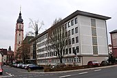
House I.
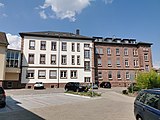
House II

House III

House IV


- Technical district building I ( Wellenbergstraße 3 , ⊙ ): Department 5 - Rural areas, wood sales point, surveying and land reorganization office.
- Technisches Kreishaus II ( Wellenbergstrasse 8 , ⊙ ): Surveying and land reorganization office.
- Technical District House III ( Wellenbergstraße 7 , ⊙ ): Forestry Office.
- Technisches Kreishaus IV ( Wellenbergstrasse 9 , ⊙ ): Road construction office.

Technical district building I

Technical District House II

Technical District House III

Technical District House IV

.jpg)
_Ansicht.jpg)
.jpg)
- Economic Development ( Liobastraße 9 , ⊙ ): Office for Economic Development, Energy and Tourism.
- Health Department ( Albert-Schweitzer-Straße 31 , ⊙ ): Health Department near the Tauberbischofsheim Hospital .
- Office for care and supply ( Am Wört 1 , ⊙ ): In the technology and start-up center building.
- Integration department ( Museumstrasse 2 , ⊙ ): Office for Social Security, Participation and Integration.
- Kreismedienzentrum ( Flurstraße 2 , ⊙ ): Formerly called Bildstelle; in the Distelhausen district.
- Main-Tauber job center ( Pestalozziallee 17 , ⊙ )

Business promotion

Health department

Office for care and supply

Integration department

District media center


- Offices in Bad Mergentheim
- Branch office of the District Office ( Wachbacher Straße 52 , ⊙ ): Agriculture Office, Traffic Office, Veterinary Office.
- Dormitory administration and refugee social work ( Wachbacher Straße 54 , ⊙ ): Office for Social Security, Participation and Integration.
- Main-Tauber job center ( Johann-Hammer-Str. 24 , ⊙ ): Branch of the Main-Tauber job center.
- Office in Lauda
- VerkehrsGesellschaft Main-Tauber mbH ( i_park Tauberfranken 8 , ⊙ ): VGMT.
- Offices in Wertheim
- Vehicle registration office ( Roter Sand 2 , ⊙ ; TÜV): Branch office of the vehicle registration office.
- Main-Tauber job center ( Wilhelm-Blos-Straße 3 , ⊙ ): Branch of the Main-Tauber job center.
Educational institutions

The Main-Tauber-Kreis is responsible for the following vocational schools : Commercial school Bad Mergentheim (including technical high school), commercial school Bad Mergentheim (including business high school and business high school with an international profile), Vocational School for Nutrition, Care and Education (EPE) Bad Mergentheim (including a nutritional high school), vocational school center Wertheim (including a technical high school, business high school and biotechnological high school), commercial school Tauberbischofsheim (including a technical high school) and commercial school Tauberbischofsheim (including a business high school and business high school specializing in finance).
Furthermore, the Main-Tauber-Kreis is responsible for the following special education and advice centers : School in Taubertal with school kindergarten Lauda-Königshofen (Unterbalbach) as well as a branch in Wertheim (support focus on intellectual development), School Boxberg (support focus on language) and school kindergarten Wertheim (Waldenhausen) ( Mental development and physical-motor development).
Hospitals and homes
The "Krankenhaus und Heime Main-Tauber GmbH" (KHMT) consists of the Tauberbischofsheim Hospital , the neighboring Haus Heimberg senior center with residential complex and care areas, and the Gerlachsheim senior center. On January 1, 2012, Gesundheitsholding Tauberfranken gGmbH was founded as a joint corporate and organizational umbrella of Caritas-Krankenhaus Bad Mergentheim gGmbH (CKBM) and KHMT. The holding is formed by the three shareholders Barmherzige Brüder Trier with 51 percent, the Caritas Association of the Diocese of Rottenburg-Stuttgart with 29 percent and the Main-Tauber district with 20 percent . Both CKBM and KHMT will continue to exist as independent companies. In future, however, KHMT's shareholders will be the health holding Tauberfranken with 94.9 percent and the Main-Tauber district with 5.1 percent. The same applies to the CKBM. Here, too, the health holding Tauberfranken becomes a shareholder with 94.9 percent, the old shareholders still hold 5.1 percent.
Bronnbach Monastery

In 1986 the Main-Tauber-Kreis acquired the former Cistercian Abbey of Bronnbach Monastery to prevent further deterioration of the valuable building fabric. In the meantime, u. a. established a cultural center. The Bronnbach Monastery is idyllically located on the lower Tauberlauf, near the large district town of Wertheim.
The Main-Tauber-Kreis has developed the property into a spiritual, scientific and cultural center. Today four missionaries of the Holy Family do spiritual work. Scientific institutions such as the Fraunhofer Institute for Silicate Research as well as Process and Measurement Technology, the Main-Tauber Archive Network or the Museum for Rural Cultural Assets are contact points for business and those interested in history.
Numerous cultural events are offered under the name "Bronnbacher Cultures" and modern conference rooms and overnight accommodation are available in the Bursariat guest house and in the orangery. The latest piece of the puzzle is the "Bronnbach Academy", which invites you to interesting lectures and educational offers on the topics of history, music, wine growing and growing, art and business. A special treat is the "Vinothek Taubertal" created in the prelate building. In the historic vaulted cellar there, 20 wine-growing companies from all over the Taubertal present themselves and present their best products.
Since January 1st, 2007, the Main-Tauber-Kreis has combined its Bronnbach activities in its own business "Kloster Bronnbach".
Energy agency
The energy agency was founded in December 2008 as a company in the Main-Tauber district in the legal form of a GmbH. The sole shareholder is the Main-Tauber district. The agency supplements and promotes the range of tasks of the Main-Tauber District District Office in the areas of climate and environmental protection, economic development, agriculture and waste recycling. The main topics in this regard are energy saving, energy efficiency and the increased use of renewable energies. The focus of the work is on advice, information and the transfer of knowledge.
Culture and sights
particularities
In the Main-Tauber-Kreis there was no consolidation of settlements and industry as in the metropolitan areas , so that outdoor cultural monuments , such as wayside shrines and other small monuments, have largely been well preserved in a structure that has been agricultural since the Middle Ages. For this reason, according to Bernhard Losch, the Main-Tauber district is also home to most of the murder and atonement crosses of all districts in Baden-Württemberg.
Architectural, art and cultural monuments
Cultural monuments
Among the cultural monuments , the small monuments and boundary stones of the 18 municipalities are gradually recorded in the geographic information system (GIS) of the Main-Tauber district and made available to the public with coordinates and descriptions on a separate website.

War memorials
Murder and Atonement Crosses
Of the numerous murder and atonement crosses preserved in the district up to modern times, the stone cross nest near Reicholzheim is particularly worth mentioning. It is the largest known collection of stone crosses in southern Germany with 14 stone crosses made of sandstone, which are embedded in a sandstone retaining wall. Around the stone cross nest there are various variants of a legend in which up to 14 boys are said to have killed each other in a dispute over a village beauty.
Free-range crossroads
In the predominantly Catholic parts of the Main-Tauber district there are over 20 open-air crossroads .
Museums
Recreation
Communities


Since the Baden-Württemberg district reform was completed in 1973, the Main-Tauber district has comprised 18 communities, including 11 cities (Bad Mergentheim, Boxberg, Creglingen, Freudenberg, Grünsfeld, Külsheim, Lauda-Königshofen, Niederstetten, Tauberbischofsheim, Weikersheim and Wertheim) and 7 other municipalities (Ahorn, Assamstadt, Großrinderfeld, Igersheim, Königheim, Werbach and Wittighausen).
In terms of population, Bad Mergentheim is the largest municipality and Wittighausen the smallest. In terms of the municipal area, Wertheim is the largest municipality and Assamstadt the smallest. The municipality with the highest population density is Tauberbischofsheim with 191 inhabitants per km², the lowest is Creglingen with 40 inhabitants per km².
Administrative communities
There are four agreed administrative communities between individual municipalities with headquarters in Bad Mergentheim, Boxberg, Grünsfeld and Tauberbischofsheim. The following cities and municipalities have come together to carry out their administrative business into agreed administrative communities:
- Agreed administrative partnership between the city of Bad Mergentheim and the communities of Assamstadt and Igersheim
- Agreed administrative partnership between the city of Boxberg and the municipality of Ahorn
- Agreed administrative partnership between the city of Grünsfeld and the municipality of Wittighausen
- Agreed administrative partnership between the city of Tauberbischofsheim and the communities of Großrinderfeld, Königheim and Werbach
Cities
Tauberbischofsheim is the district town of the Main-Tauber district. Among the 11 towns in the district there are two large district towns, Bad Mergentheim and Wertheim .
| city | coat of arms | Area km² |
Resident December 31, 2018 |
PE density PE per km² |
Height above sea level |
District location |
|---|---|---|---|---|---|---|
| Bad Mergentheim , large district town | 129.97 | 23,704 | 182 | 206 |

|
|
| Boxberg | 101.81 | 6,664 | 65 | 269 |
.png)
|
|
| Creglingen | 117.22 | 4,694 | 40 | 278 | ||
| Freudenberg | 34.78 | 3,774 | 109 | 133 |
.png)
|
|
| Grünsfeld | 44.72 | 3,651 | 82 | 210 | ||
| Külsheim | 81.46 | 5.122 | 63 | 327 | ||
| Lauda-Koenigshofen | 94.47 | 14,542 | 154 | 198 | ||
| Niederstetten | 104.06 | 4,834 | 46 | 306 | ||
| Tauberbischofsheim | 69.31 | 13,231 | 191 | 183 |

|
|
| Weikersheim | 80.94 | 7,333 | 91 | 230 |

|
|
| Wertheim , large district town | 138.63 | 22,780 | 164 | 145 |

|
Other communities
| local community | coat of arms | Area km² |
Resident December 31, 2018 |
PE density PE per km² |
Height above sea level |
District location |
|---|---|---|---|---|---|---|
| maple | 53.96 | 2,244 | 42 | 360 |
.png)
|
|
| Assamstadt | 17.20 | 2,262 | 132 | 340 |

|
|
| Large cattle field | 56.28 | 3,985 | 71 | 311 |

|
|
| Igersheim | 42.84 | 5,552 | 130 | 212 |

|
|
| Koenigheim | 61.23 | 2,997 | 49 | 223 |

|
|
| Werbach | 43.18 | 3,320 | 77 | 187 |

|
|
| Wittighausen | 32.36 | 1,632 | 50 | 245 |

|
License Plate
On January 1, 1973, the Tauber District (now Main-Tauber District) was assigned the TBB distinctive sign , which had been valid for the Tauberbischofsheim district since July 1, 1956 . It is still issued today. Until the 1990s, vehicles from the old district of Mergentheim were given license plates with the letter pairs RA to ZZ and the numbers from 1 to 999. As a result of license plate liberalization , the MGH (Bad Mergentheim) distinctive sign has been available since January 7, 2014 .
literature
- The state of Baden-Wuerttemberg - official description according to districts and municipalities (in eight volumes); Edited by the Baden-Württemberg State Archives Department; Volume IV: Stuttgart District - Regional Associations Franconia and East Wuerttemberg, Stuttgart 1980, ISBN 3-17-005708-1
- The nature reserves in the Stuttgart administrative region . Edited by Reinhard Wolf . Jan Thorbecke Verlag, Stuttgart 2002. ISBN 3-7995-5173-5
- Wolfram Angerbauer (Red.): The heads of the upper offices, district offices and district offices in Baden-Württemberg from 1810 to 1972 . Published by the working group of the district archives at the Baden-Württemberg district assembly. Theiss, Stuttgart 1996, ISBN 3-8062-1213-9 , pp. 85-88 .
See also
Web links
- Official website of the district at main-tauber-kreis.de
- Geographic information system of the Main-Tauber district (map view) at gistbb.de
- Literature from and about Main-Tauber-Kreis in the catalog of the German National Library
Individual evidence
- ↑ State Statistical Office Baden-Württemberg - Population by nationality and gender on December 31, 2018 (CSV file) ( help on this ).
- ^ District Office Main-Tauber District: District Administrator Reinhard Frank. Retrieved April 20, 2020 .
- ↑ a b c d e f g h i j k l m Main-Tauber-Kreis: District history . Online at www.main-tauber-kreis.de. Retrieved November 9, 2019.
- ↑ Geotopes in the Stuttgart administrative region - geotope_stuttgart.pdf. In: fachdokumente.lubw.baden-wuerttemberg.de. Accessed June 1, 2020 .
- ↑ Survey of land according to type of actual use in 2015
- ↑ LUBW State Institute for the Environment, Measurements and Nature Conservation Baden-Württemberg: List of protected areas of the State Institute for the Environment (select type of area and city or district) . Online at rips-dienste.lubw.baden-wuerttemberg.de. Retrieved June 25, 2016.
- ↑ LUBW protected area statistics ( Memento from January 20, 2015 in the Internet Archive )
- ↑ Main-Tauber-Kreis: Nitrate levels in groundwater will also decrease in 2013 . December 19, 2013. Online at www.main-tauber-kreis.de. Retrieved August 10, 2018.
- ↑ Main-Tauber-Kreis: Requirements for farmers in water protection areas are changing . December 22, 2014. Online at www.main-tauber-kreis.de. Retrieved August 10, 2018.
- ↑ a b c Federal Statistical Office (ed.): Historical municipality directory for the Federal Republic of Germany. Name, border and key number changes in municipalities, counties and administrative districts from May 27, 1970 to December 31, 1982 . W. Kohlhammer, Stuttgart / Mainz 1983, ISBN 3-17-003263-1 , p. 468 ff .
- ↑ District Office of the Main-Tauber-District: First confirmed case of coronavirus in the Main-Tauber-District . March 4, 2020. Online at www.main-tauber-kreis.de. Accessed March 31, 2020.
- ↑ Main-Post: 34 new corona cases in the Main-Tauber district on Wednesday . April 1, 2020. Online at www.mainpost.de. Retrieved April 1, 2020.
- ↑ Fränkische Nachrichten: Coronavirus 34 further cases confirmed in the district. Number of infections rises to 175 . April 2, 2020. Online at www.fnweb.de. Retrieved April 2, 2020.
- ↑ https://www.statistik-bw.de/Wahlen/Kommunal/02043000.tab?R=KR128
- ^ Result of the district council election 2019 in the Main-Tauber district ; accessed November 9, 2019.
- ^ A b Franz Gehrig , Hermann Müller: Tauberbischofsheim . Association of Tauberfränkische Heimatfreunde e. V., Tauberbischofsheim 1997, p. 304.
- ↑ a b c Wolfram Angerbauer (Red.): The heads of the upper offices, district offices and district offices in Baden-Württemberg 1810 to 1972 . Published by the working group of the district archives at the Baden-Württemberg district assembly. Theiss, Stuttgart 1996, ISBN 3-8062-1213-9 , pp. 87-88 .
- ↑ IHK Heilbronn-Franken figures, September 2012: "Employees subject to social security contributions on June 30, 2011 by economic sector"
- ↑ statistik.arbeitsagentur.de (accessed on October 22, 2012)
- ↑ Future Atlas 2016. Archived from the original on October 2, 2017 ; accessed on March 23, 2018 . Info: The archive link was inserted automatically and has not yet been checked. Please check the original and archive link according to the instructions and then remove this notice.
- ↑ Statistics for districts, Main-Tauber-Kreis 2011, branch structure p. 14
- ^ Touristikgemeinschaft Liebliches Taubertal: Cycling - The classic online at www.liebliches-taubertal.de. Retrieved November 25, 2014.
- ^ Touristikgemeinschaft Liebliches Taubertal: Cycling - The Sportive Online at www.liebliches-taubertal.de. Retrieved November 9, 2019.
- ↑ Microsoft Word - Radwegekonzept.doc - 2177_965_1.PDF. In: main-tauber-kreis.de. Retrieved August 3, 2020 .
- ↑ Günther E. Ascher (author): Fascination Jakobsweg “Main-Taubertal”: A pilgrimage in 9 stages from Miltenberg am Main to Rothenburg ob der Tauber . RegioKom publishing house, Großheubach 2013, p. 4f.
- ^ Fränkische Nachrichten: Educational wine trail set up . Online at www.fnweb.de. April 5, 2012. Retrieved May 4, 2015.
- ↑ Fitness trail: Fitness trail Tauberbischofsheim . Online at www.trimm-dich-pfad.com. Retrieved May 4, 2015.
- ↑ Fitness trail: Fitness trail Bad Mergentheim . Online at www.trimm-dich-pfad.com. Retrieved May 4, 2015.
- ↑ Landesgesundheitsamt Baden-Württemberg: Monitored swimming lakes in the Main-Tauber district ( memento of the original from May 12, 2015 in the Internet Archive ) Info: The archive link was automatically inserted and not yet checked. Please check the original and archive link according to the instructions and then remove this notice. . Online at www.lubw.baden-wuerttemberg.de. Retrieved May 13, 2015.
- ↑ Lovely Taubertal: Bathing lakes . Online at www.liebliches-taubertal.de. Retrieved December 13, 2018.
- ↑ City of Creglingen: Bathing in the Münstersee - the holiday experience in the middle of nature! . Online at www.creglingen.de. Retrieved December 15, 2018.
- ↑ a b c Main-Post: Swimming lakes in Lower Franconia: special features and water quality . April 15, 2019. Online at www.mainpost.de. Retrieved August 26, 2019.
- ^ City of Freudenberg: Swimming lake Freudenberg am Main . Online at www.freudenberg-main.de. Retrieved December 15, 2018.
- ↑ Seen.de: The Rinderfelder See . Online at www.seen.de. Retrieved August 26, 2019.
- ↑ Advertising brochure of the Bad Mergentheim spa administration, as of June 1, 2007
- ↑ Viticulture History . Working group Weinland Taubertal, accessed on August 11, 2013 .
- ↑ The Tauberbischofsheim Medal Forge: Successes of the Tauberbischofsheim fencing club. Fencing Club Tauberbischofsheim e. V., archived from the original on May 5, 2015 ; accessed on May 2, 2015 . Info: The archive link was inserted automatically and has not yet been checked. Please check the original and archive link according to the instructions and then remove this notice.
- ^ Fecht-Club Tauberbischofsheim: History ( Memento from May 5, 2015 in the Internet Archive ). Online at www.fechtentbb.de. Retrieved May 2, 2015.
- ↑ Fränkische Nachrichten: Fencing Sponsorship of the Olympic base Tauberbischofsheim changes from FC to the state sports association. Clear commitment to the location . September 29, 2017. Online at www.fnweb.de. Retrieved October 11, 2017.
- ↑ Main-Tauber-Kreis: Road Construction Office . Online at www.main-tauber-kreis.de. Retrieved March 6, 2019.
- ^ Main-Tauber district: Bad Mergentheim road maintenance depot . Online at www.main-tauber-kreis.de. Retrieved March 6, 2019.
- ↑ Main-Tauber district: Road maintenance department Tauberbischofsheim . Online at www.main-tauber-kreis.de. Retrieved March 6, 2019.
- ^ Main-Tauber district: Wertheim road maintenance depot . Online at www.main-tauber-kreis.de. Retrieved March 6, 2019.
- ↑ 150 years of the Frankenbahn. In: mainpost.de. Retrieved May 21, 2020 .
- ↑ fn: 150 years of the Tauberbahn - Mannheimer Morgen. In: morgenweb.de. Retrieved May 21, 2020 .
- ↑ 600 workers laid the route in the Taubertal. In: mainpost.de. Retrieved May 21, 2020 .
- ↑ The Tauberbahn special train opened 150 years ago - Fränkische Nachrichten. In: fnweb.de. Retrieved May 21, 2020 .
- ^ Bieberehren - Creglingen. In: vergierter-bahnen.de. Retrieved May 20, 2020 .
- ^ Ochsenfurt - Weikersheim / Bieberehren - Creglingen. In: vergierter-bahnen.de. Retrieved May 21, 2020 .
- ^ Alexander Wörn: The branch line Lohr - Wertheim . In: The Rail Bus, Edition 2/2014, p. 11.
- ↑ Uwe Büttner: 100 years of the Tauberbischofsheim - Königheim railway line: look back to the “Brehmbachtalblitz”. Fränkische Nachrichten Verlags-GmbH, January 4, 2014, accessed on October 19, 2014 .
- ↑ a b Liebliches Taubertal: Aviation in the Liebliches Taubertal . Online at www.liebliches-taubertal.de. Retrieved April 22, 2016.
- ^ Bernhard Losch: Atonement and Remembrance. Stone crosses in Baden-Württemberg . Theiss, Stuttgart 1981.
- ↑ GISTBB.de: Geographic Information System (GIS) of the Main-Tauber District . Online at www.gistbb.de. Retrieved January 5, 2020.
- ↑ locations. In: suehnekreuz.de. Retrieved May 23, 2020 .
- ↑ Reicholzheim. In: www.suehnekreuz.de. Retrieved January 5, 2020 .
Alb-Danube District | Baden-Baden | Biberach | Lake Constance district | Boeblingen | Breisgau-Upper Black Forest | Calw | Emmendingen | Enzkreis | Esslingen | Freiburg im Breisgau | Freudenstadt | Göppingen | Heidelberg | Heidenheim | Heilbronn (Land) | Heilbronn (city) | Hohenlohekreis | Karlsruhe (State) | Karlsruhe (city) | Constance | Loerrach | Ludwigsburg | Main-Tauber district | Mannheim | Neckar-Odenwald district | Ortenaukreis | Ostalbkreis | Pforzheim | Rastatt | Ravensburg | Rems-Murr-Kreis | Reutlingen | Rhein-Neckar District | Rottweil | Schwäbisch Hall | Schwarzwald-Baar district | Sigmaringen | Stuttgart | Tübingen | Tuttlingen | Ulm | Waldshut | Zollernalb district
Maple | Assamstadt | Bad Mergentheim | Boxberg | Creglingen | Freudenberg | Large cattle field | Grünsfeld | Igersheim | Koenigheim | Külsheim | Lauda-Koenigshofen | Niederstetten | Tauberbischofsheim | Weikersheim | Werbach | Wertheim | Wittighausen