
Tolna county
  |
|

|
|
| Tolna | |
| County seat : | Szekszárd |
| Surface: | 3,703 km² |
| Residents: | 223,618 as of 2016 |
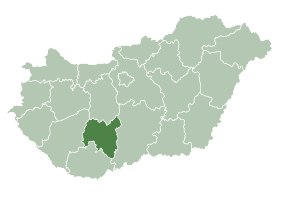
Tolna [ ˈtolnɒ ] (German Tolnau ) is a county (administrative district) in south-central Hungary . It borders on Fejér , Bács-Kiskun , Baranya and Somogy counties . It has an area of 3703.17 km² and 223,618 inhabitants (beginning of 2016). The county seat is Szekszárd , other towns are Tolna and Paks , where there is a nuclear power plant .
geography
The area is hilly and is crossed by the northern foothills of the Mecsek Mountains. The land slopes gently towards the Danube , which forms the eastern border of the county.
structure
With the government ordinance No. 218/2012 of August 13, 2012, the statistical small regions (Hungarian kistérség ) were abolished on January 1, 2013 and replaced by an approximately equal number of districts (Hungarian járás ). The small areas were retained for a while for planning and statistical purposes, but were finally abolished on February 25, 2014. There were five small areas in the county before it was dissolved. Only the administrative unit Tamási remained unchanged in its boundaries during the reform.
Former classification
Until the end of 2012 the following 5 small areas existed in Tolna County:
| code | Small area | Administrative headquarters | Population (December 31, 2012) |
Area in km² |
Number of parishes |
including cities |
|---|---|---|---|---|---|---|
| 4701 | Bonyhád | Bonyhád | 28,118 | 377.46 | 21st | 1 |
| 4702 | Dombóvár | Dombóvár | 32,333 | 509.02 | 16 | 1 |
| 4703 | Paks | Paks | 47,314 | 765.07 | 14th | 2 |
| 4704 | Szekszárd | Szekszárd | 83,382 | 1,031.66 | 26th | 3 |
| 4705 | Tamási | Tamási | 38,795 | 1,019.94 | 32 | 2 |
Current classification
Tolna county is divided into 6 districts (Hungarian járás ) with 109 villages: the city of Szekszárd with county law (Hungarian Megyei jogú város ), 10 cities without county law (Hungarian város ), 5 large municipalities (Hungarian nagyközség ) and 93 municipalities (Hungarian község ) .

| Location type | number | Area (in km²) | Population on January 1, 2016 | Population density (Ew / km²) |
||||
|---|---|---|---|---|---|---|---|---|
| absolutely | proportionally | on average | absolutely | proportionally | on average | |||
| City with county law | 1 | 96.28 | 2.60% | 32,844 | 14.69% | 341.1 | ||
| Cities without county law | 10 | 745.44 | 20.13% | 74.54 | 92,885 | 41.54% | 9,289 | 124.6 |
| Large municipalities | 5 | 290.90 | 7.86% | 58.18 | 15,313 | 6.85% | 3,063 | 52.6 |
| Communities | 93 | 2,570.55 | 69.41% | 27.64 | 82,576 | 36.93% | 888 | 32.1 |
| Tolna county as a whole | 109 | 3,703.17 | 33.97 | 223,618 | 2,052 | 60.4 | ||
The current circles are:
| code | circle | Circular seat | Residents (January 1, 2013) |
Area in km² |
Number of parishes |
including cities |
|---|---|---|---|---|---|---|
| 140 | Bonyhád | Bonyhád | 31,582 | 476.77 | 25th | 1 |
| 171 | Dombóvár | Dombóvár | 32,333 | 509.02 | 16 | 1 |
| 172 | Paks | Paks | 49,610 | 836.00 | 15th | 2 |
| 173 | Szekszárd | Szekszárd | 59,412 | 656.18 | 17th | 2 |
| 174 | Tamási | Tamási | 38,795 | 1,019.94 | 32 | 2 |
| 175 | Tolna | Tolna | 18,210 | 205.24 | 4th | 1 |

Largest cities and towns
All places without a name are cities.
| City / municipality | German name | Residents (January 1, 2016) |
|---|---|---|
| Szekszárd | Six-hard | 32,844 |
| Paks | Paksch | 19,117 |
| Dombóvár | Dumbowa | 18,461 |
| Bonyhád | Bonnhard | 13,322 |
| Tolna | Tolnau | 11,080 |
| Dunaföldvár | Feldburg on the Danube | 8,501 |
| Tamási | Tammasching | 8,068 |
| Bátaszék | Bathing corner | 6.118 |
| Fadd , large parish | 4.036 | |
| Simontornya | Simonsthurm | 3,986 |
| Decs , Greater Parish | Detsch | 3,746 |
| Hőgyész , large municipality | Hedjess | 2,819 |
| Bölcske , parish | 2,754 | |
| Iregszemcse , parish | 2,621 | |
| Nagydorog , large parish | 2,544 | |
| Dunaszentgyörgy , parish | 2,528 |
Population development
Population development of the county
Dates in bold are census results.
| date | population | date | population |
|---|---|---|---|
| 01/01/1960 1 | 272.101 | 01/01/2007 | 240.966 |
| 01/01/1970 | 258.760 | 01/01/2008 | 238.431 |
| 01/01/1980 | 266.273 | 01/01/2009 | 235.874 |
| 01/01/1990 | 253,675 | 01/01/2010 | 233,650 |
| 01/01/2001 | 251,594 | 01/01/2011 | 231.183 |
| 02/01/2001 | 249,683 | October 01, 2011 | 230.361 |
| 01/01/2002 | 250,337 | 01/01/2012 | 231,533 |
| 01/01/2003 | 248.998 | 01/01/2013 | 229,942 |
| 01/01/2004 | 247.287 | 01/01/2014 | 227.996 |
| 01/01/2005 | 245.350 | 01/01/2015 | 225,936 |
| 01/01/2006 | 242,946 | 01/01/2016 | 223,618 |
1 1960: present population; otherwise resident population
Population development of the districts
A negative population balance can be seen for all districts.
| District name | Population level on January 1st | |||
|---|---|---|---|---|
| 2013 | 2014 | 2015 | 2016 | |
| Bonyhád | 31,582 | 31,322 | 30,955 | 30,594 |
| Dombóvár | 32,333 | 31,993 | 31,663 | 31,192 |
| Paks | 49,610 | 49,319 | 49,022 | 48,606 |
| Szekszárd | 59,412 | 58,958 | 58,410 | 57,923 |
| Tamási | 38,795 | 38,304 | 37,892 | 37,429 |
| Tolna | 18,210 | 18,100 | 17,994 | 17,874 |
| Tolna county | 229,942 | 227.996 | 225,936 | 223,618 |
History and culture
Museums
The State Directorate of Museums of Tolna County runs 5 county museums . The county seat is the town of Szekszárd .
|
|
|
* County Museum
photos


Web links
- Tolna County Self-Government (Hungarian)
Individual evidence
- ↑ a b c 6.1.1. Resident population by sex, January 1st (2001-) (STADAT table). KSH, accessed February 17, 2017 .
- ^ Detailed Gazetteer of Hungary
- ↑ Gazetteer of Hungary, 1st January, 2013 (Hungarian / English)
- ↑ KSH: Gazetteer of Hungary, 1st January, 2016. In: Minden helység adata. KSH, accessed on March 7, 2017 (Hungarian / English, also PDF file).
- ↑ Tolna County Museums Directorate , TMMI (Tolna Megyei Múzeumok Igazgatósága)
Bács-Kiskun | Baranya | Békés | Borsod-Abaúj-Zemplén | Budapest | Csongrád-Csanád | Fejér | Győr-Moson-Sopron | Hajdú-Bihar | Heves | Jász-Nagykun-Szolnok | Komárom-Esztergom | Nógrád | Plague | Somogy | Szabolcs-Szatmár-Bereg | Tolna | Vas | Veszprém | Zala
Coordinates: 46 ° 30 ' N , 18 ° 35' E