
Békés county
  |
|

|
|
| Békés | |
| County seat : | Békéscsaba |
| Surface: | 5,630 km² |
| Residents: | 347,058 as of 2016 |

Békés [ ˈbeːkeːʃ ] is a county in southeast Hungary . It borders with Romania and with the counties of Csongrád-Csanád , Jász-Nagykun-Szolnok and Hajdú-Bihar . It has an area of 5,629.72 km² and a population of 347,058 (beginning of 2016). The county seat is Békéscsaba , other important cities are Békés , Orosháza , Szarvas and Gyula .
geography
The area is flat and forms part of the Great Hungarian Plain . The main river is the Körös (Kreisch) .
structure
Former classification
With the government ordinance No. 218/2012 of August 13, 2012, the statistical small regions (Hungarian kistérség ) were abolished on January 1, 2013 and replaced by an approximately equal number of districts (Hungarian járás ). The small areas were retained for a while for planning and statistical purposes, but were finally abolished on February 25, 2014. Until the dissolution there were 8 small areas in the county. Three administrative units remained unchanged during the reform: Guyla, Mezőkovácsháza and Sarkad.

Until the end of 2012, the following small areas (kistérség) existed in Békès county
| code | Small area | Administrative headquarters | Population (December 31, 2012) |
Area in km² |
Number of parishes |
including cities |
|---|---|---|---|---|---|---|
| 3401 | Békéscsaba | Békéscsaba | 71.903 | 450.73 | 6th | 2 |
| 3402 | Mezokovácsháza | Mezokovácsháza | 40,608 | 881.49 | 18th | 4th |
| 3403 | Orosháza | Orosháza | 57,706 | 848.14 | 10 | 3 |
| 3404 | Sarkad | Sarkad | 23,228 | 570.97 | 11 | 1 |
| 3405 | Szarvas | Szarvas | 42,909 | 821.57 | 8th | 2 |
| 3406 | Szeghalom | Szeghalom | 39,366 | 1009.73 | 9 | 5 |
| 3407 | Békés | Békés | 41,854 | 633.87 | 9 | 2 |
| 3408 | Gyula | Gyula | 41,579 | 413.22 | 4th | 2 |
Current classification
The Békés county is divided into 9 districts (Hungarian járás ) with 75 villages. One of them is a town with county law (Békéscsaba), 21 towns without county law (Hungarian varós ), 8 large municipalities (Hungarian nagyközség ) and 45 municipalities (Hungarian község ).
| Location type | number | Area (in km²) | population | Population density (Ew / km²) |
||||
|---|---|---|---|---|---|---|---|---|
| absolutely | proportionally | on average | absolutely | proportionally | on average | |||
| City with county law | 1 | 193.93 | 3.44% | 60.126 | 17.32% | 310.0 | ||
| Cities without county law | 21st | 2,940.30 | 52.23% | 140.01 | 206.503 | 59.50% | 9,833 | 70.2 |
| Large community | 8th | 484.23 | 8.60% | 60.53 | 25.193 | 7.26% | 3.149 | 52.0 |
| Communities | 45 | 2,011.26 | 35.73% | 44.69 | 55,236 | 15.92% | 1,227 | 27.5 |
| County Békés total | 75 | 5,629.72 | 75.06 | 347.058 | 4,627 | 61.6 | ||
The current circles are:
| code | circle | Circular seat | Residents (January 1, 2013) |
Area in km² |
Number of parishes |
including cities |
|---|---|---|---|---|---|---|
| 045 | Békés district | Békés | 37,259 | 525.24 | 7th | 2 |
| 046 | Békéscsaba | Békéscsaba | 82,424 | 636.16 | 9 | 3 |
| 047 | Gyomaendrőd | Gyomaendrőd | 23,980 | 686.21 | 5 | 2 |
| 048 | Gyula | Gyula | 41,579 | 413.22 | 4th | 2 |
| 049 | Mezőkovácsháza | Mezőkovácsháza | 40,608 | 881.49 | 18th | 4th |
| 050 | Orosháza | Orosháza | 51,392 | 717.18 | 8th | 2 |
| 051 | Sarkad | Sarkad | 23,228 | 570.97 | 11 | 1 |
| 052 | Szarvas | Szarvas | 28,558 | 485.06 | 6th | 1 |
| 053 | Szeghalom | Szeghalom | 30,125 | 714.19 | 7th | 4th |
Largest cities and towns
| city | Residents (January 1, 2016) |
|---|---|
| Békéscsaba | 60.126 |
| Gyula | 30,318 |
| Orosháza | 28.093 |
| Békés | 19,243 |
| Szarvas | 16,044 |
| Gyomaendrőd | 13,133 |
| Mezőberény | 10.148 |
| Sarkad | 9,808 |
| Szeghalom | 9.005 |
| city | Residents (January 1, 2016) |
|---|---|
| Dévaványa | 7,747 |
| Vésztő | 6,784 |
| Mezőkovácsháza | 6,059 |
| Tótkomlós | 5,902 |
| Battonya | 5,835 |
| Füzesgyarmat | 5,752 |
| Mezőhegyes | 5,274 |
| Újkígyós | 5,009 |
| Nagyszénás 1 | 4,900 |
| city | Residents (January 1, 2016) |
|---|---|
| Condoros 2 | 4,898 |
| Csorvás | 4,789 |
| Elec | 4,659 |
| Körösladány | 4,476 |
| Doboz 1 | 4.026 |
| Békésszentandrás 1 | 3,557 |
| Medgyesegyháza | 3,527 |
| Gádoros 1 | 3,485 |
| Kétegyháza 1 | 3,458 |
1 Large municipalities (Hungarian: nagyközség )
2 The large municipality of Kondoros (Szarvas district) received town charter in mid-2013
Population development
Population development of the county
Dates in bold are census results.
| date | population | date | population |
|---|---|---|---|
| 01/01/1960 1 | 467.861 | 01/01/2007 | 382.190 |
| 01/01/1970 | 438,971 | 01/01/2008 | 376,657 |
| 01/01/1980 | 436.910 | 01/01/2009 | 371,322 |
| 01/01/1990 | 411,887 | 01/01/2010 | 366,556 |
| 01/01/2001 | 401.919 | 01/01/2011 | 361,802 |
| 02/01/2001 | 397.791 | October 01, 2011 | 359,948 |
| 01/01/2002 | 399.061 | 01/01/2012 | 362,662 |
| 01/01/2003 | 396.131 | 01/01/2013 | 359.153 |
| 01/01/2004 | 392.845 | 01/01/2014 | 355.199 |
| 01/01/2005 | 389,590 | 01/01/2015 | 351.148 |
| 01/01/2006 | 385,847 | 01/01/2016 | 347.058 |
1 1960: present population; otherwise resident population
Population development of the districts
A negative population balance can be seen for all districts.
| District name | Population level on January 1st | |||
|---|---|---|---|---|
| 2013 | 2014 | 2015 | 2016 | |
| Békés | 37,359 | 36,877 | 36,279 | 35,745 |
| Békéscsaba | 82,424 | 81,694 | 81.113 | 80,613 |
| Gyomaendrőd | 23,980 | 23,642 | 23,343 | 23,118 |
| Gyula | 41,579 | 41,118 | 40,827 | 40.178 |
| Mezőkovácsháza | 40,608 | 40.186 | 39,661 | 39,032 |
| Orosháza | 51,392 | 50,893 | 50.294 | 49,699 |
| Sarkad | 23,228 | 22,926 | 22,728 | 22,449 |
| Szarvas | 28,558 | 28,103 | 27,638 | 27,221 |
| Szeghalom | 30,125 | 29,760 | 29,265 | 29.003 |
| Békés county | 359.153 | 355.199 | 351.148 | 347.058 |
History and culture
The county in its current form was created in the course of the county reform in 1950, it got its name from a county that previously existed under the same name but within smaller boundaries, see Békés county (historical) .
Museums
The State Directorate of Békés County Museums is responsible for 8 county museums . The county seat is the city of Békéscsaba .
|
|
|
* County Museum

Sarkad Castle
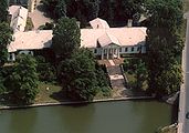
Szarvas Castle
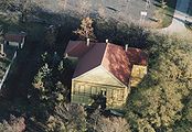
Szeghalom Castle


Web links
- Homepage of the county (Hungarian)
- Web portal Békés (Hungarian)
- Information on Békés County ( Memento of June 8, 2003 in the Internet Archive ) (Hungarian)
Individual evidence
- ↑ Gazetteer of Hungary, 1st January, 2013. (PDF) KSH, accessed on February 4, 2017 (Hungarian / English, also XLS file).
- ^ Detailed Gazetteer of Hungary. KSH, accessed February 4, 2017 (Hungarian / English).
- ↑ KSH: Gazetteer of Hungary, 1st January, 2016. In: Minden helység adata. KSH, accessed on March 7, 2017 (Hungarian / English, also PDF file).
- ↑ a b 6.1.1. Resident population by sex, January 1st (2001-) (STADAT table). KSH, accessed February 9, 2017 .
- ↑ Békés County Museums Directorate , BMMI (Békés Megyei Múzeumok Igazgatósága)
Bács-Kiskun | Baranya | Békés | Borsod-Abaúj-Zemplén | Budapest | Csongrád-Csanád | Fejér | Győr-Moson-Sopron | Hajdú-Bihar | Heves | Jász-Nagykun-Szolnok | Komárom-Esztergom | Nógrád | Plague | Somogy | Szabolcs-Szatmár-Bereg | Tolna | Vas | Veszprém | Zala
Békés | Békéscsaba | Gyomaendrőd | Gyula | Mezőkovácsháza | Orosháza | Sarkad | Szarvas | Szeghalom
Békéscsaba | Békés | Gyula | Mezőkovácsháza | Orosháza | Sarkad | Szarvas | Szeghalom
Coordinates: 46 ° 44 ' N , 21 ° 3' E