
Győr-Moson-Sopron county
  |
|

|
|
| Győr-Moson-Sopron | |
| County seat : | Győr |
| Surface: | 4208 km² |
| Residents: | 455.217 as of 2016 |
The Győr-Moson-Sopron [ ɟøːr moʃon ʃopron ] ( German Raab-Wiesel-Sopron ) is a county (administrative district) in the extreme northwest of Hungary . It has an area of 4207.86 km² and 455,217 inhabitants (as of early 2016). It borders with Austria , Slovakia and the counties Vas , Veszprém and Komárom-Esztergom . The county seat is Győr (Raab) , other important cities are Sopron (Ödenburg) and Mosonmagyaróvár (Wieselburg-Hungarian Altenburg) .
geography
structure

Győr-Moson-Sopron County is divided into 7 districts ( Járás in Hungarian ) with 183 localities. Győr and Sopron are cities with county law (Hungarian Megyei jogú város ), 10 cities without county law (Hungarian város ), 4 large municipalities (Hungarian nagyközség ) and 167 municipalities (Hungarian község ).
| Location type | number | Area (in km²) | Population on January 1, 2016 | Population density (Ew / km²) |
||||
|---|---|---|---|---|---|---|---|---|
| absolutely | proportionally | on average | absolutely | proportionally | on average | |||
| Cities with county law | 2 | 343.66 | 8.17% | 171.83 | 191,455 | 42.06% | 95,728 | 557.1 |
| Cities without county law | 10 | 702.45 | 16.69% | 70.25 | 80,976 | 17.79% | 8,098 | 115.3 |
| Large municipalities | 4th | 129.57 | 3.08% | 32.39 | 9,654 | 2.12% | 2,414 | 74.5 |
| Communities | 167 | 3,032.18 | 72.06% | 18.16 | 173.132 | 38.03% | 1,037 | 57.1 |
| Győr-Moson-Sopron com | 183 | 4,207.86 | 22.99 | 455.217 | 2,488 | 108.2 | ||
The current circles are:
| code | district | District capital | Residents (January 1, 2013) |
Area in km² |
Number of parishes |
including cities |
|---|---|---|---|---|---|---|
| 086 | Csorna | Csorna | 32,882 | 579.76 | 33 | 1 |
| 087 | Győr | Győr | 189,857 | 903.40 | 35 | 1 |
| 088 | Kapuvár | Kapuvár | 23,705 | 372.14 | 19th | 2 |
| 089 | Mosonmagyaróvár | Mosonmagyaróvár | 72,532 | 899.95 | 26th | 2 |
| 090 | Pannonhalma | Pannonhalma | 15,522 | 312.34 | 17th | 1 |
| 091 | Sopron | Sopron | 99.271 | 867.71 | 39 | 3 |
| 092 | Tét | Tét | 14,543 | 272.64 | 14th | 1 |
Former classification
With the government ordinance No. 218/2012 of August 13, 2012, the statistical small regions (Hungarian Kistérség ) were abolished on January 1, 2013 and replaced by an approximately equal number of districts (Hungarian Járás ). The small areas were retained for a while for planning and statistical purposes, but were finally abolished on February 25, 2014. Until the dissolution there were 7 small areas in the county. All administrative units experienced changes during the reform.
Until the end of 2012, the following small areas ( Kistérség in Hungarian ) existed in Győr-Moson-Sopron County:
| code | Small area | Small area seat | Population (December 31, 2012) |
Area in km² |
Number of parishes |
including cities |
|---|---|---|---|---|---|---|
| 3801 | Csorna | Csorna | 34,126 | 598.75 | 34 | 1 |
| 3802 | Győr | Győr | 180.333 | 742.56 | 27 | 1 |
| 3803 | Kapuvár-Beled | Kapuvár | 23,409 | 362.72 | 18th | 2 |
| 3804 | Mosonmagyaróvár | Mosonmagyaróvár | 74,911 | 930.66 | 27 | 2 |
| 3805 | Sopron-Fertőd | Sopron | 99,567 | 877.13 | 40 | 3 |
| 3806 | Tét | Tét | 18,986 | 375.58 | 19th | 1 |
| 3807 | Pannonhalma | Pannonhalma | 16,980 | 320.54 | 18th | 1 |
Largest cities and towns
| city | German name | Residents (January 1, 2016) |
|---|---|---|
| Győr | Raab | 129,568 |
| Sopron | Ödenburg | 61,887 |
| Mosonmagyaróvár | Wieselburg-Hungarian Altenburg | 32,856 |
| Kapuvár | Kobrunn | 10,431 |
| Csorna | Gschirnau | 10,406 |
| Győrújbarát 2 | 6,609 | |
| Janossomorja | Saint Johann | 6,099 |
| Nyúl 2 | 4,373 | |
| Tét | Tietzing | 4,062 |
| Pannonhalma | Martinsberg | 4,001 |
| Fertőszentmiklós | Saint Nicholas | 3,864 |
| Hegyeshalom 1 | Street summer | 3,445 |
| city | German name | Residents (January 1, 2016) |
|---|---|---|
| Fertőd | Esterhas | 3,396 |
| Győrszemere 2 | 3,298 | |
| Lébény 3 | Leyden | 3,229 |
| Abda 2 | Bridge | 3.138 |
| Halászi 2 | Fishing village | 3.134 |
| Gönyű 2 | 3,036 | |
| Öttevény 2 | Hochstrass | 3,026 |
| Győrzámoly 2 | 2,775 | |
| Rajka 2 | Ragendorf | 2,723 |
| Kóny 2 | Cologne | 2,642 |
| Beled | 2,632 | |
| Rábapatona 2 | 2,552 |
Locations without an addition are cities .
1 large communes ( nagyközség )
2 communes ( község )
3 The large commune of Lébény received town charter on July 15, 2013
Population development
Population development of the county
A slight increase in population since the turn of the millennium is remarkable. Dates in bold are census results.
| date | population | date | population |
|---|---|---|---|
| 01/01/1960 1 | 401.861 | 01/01/2007 | 442,667 |
| 01/01/1970 | 414.457 | 01/01/2008 | 444.384 |
| 01/01/1980 | 437.857 | 01/01/2009 | 447.033 |
| 01/01/1990 | 432.126 | 01/01/2010 | 448,435 |
| 01/01/2001 | 438.218 | 01/01/2011 | 449,967 |
| 02/01/2001 | 438.773 | October 01, 2011 | 447.985 |
| 01/01/2002 | 439.240 | 01/01/2012 | 444.935 |
| 01/01/2003 | 439.046 | 01/01/2013 | 448,312 |
| 01/01/2004 | 440.138 | 01/01/2014 | 450.318 |
| 01/01/2005 | 439,922 | 01/01/2015 | 452,638 |
| 01/01/2006 | 441,606 | 01/01/2016 | 455.217 |
1 1960: present population; otherwise resident population
Population development of the districts
A positive population balance can be seen for the districts.
| District name | Population level on January 1st | |||
|---|---|---|---|---|
| 2013 | 2014 | 2015 | 2016 | |
| Csorna | 32,882 | 32,673 | 32,513 | 32,619 |
| Győr | 189,857 | 190.912 | 192.068 | 193.102 |
| Kapuvár | 24,613 | 24,473 | 24,350 | 24,440 |
| Mosonmagyaróvár | 72,532 | 72,863 | 73,454 | 73.933 |
| Pannonhalma | 15,522 | 15,555 | 15,625 | 15,737 |
| Sopron | 98,363 | 99.397 | 100.141 | 100,853 |
| Tét | 14,543 | 14,445 | 14,487 | 14,533 |
| Győr-Moson-Sopron | 448,312 | 450.318 | 452,638 | 455.217 |
History and culture

The county in its current extent is a result of the loss of territory to Hungary through the Treaty of Trianon in 1920 . In 1923, the remnants of the Győr , Moson and Pozsony counties that remained with Hungary became the Győr, Moson és Pozsony county , which was renamed Győr-Moson in 1945 . In 1950 Sopron County , which had also been greatly reduced in size since 1920, was added. The area was now called Győr-Sopron ; on October 1, 1990, it was finally given the name it is today.
The country is part of the Little Hungarian Plain and has a steppe character . The most important river is the Raab ( Hungarian Rába ), which flows into the Danube at Győr . Near Sopron, where the land protrudes like a corner into Austria, it has a share in Lake Neusiedl . South of Lake Neusiedl is the Hanság ( German Waasen or Wasen ), a wetland with numerous rare bird species. A part of the natural landscape of the county is under protection (4 areas, over 400 km²). The Fertő-Hanság National Park ( Neusiedler See National Park ) covers 19,735 hectares. It borders on the part of Austria of the same name and is operated jointly.
The old traffic routes and a dense railway network run in the river valleys. The long-distance section Hegyeshalom - Budapest was expanded for a maximum speed of 160 km / h.
Another important sight is the Esterházy Palace in Fertőd .
Museums
The State Directorate of Museums of Győr-Moson-Sopron County is responsible for 7 county museums . The county seat is the city of Győr .
|
|
|
* County Museum
Picture gallery

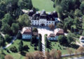
Mosonmagyaróvár Castle
Nagylózs - palace

Sopronhorpács -Széchenyi Palace

Szany - palace
Zsira - castle
Nagycenk Palace

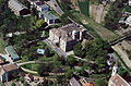
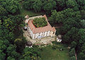
Aerial view: Mihályi Castle
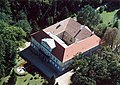
Aerial view: Dénesfa Palace
Hédervár - palace
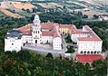
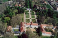
Benedictine Pannonhalma Abbey


Web links
Individual evidence
- ↑ a b c 6.1.1. Resident population by sex, January 1st (2001-) (STADAT table). KSH, accessed February 9, 2017 .
- ↑ KSH: Gazetteer of Hungary, 1st January, 2016. In: Minden helység adata. KSH, accessed on March 7, 2017 (Hungarian / English, also PDF file).
- ↑ Gazetteer of Hungary, 1st January, 2013. (PDF) KSH, accessed on February 17, 2017 (Hungarian / English, also XLS file).
- ^ Detailed Gazetteer of Hungary. KSH, accessed February 17, 2017 (Hungarian / English).
- ↑ Győr-Moson-Sopron County Museums Directorate , GYMSMMI (Győr-Moson-Sopron Megyei Múzeumok Igazgatósága)
Bács-Kiskun | Baranya | Békés | Borsod-Abaúj-Zemplén | Budapest | Csongrád-Csanád | Fejér | Győr-Moson-Sopron | Hajdú-Bihar | Heves | Jász-Nagykun-Szolnok | Komárom-Esztergom | Nógrád | Plague | Somogy | Szabolcs-Szatmár-Bereg | Tolna | Vas | Veszprém | Zala
Csorna | Győr | Kapuvár | Mosonmagyaróvár | Pannonhalma | Sopron | Tét
Coordinates: 47 ° 40 ' N , 17 ° 15' E