Kapuvár
| Kapuvár | ||||
|
||||
| Basic data | ||||
|---|---|---|---|---|
| State : | Hungary | |||
| Region : | Western Transdanubia | |||
| County : | Győr-Moson-Sopron | |||
| Small area until December 31, 2012 : | Kapuvár-Beled | |||
| Coordinates : | 47 ° 36 ' N , 17 ° 1' E | |||
| Area : | 96.05 km² | |||
| Residents : | 10,364 (Jan. 1, 2011) | |||
| Population density : | 108 inhabitants per km² | |||
| Telephone code : | (+36) 96 | |||
| Postal code : | 9330 | |||
| KSH kódja: | 28334 | |||
| Structure and administration (as of 2016) | ||||
| Community type : | city | |||
| Mayor : | György Hámori (Fidesz-KDNP) | |||
| Postal address : | Fő tér 1. 9330 Kapuvár |
|||
| Website : | ||||
| (Source: A Magyar Köztársaság helységnévkönyve 2011. január 1st at Központi statisztikai hivatal ) | ||||
Kapuvár ( German Kobrunn ) is a Hungarian city in the district of the same name in Győr-Moson-Sopron County .
geography
Kapuvár is located in western Hungary on the Raab , 10 km south of the border with Austria , between Sopron (40 km) and Győr (50 km).
history
In the Kapuvár area there are traces of settlements from the Hallstatt period , from Illyrians , Romans and Avars . Kapuvár has been the western gate of the Kingdom of Hungary since the conquest . The name of the place comes from the terms “gate” and “castle” ( Vár ). The first written record dates from 1162. King Sigismund donated the place to the Kanizsai family in 1387 as thanks for their support. In 1532 he came into the possession of the Nádasdy by marriage . In 1558 the place received market rights and the castle was strengthened to become a border fortress because of the Turkish threat . Nevertheless, the place and the castle fell briefly into the hands of the Ottomans in 1594 .
Since Ferenc Nádasdy was executed as a participant in the magnate conspiracy against Emperor Leopold I , the place went to the Habsburg- loyal Esterházys in 1681 . In the Kuruzenkrieg at the beginning of the 18th century, the castle was destroyed by the rebels, then converted into a palace by the Esterházys. However, this was always in the shadow of the nearby Esterházy Palace in Fertőd . In the middle of the 19th century, the economic boom due to industrialization also hit Kapuvár. Numerous representative buildings were erected in the center.
In 1901 the large community had 6,642 inhabitants. In 1969 the place received city rights again.
Town twinning
- Andau , Austria
Culture and sights
- Esterházy Palace (Kapuvár)
- Rábaközi Museum
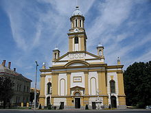
- St. Anna Church
Economy and Infrastructure
The city has been a center for the food, light and machine industries since the 1950s. In 1990 an industrial park was added. Thermal baths made it possible to set up a spa center. The location at the Fertő-Hanság National Park is also of great tourist importance .

Kapuvár is on the main road No. 85 (to Lake Balaton ) and on the Raab-Oedenburg-Ebenfurter railway .
sons and daughters of the town
- Attila Ábrahám (* 1967), Olympic champion in kayak
- Aladár Gajáry (1929–2018), Roman Catholic priest, theologian and dogmatist
- Zsuzsanna Heiner (* 1979), astronomer and physicist
- Alexandre Lamfalussy (1929–2015), Hungarian economist
Individual evidence
- ↑ a b c The history of the city
- ↑ August Ernst: History of Burgenland. History of the Austrian federal states. Oldenbourg Wissenschaftsverlag, Munich 1991, ISBN 3-486-54072-6 , p. 71.
- ^ Meyers Großes Konversations-Lexikon, Volume 10, Leipzig 1907, p. 606.


