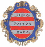
Raab county
|
Raab County (Győr) (1910) |
|
|---|---|

|
|
| Administrative headquarters : | Győr |
| Area : | 1,534 km² |
| Population : | 136.295 |
| Ethnic groups : | 98% Magyars 1.5% Germans 1% other (Slovaks, Croats) |

|
|
The County Raab (German also Raaber County ; Hungarian Győr vármegye , Slovak Rabska župa / stolica or Rábsky County , Latin comitatus Jauriensis ) was a historic administrative unit ( County / County ) in the Kingdom of Hungary .
location
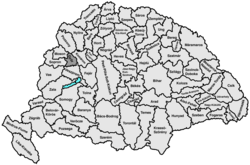
Most of it lay south of the Danube around the town of Raab (Győr in Hungarian) and was mostly in present-day Hungary , only a small part north of the Danube around the town of Baloň was in present-day Slovakia .
The county bordered on the north by the county Pressburg (Pozsony) , in the northeast on the Komárom County (Komárom) , in the south and southeast by the County Veszprém (Veszprém) , on the southwest by the Sopron County (Sopron) and on the northwest by the County Wieselburg (Moson) .
In 1907 it had 134,154 inhabitants who lived in an area of 1,534 km².
Administrative headquarters
The seat of the administration was in Győr (German Raab ).
history
Raab County was established at the end of the 10th century as one of the first in the Kingdom of Hungary . In 1541 it was conquered by the Ottomans , around 1598 it was recaptured by the Habsburgs .
1918 a small part was the area north of the Danube to the newly formed Czechoslovakia (by the Treaty of Trianon in 1920 under international law confirmed), most of the south of the Danube remained with Hungary , and together with the Moson County and a small part of the former county Pressburg the County Győr-Moson-Pozsony .
After the Second World War, the county was Győr-Moson-Pozsony with the County Sopron (Sopron) for County Győr-Sopron united, this was in 1990 finally Győr-Moson-Sopron renamed.
After the establishment of Czechoslovakia, the part of the county north of the Danube was added to the Komorn county (in Slovak Komárňanská župa ), from 1923 it came to the Pressburg county , which was then completely dissolved in 1928. Today the area belongs to the Tyrnau Regional Association ( Trnavský kraj ).
District subdivision
In the early 20th century the following chair districts existed (mostly named after the name of the administrative seat):
| Chair districts (járások) | |
|---|---|
| Chair district | Administrative headquarters |
| Tószigetcsilizköz ("Tóköz & Szigetköz & Csilizköz") | Győr |
| Sokoróalja | Tét |
| Puszta | Győrszentmárton , today Pannonhalma |
| City district (rendezett tanácsú város) | |
| Győr | |
See also
literature
- Raab . In: Meyers Konversations-Lexikon . 4th edition. Volume 13, Verlag des Bibliographisches Institut, Leipzig / Vienna 1885–1892, pp. 525–526.
Web links
- Entry in the Pallas Lexicon (Hungarian)
Individual evidence
- ↑ A magyar szent corona országainak 1910. évi népszámlálása . Budapest 1912, p. 12 ff.
- ↑ A magyar szent corona országainak 1910. évi népszámlálása . Budapest 1912, p. 22 ff. (1910 census)

