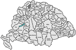
Turz county
|
Turz County (Turóc) (1910) |
|
|---|---|

|
|
| Administrative headquarters : | Turócszentmárton |
| Area : | 1,123 km² |
| Population : | 55,703 |
| Ethnic groups : | 69% Slovaks 20% Germans 10% Magyars 1% others (mainly Poles ) |

|
|
The Turóc County (Hungarian vármegye Turóc , Slovak Turčianska župa Latin comitatus Thurociensis ) is a historic administrative unit ( County / County ) in the Kingdom of Hungary .
The name is derived from the name of the river Turz ( Turiec in Slovak ), which flows through the landscape.
The county was in what is now northern central Slovakia , and the Slovak name Turiec is now used as an unofficial name for this area and as an official name for a tourist region.
location
Turz county bordered Arwa counties ( Árva , in the north), Trenčín ( Trencsén , in the north-west), Neutra ( Nyitra , in the south-west), Bars (in the south), Sohl ( Zólyom , in the south-east) and Liptau ( Liptó , in the northeast).
It was bounded by the two Fatra Mountains ( Great Fatra in the east, Little Fatra in the northwest) and flowed through by the river Turz (now Turiec in Slovak ). In 1910 the area covered an area of 1,123 km² and had 55,703 inhabitants.
Administrative offices
The original county seats were the Sklabiňa Castle and the town of Martin , since 1772 only Martin.
history
Turz County was established in the 14th century. In 1918 the region became part of the newly formed Czechoslovakia , which was confirmed by the Treaty of Trianon in 1920. The county continued to exist until 1922 (Turčianska stolica) .
In 1939, shortly before the outbreak of World War II after Czechoslovakia was dissolved, Turz became part of independent Slovakia . After the war, Czechoslovakia was restored and dissolved again in 1993.
The administrative area of the county was incorporated chronologically as follows:
- 1918–1922: Turčianska stolica (Turz County), CS
- 1923–1928: Považská župa ( Waager County), CS (more precisely Okres Martin )
- 1928–1939: Slovenská krajina / zem (Slovak Land), CS
- 1940–1945: Tatranská župa ( Tatra County), SK
- 1945–1948: Slovenská krajina (Slovak Country), CS
- 1949–1960: Žilinský kraj (Sillein Regional Association - not to be confused with today's), CS
- 1960–1990: Stredoslovenský kraj (Central Slovak Regional Association), CS
- since 1996: Žilinský kraj (Sillein Regional Association), SK
District subdivision
In the early 20th century, the county was divided into the following chair districts (named after the name of the administrative center):
| Chair districts (járások) | |
|---|---|
| Chair district | Administrative headquarters |
| Turócszentmárton | Turócszentmárton, today Martin |
| Stubnyafürdő | Stubnyafürdő, today Turčianske Teplice |
See also
Web links
- Entry on the county in Meyers Konversationslexikon from 1888
- Entry in the Pallas Lexicon (Hungarian)
Individual evidence
- ↑ A magyar szent corona országainak 1910. évi népszámlálása . Budapest 1912, p. 12 ff.
- ↑ A magyar szent corona országainak 1910. évi népszámlálása . Budapest 1912, p. 22 ff. (1910 census)


