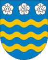
Turčianske Teplice
| Turčianske Teplice | ||
|---|---|---|
| coat of arms | map | |

|
|
|
| Basic data | ||
| State : | Slovakia | |
| Kraj : | Žilinský kraj | |
| Okres : | Turčianske Teplice | |
| Region : | Turiec | |
| Area : | 33.479 km² | |
| Residents : | 6,330 (Dec 31, 2019) | |
| Population density : | 189 inhabitants per km² | |
| Height : | 520 m nm | |
| Postal code : | 039 01 | |
| Telephone code : | 0 43 | |
| Geographic location : | 48 ° 52 ' N , 18 ° 52' E | |
| License plate : | TR | |
| Kód obce : | 512729 | |
| structure | ||
| Community type : | city | |
| Urban area structure: | 4 districts | |
| Administration (as of November 2018) | ||
| Mayor : | Igor Hus | |
| Address: | Mestský úrad Turčianske Teplice Partizánska 1 03901 Turčianske Teplice |
|
| Website: | www.turciansketeplice.sk | |
| Statistics information on statistics.sk | ||
Turčianske Teplice (until 1946 in Slovak Štubnianske Teplice ; until 1927 in Štubňanské Teplice ; in German Bad Stuben ; in Hungarian Stubnyafürdő ) is a town in central Slovakia .
City structure
The city currently consists of the following districts:
- Diviaky (incorporated 1951–1955 and 1971)
- Dolná Štubňa ( lower rooms , incorporated in 1971)
- Turčianske Teplice ( Bad Stuben )
- Turčiansky Michal (incorporated in 1971)
history
The first documentary mention is in 1281. In 1951 the municipality Vieska (German in the Middle Ages Kleindörfl ) was incorporated.
Town twinning
-
 Holešov , Czech Republic
 -
 Havířov , Czech Republic
 -
 Skawina , Poland
 -
 Wisła , Poland
 -
 Aranđelovac , Serbia
Personalities
- Gustav Adolf Riecke (1798–1883), Protestant clergyman and educator from Württemberg, was born in Turčianske Teplice.
- Mikuláš Galanda (1895–1938), painter , graphic artist and illustrator is one of the better known people who were born in Turčianske Teplice.
- Matúš Černák (1903–1955), Slovak politician and diplomat, born in Turčianske Teplice
See also
Web links
Commons : Turčianske Teplice - collection of pictures, videos and audio files

