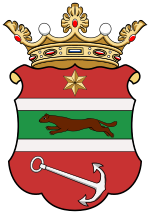
Virovititz county
|
Virovititz County (Verőce / Virovitica) (1910) |
|
|---|---|

|
|
| Administrative headquarters : | Eszék |
| Area : | 4,867 km² |
| Population : | 272.430 |
| Ethnic groups : | 50% Croats 17% Serbs 15% Germans 14% Hungarians 1% Slovaks 3% others ( Slovenes , Russians ) |

|
|
The virovitica county (Hungarian vármegye Verőce , Croatian Virovitička županija ) was a historic administrative unit in the Kingdom of Croatia-Slavonia (Hungarian Horvát-Szlavónország ), an autonomous kingdom under the Hungarian Crown of St. Stephen within the Habsburg monarchy . It was administered by a Croatian ban (viceroy). The county seat was initially in Virovitica (Hungarian Verőce , German Virovititz / Wirowititz ), but was moved to Osijek (Hungarian Eszék , German Esseg ) in the 18th century . The county covered an area of 4,867 km². According to the 1910 census, the county had 272,430 inhabitants.
In the current administrative structure of the Republic of Croatia , the Virovitica-Podravina and Osijek-Baranja counties are roughly in the same area .
District subdivision
In the early 20th century, the county consisted of the following chair districts (named after the name of the administrative center):
| Chair districts (járások) | |
|---|---|
| Chair district | Administrative headquarters |
| Alsómiholjác | Alsómiholjác, today Donji Miholjac |
| Diakovár | Diakovár, today Đakovo |
| Eszék | Eszék, today Osijek |
| Nasic | Nasic, today Našice |
| Szlatina | Szlatina, today Slatina |
| Verőce | Verőce, now Virovitica |
| City district (törvényhatósági jogú város) | |
| Eszék, today Osijek | |
All of the places mentioned are in today's Croatia .
See also
Web links
swell
- ↑ A magyar szent corona országainak 1910. évi népszámlálása . Budapest 1912, p. 12 ff.
- ↑ A magyar szent corona országainak 1910. évi népszámlálása . Budapest 1912, p. 22 ff. (1910 census)


