
Neograd county
|
Neograd County (1910) |
|
|---|---|
_v2.svg)
|
|
| Administrative headquarters : | Balassagyarmat |
| Area : | 4,128 km² |
| Population : | 261,517 |
| Ethnic groups : | 76% Magyars 22% Slovaks 1% Germans |

|
|
The nógrád county (also Neograder County , older even Neuburg ; Hungarian vármegye Nógrád , Slovak Novohradská župa , Latin comitatus Neogradiensis ) is the name of a historic administrative unit (County / County) of the Kingdom of Hungary . It existed in this form until the end of the First World War in 1918, and its direct successors were the Neograd County (Novohradská župa) , which existed in Czechoslovakia until 1922, and the Nógrád county of the same name, which still exists in Hungary today .
The area of the former county is today in southern Slovakia and today's northern Hungary . The Slovak name Novohrad is now used as an unofficial name for this area and as an official name for a tourist region. The name itself is derived from the former castle Neograd (Hungarian Nógrád , Slovak Novohrad ; southwest of Rétság ) in today's Hungary.
location


Neograd County bordered Sohl ( Zólyom ) County in the western north , Gemer and Kleinhont County ( Gömör és Kis-Hont ) in the northeast, Heves County in the southeast, and Pest-Pilis-Solt-Kiskun County in the south and in the west to Hont County . The area of the county stretched roughly along the route Poltár , Lučenec , Szécsény and Vác , was traversed by the Eipel and in 1910 had 261,517 inhabitants on an area of 4,128 square kilometers.
Administrative offices
The administrative seat of the county was first the Neograd castle , then since the 14th century Balassagyarmat (German fair , Slovak Balažské Ďarmoty ). During the Ottoman occupation (see below) there was no administrative seat. In the 18th century Lučenec took over this function for a few years and in 1790 Balassagyarmat again.
history
After the Hungarian conquest in this area, the county was established around the year 1000 as part of the Kingdom of Hungary under the name comitatus Neogradiensis .
Between 1544/1550/1552/1554 and 1606 and between 1663 and 1690 the county was occupied by the Ottomans.
After the Kingdom of Hungary ceased to exist in 1918 as a result of the First World War, the part of the county north of the Eipel River became part of the newly founded Czechoslovakia , the southern part remained with Hungary , which was also confirmed under international law by the Treaty of Trianon in 1920 (for the Hungarian part see Nógrád ).
In Czechoslovakia the county continued to exist until 1922 (Novohradská župa) . 1938–1945 the southern part of Czechoslovakia was occupied by Hungary due to the First Vienna Arbitration . In 1939, shortly before the outbreak of World War II , after Czechoslovakia had been dissolved, the rest of the Czechoslovak part belonged to independent Slovakia . After the war, Czechoslovakia was restored and dissolved again in 1993.
The administrative area of the county was incorporated chronologically as follows:
- 1918–1922: Novohradská župa (Neograd County), CS
- 1923–1928: Zvolenská župa ((Old) Sohler County), CS
- 1928–1939: Slovenská krajina / zem (Slovak Land), CS
- 1940–1945: Pohronská župa ( Gran County), SK
- 1945–1948: Slovenská krajina (Slovak Country), CS
- 1949–1960: Banskobystrický kraj (Neusohler Landschaftsverband - not to be confused with today's), CS
- 1960–1990: Stredoslovenský kraj (Central Slovak Regional Association), CS
- since 1996: Banskobystrický kraj (Neusohler Landschaftsverband), SK
District subdivision
In the early 20th century the following chair districts existed (mostly named after the name of the administrative seat):
| Chair districts (járások) | |
|---|---|
| Chair district | Administrative headquarters |
| Balassagyarmat | Balassagyarmat |
| Nógrád | Rétság |
| Szirák | Szirák |
| Szécsény | Szécsény |
| Fülek, today Fiľakovo | Salgótarján |
| Losonc | Losonc, now Lučenec |
| Gács | Gács, today Halič |
| City district (rendezett tanácsú város) | |
| Losonc, now Lučenec | |
Fiľakovo , Lučenec and Halič are in present-day Slovakia , the other places in present-day Hungary.

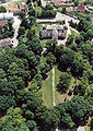
Keszeg

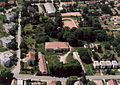
Szécsény Franciscan Abbey
Nézsa

Terske

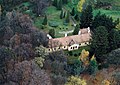
Szirák
Romhány
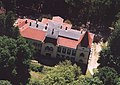
Csesztve

Alsópetény
Alsópetény

Tolmács


See also
- List of traditional regions of Slovakia
- List of historical counties of Hungary
- List of tourist regions of Slovakia
- Administrative division of Slovakia
Web links
- Entry on the county in Meyers Konversationslexikon from 1888
- Entry in the Pallas Lexicon (Hungarian)
swell
- ↑ A magyar szent corona országainak 1910. évi népszámlálása . Budapest 1912, p. 12 ff.
- ↑ A magyar szent corona országainak 1910. évi népszámlálása . Budapest 1912, p. 22 ff. (1910 census)
.png)
Abaúj-Torna (Abaujwar-Tornau) | Alsó-Fehér ( Lower White Castle ) | Arad | Árva (Arwa) | Bács-Bodrog (Batsch-Bodrog) | Baranya (Branau) | Bars (perch) | Békés (Bekesch) | Bereg (mountain) | Beszterce-Naszód (Bistritz-Naszod) | Bihar | Borsod (Borschod) | Brassó (Kronstadt) | Csanád (Chad) | Csík (Tschick) | Csongrád (Tschongrad) | Esztergom (Gran) | Fejér (Weissenburg) | Fogaras (Fogarasch) | Gömör és Kishont (Gemer and Kleinhont) | Győr (Raab) | Hajdú (Haiduck) | Háromszék | Heves (Hewesch) | Hont | Hunyad | Jász-Nagykun-Szolnok (Jaß-Großkumanien-Sollnock) | Kis-Küküllő (Little Kokelburg) | Kolozs (Cluj-Napoca) | Komárom (Komorn) | Krassó-Szörény | Liptó (Liptov) | Máramaros (Maramures) | Maros-Torda | Moson (Wieselburg) | Nagy-Küküllő (Groß-Kokelburg) | Nógrád (Neograd / Neuburg) | Nyitra (Neutra) | Pest-Pilis-Solt-Kiskun (Pest-Pilisch-Scholt-Kleinkumanien) | Pozsony (Pressburg) | Sáros (Sharosh) | Somogy (Shomodj) | Sopron (Ödenburg) | Szabolcs (Saboltsch) | Szatmár (Sathmar) | Szeben (Sibiu) | Szepes (Zips) | Szilágy | Szolnok-Doboka | Temes (Temesch) | Tolna (Tolnau) | Torda-Aranyos | Torontál (Torontal) | Trencsén (Trenčín) | Turóc (fall) | Udvarhely | Ugocsa (Ugoch) | Ung | Vas (Iron Castle) | Veszprém (Wesprim) | Zala | Zemplén (Semplin) | Zólyom (sole)
corpus separatum
Fiume város és területe (City of Fiume and its territory, degree Rijeka i okolica )
Croatia-Slavonia
Belovár-Kőrös (Belovár-Kreutz, Bjelovar-Križevci) |
Lika-Krbava |
Modrus-Fiume (Modruš-Rijeka) |
Pozsega (Požega) |
Szerém (Syrmia, Srijem) |
Varasd (Warasdin, Varaždin) |
Verőce (Virovititz, Virovitica) |
Zágráb (Agram, Zagreb)