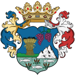
Bihar county
|
Bihar County (1910) |
|
|---|---|

|
|
| Administrative headquarters : | Nagyvárad |
| Area : | 10,657 km² |
| Population : | 646.301 |
| Ethnic groups : | 57% Hungarians 41% Romanians 1% Slovaks 0.5% Germans 0.5% others |

|
|
The Bihar County ( Hungarian vármegye Bihar , Latin Comitatus Bihariensis , Romanian Comitatul Bihor ) was an administrative unit ( county or county ) of the Kingdom of Hungary . Today the smaller part is in Hungary (in today's Hajdú-Bihar and Békés counties ), the larger part in Romania (in Bihor County ).
Location and general
It bordered on the counties of Békés , Hajdú , Szabolcs , Sathmar ( Szatmár ), Szilágy , Klausenburg ( Kolozs ), Torda-Aranyos and Arad .
Bihar County (sometimes also called Biharország in Hungarian ) used to be the largest county in the Transtisian District ( tiszántúli kerület - "District across the Tisza") of Royal Hungary . It covered an area of 10,611 km² (excluding the city of Oradea). The relief of the county was very different: In the east the West Transylvanian Mountains dominated, in the west the Great Hungarian Lowlands . The county formed the majority of the so-called Crișana ( Körösvidék ), as two screech rivers flowed through its area : the Crişul Repede (Rapid Screech) and the Crișul Negru (Black Screech). The area was so large that it was divided into several ethnographic areas (Érmellék, Bihari Mezőség, Rézalja, Sárrét, etc.). Another main river in the area was the Berettyó ( Barcău in Romanian ).
The 1910 census showed a population of 646,301 people. These included 365,642 (57%) Hungarians, 265,098 (41%) Romanians, 3,599 (0.5%) Germans and 8,457 (1%) Slovaks. The Hungarians lived mainly in the plains of the county (which is still largely in Hungary today), the Romanians in the mountains, the Germans in the cities and the Slovaks around the places Suplacu de Barcău (Berettyószéplak) and Șinteu (Sólyomkővár) . 249,613 people identified themselves as Calvinists, 233,159 as Orthodox, 68,019 as Catholics (Roman), 57,488 as Uniate Catholics and 32,462 as Israelites.
District subdivision
In the early 20th century, the county consisted of the following chair districts (named after the name of the administrative center):
| Chair districts (járások) | |
|---|---|
| Chair district | Administrative headquarters |
| Bél | Bél, today Beliu |
| Belényes | Belényes, today Beiuș |
| Berettyóújfalu | Berettyóújfalu |
| Biharkeresztes | Biharkeresztes |
| Cséffa | Cséffa, today Cefa |
| Derecske | Derecske |
| Élesd | Élesd, today Aleșd |
| Érmihályfalva | Érmihályfalva, today Valea lui Mihai |
| Központ | Nagyvárad, today Oradea |
| Magyarcséke | Magyarcséke, today Ceika |
| Margitta | Margitta, now Marghita |
| Nagyszalonta | Nagyszalonta, today Salonta |
| Sárrét | Biharnagybajom |
| Szalárd | Szalárd, today Sălard |
| Székelyhid | Székelyhid, today Săcueni |
| Tenke | Tenke, today Tinca |
| Vaskoh | Vaskoh, today Vașcău |
| City district (rendezett tanácsú város) | |
| Nagyvárad, today Oradea | |
The places Berettyóújfalu , Biharkeresztes , Derecske and Biharnagybajom are in today's Hungary , the remaining places in Romania .
See also
literature
- Bihar . In: Meyers Konversations-Lexikon . 4th edition. Volume 2, Verlag des Bibliographisches Institut, Leipzig / Vienna 1885–1892, p. 929.
Web links
- Entry in the Pallas Lexicon (Hungarian)
Individual evidence
- ↑ A magyar szent corona országainak 1910. évi népszámlálása . Budapest 1912, p. 12 ff.
- ↑ A magyar szent corona országainak 1910. évi népszámlálása . Budapest 1912, p. 22 ff. (1910 census)


