Great Hungarian Plain
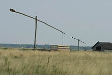
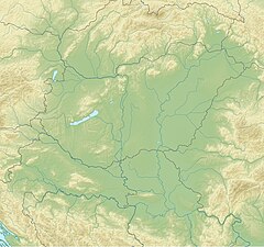
The Great Hungarian Plain ( Hungarian (Nagy-) Alföld , Slovak Veľká dunajská kotlina ) is a part of the Pannonian Plain , which is in the eastern part of Hungary , in parts of Romania , Serbia and Croatia , and on the edge of Slovakia (" East Slovakian Lowlands ") and Ukraine (" Transcarpathian Lowlands "). It is the westernmost part of the Eurasian steppe belt of a large vegetation zone .
It is traversed by the Tisza and the Danube as well as by larger tributaries ( Maros , Körös ) and two main channels of the Tisza called Keleti Canal and Nyugati Canal .
In the west the lowlands are bounded by the Danube , in the north and east by the Carpathian Arch , in the south by the Balkan Mountains .
Important cities of the Great Hungarian Plain are:
- in Hungary Szeged and Debrecen (both ~ 200,000 inhabitants), as well as Kecskemét , Nyíregyháza and Szolnok
- in Romania Timișoara ( Temesvár , ~ 320,000 Ew.) and Arad (both in the Banat ), Oradea (Großwardein) and Satu Mare (Sathmar)
- in Serbia Subotica (Maria Theresiopel), Sombor , Kikinda (all three in the province of Vojvodina ), Zrenjanin and in the south the city of Novi Sad (Neusatz)
- in eastern Slovakia Michalovce and in Carpathian Ukraine Uzhhorod 40 km further east

The Great Hungarian Plain (Nagyalföld) is now mainly cultivated for arable farming . As late as 1850, as a puszta (literally "wasteland") it was often swampy and only suitable for cattle breeding .
The part of the Great Hungarian Plain to the west of the Danube , which is around 10,000 km² in size, is the Mezőföld river plain , which begins between Budapest and Lake Balaton . It extends between Sárvíz and Danube downstream to the Mecsek Mountains (600–700 m) on the southern border with Croatia .
Not to be confused with the similar, but geomorphologically different, Small Hungarian Plain .
It is a huge sedimentary basin of the Alps , which actually continue deep below the Balaton area , Carpathian Mountains and Dinarides .
literature
- Pál Beluszky: Historical geography of the Great Hungarian Plain . (= Studia Hungarica). Schenk, Passau 2006, ISBN 3-939337-11-0

