Puszta
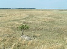
The Puszta , formerly Germanized sometimes written Pußta , is a large landscape in Hungary , the southwestern Slovakia and in today's Austrian Burgenland . The landscape consists of tree-poor steppe with a strongly continental climate . The Puszta is the westernmost branch of a Eurasian vegetation zone ( Eurasian steppe ), which extends from here - with small interruptions e.g. B. through the Carpathian Mountains and the Urals - extends to Mongolia . Until recently it was believed that the Puszta was created in the 16th and 17th centuries by massive clearing, after which the landscape could only be used as pasture , the Hungarian landscape archeology has clearly refuted this picture in recent years and decades differentiated. According to more recent findings, the Puszta emerged as a forest steppe over 35,000 years ago, gradually transformed into a grass steppe over 8,000 years ago and gradually spread over the past 3,000 years as a cultural steppe or secondary steppe, with the time between the 14th and 14th the 18th century. In the following period, especially during the 20th century, the puszta was cultivated for intensive agriculture. Only a few large areas of the old steppe landscape of the Puszta can be found - for example the Hortobágy National Park .
etymology
The term “puszta” is derived from the old Slavic word “pust”, which means something like “barren”, “desolate”, “empty”. In this sense, the derivation “Puszta” can be translated as “wasteland”, “desert”, “barren”, “fallow”, “abandoned” or “undeveloped land”. In the 16th century, the term “puszta” in the sense of “lying fallow” and “undeveloped” was also projected onto unmarried girls. Since the word became independent in Hungarian, the term also stands for extensively and intensively used agricultural areas such as heaths, pasture lands, grass steppes. Ultimately, large estates and farms can also be labeled with it. One of the most famous tourist estates of this type is Szántódpuszta near Szántód ( Somogy County ), which is in the immediate vicinity of Lake Balaton . The word can also be found in the case of managed or at least reforested forest areas or groves. For example, in the term Újberekpuszta (Neuhainpuszta) near the southern Hungarian village of Várdomb in Tolna County . The peasant inns (csárda) typical of the traditional agricultural country of Hungary were and are often called Pusztaschenken or Heideschenken in German . In the course of the resettlement after the Turkish wars , the term has also manifested itself in a number of Hungarian place names. So in the village name Bugac Puszta in the national park of the same name south of Kecskemét ( Bács-Kiskun county ).
Location in Hungary |
geography
The Puszta is a cultural landscape that represents an exclave of the Eurasian steppe and is its westernmost branch. The most important original areas, traditionally characterized by extensive agriculture, can be found in the Hortobágy National Park east of the Tisza , in the Bugac-Puszta in southern Hungary and at Lake Neusiedl , one of the largest steppe lakes in Europe.
history
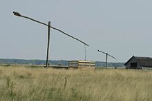
Until a few decades ago, it was believed that the Puszta was almost exclusively a man-made secondary steppe . This was concluded from the existence of old relict forests and from the discovery of the remains of permanent settlements from the Middle Ages in the Puszta. According to this theory, the steppe was created in the 16th and 17th centuries through massive human interventions in the original natural landscape. The steppe formation was attributed to the invasion of the Ottomans , the Turkish occupying power, from 1526, who cleared large areas of the forests and at the same time depopulated villages with drained arable land. The resulting swamping of the land was countered with extensive drainage until the 20th century, which in turn led to desertification. The regulation of the rivers, the forces of which were shown by the changes in the soil during floods, are believed to have contributed to this development. The final end to the original ecological landscape was the salt steppes that are typical of parts of the Hortobágy. According to this older theory, the region is said to have been dominated by swamp forests at the time of King Matthias Corvinus (1458–1490). Soil erosion contributed to the fact that today mostly layers of sand can be found under very thin humus layers. Despite the drainage, the water table remained high in some regions. This also made possible the construction of fountains, the most famous shape of which in the puszta is the Gémeskút (draw well), but this was not the only common form of fountain. In extreme form, the interventions led to salt lakes and quicksand areas. In addition, there were moor meadows and old meadows as intermediate phases to this development. The extensively used Puszta, however, became the habitat of many animal and plant species, some of which are now under species protection, including domestic animal breeds that have become rare, such as the Hungarian steppe cattle, which is about to die out . Until the 1960s, this theory was also widely accepted by Hungarian landscape archeology, an interdisciplinary combination of historical science, archeology, paleobotany, geology and geophysics, because the remains of numerous drainage ditches and settlements were found in sandy, saline or marshy areas.

After that, doubts about this image first increased in history and archeology, because it could not be explained that historical associations from the more eastern steppes, such as the Jazygens , Huns , Avars , Magyars , Pechenegs , Cumans and Jassen , sought the region as a habitat. In which, according to archaeological research, they mostly lived in permanent settlements, but continued their way of life as primary cattle breeders, which required large pastures. Historical-demographic studies on the settlement of the eastern and southern Great Hungarian Plain showed that almost all cities, market towns and villages concentrated on the area around the large rivers, their floodplain. In between, grassland and Puszta were also mentioned in several sources (see adjacent map). More recent geological ( soil pH ) investigations show that steppe landscapes have existed here since the Pleistocene 35–40,000 years ago up to the Middle Ages, which, however, merged more strongly than today near the rivers into forest steppes and alluvial forests ; only 15% of the plain was initially alkaline steppe soil. Paleobotanical ( pollen analysis ) and geological investigations prove that these forest steppes have slowly been transformed into grass steppes since the Copper Age and that they have gradually spread as cultural steppes for 3000 years due to human influences. It is correct, however, that from the 14th to the 18th century many fields and forest islands were destroyed, which resulted in an additional, secondary expansion of the steppes with cattle-rearing by shepherds (especially in the Little Hungarian Plain , in Transdanubia and partly in the river valleys) and the Swamping of some areas resulted in it. Many historians and archaeologists no longer blame the Ottoman conquest from 1526 onwards, but above all the frequent border wars between the three , including those of irregular troops ( Akıncı , Sipahi and Vojnuken on the Ottoman side, Hajduken and hussars on the Christian side) Parts of Hungary, Ottoman Hungary, Royal Hungary and the Principality of Transylvania . The Ottoman conquest of southern and central Hungary in 1526–33 undoubtedly caused a population decline, albeit not as extreme as previously assumed; In the Long Turkish War of 1593–1606 there was a rural exodus from destroyed villages (approx. 20%) and some forests were cleared by the Ottomans to prevent enemy armies, militants and tax refugees from retreating. Further devastation followed with the reconquest of Ottoman-Hungary in the Great Turkish War 1683–99 and finally in the Kuruc uprisings until 1711 against the new central Catholic rule of the Habsburgs . These events undoubtedly led to a further, secondary expansion of the previously existing cultural steppe.
In addition to the depopulation and desertification of former cultivated land and the above-mentioned lowering of the groundwater level through regulation of rivers and irrigation, there are other ecological causes for the formation of the secondary steppe, such as the establishment of invasive long steppe grasses that deny young trees access to light, or overgrazing by livestock ( Domestic cattle , domestic sheep , domestic goats ), sometimes also through wild animals in wild animal enclosures, which eat young trees and keep the landscape open. The later conversion into arable land through amelioration is not an argument, as was sometimes assumed in the past, that there was no steppe at the beginning, because almost all Romanian, Ukrainian and southern Russian steppes were converted to arable land.
See also
literature
- Loránd Benkő (Ed.): Etymological Dictionary of Hungarian . Volume 6, Akadémiai Kiadó, Budapest 1995, ISBN 9630568462
Web links
- Hortobágy National Park Website of the National Park Administration , accessed on June 8, 2014
Remarks
- ↑ Welt online: Unesco World Heritage Europe: Hortobágy National Park - the "Puszta" ( Memento from December 21, 2011 in the Internet Archive )
- ↑ a b Unesco description of the Hortobágy World Natural Heritage with the historical development of the Puszta landscape.
- ↑ Tibor Kestyüs: Studies on the Hungarian loan and foreign words in the German language . In: Finnisch-Ugrische Mitteilungen , Volume 21/22, Buske, 1999, pp. 83 ff .; here: p. 102.
- ↑ Gustav Wendelberger: On the sociology of the continental halophyte vegetation of Central Europe with special consideration of the salt plant communities on Lake Neusiedl. In: Memoranda of the Academy of Sciences, 108, Vienna 1951, p. 13.
- ↑ See e.g. B. Csilla Zatykó: People beyond landscapes: Past, present and future of Hungarian landscape archeology. in: Antaeus 33 (2015), pp. 369–388, which at the end is only devoted to the catchment areas of the Danube and Tisza and Transdanubia .
- ^ Géza Dávid: Towns, villages, depopulated settlements: Population movements in Ottoman Hungary. in: HStud27 (2013) 2, pp. 251–261, here p. 257.
- ↑ Summary of a geological paper by Pál Sümegy, University of Szeged in cooperation with the biological administrations of the national parks in the region and geological, geophysical, nuclear science and archaeological institutes.
- ↑ Enikő Magyari et al .: Holocene persistence of wooded steppe in the Great Hungarian Plain. in: Journal of Biogeography, 2010.
- ^ E.g. William McNeill: Europe's Steppe Frontier 1500–1800. Chicago 2011, pp. 18-20. The Ottoman forays into southern Hungary began in the second half of the 14th century, to which the southern Hungarian rural population, according to McNeill, reacted with a “more archaic pastoralist lifestyle”. But even they do not explain the formation of the Puszta alone, because in Transylvania , also affected , the residents reacted to it with the increased construction of fortified churches without desertification of the landscape.
- ^ Géza Dávid: Towns, villages, depopulated settlements: Population movements in Ottoman Hungary. in: HStud27 (2013) 2, pp. 251–261, there was even a slight demographic increase over the Ottoman period, even if almost 40% had no previous Hungarian population.
- ^ Hungarian Ministry of National Cultural Heritage (ed.): Hungarian Archeology at the Turn of the Millenium. Budapest 2003, pp. 405-413.
- ^ Zs. Molnár et al: Past Trends, Present State and Future Prospects of Hungarian Forest-Steppe. in: Marinus JA Werger, Marija A. van Staalduinen (eds.): Eurasian Steppes. Ecological Problems and Livelihoods in a Changing World. Heidelberg u. a. 2012, pp. 209-252. On p. 241/242 eight reasons for the formation of the cultural steppe of the Puszta are listed.


