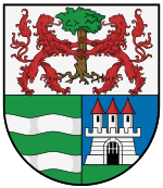
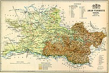
Arad county
|
Arad County (1910) |
|
|---|---|

|
|
| Administrative headquarters : | Arad |
| Area : | 6,048 km² |
| Population : | 414,388 |
| Ethnic groups : | 58% Romanians 30% Hungarians 9% Germans 1% Slovaks 0.5% Serbs 1.5% others |

|
|
The Arad County ( Hungarian vármegye Arad , Latin comitatus Aradiensis / comitatus Orodiensis , Romanian Comitatul Arad ) was an administrative unit ( county or county ) of the Kingdom of Hungary . Today the main part of the area is in Romania (in Arad County ), a small part south of the city of Békéscsaba belongs to Hungary (in today's Békés County ).
Location and general
It bordered on the counties of Békés , Bihar , Torda-Aranyos , Hunyad , Krassó-Szörény , Temes , Torontal and Csanád .
geography
The eastern part of the county was mountainous, the western part was flat, without forests and swampy towards the Tisza. The county was traversed by the rivers Marosch in the south and the White Kreisch in the north. The majority of the inhabitants were Romanians, there were also Hungarians and Germans, the economic production was strongly oriented towards agriculture and forestry (wheat, barley, rye, rape, maize, tobacco, wood, flax, fruit, wine and cattle and beekeeping). In the west , iron mining was also carried out in Borossebes , Dézna , Zimbro and other places.
history
Arad County was established in the 11th century. Later it was part of the so-called partium . After the occupation by the Ottomans, the area came to Eyalet Temeșvar in the 16th century , after the reconquest of the area, parts of the county were part of the military border from 1744 to 1750 , after which it became part of the Kingdom of Hungary again .
During the administrative reform in 1876, the northern Zaránd county was incorporated.
After the end of the First World War in 1918, the county existed after the separation of most of the area to Romania in the Treaty of Trianon until a reform in 1923 with the capital Elek . After that, it was until 1945 part of the county Csanád-Arad-Torontál and then came to the big Komitatsreform 1950, when it became part of today's Békés County , became the csanád county .
The Romanian part of the former county became part of Arad County after 1920 .
District subdivision
In the early 20th century, the county consisted of the following chair districts (named after the name of the administrative center):
| Chair districts (járások) | |
|---|---|
| Chair district | Administrative headquarters |
| Arad | Arad |
| Borosjenő | Borosjenő, today Ineu |
| Borossebes | Borossebes, today Sebiș |
| Elec | Elec |
| Kisjenő | Kisjenő, today Chișineu-Criș |
| Magyarpécska | Magyarpécskam, today Pecica |
| Máriaradna | Máriaradna , today Radna |
| Nagyhalmágy | Nagyhalmágy, today Hălmagiu |
| Tornova | Tornova, today Târnova |
| Világos | Világos, today Șiria |
| City district (törvényhatósági jogú város) | |
| Arad | |
The place Elek is in today's Hungary , the remaining places in Romania .
See also
literature
- Arad . In: Meyers Konversations-Lexikon . 4th edition. Volume 1, Verlag des Bibliographisches Institut, Leipzig / Vienna 1885–1892, p. 734.
Web links
- Entry in the Pallas Lexicon (Hungarian)
Individual evidence
- ↑ A magyar szent corona országainak 1910. évi népszámlálása . Budapest 1912, p. 12 ff.
- ↑ A magyar szent corona országainak 1910. évi népszámlálása . Budapest 1912, p. 22 ff. (1910 census)

