Taubertal panorama trail
| Taubertal panorama trail | |
|---|---|
 Panoramaweg Liebliches Taubertal |
|
| Data | |
| length | 133.3 km |
| location |
Ansbach , district of Würzburg , Main-Tauber-Kreis |
| Starting point |
Rothenburg ob der Tauber 49 ° 22 ′ 49.6 ″ N , 10 ° 10 ′ 34.5 ″ E |
| Target point |
Freudenberg 49 ° 44 ′ 31.6 ″ N , 9 ° 19 ′ 20.5 ″ E |
| Type | Long-distance hiking trail |
| Level of difficulty | light |
| season | all year round |
The Panoramaweg Taubertal (also Panoramaweg Liebliches Taubertal ) is a 133.3 kilometer hiking trail through the Taubertal and the adjacent Main Valley . The route runs from Rothenburg ob der Tauber to Freudenberg am Main. The hiking trail is divided into five stages and four extra tours.
route
| Taubertal panorama trail | |||||||||||||||||||||||||||||||||||||||||||||||||||||||||||||||||||||||||||||||||||||||||||||||||||||||||||||||||||||||||||||||||||||||||||||||||
|---|---|---|---|---|---|---|---|---|---|---|---|---|---|---|---|---|---|---|---|---|---|---|---|---|---|---|---|---|---|---|---|---|---|---|---|---|---|---|---|---|---|---|---|---|---|---|---|---|---|---|---|---|---|---|---|---|---|---|---|---|---|---|---|---|---|---|---|---|---|---|---|---|---|---|---|---|---|---|---|---|---|---|---|---|---|---|---|---|---|---|---|---|---|---|---|---|---|---|---|---|---|---|---|---|---|---|---|---|---|---|---|---|---|---|---|---|---|---|---|---|---|---|---|---|---|---|---|---|---|---|---|---|---|---|---|---|---|---|---|---|---|---|---|---|---|
|
|||||||||||||||||||||||||||||||||||||||||||||||||||||||||||||||||||||||||||||||||||||||||||||||||||||||||||||||||||||||||||||||||||||||||||||||||
Profile and characteristics
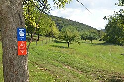
The Taubertal Panorama Trail leads from Rothenburg ob der Tauber to Freudenberg am Main on mostly natural paths, surrounded by vineyards, fields and mixed forests, along the course of the Tauber river . Traces of times past can be discovered on the route, for example the medieval town of Rothenburg ob der Tauber, Weikersheim Castle, the Teutonic Order Museum in Bad Mergentheim and the Bronnbach Monastery . The path is signposted throughout and indicates restaurants, accommodation and sights.
Stages
1st stage: Rothenburg ob der Tauber - Creglingen
The path runs from Rothenburg to Creglingen through the Taubertal for 21.8 kilometers. The path goes through woods and grasslands, along the stone bar landscape typical of the region , with a view of numerous mills.
2nd stage: Creglingen - Bad Mergentheim
The second stage runs over 31.9 kilometers past several castles, palaces, forests and vineyards.
3rd stage: Bad Mergentheim - Tauberbischofsheim
The route runs over 27.9 kilometers from Bad Mergentheim to Tauberbischofsheim through mixed and beech forests, past wayside shrines and vineyards and offers several options for viewing the Taubertal.
4th stage: Tauberbischofsheim - Wertheim
The fourth stage leads from Tauberbischofsheim to Wertheim past red sandstone terraces. The route length is 25.7 kilometers. The path goes past nature reserves and terraced vineyards. The path offers views of Tauberbischofsheim and Gamburg Castle . The monastery Bronnbach is also on the stage.
5th stage: Wertheim - Freudenberg
The path of the fifth stage leads from Wertheim to Freudenberg. Castle ruins line the stage along the Main. The route runs over 26 kilometers. The path offers several views of the Main Valley. The conclusion of the Taubertal panorama path is formed by the 440 steps down into the valley to Freudenberg.
Further stages
The Taubertal Panorama Trail has four additional tours:
1. Tour: Vorbachtal-Hohenlohe
The first extra tour runs on a 27-kilometer circuit from Weikersheim via Laudenbach, Niederstetten, Wermutshausen and Laudenbach back to Weikersheim.
2. Tour: To the "High Lord God" on the heights
The circuit runs over a length of 25.6 kilometers from Tauberbischofsheim via Königheim and Külsheim to Bronnbach. From there, you can take the train or bus to Tauberbischofsheim. Route length approx. 25.6 kilometers.
3. Tour: To sacred art monuments
The third extra tour leads from Tauberbischofsheim via Grünsfeldhausen, Grünsfeld, Gerlachsheim and Lauda back to Tauberbischofsheim. From Lauda, the route can also be covered by train or bus. The length of the route is about 15 kilometers.
4th tour: Frankendom and Umpfertal
The fourth tour leads from Bad Mergentheim via Dainbach, Scheigern, Boxberg, Schweigern and Unterschüpf to Königshofen. The route length is 25 kilometers.
connections
There are several train stations and bus stops along the route. By train, it is possible to travel from Freudenberg am Main via Wertheim with the Taubertalbahn to Schrozberg near Rothenburg ob der Tauber.
Culture and sights
-
Rothenburg ob der Tauber
- Historic city walls with towers, town hall, Das Plönlein
- Castle, castle garden and castle garden gate
- Medieval crime museum, historic Tauber Bridge
- St. Jacob's Church with Holy Blood reredos by Tilman Riemenschneider , St. Wolfgang's Church
-
Creglingen
- medieval town center, Herrgottskirche with St. Mary's altar by Tilman Riemenschneider
- Thimble Museum , Fire Brigade Museum , Jewish Museum and Lindlein Tower Museum
- Frauental monastery with museum
-
Röttingen
- Medieval town center with walls and towers, Brattenstein Castle
- City parish church St. Kilian, hospital church St. Peter and Paul, chapel St. Georg
- Sundial path, wayside shrine, wine museum with museum vineyard
-
Weikersheim
- Bergkirche Laudenbach, Evangelical town church
- Tauberland village museum, city museum, forest museum, observatory and game reserve
- Gänsturm, historic old town
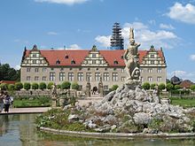
- Weikersheim Castle with a baroque garden with many statues, alchemy exhibition
-
Igersheim
- St. Michael Church
- Neuhaus Castle
-
Bad Mergentheim (health resort)
- Historic downtown
- Spa and palace park with a total area of 160,000 m²
- Teutonic Order Museum in the Teutonic Order Castle , twin houses on the market square
- Deutschmeistermuseum, Münsterschatz, Ottmar-Mergenthaler memorial, Stuppach Madonna, wine trail
- "Solymar" leisure pool and three outdoor pools
- Wildlife Park Bad Mergentheim , on an area of around 35 hectares, various animal species native to Europe live
-
Lauda-Koenigshofen
- Medieval old town with city gate (Upper Gate)
- Steam locomotive monument
- Powder tower
- Local history museum, city library
- City church St. James from the 14th century with rich baroque furnishings
- Outdoor terrace and indoor pool with sauna
-
Tauberbischofsheim
- Historical old city,
- Kurmainzisches Schloss with Tauberfränkisches Landscape Museum
- Türmersturm , hunger tower with remains of the medieval city wall
- Neo-Gothic town hall
- City Church St. Martin , Liobakirche, Bonifatiuskirche , Peterskapelle
- Olympic base Tauberbischofsheim the fencing club Tauberbischofsheim
- Solar-heated Frankenbad , as well as an indoor pool with sauna
-
Gamburg
- Gamburg Castle
- Buschermuseum
-
Wertheim
- Historic old town with city wall and many architectural monuments
- Wertheim Castle , one of the oldest castle ruins in Baden-Württemberg
- Glass museum and county museum with Otto Modersohn cabinet in the old town hall
- Pointed Tower , Angel Fountain, Kittstein Gate
- St. Mary's Church, Evangelical Collegiate Church, Kilian's Chapel
- Castle in the courtyard garden
-
Freudenberg
- Freudenburg
- Historic old town with half-timbered houses
- St. Laurentius Chapel, Town Hall
Awards
Since 2012, the Panoramaweg has been recognized as a "Quality Trail for Hikers in Germany".
literature
- Fernwanderweg Panoramaweg Taubertal, 135 km: hiking through vineyards and mixed forests in the lovely Taubertal, hiking guide and map, 1: 35,000, weatherproof. Hikeline, Esterbauer 2009, ISBN 978-3-85000-507-4 .
- Leisure map 512 of the State Office for Geoinformation and Rural Development "Unteres Taubertal", 2015, ISBN 978-3-86398-388-8 .
- Leisure map 515 of the State Office for Geoinformation and Rural Development "Baden-Württemberg", 2015, ISBN 978-3-86398-391-8 .
- Dieter Buck: Gourmet tours - In the lovely Taubertal: walking, hiking. Silberburg-Verlag, Tübingen 2015, ISBN 978-3-8425-1391-4 .
Web links
- The Taubertal Panorama Trail on the website liebliches-taubertal.de
- The Taubertal Panorama Trail on geo-coaching.net
- The Taubertal Panorama Trail on the website die-schoensten-wanderwege.de
- The Taubertal Panorama Trail on the wanderkompass.de website
- The Taubertal Panorama Trail on the frankentourismus.de website
- The Taubertal Panorama Trail on the wandersüden.de website
- The Taubertal Panorama Trail on the outdooractive.com website
Individual evidence
- ↑ a b c Tourism Association "Liebliches Taubertal": Hiking - Panorama Trail . Online at www.liebliches-taubertal.de. Retrieved August 25, 2016.
- ^ "Liebliches Taubertal" tourist office: Panorama trail - 1st stage . Online at www.liebliches-taubertal.de. Retrieved August 25, 2016.
- ↑ "Liebliches Taubertal" tourist office: Panorama trail - 2nd stage . Online at www.liebliches-taubertal.de. Retrieved August 25, 2016.
- ↑ Tourism association "Liebliches Taubertal": Panoramaweg - 3rd stage . Online at www.liebliches-taubertal.de. Retrieved August 25, 2016.
- ↑ Tourism association "Liebliches Taubertal": Panoramaweg - 4th stage . Online at www.liebliches-taubertal.de. Retrieved August 25, 2016.
- ^ "Liebliches Taubertal" tourist office: Panorama trail - 5th stage . Online at www.liebliches-taubertal.de. Retrieved August 25, 2016.


