
Main cycle path
| Main cycle path | |
|---|---|
|
|
|
| overall length | approx. 600 km |
| location |
|
| map | |
 |
|
| Overview map with distance information | |
| Starting point | Creußen ( Bf ) or Bischofsgrün |
| Target point | Mainz ( Bf ) |
| Places along the way | Kulmbach ( Bf ), Bayreuth ( Bf ), Mainleus ( Bf ), Altenkunstadt , Burgkunstadt ( Bf ), Marktzeuln , Lichtenfels ( Bf ), Bad Staffelstein ( Bf ), Ebensfeld ( Bf ), Zapfendorf ( Bf ), Breitengüßbach ( Bf ), Kemmern , Hallstadt ( Bf ), Bamberg ( Bf), Eltmann ( Bf ), Zeil am Main ( Bf ), Haßfurt ( Bf ), Schweinfurt ( Bf ), Grafenrheinfeld , Volkach , Dettelbach ( Bf ), Kitzingen ( Bf ), Ochsenfurt ( Bf ), Eibelstadt ( Bf ), Randersacker , Würzburg ( Bf ), Zell am Main , Veitshöchheim ( Bf ), Zellingen ( Bf ), Karlstadt ( Bf ), Gemünden am Main ( Bf ), Lohr am Main ( Bf ), Marktheidenfeld , Wertheim ( Bf ), Stadtprozelten ( Bf ), Freudenberg am Main ( Bf ), Miltenberg am Main ( Bf ), Großheubach , Klingenberg am Main ( Bf ), Obernburg am Main , Kleinwallstadt ( Bf ), Niedernberg , Aschaffenburg ( Bf ), Stockstadt am Main ( Bf ), Seligenstadt ( Bf ) , Hainburg ( Bf ), Hanau ( Bf ), Mühlheim am Main ( Bf ), Offenbach ( Bf ), Frankfurt am Main ( Bf ), Kelsterbach ( Bf ), Hattersheim , Flörsheim ( Bf ), Rüsselsheim am Main ( Bf ), Hochheim ( Bf ) |
| Height difference | approx. 420 m to approx. 90 m / approx. 1790 m ascent / approx. 2290 m of descents Weißer Main plus 326 m / 443 m of red main |
| difficulty | Section Bad-Staffelstein - Mainz easy |
| Traffic volume | low |
| ADFC certification | no |
| Website URL | www.mainradweg.de |
The Main-Radweg is a 600-kilometer long -distance cycle path in Bavaria and Hesse. It begins at the source of the White Main at Ochsenkopf near Bischofsgrün and at the source of the Red Main in Creußen . After about 50 km each, the two spring arms merge at Kulmbach to form the Main . The Main Cycle Route continues from there via Bamberg , Schweinfurt , Würzburg , Aschaffenburg , Hanau , Offenbach and Frankfurt to the Rhine in Mainz-Kastel , which is opposite the center of Mainz . The Main Cycle Path runs through the Franconian holiday areas of the Fichtel Mountains , Franconian Switzerland , Franconian Forest , Upper Maintal-Coburger Land, Steigerwald , Haßberge , Franconian Wine Country, Liebliches Taubertal, Spessart-Mainland and the Hessian Lower Main area.
Path quality
The General German Bicycle Club (ADFC) awarded the route five stars in 2008 as the first German long-distance cycle route. According to the ADFC, 90% of the cycle path lead through natural and scenic areas. Furthermore 90% is paved, and 77% of the route is wider than 2.50 meters. Only one side of the bank is signposted, although the banks of the Main are accessible by bike on both sides. Furthermore, there are numerous ADFC-awarded Bett + Bike businesses on the Main Cycle Path, which stand for the highest quality, as well as other bike-friendly hosts. The Main Cycle Path is also signposted uniformly along the entire route and indicates the distances to the next places.
- Views of the Main cycle path

Information sign at a cycle path crossing in Miltenberg

The Main cycle path through an avenue of fruit trees near Mainklein
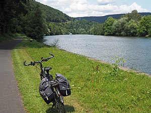
The Main cycle path near Freudenberg


Connection to other major bike paths
- Rhine cycle path on the right bank of the Rhine between Mainz-Kostheim and Mainz-Kastel (districts of Wiesbaden), opposite the center of Mainz with a view of the cathedral
- Hessian long-distance cycle route R3 between the mouth of the Main and Hanau, same or parallel course
- Hessian long-distance cycle route R4 in Maintal (Rumpenheim – Bischofsheim ferry)
- Hessischer Radfernweg R6 in Mainz Kostheim (Main Bridge), district of Wiesbaden
- Hessian long-distance cycle route R8 in Frankfurt-Höchst (Mainbrücke)
- German Limes cycle path between Großkrotzenburg and Miltenberg, same or parallel route
- Kahltal-Spessart cycle path
- Main-Tauber-Franconian wheel eight
- Main-Werra cycle path
- Taubertal cycle path
- Wern cycle path
- Saale cycle path
Awards
The Main Cycle Path was awarded five stars as a quality route in 2008 by the General German Bicycle Club ( ADFC ) as the first cycle path in Germany.
literature
- bikeline bike tour book Main-Radweg , 1: 75,000. Esterbauer publishing house, Rodingersdorf 2000, ISBN 978-3-85000-023-9 .
- BVA Kompaktspiralo Main-Radweg , 1: 75,000. Bielefelder Verlag, Bielefeld 2011, ISBN 978-3-87073-498-5 .
- Cycle route map Main Cycle Route 1 - Creußen / Ochsenkopf – Würzburg , 1: 50,000. Publicpress-Verlag, Geseke 2006, ISBN 978-3-89920-267-0 .
- Cycle tour map Main Cycle Route 2 - Würzburg – Mainz , 1: 50,000. Publicpress-Verlag, Geseke 2007, ISBN 978-3-89920-319-6 .
Web links
- Official website for the Main Cycle Route
- Directions and overview map from Esterbauer.
- Bike tour wiki: Main
- Main cycle path. BicycleRoutes & Tours, with map, GPS download, elevation profile, sights and accommodations
Individual evidence
- ↑ Main Cycle Path - information and tour tips at www.eurobike.at, accessed on June 13, 2019
- ↑ ADFC quality cycle routes and cycle travel regions on www.adfc.de, accessed in June 2019.
- ↑ Areas on the Main Cycle Path
- ↑ n-tv.de, Main-Radweg awarded - five stars from ADFC , Aug. 27, 2008
- ↑ Trekkingbike.com: ADFC-5-Star-Tour: Main-Radweg. 530 km of quality bike route with the highest distinction . Online at www.trekkingbike.com. Retrieved August 20, 2016.
- ↑ t-online.de: The ten most popular bike paths in Germany 2013 . February 19, 2014. Online at www.t-online.de. Retrieved August 20, 2016.
Coordinates: 50 ° 1 ′ 46 ″ N , 11 ° 49 ′ 26 ″ E