
Lichtenfels (Upper Franconia)
| coat of arms | Germany map | |
|---|---|---|

|
Coordinates: 50 ° 9 ' N , 11 ° 4' E |
|
| Basic data | ||
| State : | Bavaria | |
| Administrative region : | Upper Franconia | |
| County : | Lichtenfels | |
| Height : | 273 m above sea level NHN | |
| Area : | 122.27 km 2 | |
| Residents: | 20,142 (Dec. 31, 2019) | |
| Population density : | 165 inhabitants per km 2 | |
| Postal code : | 96215 | |
| Area code : | 09571 | |
| License plate : | LIF, STE | |
| Community key : | 09 4 78 139 | |
| City structure: | 28 districts | |
City administration address : |
Marktplatz 1 and 5 96215 Lichtenfels |
|
| Website : | ||
| Mayor : | Andreas Hügerich ( SPD ) | |
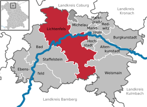
| Location of the city of Lichtenfels in the Lichtenfels district | ||
  |
||


Lichtenfels is a middle center and at the same time the district town of the Lichtenfels district in the Bavarian administrative district of Upper Franconia . It belongs to the Nuremberg Metropolitan Region .
geography
Geographical location
Lichtenfels is located in Upper Franconia in the Obermainland or Obermaintal between Bamberg and Coburg in the so-called God's Garden on the Obermain (with the Banz monastery and the Vierzehnheiligen basilica ). The city is considered a German basket city .
To the north of the center, the Main flows through the urban area.
|
Fulda (110 km) |
Erfurt (90 km) Coburg (15 km) |
Leipzig (160 km) Berlin (310 km) |
|
Frankfurt / M. (170 km) Schweinfurt (60 km) |
.svg)
|
Cheb (95 km) Prague (240 km) |
|
Würzburg (90 km) Stuttgart (200 km) |
Bamberg (30 km) Nuremberg (80 km) Munich (230 km) |
Bayreuth (45 km) Weiden / Opf. (95 km) |
* Distances are rounded kilometers to the town center.
City structure
The following 28 districts belong to the city:
| district | Residents | was standing | Incorporation into the city of Lichtenfels |
|---|---|---|---|
| Lichtenfels - core city | 11065 | Oct 31, 2016 | |
| Oberwallenstadt | included in the core city | Oct 31, 2016 | Apr 1, 1959 |
| Unterwallenstadt | included in the core city | Oct 31, 2016 | Apr 1, 1959 |
| Seubelsdorf | 1108 | Oct 31, 2016 | May 1, 1978 |
| Schney | 2316 | Oct 31, 2016 | May 1, 1978 |
| Mistletoe field | 924 | Oct 31, 2016 | Jan. 1, 1974 |
| Reundorf | 592 | Oct 31, 2016 | May 1, 1978 |
| Drive | 576 | Oct 31, 2016 | Jan. 1, 1978 |
| Book at the forest | 554 | Oct 31, 2016 | Jan. 1, 1978 |
| Kösten | 540 | Oct 31, 2016 | Jan. 1, 1975 |
| Roth | 477 | Oct 31, 2016 | Jan. 1, 1978 |
| Isling | 391 | Oct 31, 2016 | Jan. 1, 1978 |
| Klosterlangheim | 375 | Oct 31, 2016 | July 1, 1974 |
| Oberlangheim | 242 | Oct 31, 2016 | Jan. 1, 1978 |
| Stetten | 178 | Oct 31, 2016 | Jan. 1, 1975 |
| Schönsreuth | 156 | Oct 31, 2016 | Jan. 1, 1975 |
| Rothmannsthal | 153 | Oct 31, 2016 | Jan. 1, 1978 |
| Mönchkröttendorf | 141 | Oct 31, 2016 | Jan. 1, 1975 |
| Lame | 102 | Oct 31, 2016 | Jan. 1, 1978 |
| Deep red | 88 | Oct 31, 2016 | Jan. 1, 1975 |
| Vineyard | 86 | Oct 31, 2016 | July 1, 1972 |
| Köttel | 85 | Oct 31, 2016 | Jan. 1, 1978 |
| Eichig | 76 | Oct 31, 2016 | Jan. 1, 1978 |
| Krappenroth | 61 | Oct 31, 2016 | Apr 1, 1959 |
| Degendorf | 30th | Oct 31, 2016 | Jan. 1, 1978 |
| Seehof | 24 | Feb 8, 2016 | May 1, 1978 |
| Gnellenroth | 20th | Feb 8, 2016 | Jan. 1, 1975 |
| hammer | 8th | Feb 8, 2016 | Jan. 1, 1978 |
There are the districts Buch a.Forst, Burgberg, Forst Buch a.Forst, Isling, Kösten, Köttel, Lahm b.Lichtenfels, Langheim , Lichtenfels, Mistelfeld, Mönchkröttendorf, Oberlangheim, Oberwallenstadt, Reundorf, Roth, Rothmannsthal, Schney, Seubelsdorf, Stetten, Trieb, Weingarten.
history
Until the 20th century
According to archaeological excavations, Lichtenfels already existed in the early Middle Ages, i.e. since the 7th / 8th centuries. Century. It was mentioned for the first time in 1142. From 1231, the town charter granted by Otto VIII, Duke of Merania , applies .
After the Meranians died out in 1248, Lichtenfels fell to the Bamberg Monastery , which was part of the Franconian Empire from 1500 onwards. With this, the office of Lichtenfels was incorporated into the Electorate and later Kingdom of Bavaria during the secularization in 1802 .
Among the Ministerialengeschlechtern the region who were among men of Lichtenfels , who were tribal and arms related to other neighboring families.
The people of Lichtenfels are mockingly called “pool creators” (spoken: Dümblschöbfä ). They were given this name after the Thirty Years' War when they tried to retrieve the city treasure, which had been sunk in a lake (pond), by scooping up the water, but could not do so because the groundwater flowed too quickly.
In 1840 there were 1902 people in Lichtenfels.
During the Second World War , on February 23, 1945, Lichtenfels was the target of an attack by the 8th US Air Force as part of Operation Clarion . 13 heavy four-engine bombers of the type B-17 "Flying Fortress" dropped 39 tons of bombs on the city. The depot was destroyed.
Incorporations
On October 1, 1929, the previously independent municipality of Burgberg was incorporated. On April 1, 1959, the municipality of Oberwallenstadt was incorporated with the places Oberwallenstadt, Unterwallenstadt and Krappenroth. A part of the community Weingarten, the places Weingarten and Heinach , was added on July 1, 1972. Mistelfeld was added on January 1, 1974. Klosterlangheim followed on July 1, 1974, Kösten, Mönchkrottendorf and Stetten on January 1, 1975. Isling, Köttel, Lahm bei Lichtenfels, Oberlangheim, Roth, Trieb and the community of Rothmannsthal formed by hiving off the community of Arnstein in 1864, as well as parts of the dissolved Buch am Forst municipality were incorporated on January 1, 1978. Also on January 1, 1978, the municipality-free area of Forst Buch am Forst was incorporated (area on October 1, 1966: 943.30 hectares). With the incorporation of Reundorf, Schney and Seubelsdorf on May 1, 1978, the series of incorporations was essentially completed. On January 1, 1989, a larger uninhabited forest area was incorporated, the largest part of the dissolved parish -free area Langheim , 1489.57 of a total of 1526.68 hectares.
Population statistics
In the period from 1988 to 2018, the population decreased minimally from 20,252 to 20,133 by 119 or 0.6%. On December 31, 2002, Lichtenfels had the highest population of the previous 30 years with 22,558.
Denomination statistics
According to the 2011 census , in 2011 30.3% of the population were Protestant , 54.2% were predominantly Roman Catholic and 15.4% were non-denominational , belonged to another religious community or did not provide any information. The number of Protestants and Catholics has fallen since then. Currently (as of November 1, 2019) Lichtenfels has 20,369 inhabitants, 50.0 percent Catholics , 27.5 percent Protestants and 22.5 percent have either another religion or no religion.
politics
City council
After the local elections on March 15, 2020 , the city council will be composed as follows:
| Party / list | Share of votes | Seats | G / V |
|---|---|---|---|
| SPD | 28.5% | 8th | - 1 |
| CSU | 26.5% | 8th | - 1 |
| Green | 12.1% | 4th | + 1 |
| AfD | 4.6% | 1 | + 1 |
| FW / FB (Free Voters - Free Citizens Lichtenfels) | 10.0% | 3 | - 1 |
| JB (Young Citizens) | 9.5% | 3 | ± 0 |
| WLJ (Voters' Association Leuchsental-Jura) | 8.8% | 3 | + 1 |
| total | 100% | 30th | |
| Turnout: 57.9% | |||
W / L = change compared to the previous composition
The city council also includes the first mayor.
mayor
- since 2014: Andreas Hügerich (SPD)
- 2002–2014: Bianca Fischer (non-party, nominated by CSU and Junge Bürger (JB))
- 1991–2002: Winfred Bogdahn (SPD)
- 1959–1991: Günther Hauptmann (CSU)
- 1958: Otto Betz (CSU)
- 1951–1958: Johann Unrein (until 1952 CSU, then Free Voting Group)
- 1945–1951: Julian Wittmann (CSU)
- 1945: Baptist Hofmann
- 1938–1945: Wilhelm Krautheim (NSDAP)
- 1930–1938: Josef Ullenberger
- 1928–1930: Norbert Schier
- 1912–1928: Andreas Mahr (liberal)
- 1870–1912: Adam Wenglein (liberal)
Town twinning
-
 Prestwick , Scotland (since 1974)
 -
 Vandalia (Ohio), United States (since 1975)
 -
 Cournon-d'Auvergne , France (since 1992)
 -
 Ariccia , Italy (since 2004)
There is also a city friendship with Bad Bergzabern and the Berlin district of Reinickendorf .
![]()
![]()
Sponsorships
In 1978 the sponsorship for the expelled Sudeten Germans from the municipality of Altendorf in the district of Bärn and in 1986 from the market community of Deutsch Häuser in the district of Sternberg was taken over.
Regional importance
Lichtenfels is a middle center and district town of the district of the same name with the seat of the district office. The city is also the seat of a local court , the tax office, a branch of the Federal Employment Agency and a police station. The district medical center is located in Lichtenfels. There is, for example, a department store in the pedestrian zone as well as branches of larger hardware store chains and hypermarkets on the “green meadow”. The pedestrian zone is also easy to reach for drivers thanks to two parking garages in the immediate vicinity. In 2012 a new shopping center opened in the north of the city.
Public facilities

The city of Lichtenfels, partly in cooperation with the Lichtenfels district , and the Lichtenfels municipal utilities operate several public institutions. The most important are:
- the youth center
- the city museum (with changing exhibitions on the city's history and development)
- the former synagogue (cultural meeting place and place for events and exhibitions)
- two pools, the leisure pool Merania and a river pool on the Main
- a camp site
- the city palace, which is used for cultural events such as concerts and theater performances
- two parking garages
- a public library in the town hall
- the town hall (supraregional venue for concerts and events)
- a cross-country ski run in winter
- an office of the Office for Food, Agriculture and Forests Coburg
Denominations
In addition to the Roman Catholic and Protestant Churches, a Free Church Free Christian Congregation, the Jehovah's Witnesses and the New Apostolic Church are also represented in Lichtenfels . Further, in Lichtenfels a mosque of DITIB .
Economy and Infrastructure

economy
Basket trade

Lichtenfels became a center of the basket trade from the middle of the 19th century . Basket makers from the area in the Upper Main Valley brought their products to dealers in Lichtenfels, who sold them wholesale and retail. The leading entrepreneur was the basket dealer Joseph Krauss. A basket school was opened in 1904, and from 1912 there were also braiding courses for women, as baskets were very often made by the whole family at home. After the First World War , Lichtenfels acquired the title Deutsche Korbstadt . Since basket making in Germany practically died out in the period after the Second World War , the remaining basket merchants now focus exclusively on importing wicker products.
Established businesses
The city, with around 20,000 inhabitants, has an above-average employment rate, which is mainly due to the success of the numerous small and medium-sized companies. Traditionally, several companies from the upholstered furniture sector and the associated supplier industry, such as B. Wood processing and foam production settled in Lichtenfels. But also companies from the fields of machine, tool and model construction as well as the plastics processing industry can be found. The area of tool and model making (Hofmann Innovation Group GmbH) and a company operating in this area that builds and develops machines for selective laser melting ( Concept Laser GmbH ) have shown themselves to be very innovative and export-oriented . The shipping industry is also represented by a large, internationally operating company.
The most important companies are:
- Panzer & Kraus GmbH & Co. KG (waste management company)
- Hofmann Innovation Group GmbH (toolmaking Siegfried Hofmann GmbH, Modellbau Robert Hofmann GmbH, Concept Laser GmbH)
- Comfort and living (Himolla Group) (upholstered furniture)
- Veenendaal foam factories
- M + S Piano-Express GmbH (formerly Kraus & Pabst GmbH), (international shipping company)
- InnoTech special machines and devices GmbH
- Schmolke (furniture center)
- Horst Müller Kunststoffe GmbH
- Schwab & Gick Lichtenfels (SGL)
- AW-GmbH (plastic color concentrates)
- Lifocolor Farben GmbH & Co. KG (plastic color concentrates)
- Rießner Gase GmbH (technical and medical gases)
- KnorrPrandell (world's largest wholesaler for handicraft and decoration supplies) renamed Gütermann in 2008
- Kuehne + Nagel branch Lichtenfels (international freight forwarding)
- Ziel GmbH (software for travel agencies)
- The "Weidenwerk", a specialist shop for wickerwork design, right on the market / town hall

Other important employers for the city and the region are the Lichtenfels Clinic and the Sparkasse Coburg - Lichtenfels , both of which are among the hundred largest Upper Franconian employers.
Business associations
- Industry and trade committee Lichtenfels
- Lichtenfels district craftsman's association with training yard
- Bavarian Farmers' Association , Lichtenfels office
traffic


Road traffic
The federal highways 173 and 289 run through the city area. The B 173 is built like a motorway and was upgraded from Bamberg to Lichtenfels to federal motorway 73 at the beginning of 2008 . On September 5, 2008, the A73 coming from the north between Lichtenfels and Coburg was opened to traffic. Since then, the B 173 has branched off from the A 73 between the Seubelsdorf and Reundorf districts.
Rail transport
The first route through Lichtenfels was the Bamberg – Hof line on the Ludwig-Süd-Nord-Bahn . This was followed by the Werra railway branching off at Lichtenfels station , which led to Eisenach before the Second World War . Today the route via Coburg to Sonneberg is used. The Hochstadt-Marktzeuln – Probstzella railway branches off a little north of Lichtenfels . Until the timetable change in December 2017, Lichtenfels was a two-hour system stop on the ICE line Hamburg - Berlin - Munich . With the commissioning of the Nuremberg – Erfurt high-speed line , this stop was omitted because the new line passed Lichtenfels to the west, and since then only one ICE has been running to Munich every day. The closest regular long-distance traffic stop is Bamberg . There is also regional transport in the direction of Sonneberg, Coburg, Nuremberg, Bamberg, Saalfeld and Hof / Bayreuth.
Lichtenfels has been a member of the Greater Nuremberg Transport Association since January 1, 2015 .
air traffic
Through the airfield Lichtenfels , the city is also in the aviation sector. The airfield has a 700 m long grass runway and is approved for a maximum take-off weight of 3.7 tons.
Local transport
Stadtwerke Lichtenfels operates local public transport in cooperation with a local bus company. There are a total of six bus routes in the city and the surrounding villages, some of which are operated every half hour.
Hiking trails
The Franconian Marienweg runs through Lichtenfels .
Education and Research

General education schools
- Merano high school
- 4 primary schools
- Lichtenfels private business school
- School center on the Friedenslinde with
- Herzog Otto School (middle school)
- music school
Vocational schools
- State vocational school for wickerwork design
- State vocational school with a technical college for computer science
- Nursing school
- Maintal Vocational School for Cosmetics
- Private vocational school for geriatric care help
Special schools
-
Maximilian Kolbe School Center
- School for individual coping with life
- St. Catherine Support Center
- School for individual learning support
Adult education
- Adult Education Center (main office Lichtenfels)
- School for village and field renewal (in the convent building of the former Langheim monastery in the Klosterlangheim district )
Research and innovation institutions
In July 2019 it became known that the “Research and Application Center for Digital Future Technologies” (FADZ) is to be built in the former cherry tree mill in Lichtenfels. This initiative is based on a cooperation between the city and the district of Lichtenfels, the University of Coburg and the entrepreneur Frank Herzog from Lichtenfels. The FADZ begins with activities in the field of additive manufacturing and, in addition to research projects with partners from industry, application advice and knowledge transfer, will also include numerous training and further education offers.
The FADZ is investing 8.4 million euros in buildings, teaching facilities and laboratories on an area of 2300 m². The annual costs for operating the FADZ are given as around 1 million euros. The Coburg University of Applied Sciences will be offering a master's degree in “ Additive Manufacturing and Lightweight Construction ” there. The FADZ in Lichtenfels is scheduled to start operating in early 2023.
Culture and sights
movie theater
In Lichtenfels there is a small cinema center, the Neue Filmbühne, which was built as a new building in 1999. It is located in the department store complex, which was also newly built in 1999, in the city center near the pedestrian zone and since a renovation in 2014 it has three presentation halls with a total of 270 seats.
Museums
- city Museum
- Fossil collection in the Herzog Otto Middle School
- Heimatmuseum Klosterlangheim
Buildings


- Catholic parish church Mariä Himmelfahrt Lichtenfels (late medieval, choir consecrated in 1487; baroque furnishings)
- Martin Luther Church (Evangelical Lutheran, built in 1902/03 based on plans by Gustav Haeberle )
- St. Jakob Chapel (Catholic)
- Hospital Church : The Catholic Church was also redesigned in 1972 by Hubert Weber .
- City palace (built in 1555/56 as an aristocratic seat, from the 17th century a granary, 1891–1970 wicker material warehouse, since 1991 an event and conference location)
- Upper or Kronacher Gate Tower (lower floors early 15th, mid-16th centuries, top floor 1802)
- Lower or Bamberg Gate
- Red Tower (highest point of the former city fortifications)
- Parts of the old city wall
- Former forester's house (now a bookstore)
- Kastenhof
- Baroque town hall (built in 1742/43 according to plans by Justus Heinrich Dientzenhofer )
- Town hall II (former regional court, district office from 1861, land surveying office from 1916)
- railway station
- City Museum (housed since 1999 in the former director's villa of the Bavarian beer brewery)
- Art gallery in the old apothecary's house on Marktplatz 28
- Bismarck Tower , a 20.5 m high observation tower on the Herberg in the north of Lichtenfels. The tower was built in 1903 as the “Sieges Lookout Tower” according to plans by Joh. Gräbner from Lichtenfels, renamed the Bismarck Tower on April 25, 1933 and is now also known as the “Herbergturm” or “Hohe Warte”
- Water tower (used as a climbing room by the DAV Lichtenfels section)
- Baroque monastery complex of the former Cistercian monastery Langheim with convent building in the district of Klosterlangheim
- Nassanger manor in the Trieb district
- Schney Castle
- Underground passages under the old town
- Bridge structure BW 67a of the BAB 73 near Kösten
- Former Lichtenfels Castle
Jewish Cemetery
In the east of the community is the Jewish cemetery with two memorial stones that commemorate 25 Jewish victims of the Shoah and 48 other victims of National Socialism , for example Otto Bamberger (1885–1933), an important entrepreneur, art collector and patron.
Architectural monuments
Regular events
- Basket market every third weekend in September
- Shooting festival ten days from the second weekend in July
- Q11 / Q12 session: the current qualification level of the Meranier Gymnasium organizes a session in the town hall up to four times a year .
- Guided tour through the underground passages of Lichtenfels
- Lichtenfelser Sonnentage (exhibition on renewable energies in the district office annually at the end of July)
- Lichtenfelser Kirchweih (first weekend in May)
- Ragnarök Festival annually on the weekend after Easter
Lichtenfels in literature
The writer Friedrich Gerstäcker (1816–1872) chose Lichtenfels as the setting for his story, Mr. Mahlhuber's travel adventure, which was published in 1857 .
sons and daughters of the town
- Friedrich Myconius (1490–1546), reformer
- Heinrich Faber (around 1490–1552), teacher and music theorist
- Andreas Röschlaub (1768–1835), physician and natural philosopher
- Gustav Landgraf (1857–1932), educator and classical philologist
- Franz Jacobi (1866–1942), stage actor
- Hugo Bamberger (1887–1949), chemist, entrepreneur, company founder
- Thomas Dehler (1897–1967), politician ( DDP , FDP ), Federal Minister of Justice , FDP chairman, Member of the Bundestag
- Willi Ruckdeschel (1900–1974), politician (NSDAP) and SA leader
- Max Jüngling (1903–1963), politician
- Walter SG Kohn (1923–1998), political scientist
- Philipp Meyer (1919–1998), District President (1975–1984) of Lower Franconia
- Richard Müller (1920–1986), politician (SPD), Member of the Bundestag
- Heinz Körner (* 1940), graphic designer and draftsman
- Hajo Hoffmann (* 1945), Lord Mayor (1991–2004) of Saarbrücken
- Reiner Dinkel (1946–2010), population scientist
- Werner Schiffauer (* 1951), cultural scientist, ethnologist and publicist
- Reinhard Hütter (* 1958), Full Professor of Theology at Duke University (USA); full member of the Pontifical Academy of Thomas Aquinas
- Jochen Großmann (* 1959), organist and choir director; Professor at the UdK Berlin
- Gerhard Rießbeck (* 1964), painter
- Uwe Voigt (* 1965), holder of the chair for analytical philosophy and philosophy of science at the University of Augsburg
- Stefan Kießling (* 1984), soccer player a. a. at Bayer 04 Leverkusen
- Torsten Oehrl (* 1986), soccer player at Bayern Munich II
- Emmi Zeulner (* 1987), politician ( CSU )
- Andreas Dreitz (* 1988), triathlete
- Niklas Dorsch (* 1998), soccer player
literature
- Tilmann Breuer : Lichtenfels district (= Bavarian art monuments . Volume 16 ). Deutscher Kunstverlag, Munich 1962, DNB 450619370 , p. 89-114 .
- Johann Kaspar Bundschuh : Lichtenfels . In: Geographical Statistical-Topographical Lexicon of Franconia . tape 3 : I-Ne . Verlag der Stettinische Buchhandlung, Ulm 1801, DNB 790364301 , OCLC 833753092 , Sp. 357-358 ( digitized version ).
- Günter Dippold: Lichtenfels. Basket and railway town on the upper Main . Stuttgart 1997, ISBN 978-3-09-303850-1 .
- Günter Dippold (Ed.): Bavarian Justice on the Obermain. Festival ceremony for the 100th anniversary of the Lichtenfels District Court . Lichtenfels 2003.
- Dieter George: Lichtenfels: The Altlandkreis (= historical book of place names of Bavaria, Upper Franconia . Volume 6 ). Michael Laßleben, Kallmünz 2008, ISBN 978-3-7696-6862-9 , p. 82-84 .
- Pleikard Joseph Stumpf : Lichtenfels . In: Bavaria: a geographical-statistical-historical handbook of the kingdom; for the Bavarian people . Second part. Munich 1853, p. 605-606 ( digitized version ).
Web links
- Entry on the coat of arms of Lichtenfels (Upper Franconia) in the database of the House of Bavarian History
- Günter Dippold: City on the river, road and rail - An outline of the history of Lichtenfels (PDF file; 2.25 MB)
- Lichtenfels (Upper Franconia): Official statistics of the LfStat (PDF; 1.04 MB)
- History of the Jewish community and the synagogue on the Alemannia Judaica homepage
- History of the Jewish cemetery on the Alemannia Judaica homepage
- Town twinning of Lichtenfels on the homepage of the town twinning committee Lichtenfels
Individual evidence
- ↑ "Data 2" sheet, Statistical Report A1200C 202041 Population of the municipalities, districts and administrative districts 1st quarter 2020 (population based on the 2011 census) ( help ).
- ↑ City of Lichtenfels - Annual Report 2016, p. 89
- ^ City of Lichtenfels - Seehof
- ^ City of Lichtenfels - Gnellenroth
- ^ City of Lichtenfels - Hammer
- ^ Office for Digitization, Broadband and Surveying Coburg. District. Retrieved June 5, 2020 .
- ↑ Thomas Gunzelmann: The cultural landscape around 1840 . In: Günther Dippold: In the upper Main Valley on the Jura an Rodach and Itz , self-published by Kreissparkasse Lichtenfels, Lichtenfels 1990, p. 75
- ↑ City Lichtenfels - www.lichtenfels.de - Upper Wallstadt
- ↑ City Lichtenfels - www.lichtenfels.de - Unterwall city
- ^ Wilhelm Volkert (ed.): Handbook of Bavarian offices, communities and courts 1799–1980 . CH Beck, Munich 1983, ISBN 3-406-09669-7 , p. 511 .
- ^ Federal Statistical Office (ed.): Historical municipality directory for the Federal Republic of Germany. Name, border and key number changes in municipalities, counties and administrative districts from May 27, 1970 to December 31, 1982 . W. Kohlhammer GmbH, Stuttgart / Mainz 1983, ISBN 3-17-003263-1 , p. 694 and 695 .
- ↑ RABl No. 17 v. December 28, 1988
- ↑ 1st ISEK report - City of Lichtenfels, p. 14
- ^ City of Lichtenfels Religion , 2011 census
- ↑ Population statistics 2019 , accessed on May 27, 2020
- ↑ City council election 2020, City of Lichtenfels, official final result , accessed on May 30, 2020
- ↑ Life City Center opened in Lichtenfels. October 17, 2012, accessed January 4, 2017 .
- ↑ Uwe Ritzer : The third dimension. In the structurally weak Upper Franconia, of all places, the US company General Electric is building a global competence center for 3-D printing . With the help of a smart entrepreneur and a quick mayor . In: Süddeutsche Zeitung of May 12, 2017, p. 19.
- ↑ Simone Käfer: Master's degree “Additive Manufacturing and Lightweight Construction” planned. In: Machine Market. Vogel Communications Group, October 17, 2019, accessed on October 28, 2019 (German).
- ^ Editing for plastics: FADZ Lichtenfels is launched. In: https://www.kunststoffe.de . Carl Hanser Verlag, Munich, October 25, 2019, accessed on October 28, 2019 (German).
- ↑ Bismarck Tower Lichtenfels on bismarcktuerme.de
- ↑ Memorial sites for the victims of National Socialism. A documentation, volume 1. Federal Agency for Civic Education, Bonn 1995, ISBN 3-89331-208-0 , p. 160
- ^ Friedrich Gerstäcker: Mr. Mahlhuber's travel adventure. Eulenspiegel Verlag, Berlin 1987, ISBN 3-359-00135-4 .

Altenkunstadt | Bad Staffelstein | Burgkunstadt | Ebensfeld | Hochstadt am Main | Lichtenfels | Marktgraitz | Marketers | Michelau in Upper Franconia | Redwitz an der Rodach | Weismain
Unregulated areas: Breitengüßbacher Forst | Neuensorger Forest
Book at the forest | Degendorf | Eichig | Gnellenroth | Hammer | Isling | Klosterlangheim | Kösten | Köttel | Krappenroth | Lame | Mistletoe field | Mönchkröttendorf | Oberlangheim | Oberwallenstadt | Reundorf | Roth | Rothmannsthal | Schney | Schönsreuth | Seehof | Seubelsdorf | Stetten | Sticks | Tiefenroth | Shoot | Unterwallenstadt | Vineyard